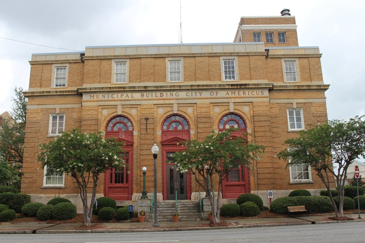
Photo: Wikipedia
Strategic Assessment of Americus, GA
Workable tactical position. Some exposure to population density or targets, but generally defensible in a crisis.
What does the Strategic Assessment tell us?
Our Strategic Assessment grades tactical survivability of an area. Major population centers, military targets, fallout zones, natural disasters, and border exposure all drive risk — lower exposure means a more defensible position in a crisis.
This is heavily inspired by Joel Skousen's Strategic Relocation book. Highly recommended you checkout the book ($)What does this tell us?
Our Strategic Assessment grades tactical survivability of an area. Major population centers, military targets, fallout zones, natural disasters, and border exposure all drive risk — lower exposure means a more defensible position in a crisis.
This is heavily inspired by Joel Skousen's Strategic Relocation book. Highly recommended you checkout the book ($)Strategic Pillars

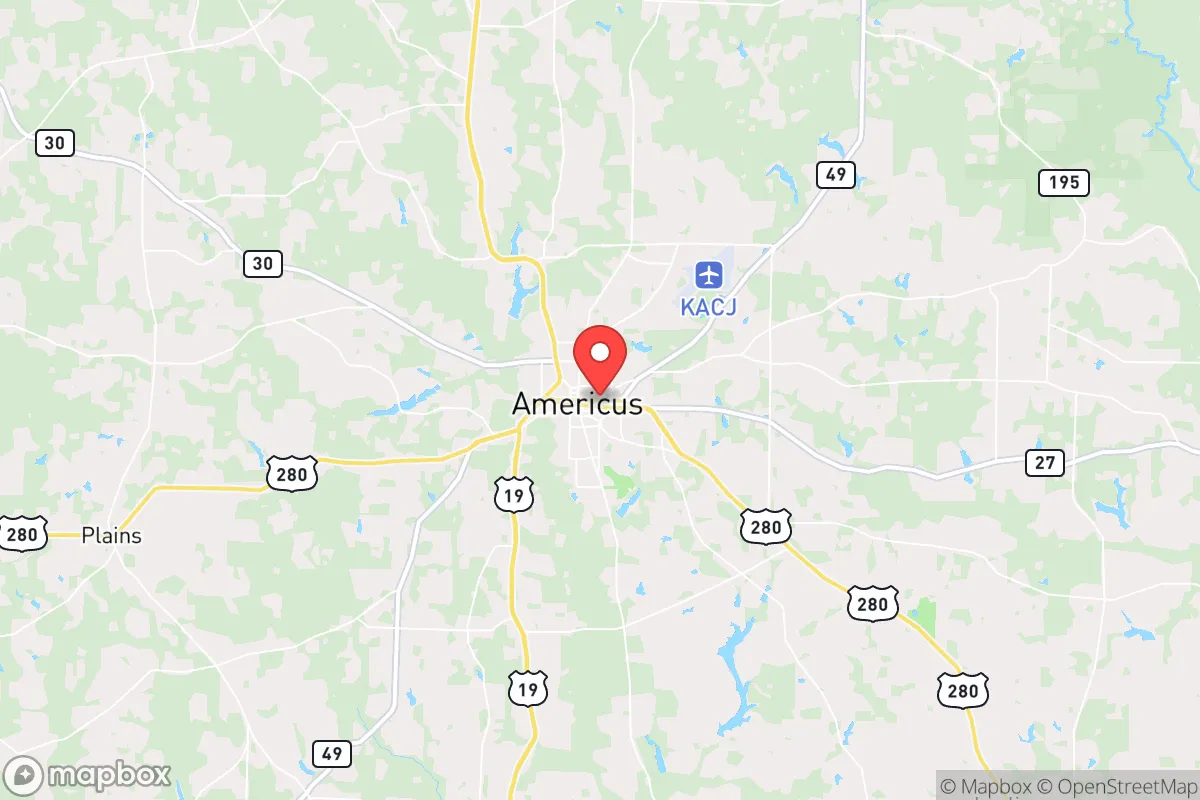
Key Distances
Regional Safe Places
Below is our recommended "safe zones" in Georgia and the surrounding area based on our strategic heuristics. For most people, it's unrealistic to live in a “safe zone” full-time due to work, family or other personal reasons. They tend to be more rural. However, many of these areas are perfect for second homes and retreat properties that double as a vacation home or even a short-term rental.
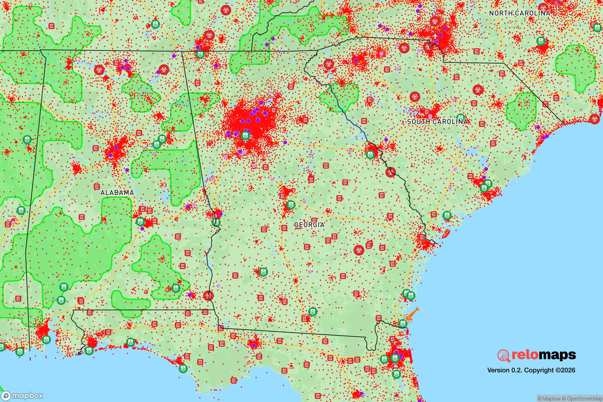
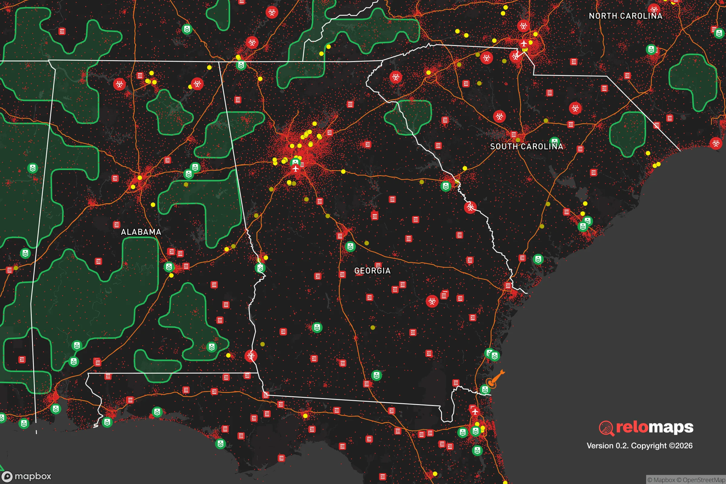


Important Note: For informational purposes only. This does not mean nothing bad ever happens in the green zones. Please use common sense. This is based on public data and modeled with AI. We tried to take a conservative approach but mistakes happen. We update this regularly as new information becomes available.
Solar Generator Recommendations
Backup power matters more here than in safer locations. We've picked three solar generators across budgets and capacity tiers — start with the budget unit if you only need a few essentials, or step up if you want to run a fridge and HVAC for days at a time.

Jackery Portable Power Station Explorer 300
Budget OptionPower on the Go: Weighing only 11 lbs, it's convenient to set up and store with book-sized foldable solar panels

BLUETTI Portable Power Station AC180
Designed for both indoor and outdoor scenarios, AC180 is highly capable as it has a robost capacity and continuous output power.

EF ECOFLOW DELTA Pro Ultra Power Station
Upgraded PickEcoFlow DELTA Pro Ultra is a whole-home energy system designed to grow with your family. Integrated with the Smart Home Panel 2, it scales to meet your evolving energy needs — keeping your home powered, intelligent, and secure through every stage of life.
We earn a commission, at no additional cost to you.
Strategic Assessment Analysis
Americus, Georgia, presents a mixed strategic picture for the relocation-minded reader focused on resilience and self-sufficiency. Its location in the southwestern part of the state offers a genuine buffer from the densest population corridors of the Eastern Seaboard, yet it sits within a region that carries its own set of vulnerabilities. For a single individual or family weighing disaster readiness, Americus offers a lower-cost, lower-density environment with some natural advantages, but it demands clear-eyed awareness of its exposure to both natural hazards and the ripple effects of nearby strategic infrastructure.
Geographic position and natural advantages for self-sufficiency
Americus is situated in Sumter County, roughly 100 miles south of Atlanta and 40 miles west of the I-75 corridor, placing it away from the most congested evacuation routes and primary target zones of major metropolitan areas. The surrounding landscape is predominantly agricultural—peanuts, cotton, and pecans dominate—which provides a local food production base that many suburban areas lack. The Flint River flows roughly 15 miles to the east, offering a potential surface water source, though access is not immediate from most residential properties within city limits. The terrain is gently rolling, with no significant mountains or floodplains that would create natural choke points, but this also means there are few defensible high-ground positions. The climate is humid subtropical, with long growing seasons (roughly 230 frost-free days) that support year-round gardening and small-scale farming, a tangible advantage for anyone prioritizing food self-sufficiency. The area's population density is low—Sumter County has about 28,000 residents spread over 485 square miles—which reduces competition for resources in a crisis scenario compared to metro Atlanta or even Columbus.
Risks, exposures, and proximity to fallout-relevant landmarks
The most significant risk factor for Americus is its proximity to two major military installations: Robins Air Force Base (about 60 miles northeast, near Warner Robins) and Fort Moore (formerly Fort Benning, about 70 miles southwest, near Columbus). Both are high-value strategic assets that could become targets in a major conflict, and while Americus is far enough away to avoid direct blast effects, fallout patterns depend heavily on wind direction. A prevailing westerly or southwesterly wind could carry particulate from a strike on Fort Moore toward the Americus area. Additionally, Marine Corps Logistics Base Albany is roughly 40 miles south, and the Savannah River Site (a nuclear materials facility) is about 150 miles east—outside immediate danger but relevant for long-term contamination scenarios. Natural hazards are more immediate: Americus lies in a region prone to severe thunderstorms, tornadoes (particularly in spring), and occasional hurricanes that weaken as they move inland. The 2007 EF2 tornado that struck downtown Americus caused significant damage, and the area is no stranger to flooding along the Flint River and its tributaries. The city itself sits on a relatively flat plateau, so flash flooding is less of a concern than in river-bottom communities, but drainage can be poor during heavy rains. For a relocator, the key takeaway is that Americus avoids the highest-risk zones for nuclear targets (like D.C., New York, or major military command centers) but is not remote enough to be considered a safe haven from secondary effects.
Practical resilience for a relocator: food, water, energy, and defensibility
For someone serious about self-sufficiency, Americus offers a few concrete advantages and several notable gaps. Food production is the strongest point: the surrounding farmland means local farmers' markets and direct-from-farm purchasing are viable even in normal times, and the growing season allows for three-season vegetable gardening. The city itself has a small but active community garden network, and land outside city limits is affordable—acreage can be found for $3,000–$6,000 per acre, making it feasible to establish a homestead. Water security is more complex. The city's municipal water comes from the Flint River aquifer, which is generally reliable, but a prolonged power outage would disrupt pumping. Well drilling is an option in rural areas, with typical depths of 100–300 feet, but the cost ($5,000–$15,000) and the need for a backup power source (solar or generator) are real considerations. Rainwater catchment is legal in Georgia, and the region's average 50 inches of annual rainfall makes it a viable supplementary strategy. Energy resilience is a mixed bag: Georgia Power's grid is moderately reliable, but the area is prone to storm-related outages that can last days. Solar potential is decent—the region gets about 5.0 peak sun hours per day—and local installers are present, but permitting in Sumter County is straightforward for off-grid systems. Natural gas is available in parts of Americus but not universally; propane is a common alternative for heating and cooking. Defensibility is the weakest category. Americus is a small city with a grid street layout and no natural barriers, making it difficult to secure a perimeter in a widespread breakdown. The local law enforcement presence is limited (Sumter County Sheriff's Office has roughly 40 deputies), and the nearest National Guard unit is in Albany, 40 miles away. For a relocator, the best strategy is to buy land outside city limits—ideally with a creek or pond, good soil, and a clear line of sight to approach roads—rather than relying on in-town property for long-term security.
The overall strategic picture for Americus is one of moderate resilience with clear trade-offs. It offers genuine advantages in food production, low population density, and distance from primary target zones, making it a viable option for someone who wants to be out of the immediate blast radius of major cities and military hubs. However, it is not a remote bunker location—it sits within a 100-mile radius of multiple high-value military assets, and its flat, open terrain offers little natural defensibility. For a relocator willing to invest in well water, solar power, and a rural property with good soil, Americus can support a self-sufficient lifestyle at a fraction of the cost of comparable land in the Northeast or West Coast. The key is to treat it as a base for building resilience rather than a turnkey safe haven—proactive preparation, including food storage, water purification, and community networking with like-minded neighbors, will determine whether this area becomes a strategic asset or just another vulnerable small town in a crisis.

* Values derived from national, state, county, city and local statistics and may differ in a specific area. Last updated: 2026-10-29T21:15:33.000Z
Narrative content on this page is AI-generated and may contain mistakes. Verify any details that matter before acting on them.
ReloMaps may earn a commission from affiliate links at no extra cost to you.

