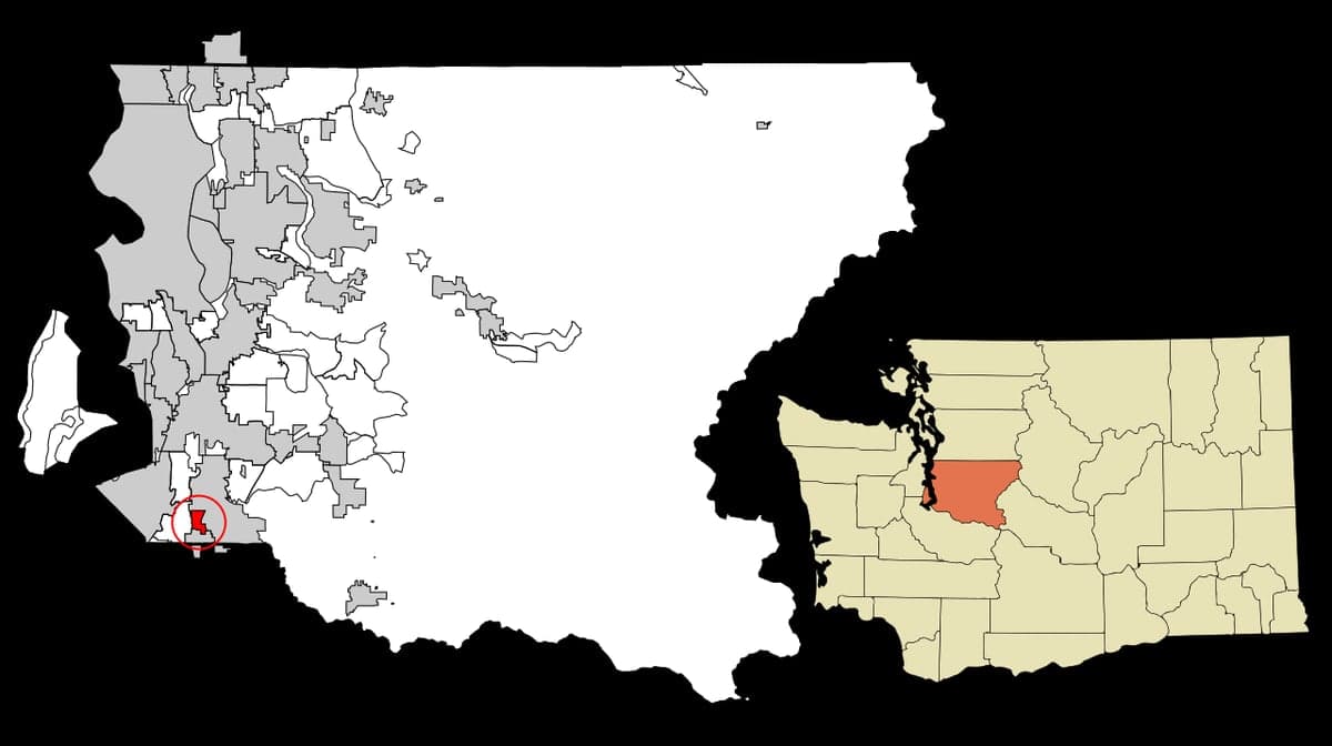
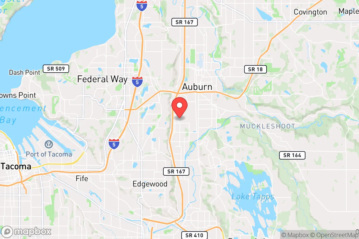
Photo: Wikipedia
Strategic Assessment of Algona, WA
Multiple tactical vulnerabilities. Population density, target proximity, or disaster risk are likely compounding. A retreat property and exit planning is required.
What does the Strategic Assessment tell us?
Our Strategic Assessment grades tactical survivability of an area. Major population centers, military targets, fallout zones, natural disasters, and border exposure all drive risk — lower exposure means a more defensible position in a crisis.
This is heavily inspired by Joel Skousen's Strategic Relocation book. Highly recommended you checkout the book ($)What does this tell us?
Our Strategic Assessment grades tactical survivability of an area. Major population centers, military targets, fallout zones, natural disasters, and border exposure all drive risk — lower exposure means a more defensible position in a crisis.
This is heavily inspired by Joel Skousen's Strategic Relocation book. Highly recommended you checkout the book ($)Strategic Pillars

Key Distances
Regional Safe Places
Below is our recommended "safe zones" in Washington and the surrounding area based on our strategic heuristics. For most people, it's unrealistic to live in a “safe zone” full-time due to work, family or other personal reasons. They tend to be more rural. However, many of these areas are perfect for second homes and retreat properties that double as a vacation home or even a short-term rental.
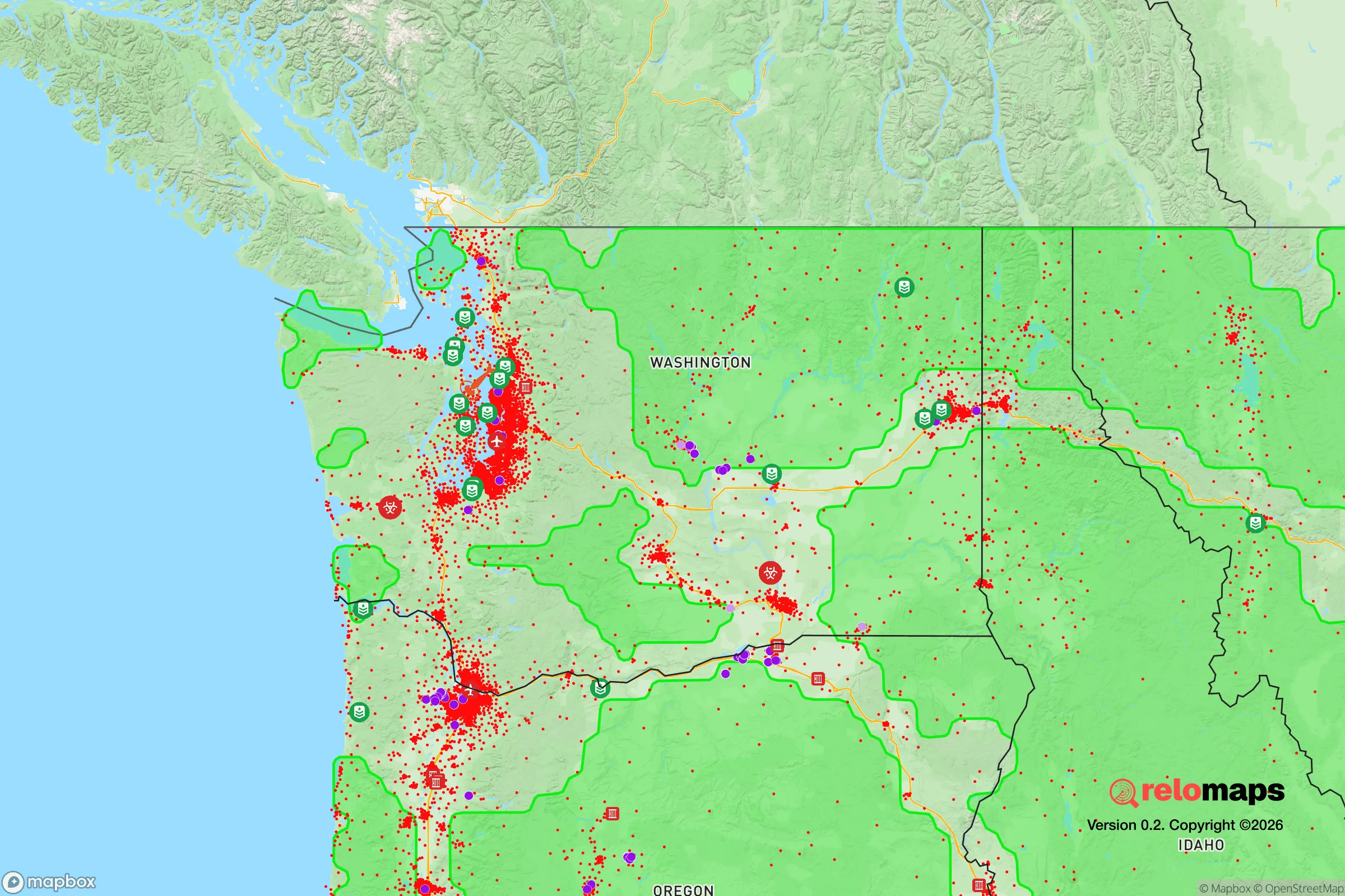
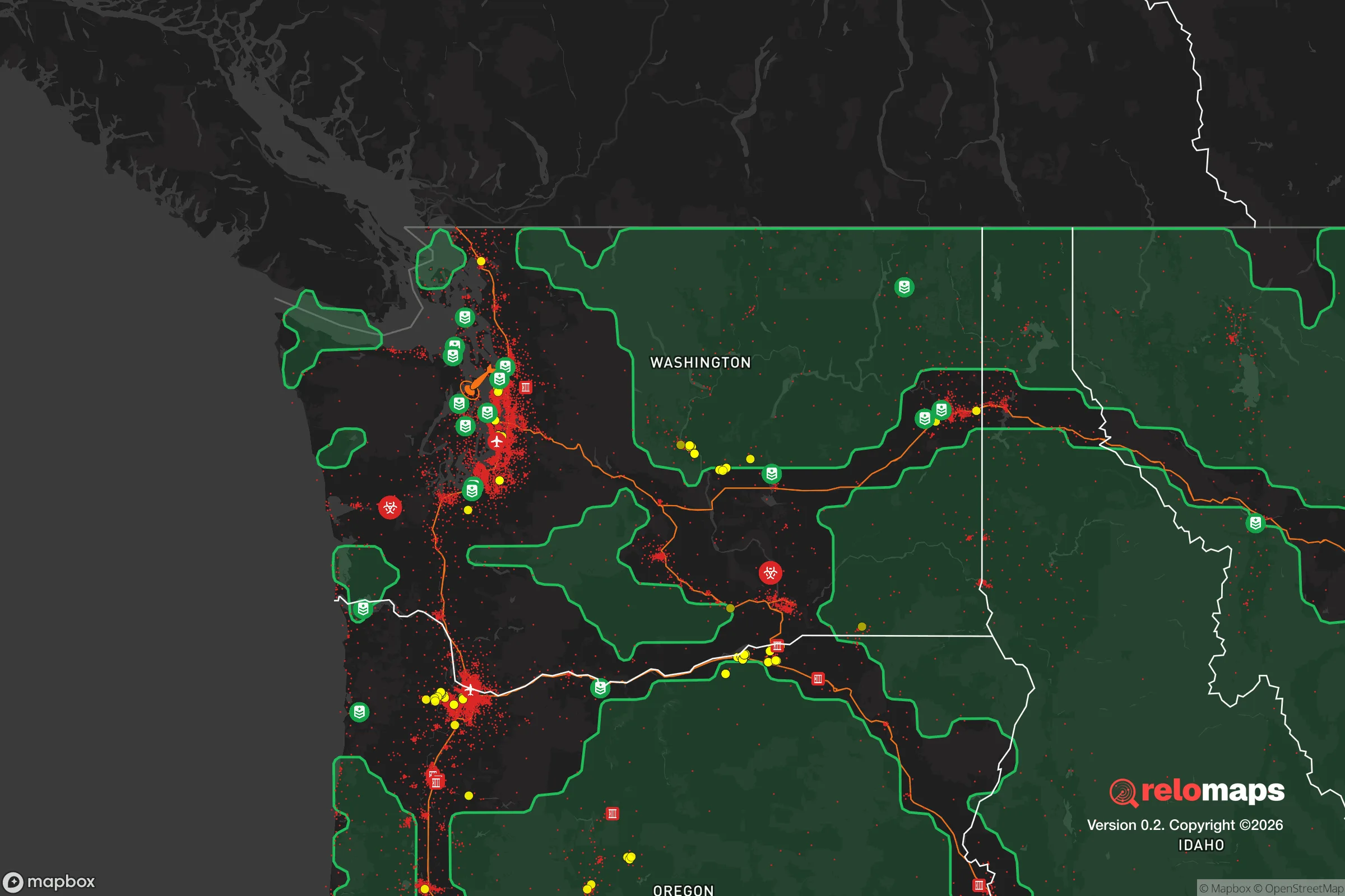


Important Note: For informational purposes only. This does not mean nothing bad ever happens in the green zones. Please use common sense. This is based on public data and modeled with AI. We tried to take a conservative approach but mistakes happen. We update this regularly as new information becomes available.
Solar Generator Recommendations
Backup power matters more here than in safer locations. We've picked three solar generators across budgets and capacity tiers — start with the budget unit if you only need a few essentials, or step up if you want to run a fridge and HVAC for days at a time.

Jackery Portable Power Station Explorer 300
Budget OptionPower on the Go: Weighing only 11 lbs, it's convenient to set up and store with book-sized foldable solar panels

BLUETTI Portable Power Station AC180
Designed for both indoor and outdoor scenarios, AC180 is highly capable as it has a robost capacity and continuous output power.

EF ECOFLOW DELTA Pro Ultra Power Station
Upgraded PickEcoFlow DELTA Pro Ultra is a whole-home energy system designed to grow with your family. Integrated with the Smart Home Panel 2, it scales to meet your evolving energy needs — keeping your home powered, intelligent, and secure through every stage of life.
We earn a commission, at no additional cost to you.
Strategic Assessment Analysis
Algona, Washington, occupies a narrow but strategically interesting position in the Pacific Northwest, offering a mix of proximity to urban resources and a degree of separation from the densest population centers. For the relocator prioritizing disaster readiness and self-sufficiency, this small city of roughly 3,200 residents presents a trade-off: it is close enough to Seattle and Tacoma to access critical supplies and medical care, yet far enough to avoid the immediate chaos of a major metropolitan collapse. Its location along the Green River Valley and near major transportation corridors like State Route 167 and Interstate 5 provides both advantages and vulnerabilities that demand careful consideration.
Geographic position and natural advantages for long-term stability
Algona sits in the southern portion of King County, roughly 25 miles south of Seattle and 10 miles east of Tacoma, placing it within the fertile Green River Valley. This valley floor is historically rich agricultural land, which is a genuine asset for anyone thinking about local food security. The surrounding area includes the Cascade foothills to the east and the Olympic Mountains to the west, creating a natural rain shadow effect that gives Algona a relatively mild, wet climate—averaging about 38 inches of rain per year—without the extreme snowfall or wildfire risk seen in drier inland regions. The city’s elevation is low, around 50 feet above sea level, which means it is not exposed to the landslide or avalanche risks common in the Cascades. The proximity to the Green River also offers a potential water source, though this comes with its own set of risks (detailed below). For a relocator, the key natural advantage is the region’s moderate climate: no deep freezes, no prolonged droughts, and a growing season long enough to support year-round gardening with some protection. The area’s position in a valley also provides some natural wind protection, reducing the impact of Pacific storms.
Risks, exposures, and proximity to fallout-relevant landmarks
The most significant risk for Algona is its location within the Green River floodplain. The Green River has a history of significant flooding, most notably in 2009 when the Howard Hanson Dam’s capacity was compromised, leading to emergency flood-control measures. While the Army Corps of Engineers has since reinforced the dam, the risk of a 100-year flood event remains real. A major flood could isolate Algona, as the main roads—SR 167 and I-5—are both vulnerable to flooding in the valley. This is a critical vulnerability for anyone relying on evacuation or supply routes. Beyond natural hazards, Algona’s proximity to several high-value man-made targets is a serious concern. The city is roughly 10 miles from Joint Base Lewis-McChord (JBLM), one of the largest military installations on the West Coast, housing the I Corps and the 7th Infantry Division. In a major conflict or terrorist event, JBLM is a primary target. Additionally, the Port of Tacoma and the Seattle-Tacoma International Airport (Sea-Tac) are within 15-20 miles, both of which are strategic infrastructure nodes. The presence of the Boeing Renton Factory (about 12 miles north) and the Puget Sound Naval Shipyard in Bremerton (about 35 miles west) adds to the region’s target density. For a relocator, this means that while Algona itself is a small, low-profile community, it sits within a high-risk zone for fallout and secondary effects from an attack on these installations. The prevailing winds in the Pacific Northwest are from the southwest, which would carry fallout from a JBLM or Tacoma event directly toward Algona. This is a non-negotiable negative for anyone prioritizing fallout avoidance.
Practical resilience for a relocator: food, water, energy, and defensibility
On the practical side, Algona offers some genuine strengths for self-sufficiency. The city is surrounded by agricultural land, including several working farms and the nearby Auburn Valley, which produces a variety of crops. The local farmers’ markets in Auburn and Kent (within 5 miles) provide access to fresh produce, and the soil in the valley is rich and well-suited for home gardening. For water, the Green River is a perennial source, but it requires treatment due to agricultural runoff and industrial contaminants from upstream. The city’s municipal water comes from the Green River watershed, but in a grid-down scenario, a well is not a given—most residential properties in Algona are on municipal water, not private wells. A relocator would need to invest in rainwater catchment or a portable filtration system. Energy resilience is moderate: the region is served by Puget Sound Energy, which has a mixed grid of hydro, natural gas, and some renewables. Power outages are common during winter storms (wind and ice), but the grid is generally reliable. Solar potential is limited due to the region’s frequent cloud cover, but a small solar array with battery storage can still provide baseline power. For defensibility, Algona is a compact, low-density city with a mix of single-family homes and small businesses. The street layout is grid-like in the core, with some cul-de-sacs in newer subdivisions. The city’s small size means a determined group could secure a perimeter, but the proximity to major highways (I-5 and SR 167) makes it a natural transit corridor for anyone moving north or south. In a collapse scenario, this could be a liability—Algona could become a chokepoint for refugees or looters moving between Tacoma and Seattle. The local police department is small (about 10 officers), so security would largely fall to residents. The community itself is tight-knit, with a strong sense of local identity, which is a plus for mutual aid. The presence of the Algona-Pacific Community Center and the nearby Green River College (in Auburn) offers potential gathering points for coordination.
The overall strategic picture for Algona is one of calculated trade-offs. It offers a relatively low cost of living for the Seattle metro area, a mild climate, and access to fertile land and water—all genuine advantages for a self-sufficient lifestyle. However, its position in a flood-prone valley and its proximity to multiple high-value military and industrial targets are significant liabilities. For a relocator who is serious about disaster readiness, Algona is best viewed as a transitional location: close enough to urban resources to build skills and stockpile supplies, but not remote enough to be safe from the fallout of a major event. If the goal is to be within a day’s drive of a more defensible retreat in the Cascades or the Olympic Peninsula, Algona works as a base. If the goal is to be completely off the grid and out of the target zone, look farther east or north. The city’s resilience is real but conditional—it depends on the severity of the event and the relocator’s ability to adapt to the valley’s inherent vulnerabilities. For the conservative-minded individual or family, Algona represents a pragmatic, not ideal, choice: a place to live well in normal times, with a plan to move if the worst happens.

* Values derived from national, state, county, city and local statistics and may differ in a specific area. Last updated: 2026-09-03T05:10:55.000Z
Narrative content on this page is AI-generated and may contain mistakes. Verify any details that matter before acting on them.
ReloMaps may earn a commission from affiliate links at no extra cost to you.

