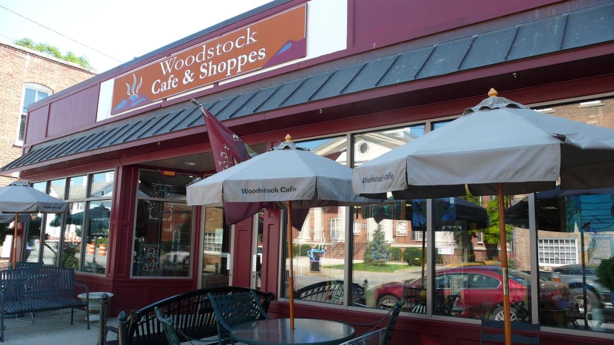
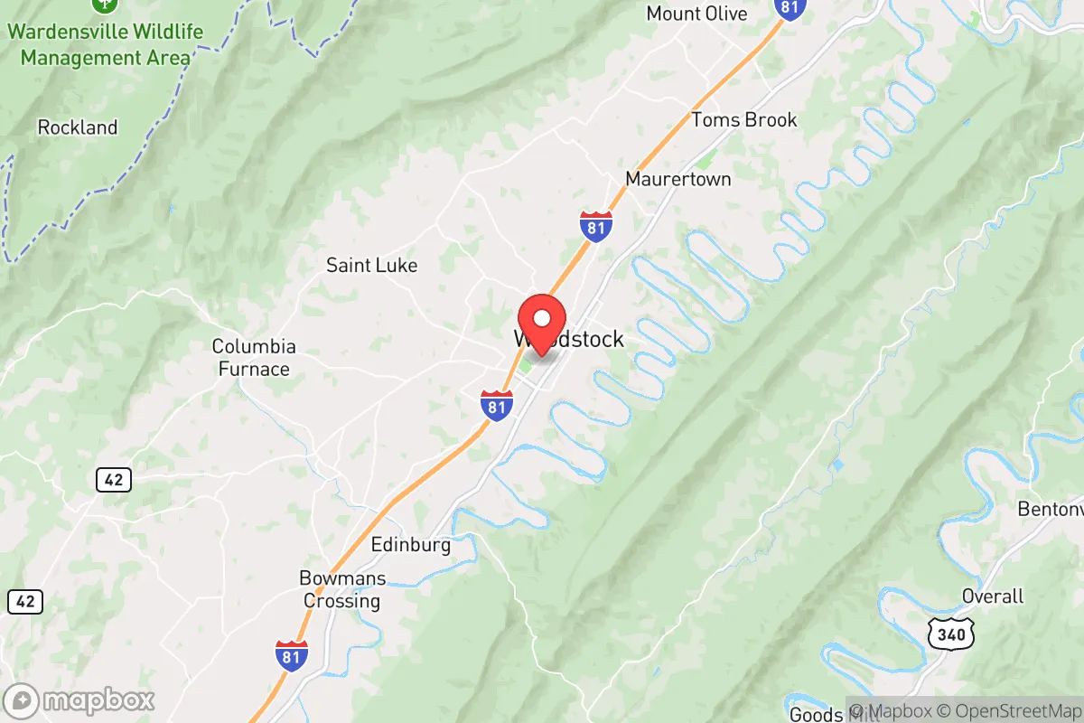
Photo: Wikipedia
Strategic Assessment of Woodstock, VA
Meaningful friction. Expect exposure to either population pressure, blast zones, or natural disaster risk. Consider buying a retreat property.
What does the Strategic Assessment tell us?
Our Strategic Assessment grades tactical survivability of an area. Major population centers, military targets, fallout zones, natural disasters, and border exposure all drive risk — lower exposure means a more defensible position in a crisis.
This is heavily inspired by Joel Skousen's Strategic Relocation book. Highly recommended you checkout the book ($)What does this tell us?
Our Strategic Assessment grades tactical survivability of an area. Major population centers, military targets, fallout zones, natural disasters, and border exposure all drive risk — lower exposure means a more defensible position in a crisis.
This is heavily inspired by Joel Skousen's Strategic Relocation book. Highly recommended you checkout the book ($)Strategic Pillars

Key Distances
Regional Safe Places
Below is our recommended "safe zones" in Virginia and the surrounding area based on our strategic heuristics. For most people, it's unrealistic to live in a “safe zone” full-time due to work, family or other personal reasons. They tend to be more rural. However, many of these areas are perfect for second homes and retreat properties that double as a vacation home or even a short-term rental.
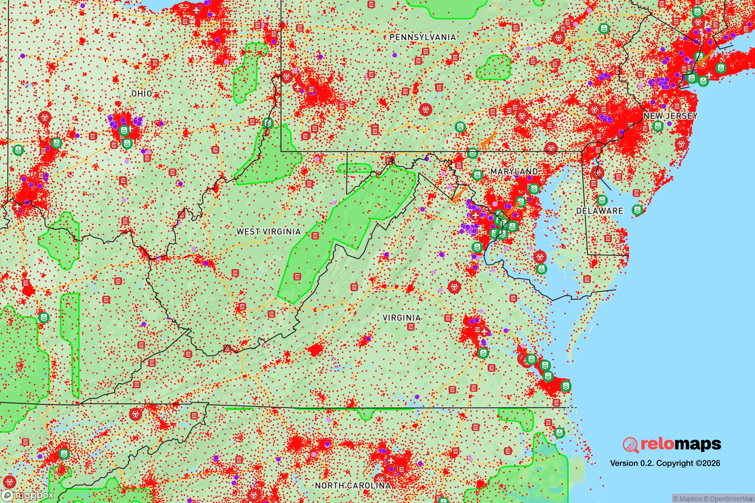
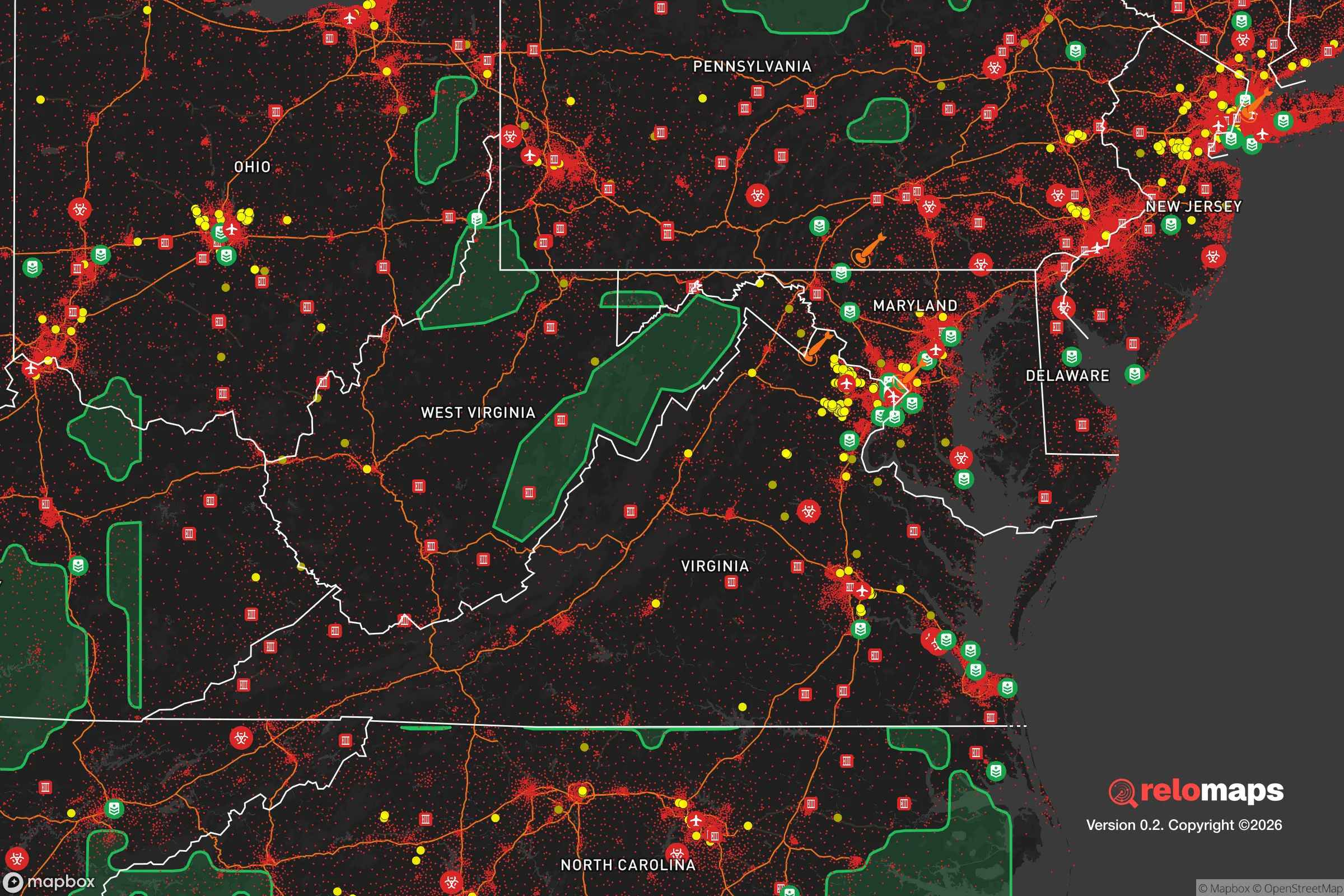


Important Note: For informational purposes only. This does not mean nothing bad ever happens in the green zones. Please use common sense. This is based on public data and modeled with AI. We tried to take a conservative approach but mistakes happen. We update this regularly as new information becomes available.
Solar Generator Recommendations
Backup power matters more here than in safer locations. We've picked three solar generators across budgets and capacity tiers — start with the budget unit if you only need a few essentials, or step up if you want to run a fridge and HVAC for days at a time.

Jackery Portable Power Station Explorer 300
Budget OptionPower on the Go: Weighing only 11 lbs, it's convenient to set up and store with book-sized foldable solar panels

BLUETTI Portable Power Station AC180
Designed for both indoor and outdoor scenarios, AC180 is highly capable as it has a robost capacity and continuous output power.

EF ECOFLOW DELTA Pro Ultra Power Station
Upgraded PickEcoFlow DELTA Pro Ultra is a whole-home energy system designed to grow with your family. Integrated with the Smart Home Panel 2, it scales to meet your evolving energy needs — keeping your home powered, intelligent, and secure through every stage of life.
We earn a commission, at no additional cost to you.
Strategic Assessment Analysis
Woodstock, Virginia, presents a compelling case for relocation when viewed through a resilience and preparedness lens. Its position in the northern Shenandoah Valley offers a blend of natural defensive geography, agricultural self-sufficiency, and a comfortable distance from the highest-risk urban and strategic military targets. While no location is immune to disruption, Woodstock’s combination of a defensible valley position, a working agricultural hinterland, and a modest population footprint makes it a serious contender for those prioritizing long-term stability and self-reliance.
Geographic position and natural defensive advantages in the Shenandoah Valley
Woodstock’s strategic value begins with its geography. The town sits in the Shenandoah Valley, a natural corridor flanked by the Blue Ridge Mountains to the east and the Allegheny Mountains to the west. This topography provides a genuine defensive buffer: the Massanutten Mountain range, which runs parallel to the valley, creates a natural barrier that historically funneled movement and offers numerous choke points. For a relocator, this means the area is less exposed to the sprawling suburban and exurban development patterns that characterize the I-81 corridor further north, while still maintaining critical access to that artery for supply and travel.
The valley floor itself is among the most productive agricultural land in the eastern United States. The limestone-based soils and the North Fork of the Shenandoah River provide a foundation for local food production that is rare in the Mid-Atlantic. This isn't just scenic; it's a practical resilience asset. A community surrounded by working farms and orchards has a structural advantage in a supply-chain disruption scenario. The town’s elevation, roughly 700 feet, and its position away from the immediate flood plains of the river’s main channel reduce—though do not eliminate—the risk of catastrophic flooding that affects other valley towns.
Risk profile: natural hazards and proximity to high-value targets
Assessing the risk picture requires a clear-eyed look at both natural and man-made threats. The primary natural risks in Woodstock are winter weather events and occasional flooding. The valley is prone to significant snow and ice storms, which can knock out power for days, particularly in the more rural stretches outside town limits. Flash flooding along the North Fork and its tributaries is a periodic concern, but the town’s core sits on higher ground, mitigating the worst impacts. Tornado risk is present but historically lower than in the Midwest or the Piedmont regions to the east.
The man-made risk profile is where Woodstock’s location becomes a strategic advantage. The town is roughly 90 miles west of Washington, D.C., and about 70 miles from the Richmond metro area. This distance places it outside the immediate blast and thermal zones of a hypothetical nuclear exchange on those cities, but more importantly, it sits outside the likely fallout plume patterns for prevailing westerly winds. The more immediate concern is the I-81 corridor itself, which runs through the valley and is a critical logistics artery. In a major disruption, this highway could become congested or targeted, but it also provides the primary evacuation and supply route. The proximity to the Massanutten and Blue Ridge ranges offers a natural shield against the worst of a regional electromagnetic pulse (EMP) effect, though the power grid remains vulnerable. The lack of major military installations or strategic industrial complexes within a 50-mile radius of Woodstock significantly lowers its attractiveness as a secondary target.
Practical resilience for a relocator: food, water, energy, and defensibility
For the individual or family, practical resilience in Woodstock is a mix of existing infrastructure and personal initiative. The town’s water supply comes from the North Fork of the Shenandoah, treated and distributed by the town utility. For a relocator, this means a municipal supply that is generally reliable, but a private well on the outskirts offers true independence. The water table in the valley is generally accessible at moderate depths, making well-drilling a viable option for those seeking off-grid capability. The local agricultural base means that farmers' markets, roadside stands, and direct-from-farm purchasing are not just amenities but functional food security networks. Establishing relationships with local producers before a crisis is a practical step that pays dividends.
Energy resilience is the weakest link. The grid in the valley is susceptible to ice storms and regional blackouts. A relocator should plan for a backup power source—solar with battery storage is increasingly viable given the valley’s decent sun exposure, but a propane or diesel generator is a more immediate and cost-effective solution. Wood is a practical heating supplement, given the surrounding forests and the prevalence of wood stoves in the region. In terms of defensibility, the town itself is not a fortress, but the surrounding terrain offers natural chokepoints. A property on the valley’s edge, with a clear view of the main approaches and a single access road, provides a level of security that is difficult to find closer to urban centers. The local community is a mix of long-standing farming families and newer transplants, and the culture of neighborly assistance and barter is more intact here than in most suburban environments.
The overall strategic picture for a Woodstock relocation
Woodstock offers a balanced strategic profile for the preparedness-minded relocator. It lacks the extreme remoteness of a mountain bunker location, but it compensates with a robust local food economy, a defensible valley position, and a critical distance from the highest-risk targets on the East Coast. The trade-offs are clear: you accept the risk of winter storms and the need for personal energy backup in exchange for a community that has the structural capacity to absorb and recover from regional shocks. For a single individual or a family looking to build a resilient life without going fully off-grid, Woodstock represents a pragmatic middle path—a place where self-sufficiency is supported by the land and the local culture, rather than fought against it. The infrastructure is solid, the natural buffers are real, and the community is grounded in a rural work ethic that values preparedness. It is not a retreat from the world, but a strategic position within it.

* Values derived from national, state, county, city and local statistics and may differ in a specific area. Last updated: 2026-10-26T03:41:00.000Z
Narrative content on this page is AI-generated and may contain mistakes. Verify any details that matter before acting on them.
ReloMaps may earn a commission from affiliate links at no extra cost to you.

