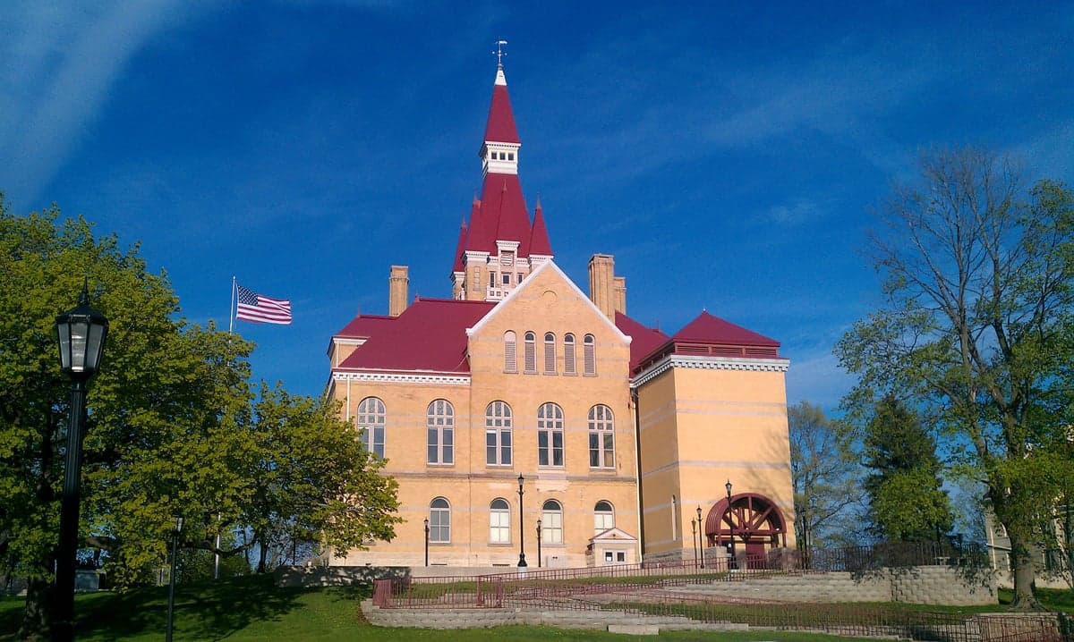
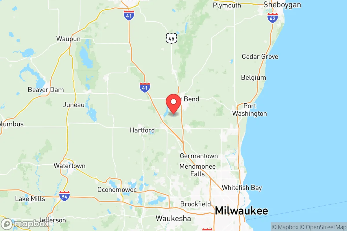
Photo: Wikipedia
Quality of Life in Washington County
A livable area that tracks near national norms for affordability, walkability, and neighborhood health.
What does Quality of Life tell us?
Quality of Life measures an area by evaluating factors like cost of living, nearby amenities, country club access, airport proximity, socioeconomic signals and neighborhood character. For large states, this is a general average — quality of life can vary dramatically between metro areas, suburbs, and rural communities within the same state.
What does this tell us?
Quality of Life measures an area by evaluating factors like cost of living, nearby amenities, country club access, airport proximity, socioeconomic signals and neighborhood character. For large states, this is a general average — quality of life can vary dramatically between metro areas, suburbs, and rural communities within the same state.
Cost of Living
3% above national average
106%
The Real Cost of Living in Washington County for 2026
| Tier | Individual | Family (4) |
|---|---|---|
| Survival | $18k | $34k |
| Comfortable | $61k | $90k |
| Luxury | $141k+ | $219k+ |
| Elite (Top 5%) | $166k+ | $258k+ |
Quality-of-Life Analysis
Washington County, Wisconsin, offers a broad quality-of-life spectrum that ranges from the walkable, historic downtown of its largest city to quiet, unincorporated crossroads and working farms, attracting everyone from Milwaukee-area commuters to retirees seeking small-town pace. The county’s overall cost of living index sits at 103 (just above the national average), with a median home value of $316,200 and median rent of $1,126, but those figures mask significant variation between its urbanized core and its rural periphery. The average commute of roughly 26 minutes is manageable, though residents in the far northern and western townships often tack on extra drive time to reach the county’s job centers along the I-41/US-45 corridor.
Largest town(s) & population centers
West Bend, the county seat and largest city (population roughly 32,000), anchors the county with a compact, walkable downtown centered on Main Street and the Milwaukee River. Daily life here revolves around the West Bend Farmers Market, the Museum of Wisconsin Art, and the paved Eisenbahn State Trail, which runs 25 miles north to Fond du Lac. Housing stock is a mix of early-20th-century bungalows near downtown and newer subdivisions on the city’s north and east sides. Germantown (population ~20,000) is the county’s second-largest municipality and functions more as a Milwaukee exurb, with a heavy concentration of corporate offices (including Quad/Graphics headquarters) and big-box retail along County Line Road. Its schools are consistently rated among the state’s top, and its housing market is pricier than West Bend’s, with many homes in the $350,000–$500,000 range. Hartford (population ~15,000) sits at the county’s western edge and retains a distinct industrial heritage, anchored by the Bremen Brauerei and the Hartford Union High School’s nationally recognized automotive program. Its downtown is smaller than West Bend’s but active, with a weekly summer concert series at Firemen’s Park.
Smaller towns & rural pockets
Outside the three main cities, Washington County is dotted with villages and unincorporated communities that offer a markedly quieter pace. Slinger (population ~5,500) is a classic railroad town with a compact downtown and a strong sense of local boosterism around the Slinger Speedway. Jackson (population ~7,000) straddles US-45 and has grown as a bedroom community, but its historic core near the Milwaukee River retains a village feel. Kewaskum (population ~4,000) in the county’s northern tier is more rural, with a small downtown and easy access to the Kettle Moraine State Forest’s Northern Unit. Unincorporated places like Fillmore, Saint Lawrence, and Thompson are little more than a crossroads with a tavern and a handful of homes, where residents rely on wells and septic systems and drive 15–20 minutes to the nearest grocery store. The Town of Polk and Town of Trenton are large rural townships with scattered subdivisions on former farmland, offering acreage and privacy while still being within 30 minutes of West Bend or Germantown.
Cost & lifestyle range
The cost spread across Washington County is driven primarily by housing type and proximity to Milwaukee. At the high end, Germantown and the newer subdivisions in West Bend’s Silverbrook and Paradise Drive areas see median home values above $400,000, with many custom-built homes on half-acre lots. Rentals in these areas are scarce and often exceed $1,400 for a two-bedroom. At the lower end, the Village of Kewaskum and the rural Town of Hartford offer older fixer-uppers and mobile homes in the $180,000–$250,000 range, with rents closer to the county median of $1,126. Property taxes in Washington County are typical for southeastern Wisconsin (roughly 1.8–2.2% of assessed value), but rural townships often have lower mill rates than the cities because they provide fewer services (no municipal water, no streetlights, limited snow plowing). Lifestyle varies accordingly: Germantown residents have a dozen chain restaurants and a Target within a five-minute drive, while a family in the Town of Addison might drive 20 minutes to the nearest gas station and rely on a private well for water. The trade-off is space — a home on five acres in Addison costs about the same as a 1,500-square-foot ranch on a quarter-acre in Germantown.
Washington County is best suited for people who want access to Milwaukee-area jobs and amenities (the commute to downtown Milwaukee is about 35–45 minutes from West Bend, 25–30 from Germantown) but prefer a lower-density, more family-oriented environment than Waukesha or Ozaukee counties. Retirees and remote workers gravitate toward the rural townships for the land and quiet, while families with school-age children cluster in Germantown and West Bend for the highly rated public schools and organized youth sports. The county’s mix of historic downtowns, working farms, and commuter subdivisions means there is a genuine niche for nearly every budget and lifestyle preference within its 436 square miles.

Crime in Washington County
Generally safer than 61% of comparable U.S. locations.
Violent CrimeViolent Crime Analysis
Property CrimeProperty Crime Analysis
Crime Analysis
Washington County, Wisconsin, posts a violent crime rate of 236.8 incidents per 100,000 residents and a property crime rate of 996.9 per 100,000, placing it in a moderate tier for safety within the Milwaukee metropolitan area. While these figures are lower than Milwaukee County's averages, they are elevated compared to the safest exurban communities in southeastern Wisconsin. The county's proximity to Milwaukee means that crime patterns are influenced by regional drug trafficking and property crime rings, though most violent incidents remain concentrated in specific municipalities rather than being evenly distributed across the county.
Crime in context
Washington County's violent crime rate of 236.8 per 100,000 sits below the Wisconsin state average of roughly 300 per 100,000 but above the national target of 200 per 100,000 set by the FBI's safe-community benchmarks. Property crime at 996.9 per 100,000 is notably lower than the state average of approximately 1,500 per 100,000, reflecting the county's suburban and rural character. However, these countywide averages mask significant variation: the city of West Bend, the county seat and largest municipality, accounts for a disproportionate share of reported thefts and burglaries, while Germantown and Richfield consistently report lower crime densities. The Washington County Sheriff's Office and the West Bend Police Department collaborate on multi-jurisdictional task forces targeting drug distribution, which has helped keep violent crime from rising as fast as in neighboring Ozaukee County.
What residents experience
Residents of Washington County most commonly encounter property crime — vehicle break-ins, package thefts, and occasional residential burglaries — rather than violent confrontations. The county's prosecutorial approach under District Attorney Mark Bensen has historically emphasized charging enhancements for repeat offenders and drug-related crimes, which contributes to a perception of accountability. However, as Milwaukee's progressive district attorney's office has adopted policies of reduced bail and declined prosecution for certain low-level offenses, some of that leniency has spilled into Washington County through regional crime networks. Residents in Hartford and Slinger report feeling safer than those in West Bend's downtown corridor, where a handful of aggravated assaults and robberies occur each year near bar districts and the UW-Washington County campus. The county's judicial circuit, part of the 3rd Judicial District, has not adopted the sweeping bail reform or diversion programs seen in Dane County, which maintains a more traditional sentencing structure that property owners and long-term residents view as protective of public safety.
Neighborhood-level variation
Safety in Washington County varies noticeably by municipality and even by subdivision. Germantown, with its higher median home values and active neighborhood watch programs, reports violent crime rates near 100 per 100,000 — less than half the county average. Jackson and Trenton similarly benefit from low population density and limited commercial corridors that attract opportunistic crime. Conversely, West Bend's 53095 zip code, which includes the downtown core and several older apartment complexes, sees property crime rates approaching 1,500 per 100,000, driven largely by unlocked vehicle entries and garage burglaries. The Village of Kewaskum, at the county's northern edge, experiences minimal violent crime but has seen an uptick in thefts from construction sites as new housing developments expand. For prospective residents, choosing a home in a township with its own police department — such as Germantown or Hartford — rather than relying solely on sheriff's patrols can correlate with faster response times and more proactive code enforcement, both of which contribute to a stronger sense of neighborhood security.
* Values derived from national, state, county, city and local statistics and may differ in a specific area. Last updated: 2026-07-10T13:04:43.000Z
Narrative content on this page is AI-generated and may contain mistakes. Verify any details that matter before acting on them.
ReloMaps may earn a commission from affiliate links at no extra cost to you.

