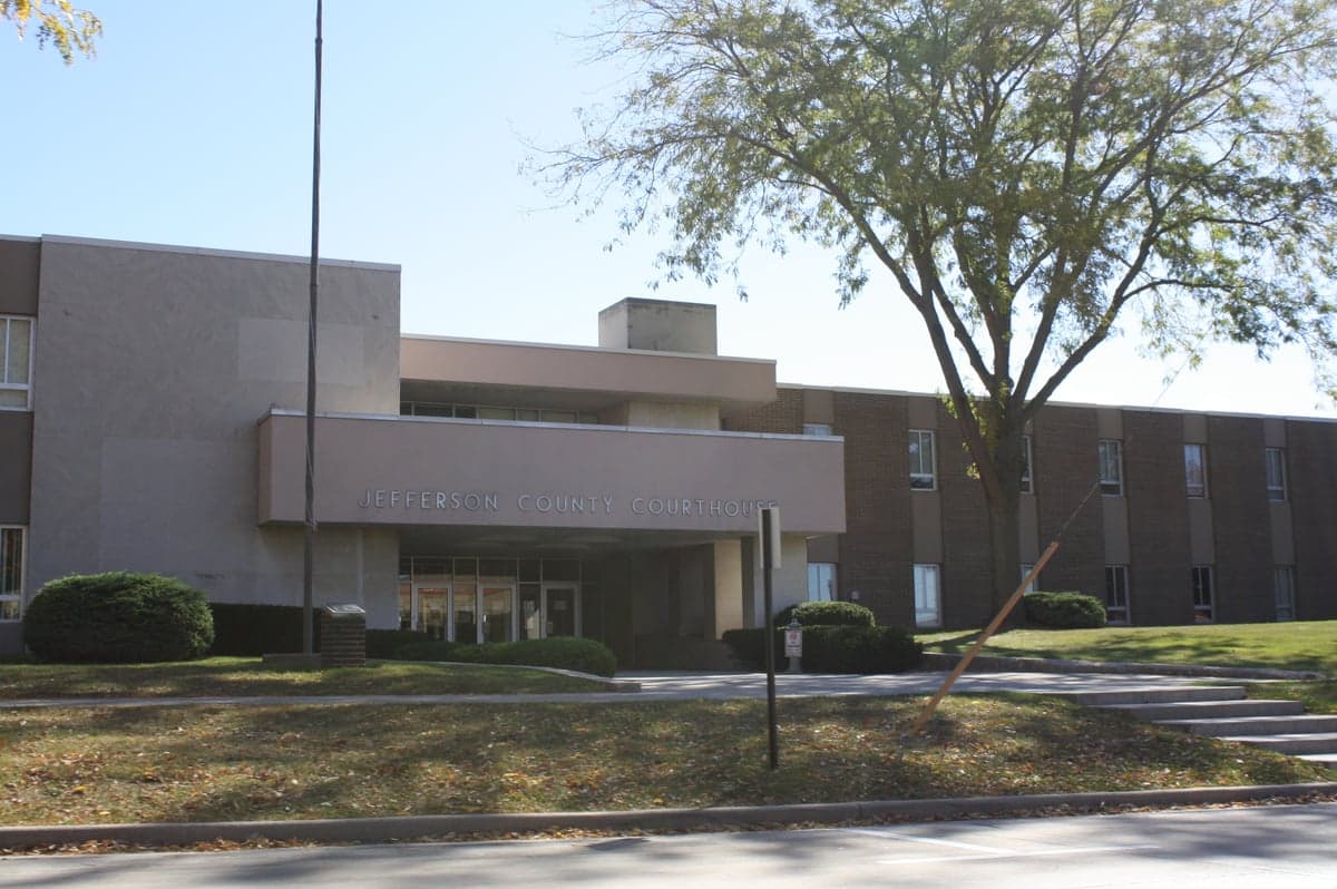
Photo: Wikipedia
Strategic Assessment of Jefferson County
Meaningful friction. Expect exposure to either population pressure, blast zones, or natural disaster risk. Consider buying a retreat property.
What does the Strategic Assessment tell us?
Our Strategic Assessment grades tactical survivability of an area. Major population centers, military targets, fallout zones, natural disasters, and border exposure all drive risk — lower exposure means a more defensible position in a crisis.
This is heavily inspired by Joel Skousen's Strategic Relocation book. Highly recommended you checkout the book ($)What does this tell us?
Our Strategic Assessment grades tactical survivability of an area. Major population centers, military targets, fallout zones, natural disasters, and border exposure all drive risk — lower exposure means a more defensible position in a crisis.
This is heavily inspired by Joel Skousen's Strategic Relocation book. Highly recommended you checkout the book ($)Strategic Pillars

Key Distances
Strategic Assessment Analysis
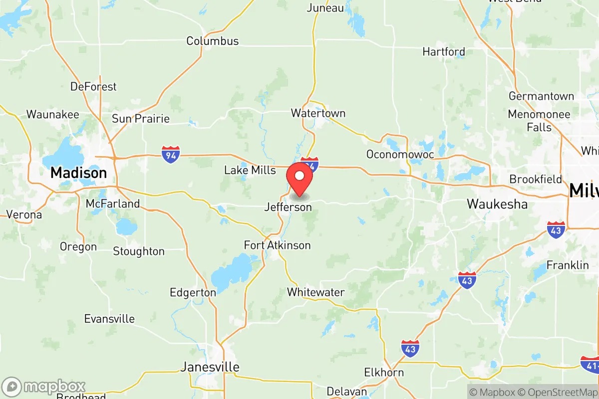
Jefferson County, Wisconsin, occupies a strategic middle ground in the upper Midwest, offering a blend of rural self-sufficiency and proximity to critical infrastructure that appeals to relocation-minded individuals and families with a conservative, preparedness-oriented outlook. Located roughly 40 miles east of Madison and 50 miles west of Milwaukee, the county sits outside the immediate blast and fallout zones of major population centers while remaining within a practical distance for supply runs, medical access, and community networking. Its position along the Rock River and its agricultural backbone provide a baseline of resilience that many suburban or exurban counties lack, making it a credible option for those prioritizing long-term stability over urban convenience.
Geographic position and natural advantages for long-term stability
Jefferson County’s geography is defined by the Rock River, which flows north-south through the county seat of Jefferson and the larger city of Watertown, providing a reliable freshwater source and a natural corridor for movement and trade. The county sits on the eastern edge of Wisconsin’s Driftless Area, a region that largely escaped the flattening effects of the last glacial period, resulting in rolling hills, wooded valleys, and well-drained soils that support diverse agriculture. This terrain offers natural defensibility—elevated ridgelines and river bends create chokepoints and observation points—while avoiding the floodplain risks of flatter, river-bottom counties. The area’s glacial till soils are fertile for row crops like corn and soybeans, and the county’s 400+ farms produce enough food to sustain the local population many times over. For a relocator, this means the land itself is a productive asset, not just a scenic backdrop. The county’s position also places it within a 90-minute drive of the Lake Michigan shoreline, offering access to a massive freshwater reservoir without the coastal storm surge or lake-effect snow extremes that plague the immediate lakeshore communities.
Risks, exposures, and proximity to fallout-relevant landmarks
While Jefferson County avoids the direct threat of a major metropolitan target, it is not immune to secondary risks. The county lies within 100 miles of two significant military installations: Fort McCoy in Monroe County (about 90 miles northwest) and the Volk Field Air National Guard Base near Camp Douglas (roughly 80 miles northwest). These are potential targets in a conflict scenario, though their distance and the prevailing westerly winds mean fallout patterns would likely carry eastward, away from Jefferson County. More immediate is the county’s proximity to the Point Beach Nuclear Plant in Manitowoc County, about 70 miles northeast. While not a direct fallout risk in a nuclear exchange, a reactor incident could affect the region’s water and air quality, particularly if winds shift southwesterly. The county also sits within the broader Chicago-Milwaukee-Madison triangle, meaning that in a major event, refugee flow from those cities would likely pass through or settle in the area. Interstate 94 runs along the county’s northern edge, and Highway 26 cuts through its center, both of which could become evacuation corridors or chokepoints. Natural risks are modest: tornadoes are a seasonal reality, with the county averaging 2-3 touchdowns per decade, and the Rock River has a history of moderate flooding in spring, particularly around the city of Jefferson and the village of Lake Mills. However, the county’s rolling terrain and lack of major fault lines or coastal exposure make it one of the lower-risk areas in the state for natural disasters.
Practical resilience for a relocator: food, water, energy, and defensibility
For a family or individual serious about self-sufficiency, Jefferson County offers a strong foundation. The agricultural base means local food production is abundant and accessible: farmers’ markets operate in Watertown, Jefferson, and Fort Atkinson from spring through fall, and the county’s many u-pick orchards and vegetable farms allow direct sourcing. The Rock River and its tributaries, including the Crawfish River and Bark River, provide surface water for irrigation and, with proper treatment, drinking water. Groundwater is generally good quality, though private wells in the eastern part of the county may require deeper drilling due to glacial till layers. Energy resilience is a mixed picture: the county is served by We Energies and Alliant Energy, both of which rely on a mix of coal, natural gas, and renewables. However, the area’s rural character means many homes already have backup generators, wood stoves, or solar panels, and the county’s relatively low population density (about 85 people per square mile) reduces the strain on grid infrastructure during outages. Defensibility is aided by the county’s geography: the Rock River and its bluffs create natural barriers, and the many gravel roads and farm lanes offer multiple escape routes or concealed positions. The county’s law enforcement presence is modest—the Jefferson County Sheriff’s Office has about 60 sworn deputies—so community-based security and mutual aid networks are more practical than relying on formal response. For a relocator, the key is to choose a property with good water access, a defensible position (e.g., a hillside farmstead with clear sightlines), and a buffer from major highways to avoid refugee traffic.
The overall strategic picture for Jefferson County is one of balanced opportunity and manageable risk. It offers the agricultural productivity and water security that are the bedrock of long-term resilience, while its distance from primary targets and major population centers reduces the likelihood of direct impact in a crisis. The county’s location within the Driftless Area’s eastern fringe provides terrain advantages that flatter counties lack, and its network of small cities—Watertown, Fort Atkinson, Jefferson, and Lake Mills—offers redundancy in services and supplies. The primary downsides are the potential for refugee flow from the I-94 corridor and the modest but real risk from the Point Beach nuclear plant. For a conservative-leaning relocator who values self-reliance, community ties, and a slower pace of life, Jefferson County represents a solid, defensible choice—not a fortress, but a place where a prepared family can thrive with reasonable effort and foresight.

* Values derived from national, state, county, city and local statistics and may differ in a specific area. Last updated: 2026-07-13T23:42:12.000Z
Narrative content on this page is AI-generated and may contain mistakes. Verify any details that matter before acting on them.
ReloMaps may earn a commission from affiliate links at no extra cost to you.

