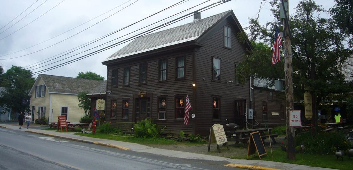
Photo: Wikipedia
Strategic Assessment of Wilmington, VT
Workable tactical position. Some exposure to population density or targets, but generally defensible in a crisis.
What does the Strategic Assessment tell us?
Our Strategic Assessment grades tactical survivability of an area. Major population centers, military targets, fallout zones, natural disasters, and border exposure all drive risk — lower exposure means a more defensible position in a crisis.
This is heavily inspired by Joel Skousen's Strategic Relocation book. Highly recommended you checkout the book ($)What does this tell us?
Our Strategic Assessment grades tactical survivability of an area. Major population centers, military targets, fallout zones, natural disasters, and border exposure all drive risk — lower exposure means a more defensible position in a crisis.
This is heavily inspired by Joel Skousen's Strategic Relocation book. Highly recommended you checkout the book ($)Strategic Pillars

Key Distances
Regional Safe Places
Below is our recommended "safe zones" in Vermont and the surrounding area based on our strategic heuristics. For most people, it's unrealistic to live in a “safe zone” full-time due to work, family or other personal reasons. They tend to be more rural. However, many of these areas are perfect for second homes and retreat properties that double as a vacation home or even a short-term rental.




Important Note: For informational purposes only. This does not mean nothing bad ever happens in the green zones. Please use common sense. This is based on public data and modeled with AI. We tried to take a conservative approach but mistakes happen. We update this regularly as new information becomes available.
Solar Generator Recommendations
Backup power matters more here than in safer locations. We've picked three solar generators across budgets and capacity tiers — start with the budget unit if you only need a few essentials, or step up if you want to run a fridge and HVAC for days at a time.

Jackery Portable Power Station Explorer 300
Budget OptionPower on the Go: Weighing only 11 lbs, it's convenient to set up and store with book-sized foldable solar panels

BLUETTI Portable Power Station AC180
Designed for both indoor and outdoor scenarios, AC180 is highly capable as it has a robost capacity and continuous output power.

EF ECOFLOW DELTA Pro Ultra Power Station
Upgraded PickEcoFlow DELTA Pro Ultra is a whole-home energy system designed to grow with your family. Integrated with the Smart Home Panel 2, it scales to meet your evolving energy needs — keeping your home powered, intelligent, and secure through every stage of life.
We earn a commission, at no additional cost to you.
Strategic Assessment Analysis
Wilmington, Vermont, presents a mixed strategic picture for the relocation-minded reader focused on resilience and self-sufficiency. While its location in the Deerfield River Valley of southern Vermont offers genuine geographic advantages—mountainous terrain, abundant water, and distance from major metropolitan blast zones—it also carries specific vulnerabilities tied to its position near a key transportation corridor and within a region with notable man-made risks. For a family or individual weighing disaster readiness, Wilmington is neither a fortress nor a trap; it is a place where careful preparation can offset real exposures, but where complacency would be a mistake.
Geographic position and natural advantages for long-term security
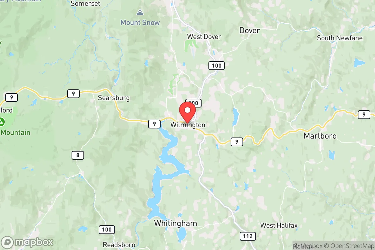
Wilmington sits in a valley surrounded by the Green Mountain National Forest, which provides a natural buffer against urban sprawl and a significant resource base for timber, game, and foraging. The town is roughly 30 miles from the Massachusetts border and about 60 miles from Albany, New York, placing it far enough from major population centers—Boston is 120 miles east, New York City 200 miles south—to reduce the risk of direct fallout from a nuclear event or the immediate chaos of a metropolitan collapse. The terrain itself is defensible: the valley is narrow, with steep ridges on both sides, limiting approach routes to a handful of roads. Route 9, the main east-west artery, runs through town, but secondary roads like Route 100 and local dirt tracks offer alternative egress if the primary route is compromised. The area’s elevation (roughly 1,500 feet) and northern latitude mean cooler summers and harsh winters, which can be a challenge but also a deterrent to unprepared populations moving through the region. Water is abundant: the Deerfield River flows through town, and numerous streams and ponds dot the surrounding forest, providing reliable surface water for filtration and irrigation. The proximity to the Green Mountain National Forest also means that fuel wood is plentiful for heating and cooking, a critical advantage in a prolonged grid-down scenario.
Risks, exposures, and proximity to fallout-relevant landmarks
The most significant man-made risk for Wilmington is its location within roughly 50 miles of the Vermont Yankee Nuclear Power Plant site in Vernon, Vermont, which, while decommissioned, still houses spent nuclear fuel in dry cask storage. A catastrophic event at that facility—whether from accident, sabotage, or natural disaster—could release radioactive material, and prevailing winds from the south and west could carry fallout up the Deerfield Valley toward Wilmington. Additionally, the town lies about 60 miles from the Albany-Schenectady-Troy metropolitan area, which includes industrial and transportation infrastructure that could be a target in a conflict scenario. The nearby Route 9 corridor is a major east-west link between the Hudson Valley and the New Hampshire seacoast, meaning that in a crisis, Wilmington could see significant through-traffic from refugees fleeing coastal cities or the Albany area. This is a double-edged sword: the town’s relative isolation is compromised by its position on a key evacuation route. Natural risks are more mundane but real: the region is prone to ice storms, heavy snow, and occasional flooding along the Deerfield River during spring thaws or heavy rain events. The mountainous terrain can also create microclimates that make road travel hazardous in winter, potentially cutting off access for days at a time. Wildfire risk is low compared to the western U.S., but dry summers can elevate the danger, especially in the forested areas surrounding town. Seismic activity is minimal, but the region is not immune to minor tremors.
Practical resilience for a relocator: food, water, energy, and defensibility
For a relocator serious about self-sufficiency, Wilmington offers a solid foundation but requires active investment. Water is the strongest asset: the Deerfield River and its tributaries provide year-round flow, and the town’s municipal water system draws from a protected groundwater source. However, a relocator should plan for a private well or a rainwater catchment system with filtration, as municipal supply could be disrupted in a prolonged emergency. The surrounding forest supports deer, turkey, and small game, and the Deerfield River holds trout and other fish, but relying on hunting and fishing alone would be insufficient for a family’s long-term protein needs. Gardening is viable but limited by a short growing season (roughly 100-120 frost-free days) and rocky, acidic soil; raised beds and greenhouse structures are advisable. Energy resilience is a mixed picture: the region has good potential for small-scale hydroelectric generation from the Deerfield River, and solar panels can be effective despite the area’s cloud cover, but winter snow accumulation can reduce solar output significantly. Wood heat is the most practical backup, and the national forest provides a sustainable fuel source if harvested responsibly. Propane is widely available for cooking and supplemental heating, but reliance on deliveries means a relocator should have a large tank and a plan for refueling during disruptions. Defensibility is moderate: the valley’s natural chokepoints can be monitored, but the town itself is not easily fortified. The population is small (roughly 2,000 year-round residents), which reduces the risk of internal conflict but also means a limited pool of skilled labor and mutual-aid partners. The local economy is tourism-dependent, centered on the Mount Snow ski area and summer recreation, which means that many residents are seasonal or transient, potentially reducing community cohesion in a crisis. A relocator should prioritize building relationships with year-round locals, particularly those with farming, mechanical, or medical skills.
In the overall strategic picture, Wilmington offers a viable but not exceptional option for the disaster-ready relocator. Its strengths—abundant water, defensible terrain, distance from major cities, and access to forest resources—are genuine and align with the priorities of self-sufficiency. Its weaknesses—proximity to a decommissioned nuclear site, position on a major evacuation corridor, short growing season, and tourism-dependent economy—require deliberate mitigation. For a family or individual willing to invest in off-grid water and energy systems, stockpile supplies for winter isolation, and build ties with the local year-round community, Wilmington can be a secure long-term base. It is not a bug-out location for the unprepared; it is a place where thoughtful preparation can create genuine resilience, but where the risks are real enough that they cannot be ignored. The town’s greatest value may be as a middle-ground option: more remote than a suburban exurb, but with better infrastructure and community resources than a deep-woods homestead. For the reader who wants a balance of isolation and access, and who is willing to do the work, Wilmington deserves serious consideration.

* Values derived from national, state, county, city and local statistics and may differ in a specific area. Last updated: 2026-10-16T23:54:53.000Z
Narrative content on this page is AI-generated and may contain mistakes. Verify any details that matter before acting on them.
ReloMaps may earn a commission from affiliate links at no extra cost to you.

