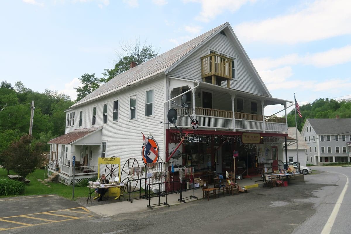
Photo: Wikipedia
Strategic Assessment of Whitingham, VT
Workable tactical position. Some exposure to population density or targets, but generally defensible in a crisis.
What does the Strategic Assessment tell us?
Our Strategic Assessment grades tactical survivability of an area. Major population centers, military targets, fallout zones, natural disasters, and border exposure all drive risk — lower exposure means a more defensible position in a crisis.
This is heavily inspired by Joel Skousen's Strategic Relocation book. Highly recommended you checkout the book ($)What does this tell us?
Our Strategic Assessment grades tactical survivability of an area. Major population centers, military targets, fallout zones, natural disasters, and border exposure all drive risk — lower exposure means a more defensible position in a crisis.
This is heavily inspired by Joel Skousen's Strategic Relocation book. Highly recommended you checkout the book ($)Strategic Pillars

Key Distances
Regional Safe Places
Below is our recommended "safe zones" in Vermont and the surrounding area based on our strategic heuristics. For most people, it's unrealistic to live in a “safe zone” full-time due to work, family or other personal reasons. They tend to be more rural. However, many of these areas are perfect for second homes and retreat properties that double as a vacation home or even a short-term rental.




Important Note: For informational purposes only. This does not mean nothing bad ever happens in the green zones. Please use common sense. This is based on public data and modeled with AI. We tried to take a conservative approach but mistakes happen. We update this regularly as new information becomes available.
Solar Generator Recommendations
Backup power matters more here than in safer locations. We've picked three solar generators across budgets and capacity tiers — start with the budget unit if you only need a few essentials, or step up if you want to run a fridge and HVAC for days at a time.

Jackery Portable Power Station Explorer 300
Budget OptionPower on the Go: Weighing only 11 lbs, it's convenient to set up and store with book-sized foldable solar panels

BLUETTI Portable Power Station AC180
Designed for both indoor and outdoor scenarios, AC180 is highly capable as it has a robost capacity and continuous output power.

EF ECOFLOW DELTA Pro Ultra Power Station
Upgraded PickEcoFlow DELTA Pro Ultra is a whole-home energy system designed to grow with your family. Integrated with the Smart Home Panel 2, it scales to meet your evolving energy needs — keeping your home powered, intelligent, and secure through every stage of life.
We earn a commission, at no additional cost to you.
Strategic Assessment Analysis
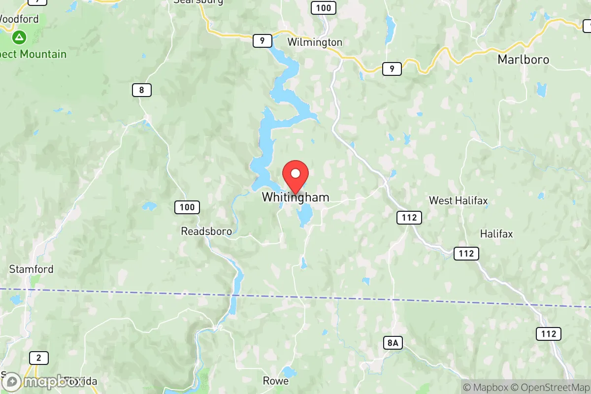
Whitingham, Vermont, offers a compelling strategic profile for relocators prioritizing resilience and self-sufficiency, largely due to its position in the remote Deerfield River Valley along the Massachusetts border. The town’s low population density—roughly 1,300 residents spread over 23 square miles—combined with its distance from major population centers like Boston (roughly 120 miles) and New York City (roughly 200 miles), provides a natural buffer against cascading urban disruptions. Its location within the Green Mountains, near the confluence of the Deerfield and North Rivers, grants access to abundant water resources and defensible terrain, while the surrounding Green Mountain National Forest offers both a resource base and a physical barrier to large-scale movement.
Geographic position and natural advantages for long-term security
Whitingham sits in a valley ringed by hills and mountains, with elevations ranging from roughly 800 feet along the Deerfield River to over 2,500 feet on nearby peaks like Bald Mountain. This topography creates natural chokepoints: the primary access routes are Vermont Route 100 and Route 112, both two-lane roads that can be monitored or blocked with minimal effort. The town is roughly 20 miles from the nearest interstate (I-91 in Brattleboro), which means through-traffic is light and the area is not a natural corridor for displaced populations. The Deerfield River, which runs through the town center, is a perennial water source fed by mountain snowmelt and springs, offering reliable surface water even during dry spells. The surrounding forest—predominantly mixed hardwoods and conifers—provides ample timber for construction, fuel, and foraging, with public access to the Green Mountain National Forest adding a significant buffer zone to the west. Whitingham’s position in the Deerfield River watershed also places it upstream of major reservoirs like Harriman and Somerset, which could be leveraged for water security or micro-hydro generation. The area’s agricultural potential is limited by rocky soils and short growing seasons (Zone 4b/5a), but the valley floor offers pockets of arable land suitable for small-scale market gardening or livestock grazing.
Risk exposure, natural hazards, and proximity to fallout-relevant landmarks
Whitingham’s primary natural risks are winter storms and flooding. The town averages roughly 80 inches of snow annually, with lake-effect bands from the Great Lakes occasionally intensifying events. Ice storms are a recurring hazard, capable of taking down power lines for days or weeks—a realistic scenario that tests any off-grid setup. The Deerfield River has a history of spring flooding, particularly during rapid snowmelt or heavy rain events, with the 2011 Tropical Storm Irene causing significant damage to roads and bridges in the area. However, the town’s elevation and valley geometry mean that most residential structures sit above the floodplain, and the risk is localized rather than widespread. Wildfire risk is low due to the moist climate and deciduous forest composition, though drought years (like 2020) can elevate it modestly. Seismic risk is negligible. From a man-made risk perspective, Whitingham’s remoteness is its greatest asset. The nearest nuclear power plant is Vermont Yankee in Vernon (roughly 30 miles south), which ceased operations in 2014 but still stores spent fuel on site—a low-probability, high-consequence risk that is nonetheless distant enough to allow for evacuation or sheltering. The town is roughly 50 miles from the Albany-Schenectady-Troy metropolitan area and 60 miles from the Springfield, Massachusetts metro, placing it outside the likely fallout zones for a major urban event. The nearby Berkshire Mountains and the Green Mountain spine provide additional shielding from blast effects or electromagnetic pulse (EMP) scenarios. Whitingham is not near any major military installations, chemical plants, or rail hubs that would make it a secondary target. The primary concern for a relocator would be the town’s proximity to Route 100, which could become a movement corridor for displaced populations from the I-91 corridor during a regional crisis, though the low population density and limited through-access mitigate this risk.
Practical resilience for a relocator: food, water, energy, and defensibility
Water security in Whitingham is strong. The Deerfield River is a perennial, high-volume stream with excellent water quality (Class B, generally suitable for treatment), and numerous tributaries and springs dot the hillsides. A well-drilled to the underlying bedrock aquifer (typically 100-300 feet) yields 5-15 gallons per minute in most locations, sufficient for a household and small-scale irrigation. Surface water filtration via a ceramic or UV system is straightforward given the low sediment load and minimal industrial contamination upstream. Food production is more challenging. The growing season averages 120-140 frost-free days, suitable for cold-hardy crops like potatoes, kale, brassicas, and root vegetables, but marginal for corn, tomatoes, or other warm-weather staples. Soil quality varies widely: the valley floor has decent loam, but hillside soils are thin, acidic, and rocky. A relocator would need to invest in raised beds, greenhouses, or hoop houses to extend the season and improve yields. Local livestock options include poultry, goats, and sheep; cattle require more pasture than most properties can support. The surrounding forest offers significant wild food resources: deer, turkey, and small game are abundant, and the area is known for maple syrup production (Whitingham is part of the Vermont Maple Sugar Makers’ Association region). Foraging for mushrooms, berries, and ramps is viable but requires knowledge of local species. Energy resilience is achievable but requires upfront investment. The Deerfield River’s flow is sufficient for micro-hydro (a 10-foot drop with 100 gallons per minute can generate 500-1000 watts continuously), and the hillsides offer good solar exposure, though winter cloud cover reduces output by 40-60%. Wood heating is the dominant backup: the area is heavily forested, and a cord of hardwood (seasoned) costs $250-400 delivered, with ample deadfall available for those willing to process it. Defensibility is excellent due to the terrain. The valley is narrow, with limited entry points; a small group could monitor the two primary roads (Routes 100 and 112) from elevated positions. The surrounding hills provide natural observation posts and fallback positions. The town’s low population density means that social friction is minimal, but it also means that mutual aid networks are thin—a relocator should plan to be self-reliant for at least the first 30-60 days of any disruption. The nearest hospital is in Brattleboro (roughly 25 miles), and the nearest trauma center is in Springfield, Massachusetts (roughly 50 miles), so medical self-sufficiency is a serious consideration.
The overall strategic picture for Whitingham is one of strong natural resilience offset by practical challenges that require deliberate preparation. Its remote valley location, abundant water, defensible terrain, and distance from major urban and industrial targets make it a strong candidate for a relocator seeking a low-probability, high-security environment. The trade-offs are real: a short growing season, limited medical access, and the need for significant upfront investment in energy and food infrastructure. For a single individual or family willing to put in the work—drilling a well, installing a micro-hydro or solar system, building a greenhouse, and stocking medical supplies—Whitingham offers a defensible, resource-rich base that is unlikely to be overwhelmed by regional disruptions. It is not a bug-out location; it is a live-in, long-term position that rewards preparation and self-sufficiency. The town’s small, tight-knit community (median age 50, largely native Vermonters) is generally self-reliant and wary of outsiders, which can be a social barrier but also a security asset—new arrivals who demonstrate competence and respect for local norms will find quiet acceptance rather than friction. For the conservative-leaning relocator who values autonomy, preparedness, and distance from the vulnerabilities of urban life, Whitingham represents a solid, if unglamorous, strategic choice.

* Values derived from national, state, county, city and local statistics and may differ in a specific area. Last updated: 2026-10-16T21:51:01.000Z
Narrative content on this page is AI-generated and may contain mistakes. Verify any details that matter before acting on them.
ReloMaps may earn a commission from affiliate links at no extra cost to you.

