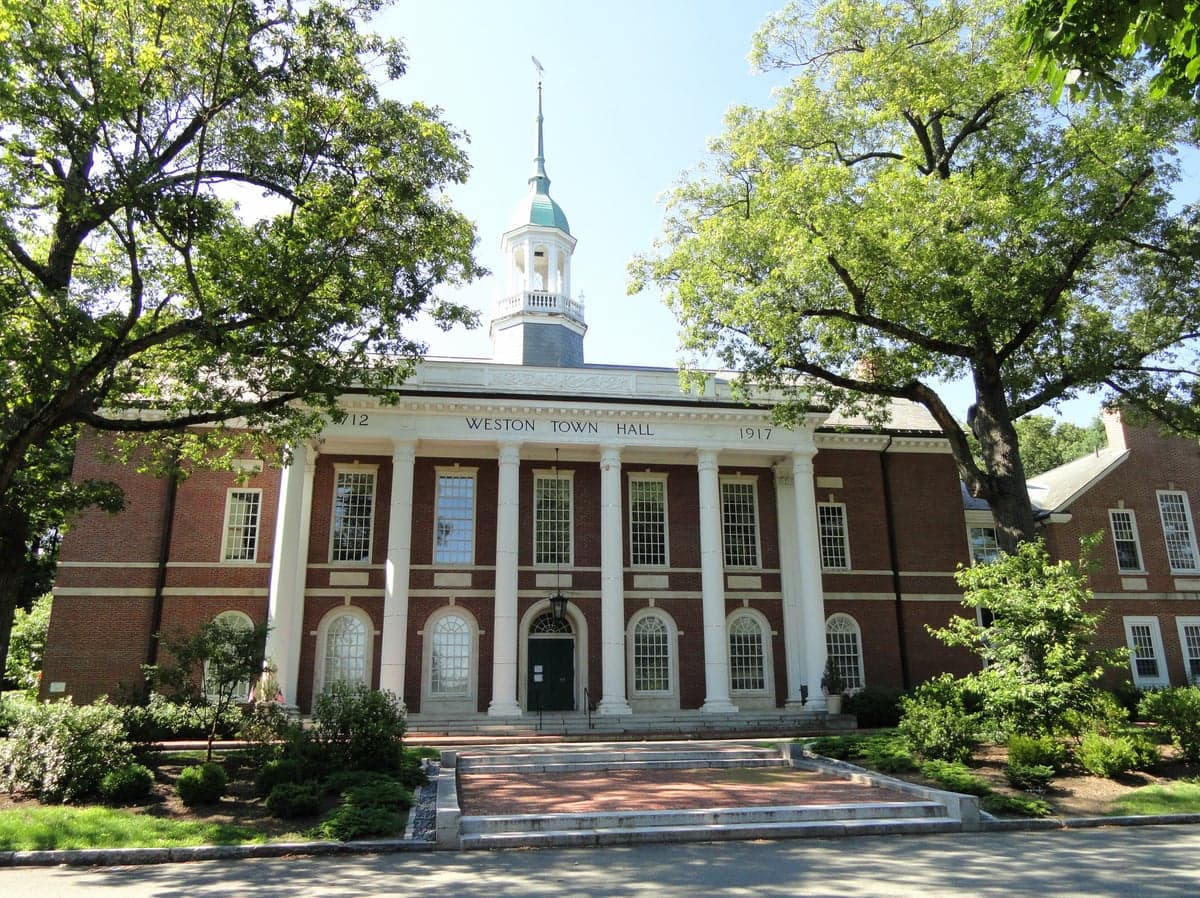
Photo: Wikipedia
Strategic Assessment of Weston, MA
Multiple tactical vulnerabilities. Population density, target proximity, or disaster risk are likely compounding. A retreat property and exit planning is required.
What does the Strategic Assessment tell us?
Our Strategic Assessment grades tactical survivability of an area. Major population centers, military targets, fallout zones, natural disasters, and border exposure all drive risk — lower exposure means a more defensible position in a crisis.
This is heavily inspired by Joel Skousen's Strategic Relocation book. Highly recommended you checkout the book ($)What does this tell us?
Our Strategic Assessment grades tactical survivability of an area. Major population centers, military targets, fallout zones, natural disasters, and border exposure all drive risk — lower exposure means a more defensible position in a crisis.
This is heavily inspired by Joel Skousen's Strategic Relocation book. Highly recommended you checkout the book ($)Strategic Pillars

Key Distances
Regional Safe Places
Below is our recommended "safe zones" in Massachusetts and the surrounding area based on our strategic heuristics. For most people, it's unrealistic to live in a “safe zone” full-time due to work, family or other personal reasons. They tend to be more rural. However, many of these areas are perfect for second homes and retreat properties that double as a vacation home or even a short-term rental.




Important Note: For informational purposes only. This does not mean nothing bad ever happens in the green zones. Please use common sense. This is based on public data and modeled with AI. We tried to take a conservative approach but mistakes happen. We update this regularly as new information becomes available.
Solar Generator Recommendations
Backup power matters more here than in safer locations. We've picked three solar generators across budgets and capacity tiers — start with the budget unit if you only need a few essentials, or step up if you want to run a fridge and HVAC for days at a time.

Jackery Portable Power Station Explorer 300
Budget OptionPower on the Go: Weighing only 11 lbs, it's convenient to set up and store with book-sized foldable solar panels

BLUETTI Portable Power Station AC180
Designed for both indoor and outdoor scenarios, AC180 is highly capable as it has a robost capacity and continuous output power.

EF ECOFLOW DELTA Pro Ultra Power Station
Upgraded PickEcoFlow DELTA Pro Ultra is a whole-home energy system designed to grow with your family. Integrated with the Smart Home Panel 2, it scales to meet your evolving energy needs — keeping your home powered, intelligent, and secure through every stage of life.
We earn a commission, at no additional cost to you.
Strategic Assessment Analysis
Weston, Massachusetts, presents a paradox for the strategic relocator: it offers exceptional natural resilience and geographic insulation from many common threats, yet its proximity to Boston and dense suburban infrastructure introduces distinct vulnerabilities that demand careful consideration. For the family or individual prioritizing disaster readiness and self-sufficiency, Weston’s value lies in its blend of rural-adjacent topography, established community resources, and relative distance from high-value targets—provided one accounts for the area’s specific exposure to cascading risks from the greater Boston metroplex. This assessment weighs those factors to give you a grounded, actionable picture of what living here means for long-term preparedness.
Geographic position and natural advantages for long-term security
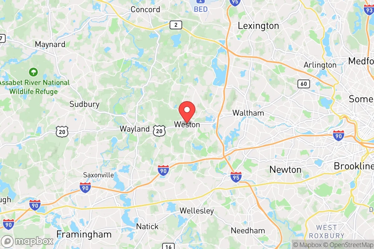
Weston sits roughly 15 miles west of downtown Boston, straddling the transition zone between the coastal plain and the more rugged, wooded terrain of central Massachusetts. This location offers several structural advantages. The town is built on a series of low hills and ridges, with elevations ranging from 100 to 300 feet above sea level, which provides natural drainage and reduces flood risk compared to communities along the Charles River or coastal areas like Revere or Quincy. The underlying geology is dominated by glacial till and bedrock, meaning the area is less prone to liquefaction during seismic events than the filled-in marshlands of Back Bay or South Boston. For the relocator concerned with natural disasters, Weston’s primary exposures are winter storms (Nor’easters) and occasional inland flooding from heavy rain—both manageable with proper preparation. The town’s extensive tree canopy and conservation land, including the 1,000-acre Weston Forest and the Cat Rock area, offer natural windbreaks and potential foraging or timber resources in a prolonged disruption. Critically, Weston is not in a designated hurricane evacuation zone, nor does it sit on a major floodplain, which places it in a lower-risk category than many eastern Massachusetts communities.
Risks, exposures, and proximity to fallout-relevant landmarks
The most significant strategic risk for Weston is its proximity to Boston and the dense web of infrastructure that supports the region’s economy and government. While the town itself is not a primary target, it lies within the fallout and secondary-effect zone of several high-consequence landmarks. Boston Logan International Airport is 18 miles east, and the Port of Boston handles container shipping and fuel imports—both are plausible targets in a conflict scenario. More directly, Weston is within 10 miles of Hanscom Air Force Base in Bedford, a major Air Force research and command facility, and within 20 miles of the Massachusetts Military Reservation on Cape Cod, which hosts the 102nd Intelligence Wing. The town is also adjacent to Route 128 (I-95), a critical transportation corridor that would likely be congested or compromised during an evacuation. For the relocator, this means that while Weston is not ground zero, it is close enough to experience fallout, supply chain disruption, and population displacement from the city. The town’s population density (roughly 1,200 people per square mile) is moderate, but its housing stock is predominantly large single-family homes on one- to three-acre lots, which offers some natural spacing. However, the area’s reliance on the regional power grid (Eversource) and natural gas supply (National Grid) means that a cyber or physical attack on substations in Waltham or Newton could leave Weston without power for extended periods. The town has no municipal water supply—residents rely on private wells—which is a double-edged sword: it reduces dependency on a centralized system but requires individual well maintenance and backup pumping capability.
Practical resilience for a relocator: food, water, energy, and defensibility
For the self-sufficient relocator, Weston offers a mixed but workable baseline. Water security is the strongest asset: nearly every home in Weston has a private well, drawing from the deep bedrock aquifer that is less vulnerable to surface contamination than municipal supplies. With a hand pump or solar-powered pump, a household can maintain water access even without grid power. The town’s conservation land and the Sudbury River watershed provide surface water sources, but these require filtration and are shared with upstream communities. Food resilience is moderate: Weston has no commercial agriculture to speak of, but the large lots (typically 1-3 acres) allow for substantial home gardening, small livestock, and fruit trees. The town’s farmers market and proximity to Lexington’s and Concord’s agricultural areas provide local food sources in normal times, but these would be strained in a crisis. The town’s zoning allows for backyard chickens and bees, and some residents maintain small orchards. For long-term food storage, the area’s cool basement and root cellar potential is excellent. Energy resilience requires upfront investment: Weston is fully dependent on the regional grid, but the prevalence of large, south-facing roofs and tree cover means solar is viable with proper siting. The town has no municipal natural gas network—most homes use oil or propane for heating—which means a fuel supply chain disruption would be felt quickly. Wood stoves are common in older homes, and the town’s forested areas provide a renewable heat source, but cutting and seasoning wood requires labor and storage. Defensibility is a function of layout: Weston’s winding, dead-end roads and limited through-traffic patterns make it naturally harder to navigate for outsiders, but also create choke points for evacuation. The town’s police department is small (about 25 officers) and would be overwhelmed in a widespread event. The community is tight-knit, with active neighborhood associations and a strong culture of mutual aid, which is a significant soft resilience factor. The town’s location on the western edge of the Boston metro area means that in a crisis, the primary threat is not direct attack but the influx of refugees from the east, combined with the failure of regional supply chains for food, fuel, and medical supplies.
The overall strategic picture for Weston is one of calculated trade-offs. It offers genuine natural advantages—elevated terrain, private wells, large lots, and forested buffers—that place it ahead of most suburban communities in terms of baseline resilience. The town’s distance from Boston (15 miles) is far enough to avoid the worst of a blast or fallout zone from a city-center event, but close enough to be affected by secondary effects like population displacement, infrastructure failure, and supply chain collapse. For the relocator who is willing to invest in off-grid energy (solar + battery), water backup (hand pump or generator), and food production (garden, livestock, storage), Weston provides a defensible, resource-rich base that is still within commuting distance of Boston for normal times. The key vulnerability is the area’s integration into the regional grid and its proximity to high-value military and transportation targets. If your threat model includes a major conflict or prolonged grid failure, Weston is a strong choice—provided you treat it as a base camp, not a fortress, and plan for the reality that you may need to shelter in place for weeks while the region stabilizes. For the family that values both normal-life convenience and serious preparedness, Weston offers one of the better balances in eastern Massachusetts.

* Values derived from national, state, county, city and local statistics and may differ in a specific area. Last updated: 2026-10-12T22:11:14.000Z
Narrative content on this page is AI-generated and may contain mistakes. Verify any details that matter before acting on them.
ReloMaps may earn a commission from affiliate links at no extra cost to you.

