Photo: Wikipedia
Strategic Assessment of Wayne, MI
Multiple tactical vulnerabilities. Population density, target proximity, or disaster risk are likely compounding. A retreat property and exit planning is required.
What does the Strategic Assessment tell us?
Our Strategic Assessment grades tactical survivability of an area. Major population centers, military targets, fallout zones, natural disasters, and border exposure all drive risk — lower exposure means a more defensible position in a crisis.
This is heavily inspired by Joel Skousen's Strategic Relocation book. Highly recommended you checkout the book ($)What does this tell us?
Our Strategic Assessment grades tactical survivability of an area. Major population centers, military targets, fallout zones, natural disasters, and border exposure all drive risk — lower exposure means a more defensible position in a crisis.
This is heavily inspired by Joel Skousen's Strategic Relocation book. Highly recommended you checkout the book ($)Strategic Pillars

Key Distances
Regional Safe Places
Below is our recommended "safe zones" in Michigan and the surrounding area based on our strategic heuristics. For most people, it's unrealistic to live in a “safe zone” full-time due to work, family or other personal reasons. They tend to be more rural. However, many of these areas are perfect for second homes and retreat properties that double as a vacation home or even a short-term rental.


Important Note: For informational purposes only. This does not mean nothing bad ever happens in the green zones. Please use common sense. This is based on public data and modeled with AI. We tried to take a conservative approach but mistakes happen. We update this regularly as new information becomes available.
Solar Generator Recommendations
Backup power matters more here than in safer locations. We've picked three solar generators across budgets and capacity tiers — start with the budget unit if you only need a few essentials, or step up if you want to run a fridge and HVAC for days at a time.

Jackery Portable Power Station Explorer 300
Budget OptionPower on the Go: Weighing only 11 lbs, it's convenient to set up and store with book-sized foldable solar panels

BLUETTI Portable Power Station AC180
Designed for both indoor and outdoor scenarios, AC180 is highly capable as it has a robost capacity and continuous output power.

EF ECOFLOW DELTA Pro Ultra Power Station
Upgraded PickEcoFlow DELTA Pro Ultra is a whole-home energy system designed to grow with your family. Integrated with the Smart Home Panel 2, it scales to meet your evolving energy needs — keeping your home powered, intelligent, and secure through every stage of life.
We earn a commission, at no additional cost to you.
Strategic Assessment Analysis
Wayne, Michigan, presents a mixed strategic picture for the relocation-minded reader focused on resilience and self-sufficiency. While its location in southeastern Michigan offers certain logistical advantages, its proximity to major population centers and critical infrastructure introduces significant vulnerabilities that a serious preparedness-minded individual must weigh. The city's position within a dense suburban corridor means that any large-scale disruption—whether natural, economic, or geopolitical—would likely be compounded by the sheer density of people and assets nearby, making true isolation or independent operation difficult.
Geographic position and natural advantages for a self-sufficient lifestyle
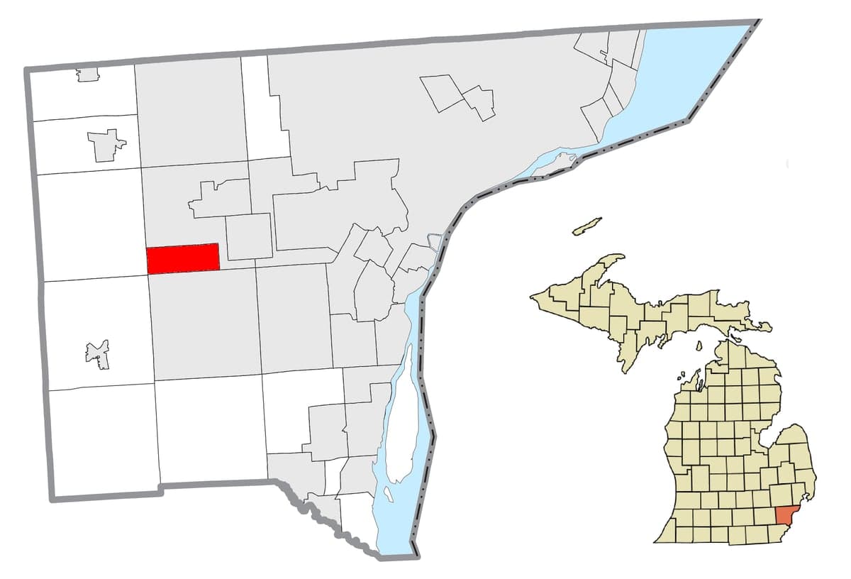
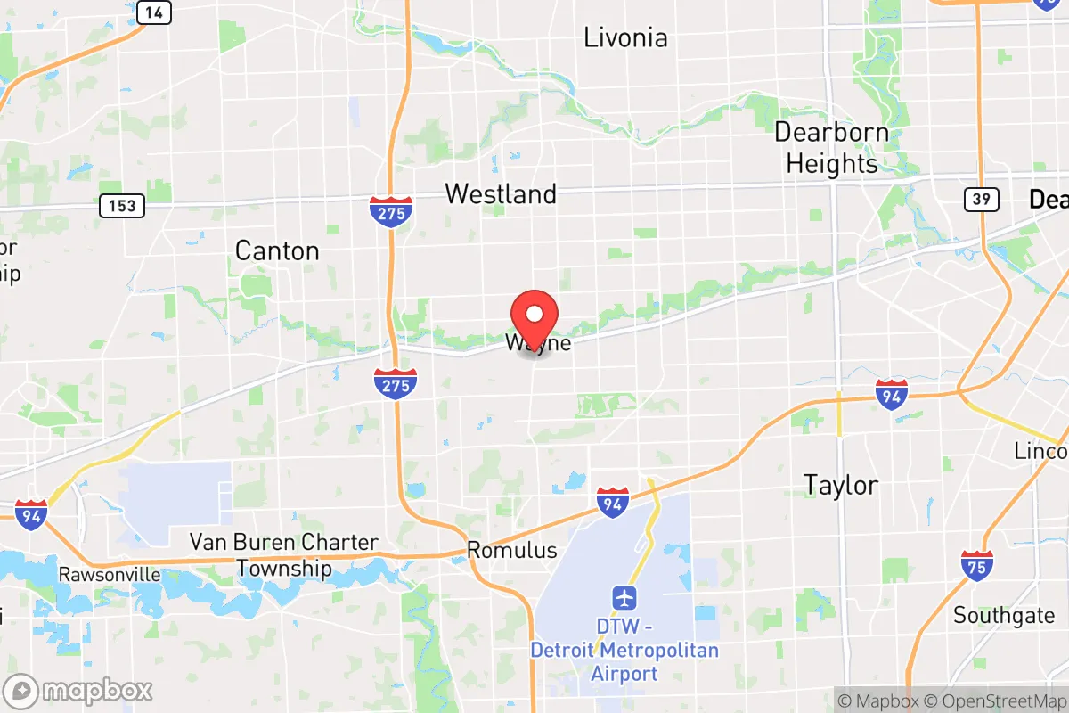
Wayne sits in Wayne County, roughly 15 miles west of Detroit, placing it squarely within the Detroit metropolitan area. The area's primary natural advantage is its access to the Great Lakes watershed, particularly the Detroit River and Lake Erie to the south and east, which provide abundant fresh water—a critical resource for any long-term resilience plan. The region's flat terrain and fertile glacial soils support agriculture, though much of the land immediately around Wayne is developed suburban and industrial. The Huron River and the Rouge River systems run nearby, offering potential for small-scale water collection and fishing, though both have histories of industrial pollution that require careful testing before use. The climate is temperate, with cold winters and warm summers, allowing for a growing season of roughly 150–170 days—enough for a serious home garden but not for year-round outdoor food production without season extension techniques. The area's primary natural risk is severe weather: tornadoes (though typically EF0–EF2 in this part of Michigan), heavy lake-effect snow, and occasional ice storms that can knock out power for days. Flooding is a real concern in low-lying areas near the Rouge River, particularly in the southern parts of Wayne and neighboring communities like Inkster and Westland. The city itself is not in a designated floodplain for the most part, but heavy rain events have caused localized street flooding in recent years.
Risks, exposures, and proximity to fallout-relevant landmarks
The most significant resilience challenge for Wayne is its proximity to high-value, high-risk targets. The city lies within 20 miles of Detroit's urban core, which includes the Detroit Metro Airport (DTW) just 5 miles south, the Ambassador Bridge and Detroit-Windsor Tunnel (key international border crossings), and major industrial facilities including the Ford River Rouge Complex in Dearborn—one of the largest integrated manufacturing plants in the world. In a geopolitical crisis or conflict scenario, these are plausible targets for disruption, whether through cyberattack, sabotage, or kinetic strike. The proximity to DTW is a double-edged sword: it provides evacuation options by air in a slow-moving crisis, but in a sudden event, the airport and its surrounding infrastructure would be a focal point for chaos, roadblocks, and potential secondary hazards (fuel depots, cargo handling). Additionally, Wayne is within 30 miles of the Fermi 2 nuclear power plant in Newport, Michigan, and within 100 miles of the Palisades plant (now decommissioned but still storing spent fuel) near South Haven. While the risk of a nuclear incident is low, the presence of these facilities adds a layer of concern for the serious preparedness planner. The area's dense road network (I-94, I-275, M-14) means that any major disruption would quickly gridlock evacuation routes, particularly if multiple communities try to flee simultaneously. The city's population of roughly 17,000 is modest, but it is surrounded by a metropolitan area of over 4 million people, meaning that in a crisis, Wayne would not be a refuge but rather a pressure point in a larger system.
Practical resilience for a relocator: food, water, energy, and defensibility
For a relocator serious about self-sufficiency, Wayne's practical resilience is limited without significant investment and adaptation. Water is the strongest asset: the city draws from the Detroit Water and Sewerage Department system, which treats water from the Detroit River. In a grid-down scenario, a well is not a common feature in most Wayne homes due to the municipal water system, but properties on larger lots or in the more rural western edges of the township may have access to groundwater. A backup plan involving rainwater collection (the area averages 32 inches of rain per year) and storage is feasible, though winter freezing requires indoor or insulated storage. Food production is possible but constrained by lot sizes—most residential parcels are a quarter-acre or less. Community gardens exist but are limited. The surrounding agricultural land in western Wayne County and Washtenaw County (20–30 minutes west) offers better options for serious gardening or small-scale farming, but that requires land ownership or long-term lease arrangements. Energy resilience is a weak point. The grid is reliable day-to-day but vulnerable to ice storms and high winds. Solar potential is moderate—Michigan averages 160–180 sunny days per year, less than the Southwest but enough for a grid-tied system with battery backup. Natural gas is widely available for heating and cooking, but a prolonged grid outage would cut gas distribution as well (pumping stations require electricity). Wood heating is possible but not common in suburban Wayne; firewood availability is limited and would require sourcing from rural areas. Defensibility is the hardest challenge. Wayne is a typical suburban grid of streets with easy access from multiple directions. There are no natural chokepoints or defensible terrain features. The city's police department is small (around 30 officers), and in a prolonged crisis, law enforcement would likely be stretched thin, as seen during the 2020 civil unrest in nearby Detroit and Ann Arbor. A relocator would need to rely on strong community ties, neighborhood watch structures, and personal security measures rather than geographic isolation. The city's location near major highways also means it could become a transit corridor for people fleeing Detroit or other urban centers, increasing the risk of opportunistic crime or resource competition.
Overall, Wayne offers a mixed strategic picture for the resilience-minded relocator. Its access to fresh water and proximity to agricultural land are genuine advantages, but its position within a dense, target-rich metropolitan area introduces risks that are hard to mitigate through personal preparedness alone. For someone willing to invest in robust backup systems (water storage, solar, food production) and build strong local networks, Wayne could serve as a base of operations—but it is not a retreat or a bug-out location. The serious planner would likely view Wayne as a stepping stone: a place to establish a foothold while scouting more defensible, lower-density property farther west in Washtenaw or Livingston counties, where the same water and agricultural advantages exist with far less exposure to the risks of a major metropolitan collapse. If you are looking for a location that balances suburban convenience with a realistic path toward self-sufficiency, Wayne requires careful, honest assessment of its vulnerabilities—and a willingness to invest in the systems and relationships that will matter most when the grid goes quiet.

* Values derived from national, state, county, city and local statistics and may differ in a specific area. Last updated: 2026-11-10T16:30:59.000Z
Narrative content on this page is AI-generated and may contain mistakes. Verify any details that matter before acting on them.
ReloMaps may earn a commission from affiliate links at no extra cost to you.

