Photo: Wikipedia
Strategic Assessment of Walkerton, IN
Meaningful friction. Expect exposure to either population pressure, blast zones, or natural disaster risk. Consider buying a retreat property.
What does the Strategic Assessment tell us?
Our Strategic Assessment grades tactical survivability of an area. Major population centers, military targets, fallout zones, natural disasters, and border exposure all drive risk — lower exposure means a more defensible position in a crisis.
This is heavily inspired by Joel Skousen's Strategic Relocation book. Highly recommended you checkout the book ($)What does this tell us?
Our Strategic Assessment grades tactical survivability of an area. Major population centers, military targets, fallout zones, natural disasters, and border exposure all drive risk — lower exposure means a more defensible position in a crisis.
This is heavily inspired by Joel Skousen's Strategic Relocation book. Highly recommended you checkout the book ($)Strategic Pillars

Key Distances
Regional Safe Places
Below is our recommended "safe zones" in Indiana and the surrounding area based on our strategic heuristics. For most people, it's unrealistic to live in a “safe zone” full-time due to work, family or other personal reasons. They tend to be more rural. However, many of these areas are perfect for second homes and retreat properties that double as a vacation home or even a short-term rental.

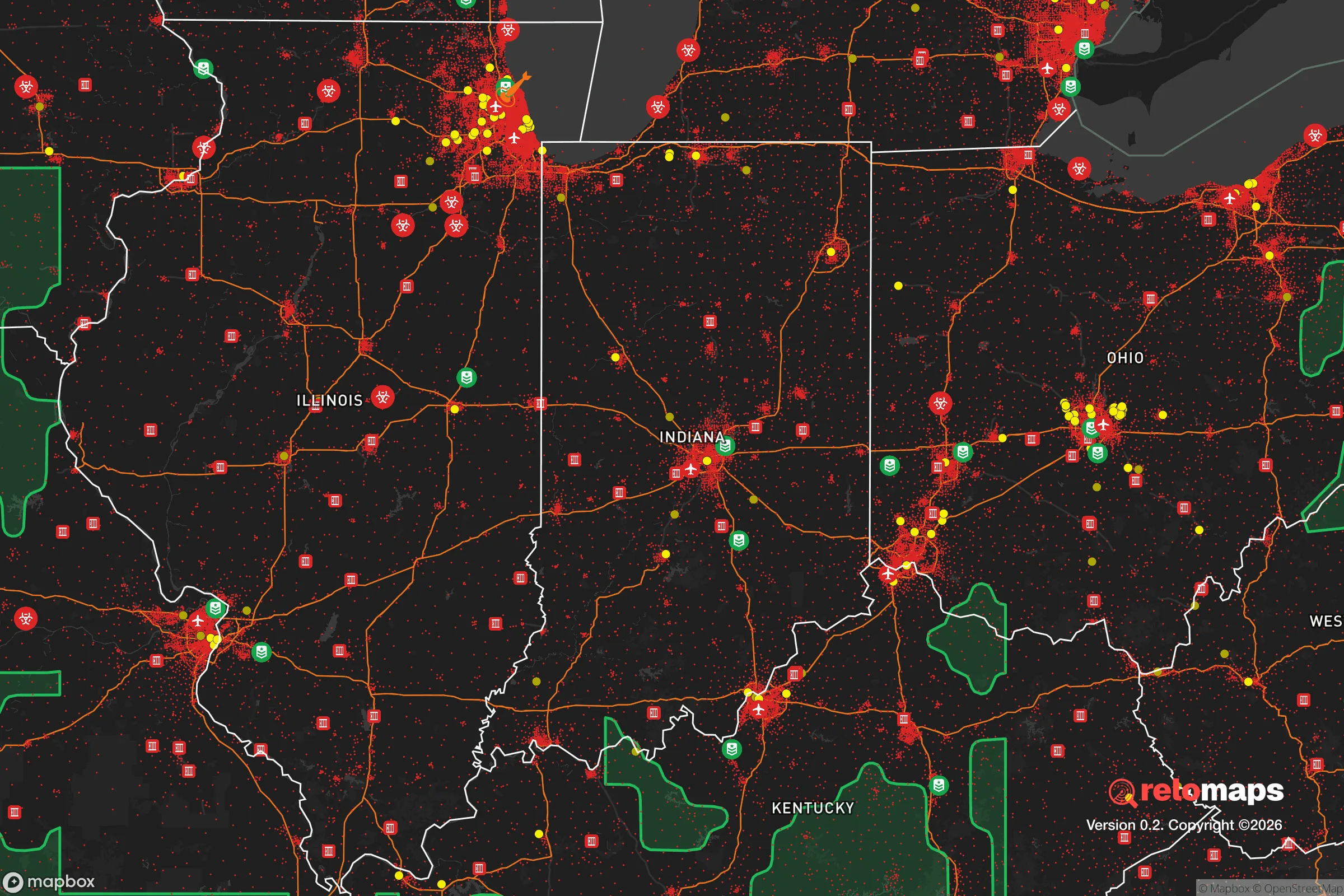


Important Note: For informational purposes only. This does not mean nothing bad ever happens in the green zones. Please use common sense. This is based on public data and modeled with AI. We tried to take a conservative approach but mistakes happen. We update this regularly as new information becomes available.
Solar Generator Recommendations
Backup power matters more here than in safer locations. We've picked three solar generators across budgets and capacity tiers — start with the budget unit if you only need a few essentials, or step up if you want to run a fridge and HVAC for days at a time.
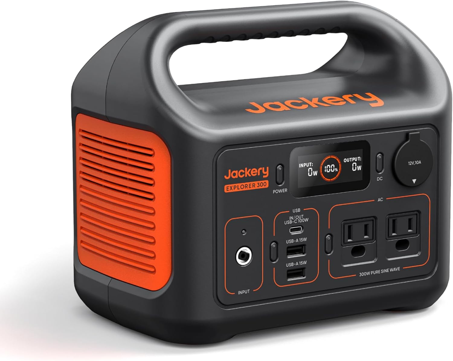
Jackery Portable Power Station Explorer 300
Budget OptionPower on the Go: Weighing only 11 lbs, it's convenient to set up and store with book-sized foldable solar panels

BLUETTI Portable Power Station AC180
Designed for both indoor and outdoor scenarios, AC180 is highly capable as it has a robost capacity and continuous output power.

EF ECOFLOW DELTA Pro Ultra Power Station
Upgraded PickEcoFlow DELTA Pro Ultra is a whole-home energy system designed to grow with your family. Integrated with the Smart Home Panel 2, it scales to meet your evolving energy needs — keeping your home powered, intelligent, and secure through every stage of life.
We earn a commission, at no additional cost to you.
Strategic Assessment Analysis
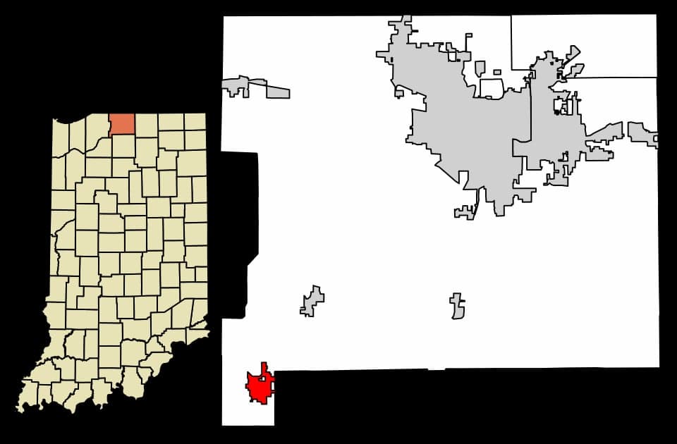
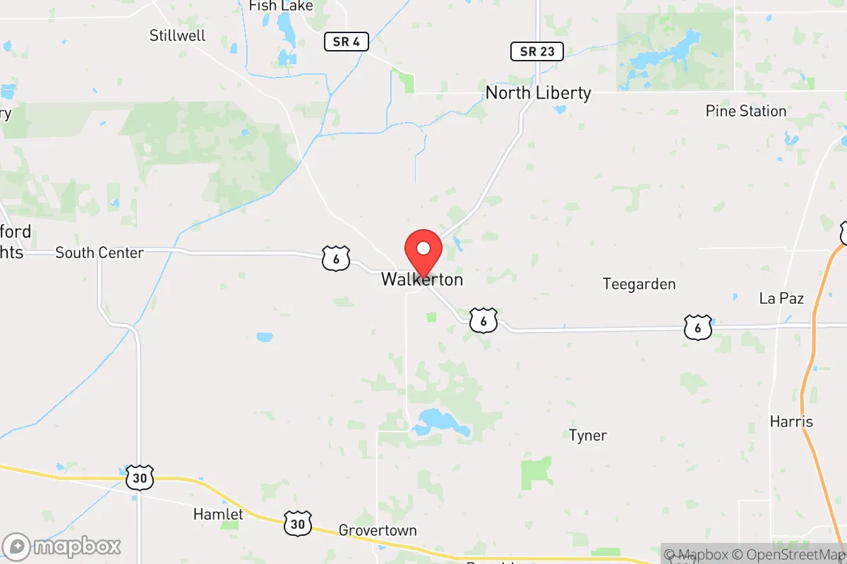
Walkerton, Indiana sits in the northeast corner of St. Joseph County where the Kankakee River crosses from St. Joseph into Marshall County, roughly 25 miles south of South Bend and 30 miles southwest of Elkhart. For a reader weighing disaster readiness and self-sufficiency, the town's core strategic value is straightforward: it is a small, low-profile agricultural community with its own water source, surrounded by productive farmland, and far enough from major population centers that it is unlikely to be a primary target or a first-wave destination for mass evacuation. It is not a fortress, and it is not remote — but it scores well on the fundamentals that matter most in a grid-down or supply-chain-disruption scenario.
Where Walkerton sits geographically and why that matters
Walkerton's position on the Kankakee River is the single most important geographic fact about it. The river provides a perennial surface water source independent of municipal wells, and the surrounding floodplain — while a hazard in wet years — is also why the area has some of the most productive corn and soybean ground in Indiana. St. Joseph County consistently ranks among the state's top agricultural counties, and the flat, well-drained glacial till around Walkerton supports row crops within a few miles of downtown in every direction. That matters for food resilience: a community embedded in working farmland has a shorter, more defensible food supply chain than a suburb dependent on grocery logistics.
The town also sits at a genuine transportation crossroads. U.S. 6 runs east-west through the area, and State Road 23 connects Walkerton north toward South Bend and south toward U.S. 30. That is a double-edged feature — good for commerce and access, less good for isolation — but it means the town is not a dead end. The broader region is served by South Bend International Airport and the Norfolk Southern and CSX rail corridors that run through northern Indiana, which is relevant both to economic resilience and to the exposure discussion below. Climate-wise, Walkerton sits in USDA Zone 6a, with a growing season long enough to support serious home food production and a winter cold enough to test any off-grid heating plan.
Risks, exposures, and proximity to fallout-relevant landmarks
The honest assessment is that Walkerton's risk profile is dominated by man-made infrastructure exposure rather than natural catastrophe. Northern Indiana's rail network carries a substantial volume of hazardous materials, and the U.S. 6/State Road 23 corridors put Walkerton within a few miles of routine hazmat transport. More significantly, the region contains several facilities that would matter in a serious industrial or radiological event: the steel and manufacturing belt around South Bend, Elkhart, and Mishawaka lies 25 to 35 miles north, and the greater Chicago industrial corridor — including the nuclear plants at Dresden and Braidwood in Illinois — sits roughly 100 to 130 miles west-northwest. Walkerton is outside the immediate emergency planning zones for those plants, but it is not outside the plume-consideration radius for a large-scale release under adverse wind conditions. Prevailing winds in northern Indiana are typically from the west and southwest, which puts Walkerton downwind of the Chicago corridor more often than not.
Natural risks are moderate and well understood. The Kankakee River floods — the town has seen repeated high-water events, and low-lying parcels near the river should be evaluated carefully before purchase. Tornado risk is real across northern Indiana but not exceptional; the region averages a handful of warnings per year and the occasional confirmed touchdown. Winter ice storms are the more frequent disruptor, taking down power lines and closing roads for days at a time. The nearest large population centers — South Bend, Mishawaka, Elkhart — are 25 to 35 miles away, which is close enough that a regional evacuation would push traffic through the area but far enough that Walkerton would not be the first stop. That distance is a meaningful buffer in a crisis, though it also means the town's hospital, grocery, and fuel access depend on those same corridors.
Practical resilience for a relocator: food, water, energy, and defensibility
On the practical side, Walkerton offers a solid but not exceptional foundation, and the gaps are the things a serious prepper should plan to close personally.
- Water: The Kankakee River and the town's municipal wells give Walkerton a real advantage over communities dependent on a single distant source. A shallow well or hand pump on a rural parcel is feasible given the area's water table, and river access provides a backup for non-potable use. Treat any surface water; agricultural runoff in the Kankakee watershed is significant.
- Food: Surrounded by row-crop agriculture, but row crops are commodity corn and soy, not calories you can eat directly. A relocator serious about food security should plan a substantial garden, fruit and nut plantings, and ideally small livestock — the zoning in the surrounding townships is permissive enough for this on acreage parcels. Local food infrastructure is thin: the nearest full-service groceries are in Plymouth, Bremen, and the South Bend area.
- Energy: Grid service is reliable in normal years but vulnerable to ice storms. Propane is the dominant rural heating fuel, and a woodlot plus a wood stove is a realistic backup on larger parcels. Solar exposure is average for the Midwest — workable for a grid-tied or modest off-grid array, less so for full winter independence without battery capacity. Generator fuel storage is worth planning given the distance to refueling.
- Defensibility: Walkerton is a small town of roughly 2,000 people with a local police presence and low crime by national standards. Its main vulnerability is the highway access that also makes it convenient — U.S. 6 and State Road 23 bring through-traffic, and in a regional disruption the town sits on a plausible evacuation route. Rural parcels set back from the highways offer better privacy and standoff distance than in-town lots.
The strategic picture for Walkerton is that of a competent, unspectacular hedge: a small agricultural town with independent water, productive surrounding land, moderate natural risk, and meaningful but manageable exposure to the industrial and rail corridors of northern Indiana. It is not a remote redoubt, and anyone treating it as one will be disappointed — the Chicago corridor is downwind, the highways bring traffic, and the food system is commodity-scale rather than subsistence-scale. But for a family or individual who wants a low-cost, low-profile base with real water access, room to grow food, and a 25-to-35-mile buffer from the region's larger cities, Walkerton delivers the fundamentals at a price that leaves budget for the improvements — well, garden, storage, backup heat — that actually determine resilience. The right posture is to buy the land and water, build the food and energy systems yourself, and treat proximity to South Bend and the northern Indiana industrial belt as a known, priced-in risk rather than a disqualifier.

* Values derived from national, state, county, city and local statistics and may differ in a specific area. Last updated: 2026-11-03T15:06:36.000Z
Narrative content on this page is AI-generated and may contain mistakes. Verify any details that matter before acting on them.
ReloMaps may earn a commission from affiliate links at no extra cost to you.

