
Photo by Library of Congress on Unsplash
Strategic Assessment of Winchester City County
Meaningful friction. Expect exposure to either population pressure, blast zones, or natural disaster risk. Consider buying a retreat property.
What does the Strategic Assessment tell us?
Our Strategic Assessment grades tactical survivability of an area. Major population centers, military targets, fallout zones, natural disasters, and border exposure all drive risk — lower exposure means a more defensible position in a crisis.
This is heavily inspired by Joel Skousen's Strategic Relocation book. Highly recommended you checkout the book ($)What does this tell us?
Our Strategic Assessment grades tactical survivability of an area. Major population centers, military targets, fallout zones, natural disasters, and border exposure all drive risk — lower exposure means a more defensible position in a crisis.
This is heavily inspired by Joel Skousen's Strategic Relocation book. Highly recommended you checkout the book ($)Strategic Pillars

Key Distances
Strategic Assessment Analysis
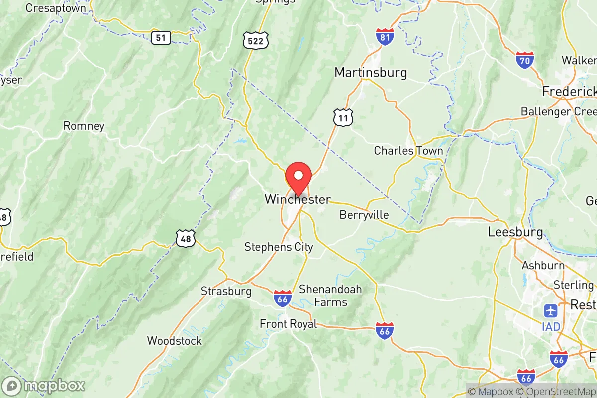
Winchester City, Virginia, occupies a strategic position in the northern Shenandoah Valley that offers a compelling mix of geographic insulation and practical resilience for relocation-minded individuals and families. As an independent city surrounded by Frederick County, it sits roughly 75 miles west of Washington, D.C., and 25 miles north of the I-81/I-66 interchange, placing it far enough from major metropolitan blast zones to avoid direct fallout exposure while remaining within a day’s drive of critical supply chains and medical infrastructure. The city’s location at the northern gateway of the Valley—flanked by the Blue Ridge Mountains to the east and the Allegheny Front to the west—provides natural chokepoint defensibility and access to abundant freshwater resources, making it a viable base for those prioritizing self-sufficiency and long-term stability.
Geographic position and natural advantages for long-term stability
Winchester’s geography is its strongest asset for resilience. The city lies in a broad, fertile valley at an elevation of roughly 725 feet, with the Shenandoah River and its tributaries—including Opequon Creek and Abrams Creek—running through the area. This positions it within the Potomac River watershed, giving residents access to surface water that is less contested than in the arid West or the over-allocated Colorado Basin. The surrounding Frederick County is agricultural, with over 1,200 farms producing apples, poultry, and grains, which means local food sources are not hypothetical but operational. The Massanutten Mountain range and the Blue Ridge create a natural buffer against storm systems moving from the Atlantic, reducing hurricane wind impacts compared to coastal Virginia. Winter storms are manageable—average snowfall is about 22 inches annually—and the region rarely sees tornado activity of the intensity found in the Plains. For a relocator, this means fewer natural-disaster disruptions to daily life and a lower risk of catastrophic infrastructure failure.
Risks, exposures, and proximity to fallout-relevant landmarks
While Winchester is not a primary target, it sits within a zone that carries secondary risks due to its proximity to high-value infrastructure. The city is 75 miles from Washington, D.C., a likely nuclear or EMP target, and roughly 50 miles from the Dulles International Airport corridor, which includes data centers and federal communications hubs. The I-81 corridor, which runs just west of the city, is a major freight artery for the eastern U.S., carrying hazardous materials including propane, ammonia, and industrial chemicals. A derailment or accident near the Winchester Regional Airport or the I-81/I-66 interchange could disrupt supply routes for days. Additionally, the Clarke County nuclear reactor (the North Anna Power Station, about 90 miles southeast) is a potential fallout source if compromised, though prevailing winds from the west-southwest would carry contamination away from Winchester in most scenarios. The city itself has no major refineries or military bases, but the Army’s Fort Belvoir (80 miles east) and Quantico Marine Corps Base (90 miles southeast) are within a 90-minute drive, meaning military traffic and potential secondary targets are a realistic concern. Flooding along Abrams Creek and Opequon Creek is a localized risk after heavy rains, but the city’s stormwater management system has been upgraded since 2018, reducing the likelihood of widespread inundation.
Practical resilience for a relocator: food, water, energy, and defensibility
For a family or individual serious about self-sufficiency, Winchester offers a strong baseline. Water access is the standout advantage: the city draws from the Shenandoah River and several deep wells, with a treatment plant capacity of 12 million gallons per day—ample for the city’s 28,000 residents. Backup generators at the water plant ensure supply during grid outages, though a long-term EMP event would require manual pumping. The surrounding county has over 300 registered private wells, and many rural properties can drill new ones at depths of 100–300 feet. Food resilience is equally solid: the Winchester Farmers Market operates year-round, and the area’s apple orchards (the city is known as the “Apple Capital”) produce a surplus that can be stored or preserved. Poultry processing plants in nearby Berryville and Edinburg provide protein sources within a 30-mile radius. Energy infrastructure is more vulnerable: the city is served by Dominion Energy, with transmission lines running along the I-81 corridor that are exposed to weather and sabotage. Solar adoption is growing but still low—roughly 5% of homes have panels—so a relocator should plan for off-grid generation. Defensibility is moderate: the valley’s narrow north-south axis means that I-81 and US-50 are the only major routes in and out, creating natural chokepoints that could be controlled by local law enforcement or community groups during a crisis. The Frederick County Sheriff’s Office and Winchester Police Department maintain a combined force of about 150 sworn officers, which is adequate for routine security but would be stretched thin in a regional emergency.
The overall strategic picture for Winchester City County is one of balanced resilience with clear trade-offs. It avoids the direct blast and fallout risks of D.C., Richmond, or the Hampton Roads ports, while retaining access to medical care (Valley Health’s Winchester Medical Center is a Level II trauma center) and supply routes via I-81 and US-50. The agricultural base and water abundance give it a genuine self-sufficiency advantage over suburban sprawl areas like Loudoun County or Prince William County. However, the city’s dependence on a single major highway for resupply, its proximity to high-value federal targets, and the lack of hardened energy infrastructure mean that a relocator should invest in backup power, water storage, and community ties before a crisis. For a conservative-leaning family seeking a place that is rural-adjacent but not isolated, with a working local economy and a history of civic preparedness, Winchester represents a solid, defensible choice—provided the risks of its corridor location are acknowledged and mitigated.

* Values derived from national, state, county, city and local statistics and may differ in a specific area. Last updated: 2026-07-23T01:01:18.000Z
Narrative content on this page is AI-generated and may contain mistakes. Verify any details that matter before acting on them.
ReloMaps may earn a commission from affiliate links at no extra cost to you.

