
Photo: Anthony Chiado via Unsplash
Strategic Assessment of Harrisonburg City County
Meaningful friction. Expect exposure to either population pressure, blast zones, or natural disaster risk. Consider buying a retreat property.
What does the Strategic Assessment tell us?
Our Strategic Assessment grades tactical survivability of an area. Major population centers, military targets, fallout zones, natural disasters, and border exposure all drive risk — lower exposure means a more defensible position in a crisis.
This is heavily inspired by Joel Skousen's Strategic Relocation book. Highly recommended you checkout the book ($)What does this tell us?
Our Strategic Assessment grades tactical survivability of an area. Major population centers, military targets, fallout zones, natural disasters, and border exposure all drive risk — lower exposure means a more defensible position in a crisis.
This is heavily inspired by Joel Skousen's Strategic Relocation book. Highly recommended you checkout the book ($)Strategic Pillars

Key Distances
Strategic Assessment Analysis
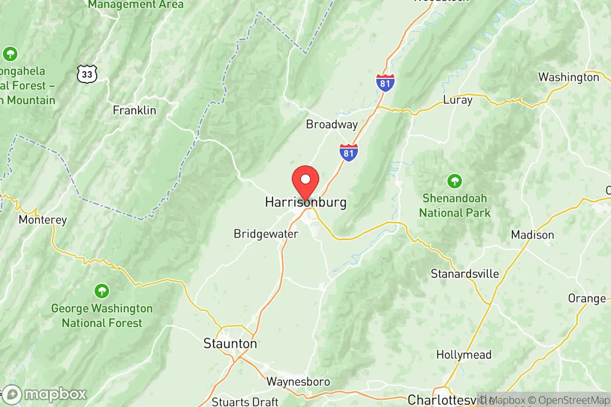
Harrisonburg City County, Virginia, occupies a strategic position in the Shenandoah Valley that offers a compelling mix of natural defensibility and practical self-sufficiency for relocators prioritizing resilience. Its location roughly 120 miles southwest of Washington, D.C., and 50 miles northeast of Roanoke places it outside the immediate blast and fallout zones of major metropolitan targets, while still providing access to regional supply chains and medical infrastructure. The city itself, with a population of roughly 53,000, sits in a valley flanked by the Allegheny Mountains to the west and the Blue Ridge Mountains to the east, creating a natural funnel that concentrates resources and limits approach vectors—a geographic advantage that has historically made the area a strategic crossroads.
Geographic position and natural advantages for long-term stability
Harrisonburg’s position in the Shenandoah Valley is its primary strategic asset. The valley is a fertile agricultural corridor, with the city surrounded by some of the most productive farmland in Virginia, including extensive poultry and dairy operations. This means local food production is not a theoretical backup but an active, ongoing reality. The North River, a tributary of the Shenandoah, runs through the city, providing a reliable surface water source, and the underlying karst aquifer system supplies groundwater that is generally abundant and of good quality. The surrounding mountains—Massanutten Mountain to the east and the Allegheny Front to the west—offer natural barriers that slow movement and provide defensible high ground. For a relocator, this means the area is less exposed to the rapid spread of chaos from coastal population centers than locations closer to I-95 or the Washington-Baltimore corridor. The valley’s elevation, averaging around 1,300 feet, also reduces the risk of flooding compared to low-lying coastal areas, though localized flash flooding in the city’s lower-lying neighborhoods near the North River remains a concern during heavy rain events.
Risks, exposures, and proximity to fallout-relevant landmarks
While Harrisonburg avoids the worst of coastal and metropolitan risks, it is not immune to man-made and natural threats. The most significant man-made risk comes from its position along the I-81 corridor, a major north-south trucking route that carries hazardous materials, including fuel, chemicals, and industrial goods. A derailment or truck accident involving hazardous materials near the city’s rail yard or the I-81 interchange at Exit 247 could contaminate local water supplies or force evacuations. Additionally, the city is roughly 60 miles southwest of the Front Royal area, which hosts a major natural gas storage facility and pipeline hub—a potential target for sabotage or accident. On the military front, Harrisonburg is about 90 miles from Fort Barfoot (formerly Fort Pickett) near Blackstone, a Virginia Army National Guard training center that could become a staging area during a crisis, potentially drawing secondary threats. The nearest nuclear power plant is the North Anna station, about 80 miles east near Mineral, Virginia—well outside the 10-mile emergency planning zone but within the 50-mile ingestion pathway zone, meaning fallout from a major accident could reach the valley depending on wind patterns. Natural risks are moderate: the area lies in a seismic zone that produces occasional minor tremors (the 2011 Mineral earthquake was felt here), and severe thunderstorms with damaging winds and hail are common in spring and summer. Tornadoes are rare but not unheard of; the 2018 EF-1 tornado that struck nearby Mount Crawford is a reminder that the valley can produce twisters.
Practical resilience for a relocator: food, water, energy, and defensibility
For a relocator serious about self-sufficiency, Harrisonburg offers several concrete advantages. Food security is strong: the city is the commercial hub for the Shenandoah Valley’s agricultural output, with multiple year-round farmers’ markets, including the Harrisonburg Farmers Market (operating Saturdays and Wednesdays), and direct access to local meat, dairy, and produce from farms within a 20-mile radius. The presence of James Madison University (JMU) and its agricultural extension programs means there is institutional knowledge and community resources for gardening, canning, and livestock management. Water security is generally good: the city draws from the North River and a network of wells, and the aquifer is replenished by valley rainfall. However, the municipal system is centralized, so a relocator should plan for private well access or rainwater catchment if living outside city limits. Energy resilience is a mixed picture: the grid is served by Dominion Energy, which has faced reliability issues during winter storms (like the 2022 ice storm that left parts of the valley without power for days). Solar potential is decent, with the valley receiving about 200 sunny days per year, but the surrounding mountains can create shading challenges in narrow valleys. Wood heating is a practical backup, given the abundance of hardwood forests in the George Washington National Forest to the west. Defensibility is where Harrisonburg truly shines: the city’s layout, with the mountains forming natural chokepoints at the north and south ends of the valley, means that a small, organized group could effectively control access via the limited number of roads (primarily I-81, US-33, and VA-42). The city itself is compact, with a walkable downtown core and a grid street pattern that facilitates neighborhood-level security. The surrounding rural areas offer numerous defensible homesteads with good sightlines and limited approach routes.
The overall strategic picture for Harrisonburg City County is one of moderate-to-high resilience for a relocator willing to invest in preparation. It avoids the worst of coastal and metropolitan risks while sitting in a region with abundant natural resources and a strong agricultural base. The primary vulnerabilities—the I-81 corridor’s hazardous material traffic, the distant but real threat from North Anna, and the potential for grid failures during winter storms—are manageable with proper planning. For a family or individual looking for a location that balances access to civilization with genuine self-sufficiency potential, Harrisonburg represents one of the better options in the Mid-Atlantic. The key is to secure property with private water and a defensible position outside the immediate city limits, ideally on the western side of the valley near the national forest, where the mountains provide both resources and a natural buffer. The area’s conservative-leaning culture and strong community networks also align well with the self-reliance mindset that resilience planning demands.

* Values derived from national, state, county, city and local statistics and may differ in a specific area. Last updated: 2026-07-03T01:40:26.000Z
Narrative content on this page is AI-generated and may contain mistakes. Verify any details that matter before acting on them.
ReloMaps may earn a commission from affiliate links at no extra cost to you.

