
Strategic Assessment of Fairfax City County
Meaningful friction. Expect exposure to either population pressure, blast zones, or natural disaster risk. Consider buying a retreat property.
What does the Strategic Assessment tell us?
Our Strategic Assessment grades tactical survivability of an area. Major population centers, military targets, fallout zones, natural disasters, and border exposure all drive risk — lower exposure means a more defensible position in a crisis.
This is heavily inspired by Joel Skousen's Strategic Relocation book. Highly recommended you checkout the book ($)What does this tell us?
Our Strategic Assessment grades tactical survivability of an area. Major population centers, military targets, fallout zones, natural disasters, and border exposure all drive risk — lower exposure means a more defensible position in a crisis.
This is heavily inspired by Joel Skousen's Strategic Relocation book. Highly recommended you checkout the book ($)Strategic Pillars

Key Distances
Strategic Assessment Analysis
Fairfax City County, Virginia, presents a complex strategic picture for the relocation-minded reader prioritizing disaster readiness and self-sufficiency. While its proximity to the nation's capital offers robust infrastructure and economic stability, that same location places it squarely within a high-density, high-target metropolitan corridor. For the conservative-leaning individual or family weighing resilience, the county offers strong institutional resources but demands serious consideration of its exposure to both natural and man-made risks.
Geographic position and natural advantages for long-term stability
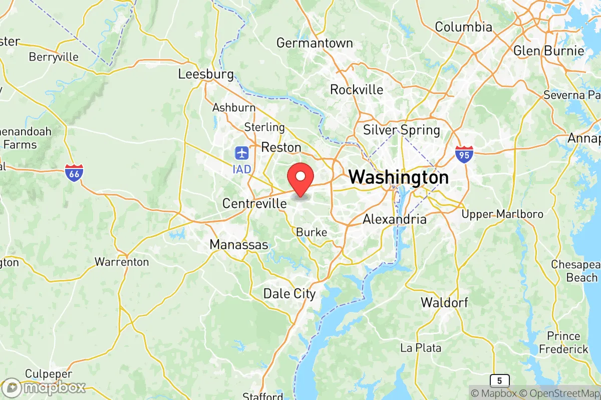
Fairfax City County sits in Northern Virginia, roughly 20 miles west of Washington, D.C., placing it within the Washington-Arlington-Alexandria metropolitan area. The county's position along the fall line—where the Piedmont region meets the Coastal Plain—provides a modest elevation advantage over areas closer to the Chesapeake Bay, reducing but not eliminating flood risk. The Potomac River forms its northern and eastern borders, offering a reliable water source, though access is largely controlled by parkland and private property. The area's rolling hills and mixed hardwood forests provide some natural cover and defensibility, though the region is far from remote. Key reference points include the city of Fairfax itself, the county seat, and surrounding communities like Vienna, Falls Church, and McLean. The proximity to Fort Belvoir, a major U.S. Army installation, and the Pentagon in nearby Arlington means a significant military and federal presence, which can be a double-edged sword: it bolsters local infrastructure and emergency response capacity but also makes the area a potential target. The county's well-maintained road network, including I-495, I-66, and the Fairfax County Parkway, facilitates movement but can become congested rapidly during an evacuation scenario.
Risk exposure and proximity to fallout-relevant landmarks
The most significant strategic liability for Fairfax City County is its location within the Washington, D.C. metropolitan area, one of the highest-value target zones in the United States for any large-scale conflict or terrorist action. The county is within 30 miles of the Pentagon, the White House, the U.S. Capitol, and numerous federal agencies, making it part of the primary blast and fallout zone for any nuclear or high-yield conventional attack on the capital. Additionally, the county hosts its own sensitive infrastructure: the Central Intelligence Agency headquarters in Langley is just across the Potomac in McLean, and the National Reconnaissance Office is based in Chantilly. Dulles International Airport, a major international hub, lies to the west. For the resilience-minded relocator, this concentration of strategic assets means that Fairfax City County is not a "retreat" location—it is a potential epicenter of chaos. Natural disaster risks are comparatively moderate: the region faces occasional hurricanes and tropical storms (remnants of systems hitting the Gulf or Atlantic coasts), nor'easters bringing heavy snow and ice, and the ever-present threat of flooding along the Potomac and its tributaries like Accotink Creek and Difficult Run. Earthquakes are rare and minor. The area's power grid, managed by Dominion Energy, is generally reliable but has shown vulnerability to storms and cyberattacks, a concern given the county's dependence on electricity for everything from water pumping to communications.
Practical resilience for a relocator: food, water, energy, and defensibility
For a family or individual serious about self-sufficiency, Fairfax City County offers a mixed bag. On the positive side, the county has a strong local food system: there are numerous farmers' markets, including the Fairfax City Farmers Market and the Reston Farmers Market, and the surrounding Shenandoah Valley is a major agricultural region within a two-hour drive. However, the county itself is highly suburbanized, with limited agricultural land—most food is trucked in via the I-95 and I-81 corridors, which are vulnerable to disruption. Water supply is managed by Fairfax Water, which draws from the Potomac River and the Occoquan Reservoir. While the system is robust, it is centralized and dependent on power and chemical treatment, making it a single point of failure. For those looking to drill a private well, the county's geology (primarily metamorphic and sedimentary rock) can make well yields unpredictable and often low, and permitting is strict. Energy resilience is a challenge: the county is fully dependent on the regional grid, and while solar panel adoption is growing, homeowners' associations and local zoning can impose restrictions. Natural gas is widely available for heating, but the pipeline network is also a potential vulnerability. Defensibility is the weakest point: Fairfax City County is a dense suburban environment with a population of over 1.1 million (county-wide) and a housing stock dominated by single-family homes on small lots, townhouses, and apartments. There is little in the way of natural chokepoints or remote terrain. The county's police and emergency services are well-funded and professional, but in a widespread crisis, they would be overwhelmed by the sheer population density. For the relocator seeking a true retreat, Fairfax City County is better viewed as a staging area or a location with strong community networks rather than a standalone survival property.
The overall strategic picture for Fairfax City County is one of calculated trade-offs. It offers exceptional economic opportunity, top-tier schools, and a high standard of living, backed by the institutional heft of the federal government and military installations like Fort Belvoir and the Pentagon. For the family that values career stability and community infrastructure above all else, and is willing to accept the elevated risk profile of living near a primary target zone, it can be a viable choice—provided they invest in home-based preparedness: backup power, water storage, food reserves, and a well-rehearsed evacuation plan. For the reader whose primary concern is long-term, off-grid self-sufficiency in a low-risk area, the county's density, centralized systems, and strategic exposure make it a less suitable option. The prudent relocator will weigh these factors carefully, recognizing that Fairfax City County's greatest strengths—its connectivity and proximity to power—are also its greatest vulnerabilities in a crisis.

* Values derived from national, state, county, city and local statistics and may differ in a specific area. Last updated: 2026-06-17T12:46:07.000Z
Narrative content on this page is AI-generated and may contain mistakes. Verify any details that matter before acting on them.
ReloMaps may earn a commission from affiliate links at no extra cost to you.

