
Strategic Assessment of Alexandria City County
Multiple tactical vulnerabilities. Population density, target proximity, or disaster risk are likely compounding. A retreat property and exit planning is required.
What does the Strategic Assessment tell us?
Our Strategic Assessment grades tactical survivability of an area. Major population centers, military targets, fallout zones, natural disasters, and border exposure all drive risk — lower exposure means a more defensible position in a crisis.
This is heavily inspired by Joel Skousen's Strategic Relocation book. Highly recommended you checkout the book ($)What does this tell us?
Our Strategic Assessment grades tactical survivability of an area. Major population centers, military targets, fallout zones, natural disasters, and border exposure all drive risk — lower exposure means a more defensible position in a crisis.
This is heavily inspired by Joel Skousen's Strategic Relocation book. Highly recommended you checkout the book ($)Strategic Pillars

Key Distances
Strategic Assessment Analysis
Alexandria City County, Virginia, presents a complex strategic picture for the disaster-ready relocator. While its location on the Potomac River offers historic advantages in commerce and defense, its status as an urbanized core of the Washington-Arlington-Alexandria metro area imposes severe vulnerabilities for those seeking resilience and self-sufficiency. The city’s dense population, heavy reliance on external supply chains, and proximity to high-value federal targets in Washington, D.C., mean that any major disruption—natural or man-made—would impact Alexandria rapidly and with cascading effects.
Geographic position and natural advantages for readiness
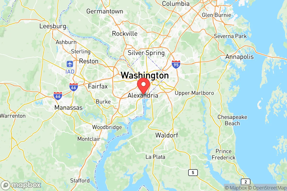
Alexandria sits on the western bank of the Potomac River, roughly six miles south of the District of Columbia, placing it within the most heavily fortified and surveilled corridor in the United States. Topographically, the city is relatively flat, with elevations ranging from sea level to about 80 feet, and sits atop the Atlantic Coastal Plain. This location provides little natural defensive high ground or cover. The Potomac River is a major freshwater source—the city’s water supply is drawn from the river at the James J. Corbalis Jr. Water Treatment Plant—but in a crisis, this source is also a liability: contamination upstream or disruption of the treatment facility would affect the entire population. The area’s climate is temperate, with hot, humid summers and moderately cold winters, meaning no extreme weather events like hurricanes or blizzards pose a routine existential threat, though occasional Nor’easters and flooding from heavy rain are real risks. The Potomac can rise several feet during storm surges, and low-lying neighborhoods like Old Town Alexandria and Del Ray are vulnerable to flash flooding and river overflow.
Risks, exposures, and proximity to fallout-relevant landmarks
Alexandria’s primary strategic disadvantage is its location within the bullseye of U.S. political and military command. The city is less than 10 miles from the Pentagon, the White House, and the Capitol—all prime targets in any conflict scenario. Within Alexandria itself, Fort Belvoir (an Army installation just south of the city) and the Mark Center (a large federal building housing several thousand Department of Defense employees) are concrete, high-value landmarks. The Potomac Yard area also hosts a major Amazon headquarters (HQ2), adding to the area’s economic target density. A detonation or blast wave from a single, large-yield event in D.C. would likely overlay much of Alexandria's northern half with lethal overpressure and thermal effects, and fallout corridors could contaminate large swaths of the city depending on wind direction. Day-to-day risks include a single point of failure at the Rosslyn-to-Alexandria corridor of I-395 and the Metro Blue/Yellow lines, which in a crisis could become choked and impassable. Natural risks are lower: the city is not earthquake-prone, and major hurricanes rarely hit this far north in force. However, the city’s extensive tree canopy creates vulnerability to ice storms and wind damage, which can bring down power lines and block roads for days.
Practical resilience for a relocator: food, water, energy, defensibility
For a relocator focused on self-sufficiency, Alexandria’s urban density inherently limits resilient options. The city’s 160,000 residents occupy a land area of just 15.5 square miles, giving it a population density of over 10,000 people per square mile. This density means that personal defensibility is low—there are no rural buffers, no farmable land, and limited ability to reinforce a single residence against a determined group. Water is sourced entirely from the Potomac, and while the system is well-maintained, it is a single-source supply with no redundancy in a crisis beyond bottled water or rainwater collection. Food resilience is poor: the city depends entirely on trucked-in supplies for its grocery stores and restaurants. The USDA-designated food desert in the West End area highlights that even under normal conditions, many residents lack easy access to fresh food. Growing food is impractical for most due to lack of yard space and restrictive HOA covenants in many neighborhoods. Energy relies on the regional grid (Dominion Energy), which has been subject to outages during severe storms. The city has no local power generation of its own, and backup systems are limited to institutional generators. For relocation, Alexandria offers little in the way of long-term off-grid living. However, it does provide strong community infrastructure for short-term emergencies: a well-funded police and fire department, hospital systems (Inova Alexandria Hospital, Mount Vernon Hospital), and a robust network of rec centers and public schools that can serve as warming/cooling stations. Defensibility for a single-family home in a dense street grid is poor compared to rural or suburban alternatives, though the city’s dense layout does provide some organic sightlines and mutual support among neighbors in a tight-knit Old Town block. A relocator considering Alexandria should plan to be mobile—having a vehicle with a full tank and a pre-planned evacuation route west toward Route 50 or south toward I-95 and the Fredericksburg area is more critical than fortifying a residence.
In the overall strategic picture, Alexandria City County ranks low for a relocator prioritizing resilience and self-sufficiency. Its primary asset is being inside the security bubble of the federal government, which provides heavy law enforcement and federal resources in a scaled crisis—but that same bubble makes it a primary target. The city’s geographic exposure to the Potomac, high population density, lack of food or water independence, and location within the immediate blast/fallout zone of the nation’s capital make it a poor choice for a long-term bug-out location or a property intended for self-reliant living. For a reader who values community preparedness and short-term disaster readiness, Alexandria’s strong public services and dense social networks are pluses. But for anyone serious about true self-sufficiency or avoiding high-risk urban corridors, Alexandria is a location to avoid. The area is best suited for those who must be near D.C. for work or family and are willing to accept the risk—and who plan accordingly with mobility, supplies, and an exit strategy.

* Values derived from national, state, county, city and local statistics and may differ in a specific area. Last updated: 2026-07-01T06:41:34.000Z
Narrative content on this page is AI-generated and may contain mistakes. Verify any details that matter before acting on them.
ReloMaps may earn a commission from affiliate links at no extra cost to you.

