
Photo: Wikipedia
Strategic Assessment of Albemarle County
Meaningful friction. Expect exposure to either population pressure, blast zones, or natural disaster risk. Consider buying a retreat property.
What does the Strategic Assessment tell us?
Our Strategic Assessment grades tactical survivability of an area. Major population centers, military targets, fallout zones, natural disasters, and border exposure all drive risk — lower exposure means a more defensible position in a crisis.
This is heavily inspired by Joel Skousen's Strategic Relocation book. Highly recommended you checkout the book ($)What does this tell us?
Our Strategic Assessment grades tactical survivability of an area. Major population centers, military targets, fallout zones, natural disasters, and border exposure all drive risk — lower exposure means a more defensible position in a crisis.
This is heavily inspired by Joel Skousen's Strategic Relocation book. Highly recommended you checkout the book ($)Strategic Pillars

Key Distances
Strategic Assessment Analysis
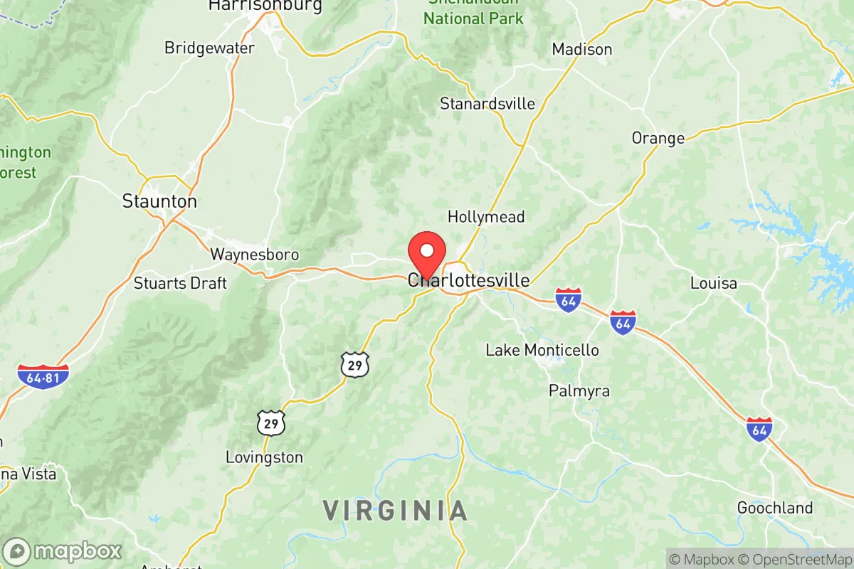
Albemarle County, anchored by the city of Charlottesville, offers a compelling blend of geographic isolation and strategic access that makes it a serious candidate for relocation-minded individuals prioritizing long-term stability and self-sufficiency. Positioned in the Piedmont region of central Virginia, the county sits roughly 70 miles west of Richmond and 100 miles southwest of Washington, D.C., placing it far enough from major metropolitan centers to avoid their most acute vulnerabilities—such as civil unrest, infrastructure strain, or targeted strikes—while remaining within a manageable distance for supply runs or medical evacuation. The area’s resilience is rooted in its topography, agricultural capacity, and low population density outside the Charlottesville urban ring, factors that collectively buffer against both natural disasters and man-made disruptions.
Geographic position and natural advantages for long-term stability
Albemarle County’s location in the foothills of the Blue Ridge Mountains provides a natural defensive layer that is rare along the Eastern Seaboard. The county’s elevation ranges from roughly 300 to 1,200 feet, with the western edge rising into the Shenandoah National Park boundary, creating a terrain that discourages large-scale movement and offers numerous choke points along secondary roads like Route 250 and Interstate 64. The area is not situated near any major petrochemical refineries, nuclear power plants, or strategic military installations—the closest significant military presence is Fort Barfoot (formerly Fort Pickett) about 90 miles south, and the Dahlgren Naval Surface Warfare Center roughly 80 miles east—which reduces the likelihood of being a primary target in a conflict scenario. The county’s watershed is fed by the Rivanna River and its tributaries, which drain into the James River system, providing a reliable freshwater source that is less susceptible to contamination than coastal aquifers. Furthermore, Albemarle sits outside the hurricane storm-surge zone and is not prone to the catastrophic flooding seen in Tidewater regions; the 2018 flooding from Hurricane Michael was localized and manageable, not a systemic threat.
Risk exposure and proximity to fallout-relevant landmarks
While Albemarle County is not a high-priority target, it is not entirely insulated from second-order risks. The county lies within 100 miles of two major population and government centers—Washington, D.C., and Richmond—both of which are plausible targets for electromagnetic pulse (EMP) attacks, conventional strikes, or cyber-induced grid failures. A detonation over the National Capital Region could induce cascading effects into central Virginia, including refugee migration along the I-64 corridor and potential grid instability from the North Anna Nuclear Generating Station, located roughly 50 miles east in Louisa County. That facility, while not within the immediate blast radius of a D.C.-targeted event, could experience off-site power loss or cooling failures that would affect regional emergency response. Additionally, the county’s proximity to the Blue Ridge Tunnel and major rail lines running through the area makes it a potential chokepoint for logistics, which could attract secondary disruptions during a national emergency. The risk of natural disasters is moderate: the region experiences occasional tornadoes (EF-1 or EF-2 strength), ice storms that can knock out power for days, and the rare earthquake—the 2011 Mineral earthquake (5.8 magnitude) was centered just 40 miles away and caused structural damage to the University of Virginia and local schools. Wildfire risk is low compared to the western U.S., but dry-season brush fires in the rural western precincts are a periodic concern.
Practical resilience for a relocator: food, water, energy, and defensibility
For a relocator serious about self-sufficiency, Albemarle County offers above-average practical resilience compared to most of the Mid-Atlantic. The county’s agricultural sector is robust: there are over 800 farms operating within the county, producing livestock, hay, corn, soybeans, and a growing number of orchard and vineyard operations. The presence of the Charlottesville City Market and numerous farm-to-table networks means that local food production is not just a niche but an established economic activity, making it feasible to source food locally even during supply chain disruptions. Water availability is strong: the county’s average annual rainfall is about 45 inches, and the Rivanna River basin provides a surface water supply that is supplemented by groundwater wells in the rural areas. The Rivanna Water and Sewer Authority maintains the Ragged Mountain Reservoir and the South Fork Rivanna Reservoir, which together hold over 1.5 billion gallons of storage—enough to sustain the county’s population through a multi-year drought if managed carefully. For off-grid energy, the region’s solar potential is moderate but viable: central Virginia receives about 4.5 peak sun hours per day, and there are no restrictive county-wide bans on residential solar or rainwater collection, though permits are required. The county’s defensibility is aided by its terrain: the western mountains and the numerous rural valleys create natural compartmentalization, making it difficult for any large group to move through the area undetected. The county seat, Charlottesville, is the only significant population center (roughly 47,000 residents), while the rest of the county’s 103,000 residents are spread across small communities like Crozet, Scottsville, and Earlysville, each with its own local governance and emergency services. This decentralized population distribution is a strategic advantage, reducing the risk of a single point of failure in a crisis.
Overall, Albemarle County presents a strong strategic profile for the relocation-minded individual or family who wants to be within a day’s drive of critical infrastructure and medical resources but far enough from the highest-risk zones to maintain autonomy. The county’s combination of defensible terrain, abundant freshwater, active agricultural base, and low target value relative to the D.C.-Richmond corridor makes it one of the more resilient options in the eastern United States. The primary vulnerabilities are its dependence on the regional power grid and its location along a major evacuation route from the capital, but these can be mitigated with proper preparation—such as installing a backup solar system, maintaining a well and septic in rural areas, and developing a network of local contacts in the farming communities. For a reader who values preparedness without wanting to live in a remote bunker, Albemarle County offers a realistic middle ground: a place where strategic thinking and practical self-reliance are not just possible, but culturally embedded in the surrounding landscape.

* Values derived from national, state, county, city and local statistics and may differ in a specific area. Last updated: 2026-10-27T21:07:59.000Z
Narrative content on this page is AI-generated and may contain mistakes. Verify any details that matter before acting on them.
ReloMaps may earn a commission from affiliate links at no extra cost to you.

