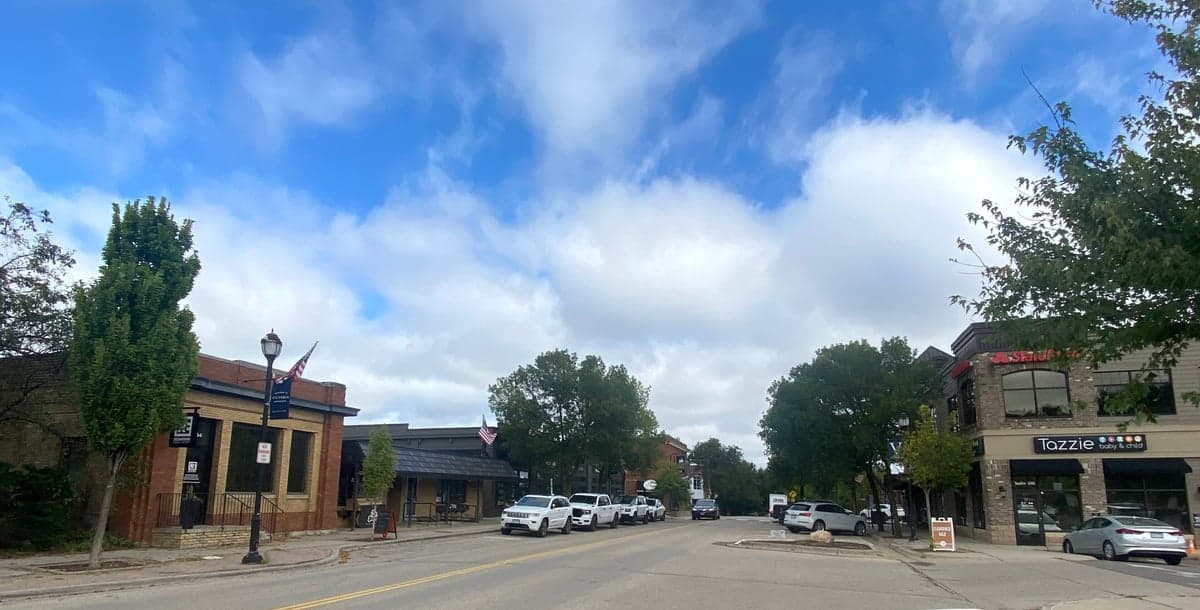
Photo: Wikipedia
Strategic Assessment of Victoria, MN
Meaningful friction. Expect exposure to either population pressure, blast zones, or natural disaster risk. Consider buying a retreat property.
What does the Strategic Assessment tell us?
Our Strategic Assessment grades tactical survivability of an area. Major population centers, military targets, fallout zones, natural disasters, and border exposure all drive risk — lower exposure means a more defensible position in a crisis.
This is heavily inspired by Joel Skousen's Strategic Relocation book. Highly recommended you checkout the book ($)What does this tell us?
Our Strategic Assessment grades tactical survivability of an area. Major population centers, military targets, fallout zones, natural disasters, and border exposure all drive risk — lower exposure means a more defensible position in a crisis.
This is heavily inspired by Joel Skousen's Strategic Relocation book. Highly recommended you checkout the book ($)Strategic Pillars

Key Distances
Regional Safe Places
Below is our recommended "safe zones" in Minnesota and the surrounding area based on our strategic heuristics. For most people, it's unrealistic to live in a “safe zone” full-time due to work, family or other personal reasons. They tend to be more rural. However, many of these areas are perfect for second homes and retreat properties that double as a vacation home or even a short-term rental.
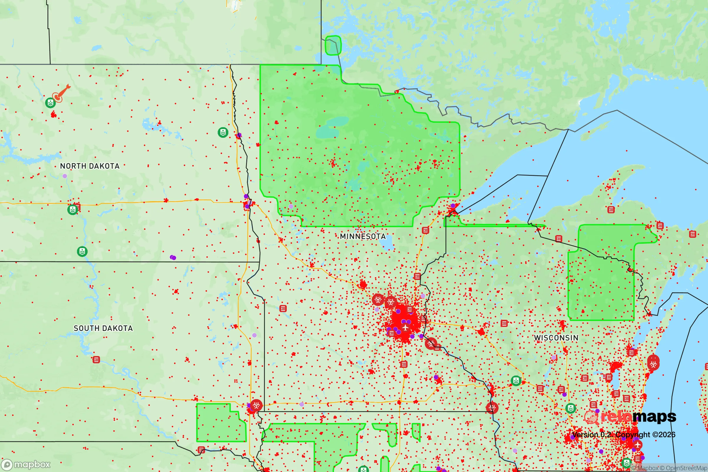
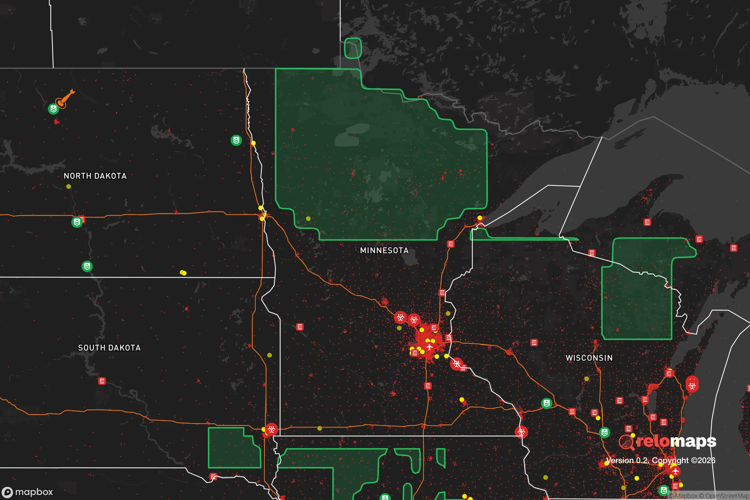


Important Note: For informational purposes only. This does not mean nothing bad ever happens in the green zones. Please use common sense. This is based on public data and modeled with AI. We tried to take a conservative approach but mistakes happen. We update this regularly as new information becomes available.
Solar Generator Recommendations
Backup power matters more here than in safer locations. We've picked three solar generators across budgets and capacity tiers — start with the budget unit if you only need a few essentials, or step up if you want to run a fridge and HVAC for days at a time.

Jackery Portable Power Station Explorer 300
Budget OptionPower on the Go: Weighing only 11 lbs, it's convenient to set up and store with book-sized foldable solar panels

BLUETTI Portable Power Station AC180
Designed for both indoor and outdoor scenarios, AC180 is highly capable as it has a robost capacity and continuous output power.

EF ECOFLOW DELTA Pro Ultra Power Station
Upgraded PickEcoFlow DELTA Pro Ultra is a whole-home energy system designed to grow with your family. Integrated with the Smart Home Panel 2, it scales to meet your evolving energy needs — keeping your home powered, intelligent, and secure through every stage of life.
We earn a commission, at no additional cost to you.
Strategic Assessment Analysis
Victoria, Minnesota, presents a mixed strategic picture for the relocation-minded reader focused on resilience and self-sufficiency. While its location in the southwest corner of the Twin Cities metro area offers certain economic and logistical advantages, those same factors introduce significant vulnerabilities that a serious preparedness-minded individual or family must weigh carefully. The town’s small size (roughly 10,000 residents) and relatively low density provide a buffer against the immediate chaos of a major metro collapse, but its proximity to the Minneapolis-St. Paul urban core—and the critical infrastructure and potential targets within it—creates a risk profile that demands clear-eyed assessment.
Geographic position and natural advantages for long-term stability
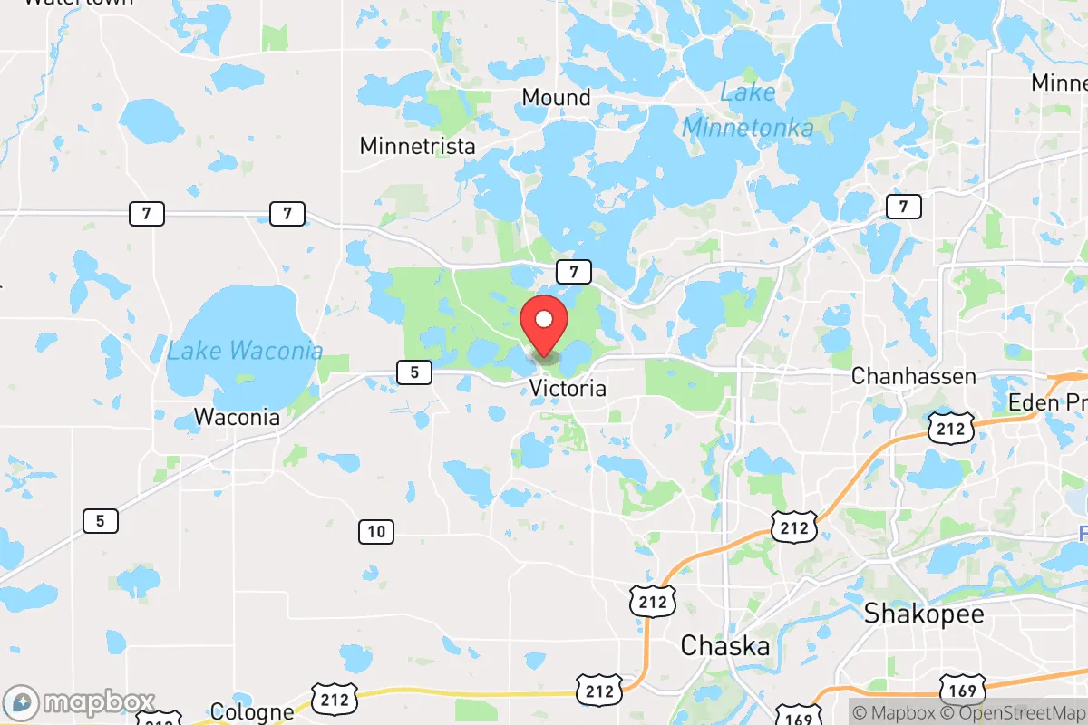
Victoria sits in Carver County, roughly 25 miles southwest of downtown Minneapolis, placing it at the edge of the metro area’s suburban sprawl. This position offers a genuine advantage: it is far enough from the urban core to avoid the worst of a sudden evacuation or panic-driven exodus, yet close enough to access regional resources like medical facilities, hardware stores, and supply chains during normal times. The area is part of the Minnesota River Valley region, with gently rolling terrain, abundant lakes (including Lake Minnetonka to the north and smaller water bodies like Lake Bavaria and Lake Susan within or near town), and fertile agricultural land. These natural features support local food production and water availability, both critical for long-term self-sufficiency. The region’s climate is continental, with cold winters and warm summers, which imposes a baseline requirement for robust heating, food storage, and winter preparedness—but also reduces the risk of heat-related infrastructure failures common in southern states. The absence of major seismic activity, hurricanes, or wildfires (outside of occasional drought-driven grass fires) means the primary natural threats are winter storms, tornadoes (typically EF-2 or lower in this corridor), and flooding along the Minnesota River, which is a manageable concern for properties not in the immediate floodplain.
Risks, exposures, and proximity to fallout-relevant landmarks
The most significant risk for Victoria is its location within the broader Twin Cities metropolitan area, which contains multiple high-value targets in a major conflict or terrorist scenario. The metro is home to the Minneapolis Federal Reserve Bank, the headquarters of several Fortune 500 companies (including Target, Best Buy, and General Mills), the University of Minnesota’s research facilities, and the Minneapolis-St. Paul International Airport—all potential targets for a sophisticated adversary. Additionally, the region hosts critical infrastructure like the Monticello Nuclear Generating Plant (about 40 miles north) and the Prairie Island Nuclear Plant (about 50 miles southeast), both of which, while not in Victoria’s immediate vicinity, are within the 50-mile radius that the Nuclear Regulatory Commission considers for emergency planning zones. In a worst-case scenario involving a nuclear detonation or major attack on the metro core, Victoria would be downwind of prevailing westerly winds, meaning fallout could drift toward the area depending on the specific event. The town’s position on the metro’s southwestern edge offers some advantage—prevailing winds in Minnesota are generally from the west-northwest, so a strike on downtown Minneapolis would likely push fallout east-northeast, away from Victoria. However, a strike on the airport or southern suburbs could shift that calculus. The area also has a moderate risk of civil unrest or supply chain disruptions tied to metro events, given that Victoria’s economy and daily life are intertwined with the Twin Cities. The 2020 civil unrest in Minneapolis demonstrated that disruptions can ripple outward, with curfews, road closures, and resource shortages affecting even distant suburbs.
Practical resilience for a relocator: food, water, energy, and defensibility
For a relocator prioritizing self-sufficiency, Victoria offers a mixed but workable foundation. Food production is viable: the surrounding Carver County is agricultural, with corn, soybeans, and livestock operations, and the town itself has a growing number of community gardens and farmers’ markets. The soil is fertile, and the growing season (roughly 150 days) supports a wide range of vegetables, fruits, and grains for a determined homesteader. However, suburban zoning in Victoria’s newer developments may restrict livestock or large-scale gardening, so a buyer should target properties on the town’s outskirts or in unincorporated areas for maximum flexibility. Water availability is a strong point: the region sits atop the Prairie du Chien-Jordan aquifer, which provides reliable groundwater, and surface water from lakes and the Minnesota River is accessible with proper treatment. Most homes are on municipal water, but private wells are common in rural parcels, offering a decentralized water source. Energy resilience is more challenging. The grid is served by Xcel Energy, which has a mixed reliability record during severe storms, but the area’s relatively low population density means power restoration is typically faster than in dense urban zones. Solar potential is moderate—Minnesota averages about 200 sunny days per year, but winter cloud cover and short days reduce output significantly. A serious off-grid setup would require battery storage and a backup generator (propane or diesel), with wood heat as a secondary option given the abundance of local timber. Defensibility is a weak point for most suburban lots. Victoria’s typical residential layout—cul-de-sacs, open yards, and proximity to neighbors—offers limited tactical advantage. However, the town’s small size and rural fringe properties provide opportunities for a more defensible setup: a home on 5-10 acres with tree lines, a long driveway, and a basement or storm shelter would offer far better security than a standard subdivision lot. The local law enforcement presence (Carver County Sheriff’s Office) is professional but thin in a crisis, so self-reliance is paramount.
Overall, Victoria, MN, is a reasonable but not exceptional choice for the resilience-focused relocator. Its strengths lie in its agricultural surroundings, water availability, and distance from the metro core’s immediate blast zones, while its weaknesses include proximity to high-value targets, moderate energy independence challenges, and suburban defensibility limitations. For a family willing to invest in a rural-adjacent property, install solar and battery backup, drill a well, and build a food-production system, Victoria offers a stable, low-crime base with access to regional resources. For someone seeking complete isolation from metro risks, a more remote location in northern Minnesota or the Driftless Area of southeastern Minnesota would be preferable. But for the reader who wants a balance of modern convenience and strategic preparedness—and who accepts the trade-offs of living near a major metro—Victoria is a solid, if not standout, option that rewards deliberate planning and investment.

* Values derived from national, state, county, city and local statistics and may differ in a specific area. Last updated: 2026-10-10T16:29:16.000Z
Narrative content on this page is AI-generated and may contain mistakes. Verify any details that matter before acting on them.
ReloMaps may earn a commission from affiliate links at no extra cost to you.

