Photo: Wikipedia
Strategic Assessment of Carbon County
Deep buffer from population centers and strategic targets. Low natural disaster risk and minimal exposure to border or coastal threats.
What does the Strategic Assessment tell us?
Our Strategic Assessment grades tactical survivability of an area. Major population centers, military targets, fallout zones, natural disasters, and border exposure all drive risk — lower exposure means a more defensible position in a crisis.
This is heavily inspired by Joel Skousen's Strategic Relocation book. Highly recommended you checkout the book ($)What does this tell us?
Our Strategic Assessment grades tactical survivability of an area. Major population centers, military targets, fallout zones, natural disasters, and border exposure all drive risk — lower exposure means a more defensible position in a crisis.
This is heavily inspired by Joel Skousen's Strategic Relocation book. Highly recommended you checkout the book ($)Strategic Pillars

Key Distances
Strategic Assessment Analysis
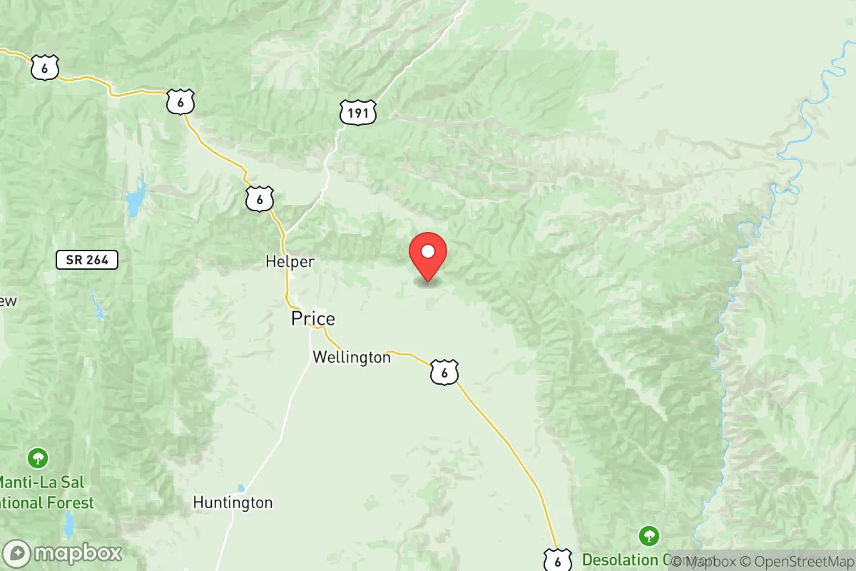
Carbon County, Utah, offers a resilience profile that is genuinely uncommon in the lower 48: a sparsely populated, high-desert basin anchored by the small cities of Price and Helper, sitting roughly 115 miles southeast of Salt Lake City and 60 miles from the Wasatch Front's urban edge. The county's strategic value lies not in what it has, but in what it lacks—dense populations, major industrial targets, and the logistical chokepoints that plague coastal metros. For a relocator weighing disaster readiness and self-sufficiency, this is a place where the math of survival is simpler, though not without its own distinct vulnerabilities.
Geographic position and natural advantages for long-term stability
Carbon County sits in a high desert valley at roughly 5,500 to 6,000 feet elevation, ringed by the Book Cliffs to the north and the Wasatch Plateau to the west. That topography provides a natural defensive perimeter—fewer approach routes, limited through-traffic, and a degree of isolation that is hard to replicate in flatter, more accessible regions. The county's population of roughly 20,000 is spread across Price (the county seat, about 8,000 residents), Helper, Wellington, and East Carbon, meaning no single concentrated target and no sprawling suburban grid to complicate evacuation or security.
The climate is arid, with about 10-12 inches of annual precipitation, which is a double-edged sword: it reduces flood risk and mold-related issues, but it also means water is the county's most critical long-term constraint. The Price River runs through the valley, and the county sits atop the Ferron and Price-San Rafael aquifer systems, which provide municipal water to Price and surrounding communities. For a relocator, the key geographic advantage is the absence of hurricane zones, tornado alleys, and seismic fault lines of the magnitude found along Utah's Wasatch Front—the county experiences minor seismic activity, but nothing approaching the risk profile of Salt Lake City's urban corridor.
Proximity to regional infrastructure is a moderate positive. U.S. Highway 6 connects Carbon County directly to the Salt Lake City metro area, and the Union Pacific rail line runs through Helper, historically a coal-shipping hub. That rail access is a genuine resilience asset—if trucking falters, rail can still move bulk goods, fuel, and agricultural supplies. The county is also within a two-hour drive of the Wasatch Front's hospitals and supply chains, close enough to access advanced care, far enough to avoid the urban blast radius of a major event.
Risks, exposures, and proximity to fallout-relevant landmarks
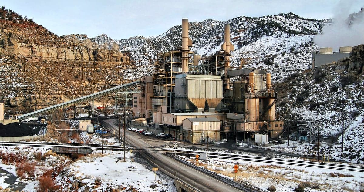
Carbon County's risk profile is comparatively clean, but it is not a blank slate. The most significant man-made exposure is the county's own industrial history: coal mining and a now-shuttered power plant at the Hunter and Huntington plants just west of the county line in Emery County. The Hunter Plant (1,064 MW) and Huntington Plant (890 MW) are still operational coal-fired facilities, and while they are not nuclear targets, they are credible secondary targets in a conflict scenario—a strike on regional energy infrastructure could disrupt grid stability across central Utah. The county is also roughly 90 miles from Hill Air Force Base near Ogden, a major logistics and F-35 maintenance hub that would be a high-priority target in any peer-level conflict. Fallout patterns in the prevailing westerlies would likely push contamination toward the Wasatch Front and Wyoming, not directly into Carbon County, but the margin is not something to rely on.
Natural hazards are more mundane but more probable. The county's coal seams have a history of underground mine fires, most notably the Crandall Canyon mine collapse in 2007, and subsidence zones exist near old workings. Wildfire risk is moderate, particularly in the pinyon-juniper foothills around Helper and the Book Cliffs, and the arid climate means a dry lightning season can produce fast-moving brush fires. Flash flooding is a real but localized threat in the Price River corridor and the narrow canyons west of town—the 2022 floods in nearby Sanpete County are a reminder that high-desert storms can be violent. Winter inversions occasionally trap particulate matter in the valley, but the air quality is far better than Salt Lake City's.
The county's isolation cuts both ways. There is no major military installation within 100 miles, no refinery corridor, no port, and no nuclear power plant in the immediate vicinity—all positives for a fallout-avoidance strategy. But that same isolation means emergency response times are longer. The nearest Level I trauma center is in Salt Lake City, roughly a 90-120 minute drive under good conditions, and the county's hospital, Castleview Hospital in Price, is a small regional facility with limited surgical capacity. A relocator should plan for self-reliant medical response, not rapid evacuation.
Practical resilience for a relocator: food, water, energy, and defensibility
Water is the first and most serious constraint. Price City and Helper both draw from municipal systems fed by the Price-San Rafael aquifer, and the county's water rights are fully allocated—new residential wells are difficult to permit, and agricultural water is expensive. A serious relocator should budget for rainwater catchment (the county allows it, with permitting) and a drilled well if purchasing land outside city limits, though well depths of 200-400 feet are common and drilling costs run $15,000-$30,000. The Price River is not a reliable year-round surface source; it runs low in late summer and is increasingly diverted for irrigation.
Food security is more promising. The county has a working agricultural base—hay, alfalfa, and some livestock operations in the Price Valley and near Wellington—and the local farmers' market in Price operates through the summer. But the growing season is short (roughly 120 frost-free days), and the county is not a breadbasket; most staple foods are trucked in from the Wasatch Front. A family serious about self-sufficiency should plan for a substantial pantry, cold storage, and greenhouse production rather than assuming local agriculture can sustain a population surge. Hunting and fishing are available—deer, elk, and trout in the surrounding national forests—but game pressure is moderate and not a reliable primary protein source.
Energy is a genuine strength. The county sits on some of the most energy-dense geology in the West: coal, natural gas, and significant wind and solar potential. Rocky Mountain Power serves the area, and the grid connection to the Hunter and Huntington plants means the county is a net electricity exporter, not an import-dependent tail. For off-grid resilience, solar is viable—the county averages over 300 sunny days per year—and the high altitude means good winter solar gain. Propane is widely available for heating and cooking, and the county's rural character means most homes have space for wood stoves and backup generation. Defensibility is strong: the valley's narrow entry points, the Book Cliffs to the north, and the Wasatch Plateau to the west create natural chokepoints, and the county's low population density means a family on a few acres has significant standoff distance from neighbors.
The overall strategic picture for Carbon County is one of solid, unglamorous resilience. It lacks the agricultural self-sufficiency of the Midwest or the water abundance of the Pacific Northwest, but it offers a rare combination of geographic isolation, energy security, and low target value. The county's weaknesses—water scarcity, limited medical infrastructure, and dependence on Wasatch Front supply chains—are manageable with planning and capital. For a relocator who values quiet competence over convenience, Carbon County is a defensible, survivable base of operations, provided they arrive with a well-drilling budget, a full pantry, and a realistic understanding that this is a place where self-reliance is not a lifestyle choice but a practical necessity.

* Values derived from national, state, county, city and local statistics and may differ in a specific area. Last updated: 2026-10-23T08:49:36.000Z
Narrative content on this page is AI-generated and may contain mistakes. Verify any details that matter before acting on them.
ReloMaps may earn a commission from affiliate links at no extra cost to you.

