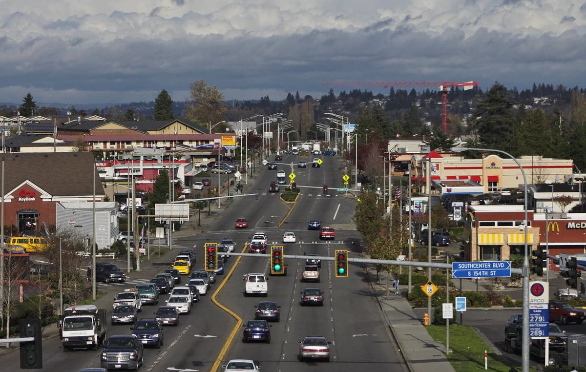
Photo: Wikipedia
Strategic Assessment of Tukwila, WA
High tactical risk. This location is likely close to major population centers, strategic targets, or sits in a high-disaster corridor. A retreat property and careful exit planning is required.
What does the Strategic Assessment tell us?
Our Strategic Assessment grades tactical survivability of an area. Major population centers, military targets, fallout zones, natural disasters, and border exposure all drive risk — lower exposure means a more defensible position in a crisis.
This is heavily inspired by Joel Skousen's Strategic Relocation book. Highly recommended you checkout the book ($)What does this tell us?
Our Strategic Assessment grades tactical survivability of an area. Major population centers, military targets, fallout zones, natural disasters, and border exposure all drive risk — lower exposure means a more defensible position in a crisis.
This is heavily inspired by Joel Skousen's Strategic Relocation book. Highly recommended you checkout the book ($)Strategic Pillars

Key Distances
Regional Safe Places
Below is our recommended "safe zones" in Washington and the surrounding area based on our strategic heuristics. For most people, it's unrealistic to live in a “safe zone” full-time due to work, family or other personal reasons. They tend to be more rural. However, many of these areas are perfect for second homes and retreat properties that double as a vacation home or even a short-term rental.
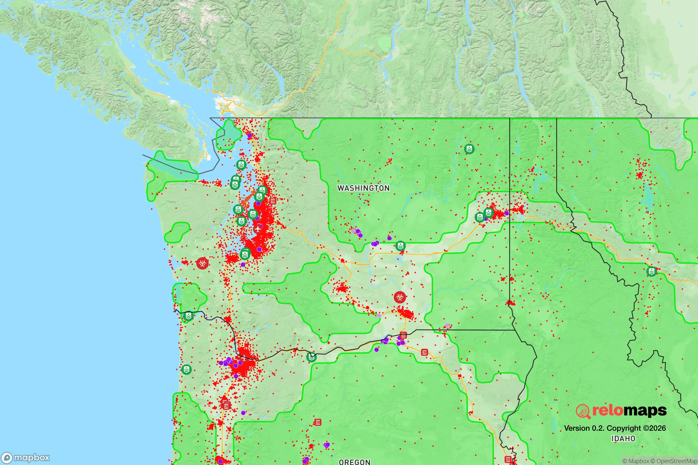
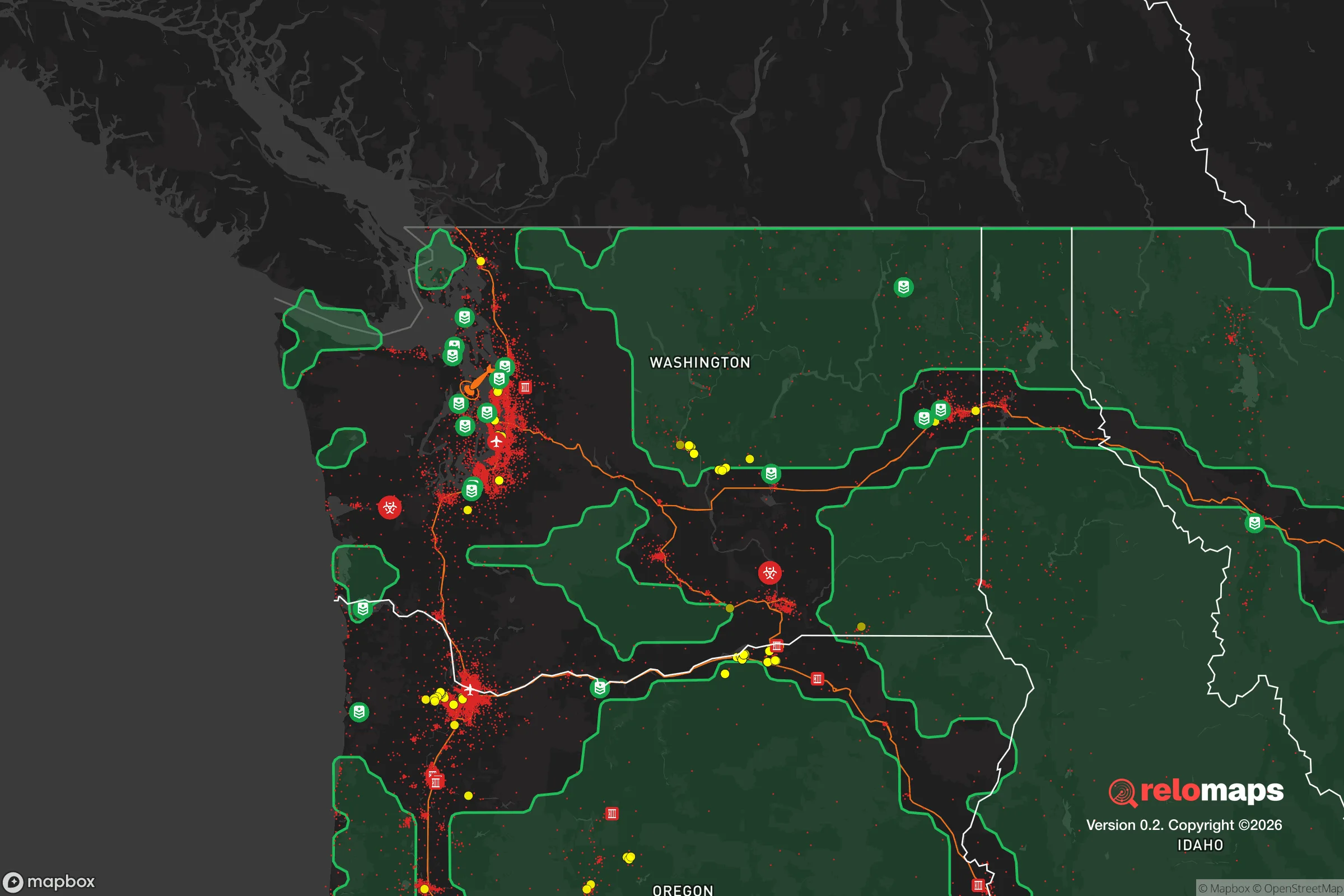


Important Note: For informational purposes only. This does not mean nothing bad ever happens in the green zones. Please use common sense. This is based on public data and modeled with AI. We tried to take a conservative approach but mistakes happen. We update this regularly as new information becomes available.
Solar Generator Recommendations
Backup power matters more here than in safer locations. We've picked three solar generators across budgets and capacity tiers — start with the budget unit if you only need a few essentials, or step up if you want to run a fridge and HVAC for days at a time.

Jackery Portable Power Station Explorer 300
Budget OptionPower on the Go: Weighing only 11 lbs, it's convenient to set up and store with book-sized foldable solar panels

BLUETTI Portable Power Station AC180
Designed for both indoor and outdoor scenarios, AC180 is highly capable as it has a robost capacity and continuous output power.

EF ECOFLOW DELTA Pro Ultra Power Station
Upgraded PickEcoFlow DELTA Pro Ultra is a whole-home energy system designed to grow with your family. Integrated with the Smart Home Panel 2, it scales to meet your evolving energy needs — keeping your home powered, intelligent, and secure through every stage of life.
We earn a commission, at no additional cost to you.
Strategic Assessment Analysis
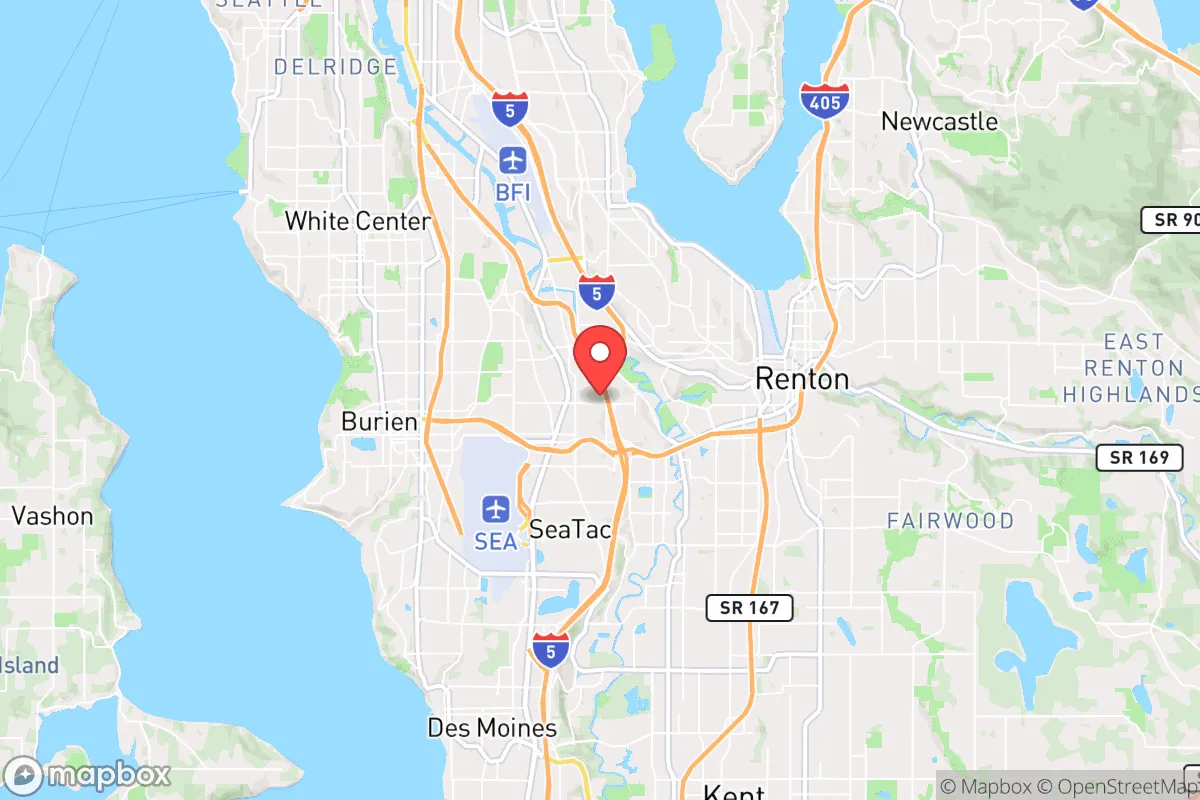
Tukwila, Washington, occupies a strategic but precarious position in the Pacific Northwest, offering relocation-minded readers a mix of genuine logistical advantages and serious exposure risks. Located just south of Seattle and bisected by the Duwamish River, this city of roughly 21,000 people sits at the intersection of Interstates 5 and 405, with direct rail access to the Port of Seattle and Seattle-Tacoma International Airport (Sea-Tac) literally on its southern border. For a reader prioritizing disaster readiness and self-sufficiency, Tukwila’s resilience profile is a study in contradictions: its central location provides unmatched access to supply chains and transportation corridors, but that same centrality makes it a high-probability target for both natural and man-made disruptions. The area’s flat, low-lying terrain and industrial character further complicate any assessment of long-term defensibility or post-event sustainability.
Geographic position and natural advantages for survival
Tukwila’s primary natural advantage is its position within the Duwamish River Valley, which offers relatively flat, buildable land and proximity to the region’s major water source. The Duwamish River itself, though heavily industrialized and a Superfund site, provides a potential water supply for filtration and non-potable uses in a prolonged emergency. The city sits about 12 miles from Puget Sound, giving residents theoretical access to marine resources and maritime evacuation routes if coastal access remains viable. The surrounding Cascade and Olympic mountain ranges create a natural rain shadow effect that keeps Tukwila’s annual precipitation around 37 inches—moderate by Pacific Northwest standards—which supports local food gardening and rainwater catchment without the constant saturation seen in areas like Aberdeen or Forks. The valley’s alluvial soils, though contaminated in many spots, could support small-scale agriculture if remediated. However, the area’s elevation is a critical weakness: much of Tukwila sits at or below 30 feet above sea level, making it vulnerable to sea-level rise, storm surge, and tsunami inundation from a Cascadia subduction zone earthquake. The flat terrain also offers no natural defensive high ground, meaning any prolonged grid-down scenario would leave residents exposed to movement from all directions.
Risks, exposures, and proximity to fallout-relevant landmarks
Tukwila’s risk profile is dominated by its proximity to high-value infrastructure and population centers. The city is directly adjacent to Sea-Tac Airport, a major international hub that would be a primary target in any conflict scenario involving strategic airfields or logistics nodes. The Port of Seattle’s container terminals, just 8 miles north, handle billions of dollars in trade annually and are critical to the West Coast supply chain. Interstate 5, which runs through Tukwila’s core, is a key military and civilian transport corridor linking Joint Base Lewis-McChord (JBLM) 30 miles south to the rest of the region. In a major earthquake, the I-5 corridor through Tukwila is expected to experience liquefaction and bridge failures, cutting off road access for days or weeks. The Duwamish River’s industrial banks host chemical storage, fuel depots, and manufacturing facilities that could release hazardous materials during a seismic event. For a reader concerned about fallout from a nuclear detonation at JBLM or a naval target in Puget Sound, Tukwila lies within the moderate-to-heavy fallout zone depending on wind patterns—roughly 15-25 miles from potential ground-zero locations. The city’s dense suburban and industrial layout means limited tree cover and few natural shelters, making effective fallout protection difficult without pre-built hardened structures. Flood risk is also significant: the Federal Emergency Management Agency (FEMA) designates large portions of Tukwila as Special Flood Hazard Areas (Zone AE), with a 1% annual chance of inundation from the Duwamish or Green Rivers.
Practical resilience for a relocator: food, water, energy, and defensibility
For a relocator serious about self-sufficiency, Tukwila presents a mixed bag of practical assets and liabilities. Water access is the strongest point: the Duwamish River flows year-round, and the city’s groundwater table is shallow, meaning wells could be dug in some areas, though contamination from industrial runoff and the Superfund site requires robust filtration (reverse osmosis or distillation). Rainwater catchment is viable, with the region’s dry season (July-September) still producing enough for basic needs if storage is adequate. Food production is limited by soil contamination and small lot sizes; most residential parcels are under 6,000 square feet, leaving little room for significant gardening. The city’s proximity to the Kent Valley—one of the most productive agricultural areas in Washington—offers a potential food source, but that farmland is also vulnerable to flooding and would be contested in a crisis. Energy resilience is poor: Tukwila relies entirely on the regional grid (Puget Sound Energy), with no municipal solar or microgrid programs of note. Natural gas lines run through the area, but these are vulnerable to earthquake rupture and fire risk. Wood heating is possible but limited by air quality regulations and small property sizes. Defensibility is the weakest category: Tukwila’s flat, open terrain, multiple highway access points, and dense population (over 3,000 people per square mile) make it nearly impossible to secure a perimeter. The city’s diverse, transient population—with over 40% foreign-born residents and a high rental rate—means less community cohesion and fewer pre-established mutual-aid networks compared to more rural or suburban areas. Law enforcement presence is moderate (Tukwila Police Department with about 40 sworn officers), but response times would degrade rapidly in a widespread event. The nearest hardened medical facility is Harborview Medical Center in Seattle, 12 miles north, which would be overwhelmed in any major disaster.
The overall strategic picture for Tukwila is one of calculated trade-offs. For a relocator who values immediate access to transportation hubs, supply chains, and emergency services, the city offers a functional base for short-term preparedness—stockpiling supplies, maintaining a vehicle for evacuation, and leveraging regional resources. But for anyone prioritizing long-term self-sufficiency, defensibility, and low exposure to man-made risks, Tukwila’s liabilities outweigh its advantages. The combination of floodplain location, industrial contamination, proximity to high-value targets, and lack of natural defensive features makes it a poor choice for a permanent retreat or bug-out location. A more resilient strategy would be to use Tukwila as a staging point for acquiring supplies and information before moving to a more defensible position in the Cascades foothills or Olympic Peninsula, where elevation, water sources, and lower population density offer better odds for sustained independence. If you are set on the Seattle metro area for work or family reasons, consider the higher-elevation suburbs east of Lake Washington—Issaquah or North Bend—which provide better terrain and lower flood risk while still maintaining regional access. Tukwila’s best use in a resilience plan is as a logistics node, not a final destination.

* Values derived from national, state, county, city and local statistics and may differ in a specific area. Last updated: 2026-09-03T05:16:51.000Z
Narrative content on this page is AI-generated and may contain mistakes. Verify any details that matter before acting on them.
ReloMaps may earn a commission from affiliate links at no extra cost to you.

