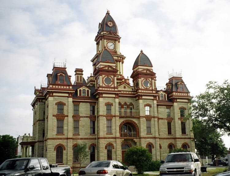
Photo: Wikipedia
Strategic Assessment of Caldwell County
Meaningful friction. Expect exposure to either population pressure, blast zones, or natural disaster risk. Consider buying a retreat property.
What does the Strategic Assessment tell us?
Our Strategic Assessment grades tactical survivability of an area. Major population centers, military targets, fallout zones, natural disasters, and border exposure all drive risk — lower exposure means a more defensible position in a crisis.
This is heavily inspired by Joel Skousen's Strategic Relocation book. Highly recommended you checkout the book ($)What does this tell us?
Our Strategic Assessment grades tactical survivability of an area. Major population centers, military targets, fallout zones, natural disasters, and border exposure all drive risk — lower exposure means a more defensible position in a crisis.
This is heavily inspired by Joel Skousen's Strategic Relocation book. Highly recommended you checkout the book ($)Strategic Pillars

Key Distances
Strategic Assessment Analysis
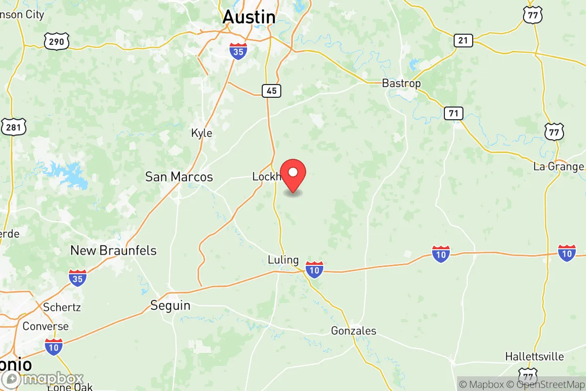
Caldwell County, Texas, presents a compelling strategic option for relocation-minded readers who prioritize resilience, self-sufficiency, and a buffer from major metropolitan vulnerabilities. Situated roughly 30 miles south of Austin and 50 miles north of San Antonio, the county offers a rural-to-suburban transition zone that balances proximity to urban resources with genuine geographic separation. Its position along the I-10 and SH-130 corridors provides logistical access without the density-driven risks of larger cities, making it a location worth serious assessment for those thinking about disaster readiness and long-term stability.
Geographic position and natural advantages for long-term stability
Caldwell County’s location is its primary strategic asset. The county seat, Lockhart, sits on the eastern edge of the Texas Hill Country, a region known for its relatively stable geology, abundant groundwater, and lower vulnerability to hurricanes and storm surge compared to coastal areas. The county’s terrain is rolling to gently hilly, with elevations ranging from 400 to 700 feet, which reduces flood risk compared to flatter, flood-prone areas downstream. The San Marcos River forms part of the county’s northern boundary, and the Plum Creek watershed runs through Lockhart, providing surface water sources that are more reliable than in arid West Texas. The area’s natural limestone aquifers, particularly the Edwards Aquifer to the west, offer a significant groundwater advantage for private well owners. For a relocator focused on water security, Caldwell County’s position atop or near these recharge zones is a tangible plus. The climate is humid subtropical, with average annual rainfall around 35 inches, supporting rain-fed agriculture and reducing dependence on irrigation. This combination of moderate elevation, stable geology, and accessible water resources makes Caldwell County a more resilient choice than many other Central Texas counties.
Risks, exposures, and proximity to fallout-relevant landmarks
No strategic assessment is complete without a clear-eyed look at risks. Caldwell County’s primary man-made exposure comes from its proximity to two major military installations: Fort Cavazos (formerly Fort Hood) lies about 70 miles north, and Joint Base San Antonio is roughly 50 miles south. While neither is a direct target for a conventional strike in a peacetime scenario, their presence as high-value military assets means the county sits within a potential secondary fallout or disruption zone in a major conflict. Additionally, the county is within 100 miles of the Houston Ship Channel and refinery corridor, one of the largest petrochemical complexes in the world. A major industrial accident or targeted disruption there could affect air quality and supply chains across the region. On the natural hazard side, Caldwell County faces moderate tornado risk (typically EF-0 to EF-2) and occasional flash flooding in low-lying areas near creeks. Wildfire risk is low but not zero, particularly in the western, more wooded parts of the county. The county’s distance from the Gulf Coast (about 150 miles) means hurricane impacts are limited to heavy rain and gusty winds, not storm surge. For a relocator weighing these factors, the key takeaway is that Caldwell County is not immune to regional risks, but its exposure is significantly lower than living directly in Austin, San Antonio, or Houston. The nearest nuclear power plant is the South Texas Nuclear Generating Station near Bay City, roughly 120 miles southeast—far enough to be outside the most severe fallout zones in a worst-case scenario.
Practical resilience for a relocator: food, water, energy, and defensibility
For someone serious about self-sufficiency, Caldwell County offers practical advantages that are hard to find closer to major cities. Food security is a strong point: the county is part of the Texas Blackland Prairie, with fertile soils that support row crops like corn, cotton, and sorghum, as well as livestock grazing. Lockhart hosts a weekly farmers’ market, and the surrounding area has numerous small farms and ranches. For a relocator wanting to grow their own food, the growing season is long (March to November), and the soil quality is above average for Central Texas. Water security is enhanced by the presence of the Edwards Aquifer and the Carrizo-Wilcox Aquifer, both of which are accessible via private wells in many parts of the county. Municipal water in Lockhart and Luling is treated and reliable, but a well-equipped property can provide independent water supply. Energy resilience is mixed: the county is served by the ERCOT grid, which has shown vulnerability during winter storms (e.g., Winter Storm Uri in 2021). However, the area’s relatively high solar insolation (about 5.0 kWh/m²/day) makes solar panel installations viable, and many rural properties already have propane or diesel generators. Natural gas is available in Lockhart and Luling but not in all rural areas. Defensibility is a more subjective factor. Caldwell County’s population density is low (about 50 people per square mile), and the terrain offers natural chokepoints along river crossings and hilltops. The county’s road network includes two interstates (I-10 and SH-130) and several state highways, which are double-edged: they provide evacuation routes but also potential ingress for outsiders. For a relocator, the ideal property would be on a dead-end road or a private lane, with good visibility and multiple water sources. The county’s law enforcement presence is modest—the Caldwell County Sheriff’s Office and Lockhart Police Department are professional but small—so community self-reliance and neighborhood watch dynamics matter more than in urban areas.
The overall strategic picture for Caldwell County is one of balanced opportunity. It offers genuine geographic advantages—stable geology, accessible water, fertile soil, and a moderate climate—while being far enough from major military and industrial targets to reduce, though not eliminate, fallout risks. Its practical resilience in food, water, and energy is above average for Central Texas, and its low population density supports a self-sufficient lifestyle. The trade-offs are real: the county is not remote enough to be completely insulated from regional disruptions, and its proximity to Austin and San Antonio means it could see population growth and infrastructure strain in the coming decades. For a relocator who values a buffer zone with tangible resources, Caldwell County deserves serious consideration as a base for long-term resilience and preparedness.

* Values derived from national, state, county, city and local statistics and may differ in a specific area. Last updated: 2026-06-18T04:15:41.000Z
Narrative content on this page is AI-generated and may contain mistakes. Verify any details that matter before acting on them.
ReloMaps may earn a commission from affiliate links at no extra cost to you.

