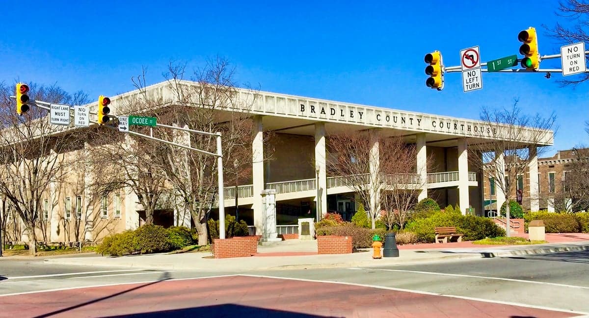
Photo: Wikipedia
Strategic Assessment of Bradley County
Workable tactical position. Some exposure to population density or targets, but generally defensible in a crisis.
What does the Strategic Assessment tell us?
Our Strategic Assessment grades tactical survivability of an area. Major population centers, military targets, fallout zones, natural disasters, and border exposure all drive risk — lower exposure means a more defensible position in a crisis.
This is heavily inspired by Joel Skousen's Strategic Relocation book. Highly recommended you checkout the book ($)What does this tell us?
Our Strategic Assessment grades tactical survivability of an area. Major population centers, military targets, fallout zones, natural disasters, and border exposure all drive risk — lower exposure means a more defensible position in a crisis.
This is heavily inspired by Joel Skousen's Strategic Relocation book. Highly recommended you checkout the book ($)Strategic Pillars

Key Distances
Strategic Assessment Analysis
Bradley County, Tennessee, anchored by the city of Cleveland, presents a compelling case for relocation-minded individuals and families who prioritize strategic resilience without sacrificing access to modern infrastructure. Its position in the southeastern corner of the state, where the Appalachian foothills meet the Tennessee Valley, offers a blend of geographic defensibility and logistical connectivity that is rare in the eastern United States. For a reader thinking seriously about disaster readiness and self-sufficiency, Bradley County provides a foundation that balances natural buffers with practical access to resources, though it is not without its own set of exposure risks that demand honest assessment.
Geographic position and natural advantages for long-term stability
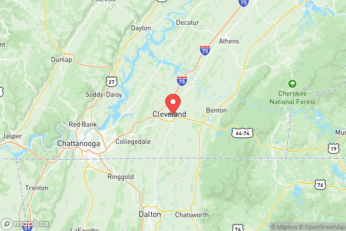
Bradley County sits roughly 30 miles northeast of Chattanooga and about 90 miles northwest of Atlanta, placing it within a day's drive of major population centers while remaining distinctly removed from their immediate vulnerabilities. The county's terrain transitions from the relatively flat Tennessee River Valley in the west to the steeper, forested ridges of the Cherokee National Forest in the east. This topography offers natural chokepoints and defensible positions, particularly in the eastern half of the county near the community of Benton Springs. The Hiwassee River forms the county's northern boundary, and the Ocoee River cuts through the southeastern corner near the town of Ducktown, providing reliable surface water sources that are less likely to be contaminated by upstream industrial activity compared to the Tennessee River itself. The area's elevation ranges from roughly 700 feet in the valley to over 2,000 feet on the ridges, which reduces flood risk in the higher zones and provides natural vantage points. The local climate is humid subtropical, with four distinct seasons and an average annual rainfall of about 52 inches, which supports year-round agriculture and recharges groundwater reliably. For a relocator evaluating long-term habitability, the combination of defensible terrain, multiple watersheds, and moderate seismic risk (the Eastern Tennessee Seismic Zone produces only minor tremors) makes Bradley County a structurally sound choice.
Risks, exposures, and proximity to fallout-relevant landmarks
No strategic assessment is complete without a clear-eyed look at the threats. Bradley County's most significant risk exposure comes from its proximity to the Watts Bar Nuclear Plant, located roughly 25 miles northwest in Spring City, Tennessee. This facility operates two pressurized water reactors and sits on the Tennessee River, which flows past Bradley County's western edge. While the plant has a solid safety record, a major incident there would place much of the county within the plume exposure pathway zone, particularly the western communities near Charleston and the area around the Hiwassee River confluence. Additionally, the county lies within 150 miles of the Oak Ridge National Laboratory and the Y-12 National Security Complex, both of which are potential high-value targets in a conflict scenario. On the natural disaster front, the region experiences occasional tornadoes — the 2011 Super Outbreak produced an EF-4 that tracked through nearby Chattanooga — and severe thunderstorms with damaging straight-line winds are an annual occurrence. Flooding is a localized concern in the low-lying areas along Candies Creek and the lower Hiwassee, but the county's hilly terrain generally prevents the kind of widespread inundation seen in flatter regions. Wildfire risk is moderate, concentrated in the forested eastern sections during late summer and fall droughts. For a relocator, the nuclear proximity is the single factor that demands the most attention, as it introduces a low-probability, high-consequence variable that is not present in many other inland Tennessee counties.
Practical resilience for a relocator: food, water, energy, and defensibility
Bradley County offers a strong baseline for practical self-sufficiency, though it requires active effort to realize. The county's agricultural sector is robust, with over 700 farms producing cattle, poultry, soybeans, corn, and hay. The Cleveland Farmers Market operates year-round, and the surrounding area has a dense network of small-scale producers selling meat, eggs, and produce directly to consumers. For a family looking to establish a homestead, the eastern part of the county near the community of Turtletown offers affordable, undeveloped land with access to spring-fed water sources. The county's water infrastructure is dominated by the Cleveland Utilities system, which draws from the Hiwassee River and groundwater wells, but private wells are common in rural areas and typically yield good-quality water at depths of 100 to 300 feet. Energy resilience is a mixed picture: the Tennessee Valley Authority (TVA) provides the grid power, which is reliable by regional standards but vulnerable to the same nuclear and weather-related disruptions mentioned earlier. Solar potential is moderate, with the area receiving about 4.5 peak sun hours per day, and off-grid solar installations are feasible on south-facing slopes. Wood heating is practical given the extensive forest cover, and many rural properties already have wood stoves or outdoor furnaces. Defensibility varies by location: the open farmland in the western part of the county near the town of McDonald offers little natural cover, while the ridge-and-valley terrain in the east provides excellent concealment and natural barriers. The county's road network is anchored by Interstate 75, which runs north-south through Cleveland, and U.S. Highway 64, which cuts east-west. In a grid-down scenario, these highways could become liabilities as chokepoints, but the extensive network of county roads and forest service routes offers alternative movement corridors for those familiar with the terrain.
The overall strategic picture for Bradley County is one of qualified opportunity. It offers genuine geographic advantages — defensible terrain, reliable water, productive farmland, and a climate that supports year-round food production — that are hard to find in the eastern U.S. without moving to more remote and economically isolated areas. The presence of Cleveland as a mid-sized city (population roughly 48,000) provides access to healthcare, hardware, and supply chains without the congestion and vulnerability of a major metro. The nuclear proximity to Watts Bar is the most serious concern, and any relocator should map their specific property's distance and prevailing wind patterns relative to that facility. For a family or individual willing to invest in well water, solar backup, and a wood heat system, Bradley County offers a realistic path to a resilient lifestyle that balances self-sufficiency with the ability to remain connected to the broader economy. It is not a bug-out location in the wilderness sense, but it is a solid, defensible base for those who want to live prepared without living off-grid entirely.

* Values derived from national, state, county, city and local statistics and may differ in a specific area. Last updated: 2026-07-12T03:48:59.000Z
Narrative content on this page is AI-generated and may contain mistakes. Verify any details that matter before acting on them.
ReloMaps may earn a commission from affiliate links at no extra cost to you.

