Strategic Assessment of St Albans, VT
Multiple tactical vulnerabilities. Population density, target proximity, or disaster risk are likely compounding. A retreat property and exit planning is required.
What does the Strategic Assessment tell us?
Our Strategic Assessment grades tactical survivability of an area. Major population centers, military targets, fallout zones, natural disasters, and border exposure all drive risk — lower exposure means a more defensible position in a crisis.
This is heavily inspired by Joel Skousen's Strategic Relocation book. Highly recommended you checkout the book ($)What does this tell us?
Our Strategic Assessment grades tactical survivability of an area. Major population centers, military targets, fallout zones, natural disasters, and border exposure all drive risk — lower exposure means a more defensible position in a crisis.
This is heavily inspired by Joel Skousen's Strategic Relocation book. Highly recommended you checkout the book ($)Strategic Pillars

Key Distances
Regional Safe Places
Below is our recommended "safe zones" in Vermont and the surrounding area based on our strategic heuristics. For most people, it's unrealistic to live in a “safe zone” full-time due to work, family or other personal reasons. They tend to be more rural. However, many of these areas are perfect for second homes and retreat properties that double as a vacation home or even a short-term rental.
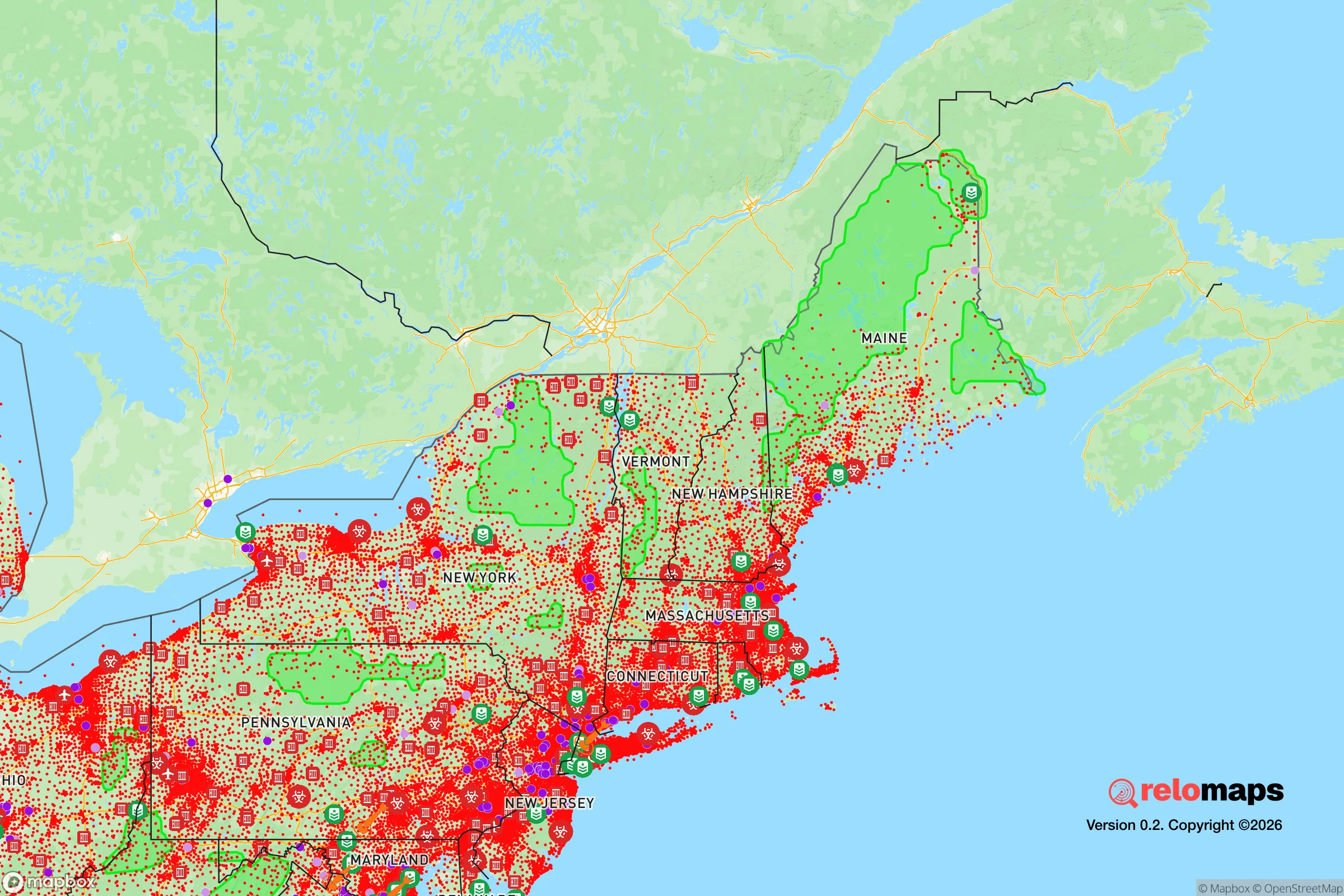
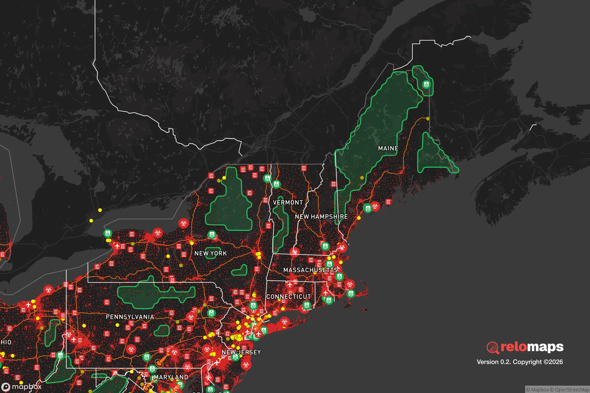


Important Note: For informational purposes only. This does not mean nothing bad ever happens in the green zones. Please use common sense. This is based on public data and modeled with AI. We tried to take a conservative approach but mistakes happen. We update this regularly as new information becomes available.
Solar Generator Recommendations
Backup power matters more here than in safer locations. We've picked three solar generators across budgets and capacity tiers — start with the budget unit if you only need a few essentials, or step up if you want to run a fridge and HVAC for days at a time.

Jackery Portable Power Station Explorer 300
Budget OptionPower on the Go: Weighing only 11 lbs, it's convenient to set up and store with book-sized foldable solar panels

BLUETTI Portable Power Station AC180
Designed for both indoor and outdoor scenarios, AC180 is highly capable as it has a robost capacity and continuous output power.

EF ECOFLOW DELTA Pro Ultra Power Station
Upgraded PickEcoFlow DELTA Pro Ultra is a whole-home energy system designed to grow with your family. Integrated with the Smart Home Panel 2, it scales to meet your evolving energy needs — keeping your home powered, intelligent, and secure through every stage of life.
We earn a commission, at no additional cost to you.
Strategic Assessment Analysis
St Albans, Vermont, offers a compelling strategic profile for the relocation-minded reader who prioritizes resilience and self-sufficiency. Its position in the northwestern corner of the state provides a meaningful buffer from major metropolitan vulnerabilities while retaining access to critical supply routes and resources. The area’s combination of agricultural capacity, freshwater abundance, and low population density makes it a serious contender for those evaluating long-term preparedness, though its proximity to certain risks demands a clear-eyed assessment.
Geographic position and natural advantages for long-term security
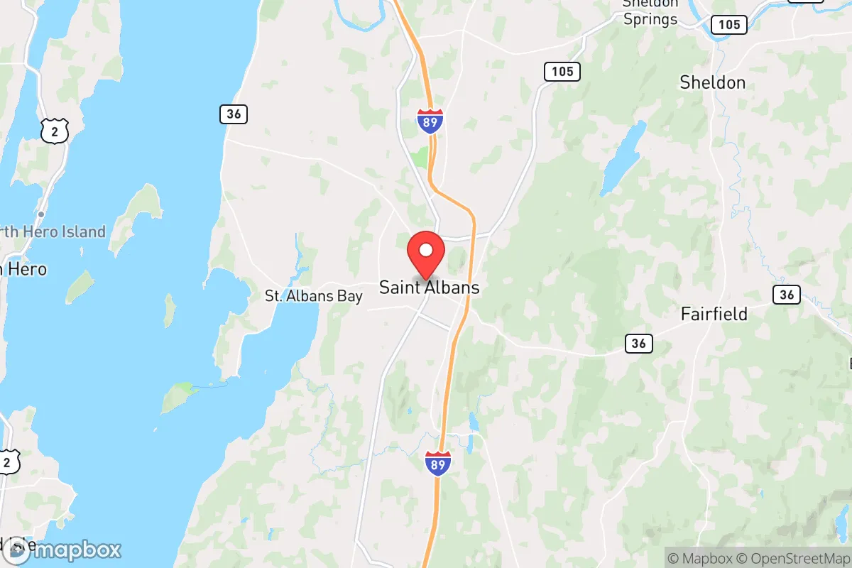
St Albans sits in Franklin County, roughly 30 miles from the Canadian border and about 35 miles north of Burlington, Vermont’s largest city. This placement offers a distinct strategic advantage: it is close enough to access regional medical centers, supply chains, and transportation hubs during normal conditions, yet far enough from Burlington’s population center to avoid the worst cascading effects of a major disruption. The area is surrounded by working farmland, the Missisquoi River, and the foothills of the Green Mountains, creating a natural landscape that supports both food production and defensible positioning.
The region’s agricultural foundation is a genuine asset. Franklin County is one of Vermont’s most productive farming areas, with dairy operations, hayfields, and vegetable growers dominating the landscape. For a relocator thinking about food security, this means local food systems are already established and not purely theoretical. The Lake Champlain basin moderates the climate slightly compared to interior Vermont, extending growing seasons and reducing the risk of extreme cold snaps that can cripple northern New England gardens. Groundwater is plentiful, and surface water from Lake Champlain and the Missisquoi River provides redundancy for water access, though treatment would be necessary for most surface sources.
The terrain itself offers practical defensibility without the isolation that creates supply problems. Rolling hills, forested ridgelines, and river valleys provide natural chokepoints and observation advantages, while the network of state highways and local roads keeps the area connected. The proximity to the Canadian border is a double-edged strategic factor: it provides an additional escape or supply corridor in a crisis, but also places the area within the zone of interest for border security operations during national emergencies.
Risk exposure, man-made threats, and proximity to vulnerable infrastructure
No resilience assessment is honest without addressing the risks, and St Albans has several that a serious relocator must weigh. The most significant is the area’s position relative to the Montreal metropolitan area, roughly 60 miles to the north. Montreal is a major population center, transportation hub, and industrial zone. In a scenario involving geopolitical instability, economic collapse, or public health emergencies, a city of 4 million people less than an hour’s drive from the border creates real risks of refugee movement, resource competition, and supply chain disruption. St Albans sits on Interstate 89, which runs directly from the Canadian border through Burlington to the rest of Vermont — a major north-south corridor that would become a primary movement route during any regional crisis.
Fallout-relevant infrastructure is present but not concentrated. Vermont has no active nuclear power plants — the Vermont Yankee facility in Vernon was decommissioned in 2014 — but the area lies within the broader risk envelope of the Seabrook Station plant in New Hampshire, roughly 150 miles southeast, and the Canadian nuclear facilities at Gentilly in Quebec, about 100 miles north. These distances provide meaningful dilution for fallout scenarios, but prevailing winds from the west and northwest mean that a major incident at Gentilly could deposit material across the Lake Champlain region. The Plattsburgh Air Force Base, now a civilian airport, is no longer an active military target, but the general presence of military infrastructure along the border corridor is worth noting.
Natural disaster risks are moderate. The area experiences harsh winters with heavy snowfall and ice storms that can knock out power for days or weeks — a recurring resilience test that locals take seriously. Flooding along the Missisquoi River and Lake Champlain shoreline is a periodic concern, particularly during spring thaw and heavy rain events. Earthquake risk is low compared to the West Coast, but the region sits in a zone of occasional seismic activity. Tornadoes are rare but not unheard of in northern Vermont. The overall natural hazard profile is manageable for a prepared household, but winter storms are a consistent and serious threat that requires robust heating, fuel storage, and backup power.
Practical resilience for a relocator: food, water, energy, and defensibility
For the reader thinking seriously about self-sufficiency, St Albans scores well on the fundamentals. Food production capacity is among the best in Vermont, with fertile soils, established agricultural infrastructure, and a culture of farming that means knowledge and equipment are available locally. A relocator with land can realistically pursue vegetable gardening, small livestock, and even grain production at a scale that would meaningfully supplement stored supplies. The local farmers’ market and co-op networks provide avenues for building relationships with producers before any crisis hits.
Water availability is a strong point. Groundwater wells are common in the rural areas surrounding St Albans, and the water table is generally reliable. For those on town water, the source is Lake Champlain, which provides enormous volume but requires treatment infrastructure. A well with a hand pump or solar-powered backup is a realistic and affordable upgrade for most properties. Surface water from streams and the Missisquoi River is abundant but requires filtration and boiling for safe consumption.
Energy resilience is achievable but requires upfront investment. The region’s winters make heating the primary energy concern. Wood heat is common and practical, with abundant forestland providing fuel for those with the land and labor to harvest it. Propane is widely used for heating and cooking, and bulk storage is feasible. Solar potential is moderate — Vermont gets less sun than the Southwest, but modern panels perform well even in cloudy conditions, and net metering policies are favorable. Backup generation, whether solar battery systems or conventional generators, is a near-necessity given the frequency of winter power outages.
Defensibility is a mixed picture. The rural areas offer natural isolation and the ability to control access to your property, but St Albans town itself is a small city of roughly 7,000 people with a traditional downtown layout that would be difficult to secure in a breakdown scenario. The surrounding countryside, with its farm roads, forested lots, and dispersed population, is far more defensible. The local population is generally self-reliant and community-oriented, which is a social resilience factor that matters — a place where neighbors know each other and share resources is far more resilient than an anonymous suburban development.
The overall strategic picture for a serious relocator
St Albans presents a balanced strategic option for the reader who wants genuine resilience without extreme isolation. It offers real agricultural capacity, abundant water, a manageable risk profile, and a population that understands winter self-sufficiency. The trade-offs are real: proximity to the Canadian border and the I-89 corridor creates exposure to population movement and supply chain disruption during major crises, and the harsh winters demand serious preparation. For a single individual or family willing to invest in wood heat, well water, food storage, and community relationships, this area provides a foundation for long-term security that few suburban or urban locations can match. It is not a bug-out location for the short-term prepper — it is a place to build a life that is already resilient by design, with the understanding that no location is risk-free and preparation is a continuous practice, not a one-time purchase.

* Values derived from national, state, county, city and local statistics and may differ in a specific area. Last updated: 2026-10-21T14:33:53.000Z
Narrative content on this page is AI-generated and may contain mistakes. Verify any details that matter before acting on them.
ReloMaps may earn a commission from affiliate links at no extra cost to you.

