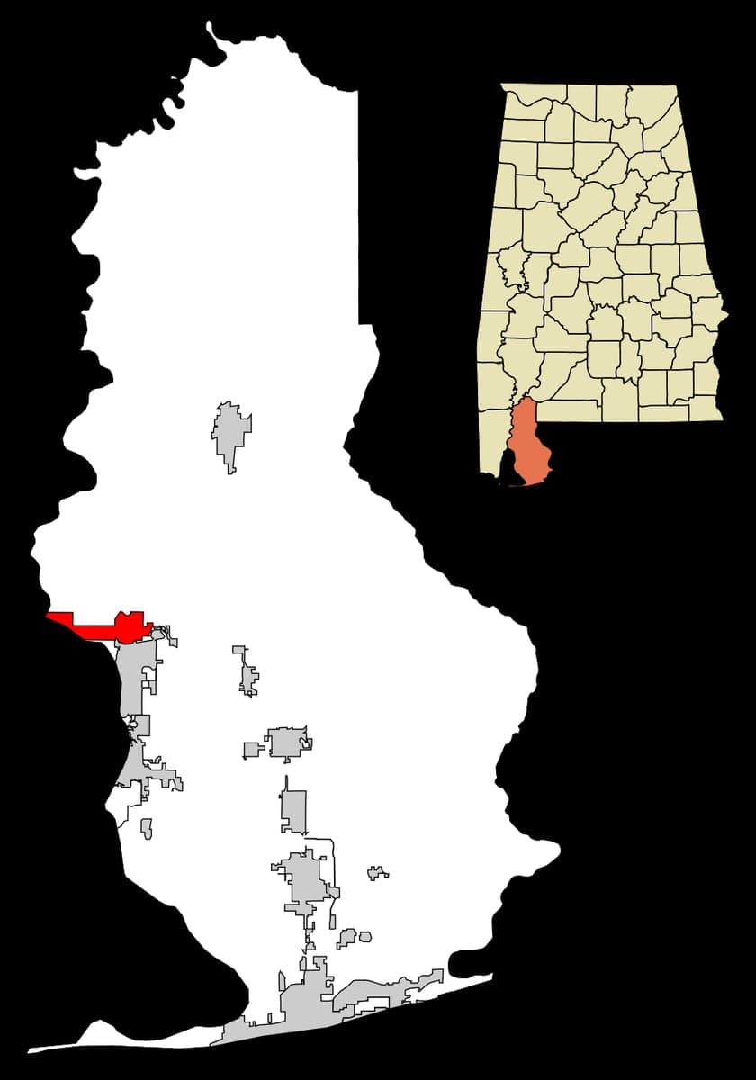
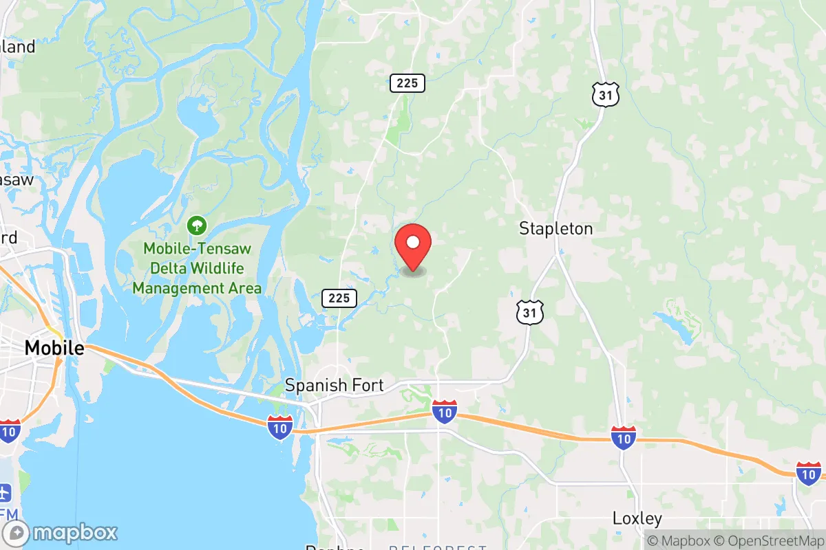
Photo: Wikipedia
Strategic Assessment of Spanish Fort, AL
Meaningful friction. Expect exposure to either population pressure, blast zones, or natural disaster risk. Consider buying a retreat property.
What does the Strategic Assessment tell us?
Our Strategic Assessment grades tactical survivability of an area. Major population centers, military targets, fallout zones, natural disasters, and border exposure all drive risk — lower exposure means a more defensible position in a crisis.
This is heavily inspired by Joel Skousen's Strategic Relocation book. Highly recommended you checkout the book ($)What does this tell us?
Our Strategic Assessment grades tactical survivability of an area. Major population centers, military targets, fallout zones, natural disasters, and border exposure all drive risk — lower exposure means a more defensible position in a crisis.
This is heavily inspired by Joel Skousen's Strategic Relocation book. Highly recommended you checkout the book ($)Strategic Pillars

Key Distances
Regional Safe Places
Below is our recommended "safe zones" in Alabama and the surrounding area based on our strategic heuristics. For most people, it's unrealistic to live in a “safe zone” full-time due to work, family or other personal reasons. They tend to be more rural. However, many of these areas are perfect for second homes and retreat properties that double as a vacation home or even a short-term rental.
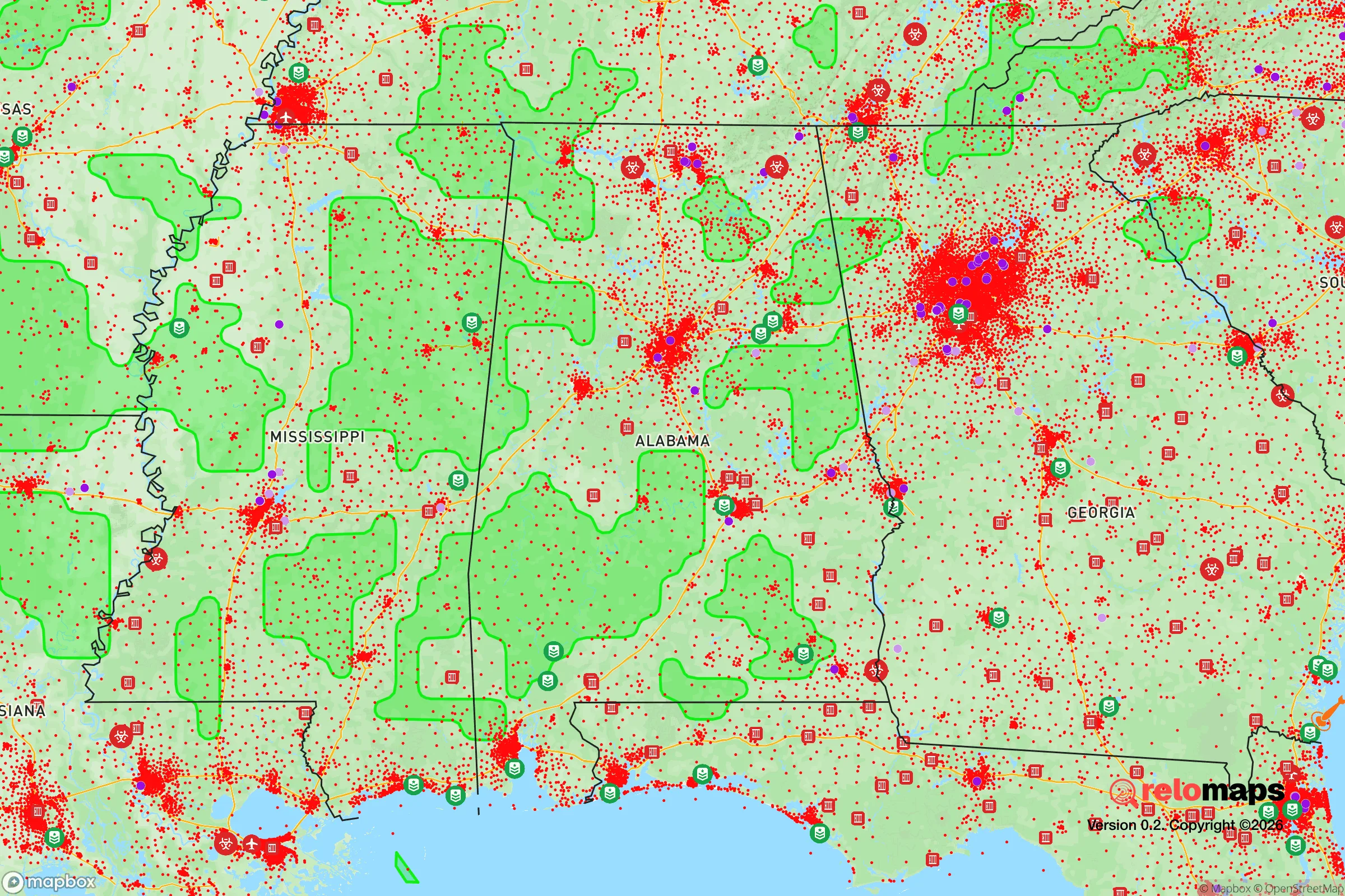
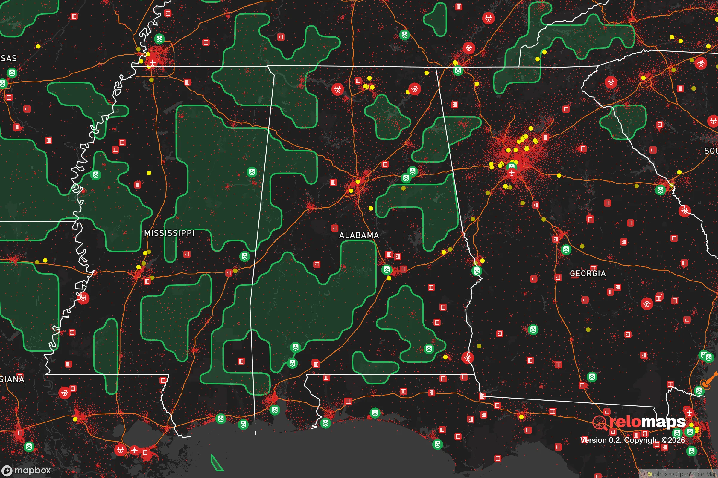


Important Note: For informational purposes only. This does not mean nothing bad ever happens in the green zones. Please use common sense. This is based on public data and modeled with AI. We tried to take a conservative approach but mistakes happen. We update this regularly as new information becomes available.
Solar Generator Recommendations
Backup power matters more here than in safer locations. We've picked three solar generators across budgets and capacity tiers — start with the budget unit if you only need a few essentials, or step up if you want to run a fridge and HVAC for days at a time.

Jackery Portable Power Station Explorer 300
Budget OptionPower on the Go: Weighing only 11 lbs, it's convenient to set up and store with book-sized foldable solar panels

BLUETTI Portable Power Station AC180
Designed for both indoor and outdoor scenarios, AC180 is highly capable as it has a robost capacity and continuous output power.

EF ECOFLOW DELTA Pro Ultra Power Station
Upgraded PickEcoFlow DELTA Pro Ultra is a whole-home energy system designed to grow with your family. Integrated with the Smart Home Panel 2, it scales to meet your evolving energy needs — keeping your home powered, intelligent, and secure through every stage of life.
We earn a commission, at no additional cost to you.
Strategic Assessment Analysis
Spanish Fort, Alabama, occupies a strategic position on the eastern shore of Mobile Bay that offers a compelling mix of natural defensibility and logistical access for those prioritizing disaster readiness and long-term self-sufficiency. Its location on a high bluff overlooking the bay provides inherent elevation advantages against storm surge, while its proximity to major transportation corridors—Interstate 10, Interstate 65, and the Port of Mobile—ensures supply chain access without placing residents directly in the crosshairs of a major metropolitan target. For the relocator weighing resilience against convenience, Spanish Fort presents a rare balance: close enough to urban resources to be practical, far enough to avoid the worst of a regional disruption.
Geographic position and natural advantages for long-term stability
Spanish Fort sits on the eastern shore of Mobile Bay, roughly 10 miles east of downtown Mobile, Alabama, and about 40 miles west of Pensacola, Florida. The area's defining geographic feature is the Blakeley Bluff, a natural escarpment rising 50 to 80 feet above the bay, which provides significant elevation advantage over the low-lying floodplains that dominate much of coastal Alabama. This elevation means that even during a Category 3 or 4 hurricane, the core of Spanish Fort remains above the storm surge zone—a critical distinction from nearby Daphne, Fairhope, or the western shore of Mobile. The city is also positioned along the Tensaw River and the Mobile-Tensaw River Delta, one of the largest intact river delta ecosystems in the United States. This delta acts as a natural buffer against storm surge from the Gulf of Mexico, absorbing wave energy before it reaches the eastern shore. For a relocator concerned with long-term climate stability, Spanish Fort's bluff location and delta protection offer a tangible resilience advantage over virtually any other coastal community in Alabama or the Florida Panhandle.
Risks, exposures, and proximity to fallout-relevant landmarks
No location is without vulnerabilities, and Spanish Fort's proximity to Mobile—a major Gulf Coast port and industrial hub—introduces specific man-made risks. The Port of Mobile, located roughly 12 miles southwest, is one of the busiest in the United States, handling over 60 million tons of cargo annually, including significant volumes of coal, petroleum products, and chemicals. In a major disruption—whether natural disaster, cyberattack, or geopolitical event—this port becomes a high-value target. The Mobile Bay Causeway (U.S. 90/98) and the I-10 Bayway are the primary road links between Spanish Fort and Mobile; both are vulnerable to storm damage, accidents, or deliberate disruption. If either bridge is compromised, access to the western shore becomes severely limited, though Spanish Fort retains road connections north toward I-65 and east toward Pensacola. Additionally, the Chemical Stockpile Emergency Preparedness Program (CSEPP) zone for the Anniston Army Depot's chemical weapons stockpile is roughly 200 miles northeast—far enough to avoid direct fallout but close enough to be aware of regional transport routes. The Baldwin County Nuclear Plant, located about 30 miles north near the Alabama River, is a low-risk facility but remains a consideration for the truly risk-averse. For the relocator, the key takeaway is that Spanish Fort's primary exposure is not direct blast or fallout but rather supply chain disruption and population displacement from Mobile and the broader Gulf Coast region in a crisis.
Practical resilience for a relocator: food, water, energy, and defensibility
For the individual or family serious about self-sufficiency, Spanish Fort offers a surprisingly strong baseline. Water access is excellent: the area sits atop the Citronelle Aquifer, a deep, high-yield groundwater source that supplies most of Baldwin County. Private wells are feasible in many parts of Spanish Fort, particularly in the more rural northern sections, and the county's water utilities have redundant treatment capacity. Food resilience is bolstered by the surrounding agricultural region—Baldwin County is Alabama's top producer of soybeans, corn, and poultry, and the Mobile-Tensaw Delta supports wild game, fish, and waterfowl. Local farmers' markets and roadside stands are common, and the area's long growing season (March through November) allows for year-round home gardening. Energy infrastructure is more mixed: the grid is served by Riverside Electric Cooperative and Alabama Power, both of which have improved storm hardening since Hurricane Sally (2020), but outages during severe weather remain common. Solar potential is high—the area averages 215 sunny days per year—and local permitting for off-grid systems is straightforward. Defensibility is where Spanish Fort's geography truly shines. The city is bounded by water on three sides (Mobile Bay to the west, the Tensaw River to the north, and the Blakeley River to the south), creating a natural choke point for any ground-based threat. The only land access is via the eastern corridor along U.S. 31 and I-10, which can be monitored or controlled with relative ease. For a relocator thinking in terms of a bug-in or long-term hold scenario, Spanish Fort's layout—a compact, elevated peninsula with limited entry points—is about as defensible as a suburban environment gets.
The overall strategic picture for Spanish Fort is one of calculated advantage with manageable trade-offs. It is not a remote mountain redoubt—it is a well-positioned coastal suburb with the elevation, water access, and agricultural surroundings to support a resilient lifestyle. The primary risks are not natural but man-made: proximity to Mobile's industrial and port infrastructure, and the potential for population influx from less-prepared areas during a crisis. For the conservative-leaning relocator who values community, preparedness, and access to resources without sacrificing comfort, Spanish Fort offers a rare combination of geographic defensibility, water security, and logistical connectivity. It is a place where a thoughtful family can build a self-sufficient homestead while still being 20 minutes from a major hospital and 30 minutes from an international airport. In the calculus of modern resilience, that balance is increasingly hard to find.

* Values derived from national, state, county, city and local statistics and may differ in a specific area. Last updated: 2026-08-18T00:28:01.000Z
Narrative content on this page is AI-generated and may contain mistakes. Verify any details that matter before acting on them.
ReloMaps may earn a commission from affiliate links at no extra cost to you.

