
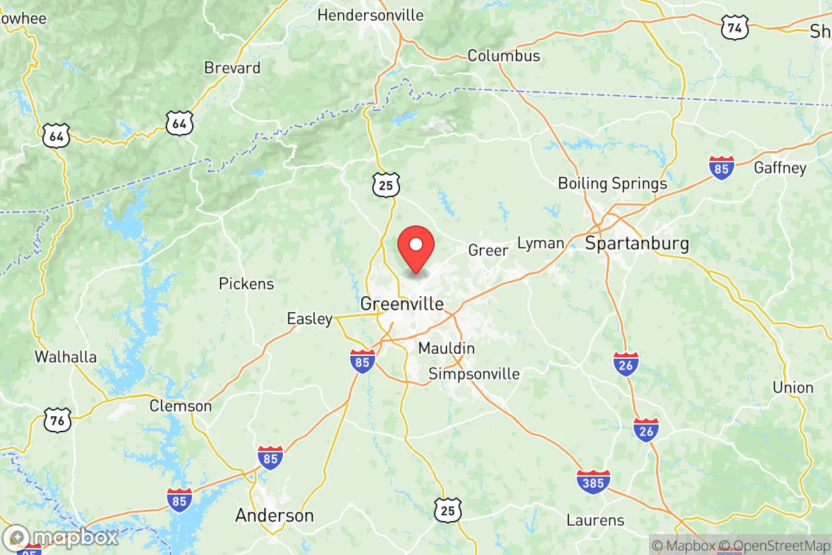
Photo: Wikipedia
Strategic Assessment of Greenville County
Meaningful friction. Expect exposure to either population pressure, blast zones, or natural disaster risk. Consider buying a retreat property.
What does the Strategic Assessment tell us?
Our Strategic Assessment grades tactical survivability of an area. Major population centers, military targets, fallout zones, natural disasters, and border exposure all drive risk — lower exposure means a more defensible position in a crisis.
This is heavily inspired by Joel Skousen's Strategic Relocation book. Highly recommended you checkout the book ($)What does this tell us?
Our Strategic Assessment grades tactical survivability of an area. Major population centers, military targets, fallout zones, natural disasters, and border exposure all drive risk — lower exposure means a more defensible position in a crisis.
This is heavily inspired by Joel Skousen's Strategic Relocation book. Highly recommended you checkout the book ($)Strategic Pillars

Key Distances
Strategic Assessment Analysis
Greenville County sits in the strategic Upstate corridor of South Carolina, offering a mix of geographic insulation and economic momentum that makes it a serious consideration for anyone prioritizing long-term resilience. Its location roughly 100 miles from the Atlantic coast keeps it out of the direct path of hurricane storm surges, while the nearby Blue Ridge escarpment provides natural barriers and reliable water sources. The area has seen steady population growth—over 15% between 2010 and 2020—and a diversified economy anchored by manufacturing, healthcare, and logistics, which gives it a stability that purely coastal or single-industry regions lack.
How Greenville County's geography shields it from coastal threats
Greenville County sits in the foothills of the Blue Ridge Mountains, with elevations ranging from about 800 feet in the city of Greenville itself to over 2,000 feet in the northern part of the county near the North Carolina state line. This topography is a natural buffer: the mountains intercept the worst of tropical systems tracking inland, and the county's position well inland means catastrophic storm surge and saltwater intrusion are non-issues. The region is also outside the highest-risk zones for tornadoes, though severe thunderstorms and occasional ice storms do occur. Water availability is a genuine strength—the county sits within the Saluda River basin, and major reservoirs like Lake Keowee and Lake Hartwell provide both recreational utility and emergency water supply capacity. The climate is temperate, with four distinct seasons, which supports year-round gardening and livestock operations without the extreme heat stress of the Deep South or the growing-season limitations of the Northeast.
Natural and man-made risks to consider in the Upstate
No location is risk-free, and Greenville County has its own set of exposures. The Eastern Tennessee Seismic Zone, which produced the 5.1-magnitude earthquake near Sparta, North Carolina, in 2020, is about 100 miles to the northwest, and while major quakes are rare, the region sits on ancient fault lines that can produce moderate tremors. Ice storms are the most common disruptive weather event—the 2014 ice storm left over 100,000 without power in the Greenville area for several days, a reminder that the grid can be brittle during winter weather. More relevant for the preparedness-minded reader: the county is situated within 100 miles of the Savannah River Site, a 310-square-mile Department of Energy nuclear reservation in Aiken County that handles tritium processing and nuclear weapons component manufacturing. While the site has a long operational history with no major off-site incidents, its presence is a legitimate consideration for anyone planning a long-term fallout strategy. Additionally, the county's position along the I-85 corridor means it sits between the Charlotte metro area (about 90 miles northeast) and the Atlanta metro area (about 150 miles southwest), both of which are major population centers with corresponding economic and logistical significance. The city of Greenville itself is home to a Lockheed Martin facility that produces F-16 fighter components, and the nearby BMW manufacturing plant in Spartanburg County is the largest automotive exporter in the United States by value—these are industrial assets that could be strategic targets in a conflict scenario, though they are dispersed and not concentrated in a single downtown core.
Practical resilience for a relocator: food, water, energy, and defensibility
For a family or individual serious about self-sufficiency, Greenville County offers a surprisingly strong base. The agricultural heritage of the Upstate is still alive—small farms, farmers markets, and u-pick operations are common in the northern and western parts of the county, and the climate supports a wide range of crops from apples to tomatoes to pasture-raised livestock. The county's soil is generally acidic, but with proper amendment, it can support productive gardens and orchards. Water is the county's strongest card: the Saluda River and its tributaries run through the county, and the Greenville Water System draws from the protected watershed of the Blue Ridge, providing some of the cleanest municipal water in the Southeast. For those with well water, the aquifer recharge rates are good in the northern half of the county, though the southern part near the Piedmont is more variable. Energy infrastructure is a mixed bag: Duke Energy and Laurens Electric Cooperative serve the area, and the grid is connected to the broader regional network, which means it is not islanded and can be affected by regional outages. However, the county's terrain—rolling hills, forested ridges, and rural pockets—offers natural defensibility. The Mountain Bridge Wilderness Area and the Jocassee Gorges region provide rugged, low-population-density terrain where a prepared individual could operate with relative privacy. The county's rural northern and western edges, particularly around the towns of Marietta and Cleveland, offer properties with hard-to-access drives, dense tree cover, and limited road frontage—factors that slow down any unwanted approach. The county's sheriff's office is professional and well-funded, but response times in the far northern reaches can exceed 30 minutes, which is a liability for immediate security but also a signal that those areas are genuinely low-density and less likely to be overwhelmed in a crisis.
The overall strategic picture for Greenville County is one of balanced advantage. It avoids the glaring vulnerabilities of the coastal plain and the target-rich environment of the I-95 corridor, while still maintaining access to major transportation networks (I-85, I-26, and the Greenville-Spartanburg International Airport) for supply movement or evacuation if needed. Its biggest liabilities are the proximity to the Savannah River Site and the possibility of cascading grid failures during winter storms, but these are manageable with proper planning—a backup generator, a well, and a pantry stocked with locally grown food go a long way here. For the relocator who values economic opportunity, a conservative political climate, and a geographic position that is neither too remote nor too exposed, Greenville County represents a defensible middle ground. It is not a bunker, but it is a strong base from which to build a resilient life.

* Values derived from national, state, county, city and local statistics and may differ in a specific area. Last updated: 2026-07-26T22:01:46.000Z
Narrative content on this page is AI-generated and may contain mistakes. Verify any details that matter before acting on them.
ReloMaps may earn a commission from affiliate links at no extra cost to you.

