Photo: Wikipedia
Strategic Assessment of Shingle Springs, CA
Workable tactical position. Some exposure to population density or targets, but generally defensible in a crisis.
What does the Strategic Assessment tell us?
Our Strategic Assessment grades tactical survivability of an area. Major population centers, military targets, fallout zones, natural disasters, and border exposure all drive risk — lower exposure means a more defensible position in a crisis.
This is heavily inspired by Joel Skousen's Strategic Relocation book. Highly recommended you checkout the book ($)What does this tell us?
Our Strategic Assessment grades tactical survivability of an area. Major population centers, military targets, fallout zones, natural disasters, and border exposure all drive risk — lower exposure means a more defensible position in a crisis.
This is heavily inspired by Joel Skousen's Strategic Relocation book. Highly recommended you checkout the book ($)Strategic Pillars

Key Distances
Regional Safe Places
Below is our recommended "safe zones" in California and the surrounding area based on our strategic heuristics. For most people, it's unrealistic to live in a “safe zone” full-time due to work, family or other personal reasons. They tend to be more rural. However, many of these areas are perfect for second homes and retreat properties that double as a vacation home or even a short-term rental.




Important Note: For informational purposes only. This does not mean nothing bad ever happens in the green zones. Please use common sense. This is based on public data and modeled with AI. We tried to take a conservative approach but mistakes happen. We update this regularly as new information becomes available.
Solar Generator Recommendations
Backup power matters more here than in safer locations. We've picked three solar generators across budgets and capacity tiers — start with the budget unit if you only need a few essentials, or step up if you want to run a fridge and HVAC for days at a time.

Jackery Portable Power Station Explorer 300
Budget OptionPower on the Go: Weighing only 11 lbs, it's convenient to set up and store with book-sized foldable solar panels

BLUETTI Portable Power Station AC180
Designed for both indoor and outdoor scenarios, AC180 is highly capable as it has a robost capacity and continuous output power.

EF ECOFLOW DELTA Pro Ultra Power Station
Upgraded PickEcoFlow DELTA Pro Ultra is a whole-home energy system designed to grow with your family. Integrated with the Smart Home Panel 2, it scales to meet your evolving energy needs — keeping your home powered, intelligent, and secure through every stage of life.
We earn a commission, at no additional cost to you.
Strategic Assessment Analysis
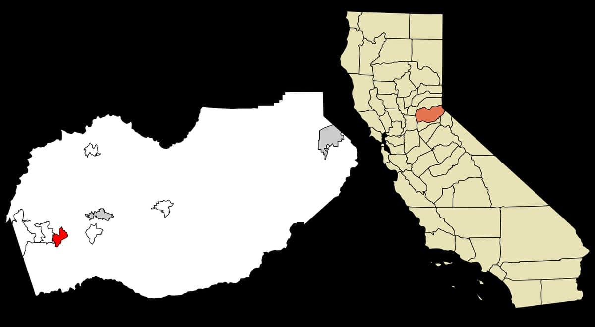
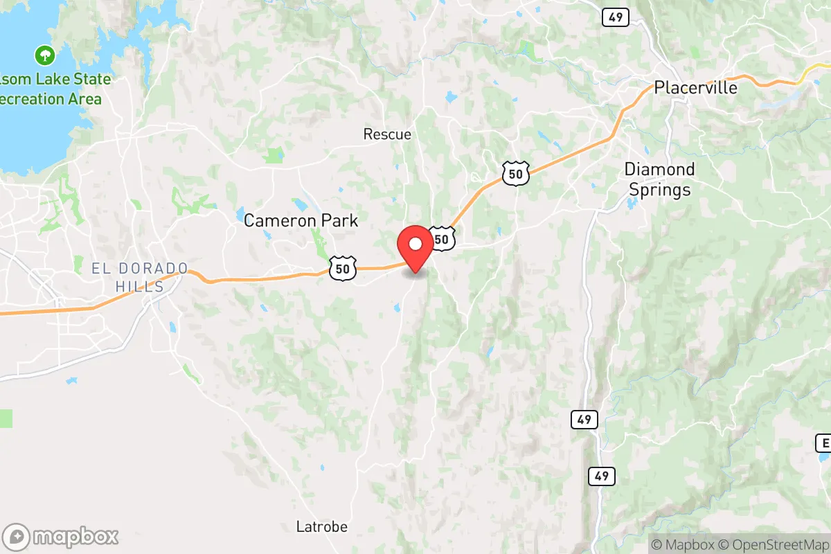
Shingle Springs, California, offers a compelling strategic position for those prioritizing resilience and self-sufficiency, balancing proximity to essential resources with a meaningful buffer from the concentrated risks of major urban centers. Located in El Dorado County, roughly 35 miles east of Sacramento and 20 miles west of Placerville, this unincorporated community sits at the transition zone between the Central Valley foothills and the Sierra Nevada, providing a natural defensive geography that complicates access for large-scale threats while maintaining viable supply lines. For a relocator thinking seriously about disaster readiness, Shingle Springs presents a workable middle ground—close enough to tap into regional infrastructure, yet far enough to avoid the immediate fallout zones of California's most critical targets.
Geographic position and natural defensive advantages
Shingle Springs occupies a strategic niche along the U.S. Route 50 corridor, a major east-west artery that connects the Sacramento Valley to the Sierra Nevada and Lake Tahoe. This positioning offers several resilience benefits. The terrain is rolling foothills at an elevation of roughly 1,400 feet, which provides natural observation points and limits the approach vectors for ground-based threats. The area is not in a major floodplain—the nearest significant waterway, the Cosumnes River, runs several miles to the south—and the elevation reduces the risk of storm surge or sea-level rise that plagues coastal communities. The region's Mediterranean climate, with hot, dry summers and cool, wet winters, supports year-round outdoor activity and limited snowfall, which keeps roads passable in most conditions. The surrounding El Dorado National Forest and Bureau of Land Management tracts create a natural buffer of undeveloped land, reducing population density and providing potential foraging, timber, and water catchment areas. For a reader weighing relocation, the key geographic advantage is that Shingle Springs is far enough from the Sacramento metropolitan area to avoid the worst of urban collapse scenarios—looting, resource competition, and infrastructure failure—while still being within a 45-minute drive of major hospitals, supply hubs, and the state capital's emergency coordination centers.
Risks, exposures, and proximity to fallout-relevant landmarks
No location is without vulnerabilities, and Shingle Springs has several that a serious relocator must weigh. The most immediate natural risk is wildfire. The 2014 King Fire burned over 97,000 acres in the region, and the 2021 Caldor Fire came within 20 miles of the community, demonstrating that the dry foothill vegetation and seasonal Diablo winds create a genuine threat. Properties in the wildland-urban interface require defensible space, fire-resistant construction, and an evacuation plan. Earthquake risk is moderate—the area is not on a major fault line like the San Andreas, but the nearby Sierra Nevada fault system can produce magnitude 5-6 events that could disrupt roads and utilities. The area's proximity to Sacramento (population 525,000) and the state capital's government and military infrastructure—including Mather Airport (a former Air Force base) and the California National Guard headquarters—makes it a secondary target in a major conflict scenario. Additionally, the U.S. Route 50 corridor itself is a critical logistics route; in a crisis, it could become a chokepoint for evacuation or resupply, and its bridges and tunnels are potential targets for disruption. The Folsom Dam, located about 25 miles west, is a high-risk infrastructure point—a catastrophic failure would flood the Sacramento Valley but would not directly threaten Shingle Springs due to elevation, though it could sever supply routes. For the resilience-minded relocator, the key takeaway is that Shingle Springs is not a remote bunker; it is a semi-rural community with real exposure to regional risks, but those risks are manageable with proper preparation.
Practical resilience for a relocator: food, water, energy, and defensibility
For a family or individual serious about self-sufficiency, Shingle Springs offers a realistic foundation. Water access is the strongest asset. The area sits above the Cosumnes River watershed, and many properties have access to groundwater via wells, with typical depths of 100-300 feet yielding reliable supplies. The El Dorado Irrigation District also serves parts of the community, providing a municipal backup. Rainwater catchment is viable given the 30-40 inches of annual precipitation, though storage must account for the dry summer months. Food resilience is moderate. The region has a strong agricultural heritage—El Dorado County is known for its apple orchards, vineyards, and small farms—and the local farmers' markets and CSAs provide fresh produce during the growing season. However, the area is not a major grain or protein producer; most staple foods are trucked in from the Central Valley. A relocator should plan for at least a 3-6 month food storage buffer. Hunting and fishing are possible in the nearby national forest (deer, turkey, and trout), but this requires skill and licensing. Energy resilience is improving. The region has good solar potential—over 260 sunny days per year—and many homes already have rooftop solar, though battery storage is not yet universal. The local grid is served by Sacramento Municipal Utility District (SMUD) and Pacific Gas & Electric (PG&E), both of which have experienced Public Safety Power Shutoffs during fire season, making off-grid backup essential. Propane is widely available for heating and cooking. Defensibility is a mixed picture. The rolling terrain and oak woodlands provide natural cover and limited sightlines, which can be an advantage for a prepared property. However, the area is not a natural fortress—there are multiple approach roads (U.S. 50, Latrobe Road, and Shingle Springs Drive), and the community is spread out, making perimeter defense impractical. The local El Dorado County Sheriff's Office has a substation in the area, but response times in a widespread emergency could be hours. For a relocator, the practical strategy is to choose a property with good road access for resupply but with natural chokepoints—a dead-end road, a hillside position, or a property with a single driveway—to control access.
The overall strategic picture for Shingle Springs is that of a viable, middle-ground relocation option for the resilience-minded. It is not a remote, off-grid paradise—it is a working-class foothill community with real infrastructure, real neighbors, and real exposure to California's natural and man-made risks. What it offers is a balance: enough distance from Sacramento's urban core to avoid the worst of a collapse scenario, enough elevation to escape flood risks and provide natural observation, and enough local resources (water, solar potential, agricultural land) to support a self-sufficient lifestyle with proper planning. The trade-offs are clear—wildfire risk, moderate earthquake exposure, and proximity to a major transportation corridor—but these are manageable for a prepared relocator who invests in fire hardening, water storage, and energy independence. For a single individual or family looking to move to a location that is not a target but is not a wilderness either, Shingle Springs deserves serious consideration. It is a place where a thoughtful, disciplined approach to preparedness can pay off, without requiring a complete withdrawal from modern life.

* Values derived from national, state, county, city and local statistics and may differ in a specific area. Last updated: 2026-09-28T10:05:42.000Z
Narrative content on this page is AI-generated and may contain mistakes. Verify any details that matter before acting on them.
ReloMaps may earn a commission from affiliate links at no extra cost to you.

