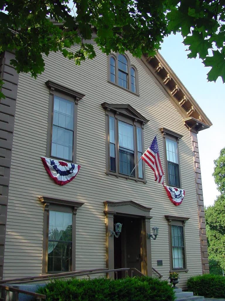
Photo: Wikipedia
Strategic Assessment of Sherborn, MA
Multiple tactical vulnerabilities. Population density, target proximity, or disaster risk are likely compounding. A retreat property and exit planning is required.
What does the Strategic Assessment tell us?
Our Strategic Assessment grades tactical survivability of an area. Major population centers, military targets, fallout zones, natural disasters, and border exposure all drive risk — lower exposure means a more defensible position in a crisis.
This is heavily inspired by Joel Skousen's Strategic Relocation book. Highly recommended you checkout the book ($)What does this tell us?
Our Strategic Assessment grades tactical survivability of an area. Major population centers, military targets, fallout zones, natural disasters, and border exposure all drive risk — lower exposure means a more defensible position in a crisis.
This is heavily inspired by Joel Skousen's Strategic Relocation book. Highly recommended you checkout the book ($)Strategic Pillars

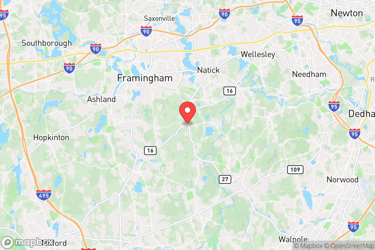
Key Distances
Regional Safe Places
Below is our recommended "safe zones" in Massachusetts and the surrounding area based on our strategic heuristics. For most people, it's unrealistic to live in a “safe zone” full-time due to work, family or other personal reasons. They tend to be more rural. However, many of these areas are perfect for second homes and retreat properties that double as a vacation home or even a short-term rental.
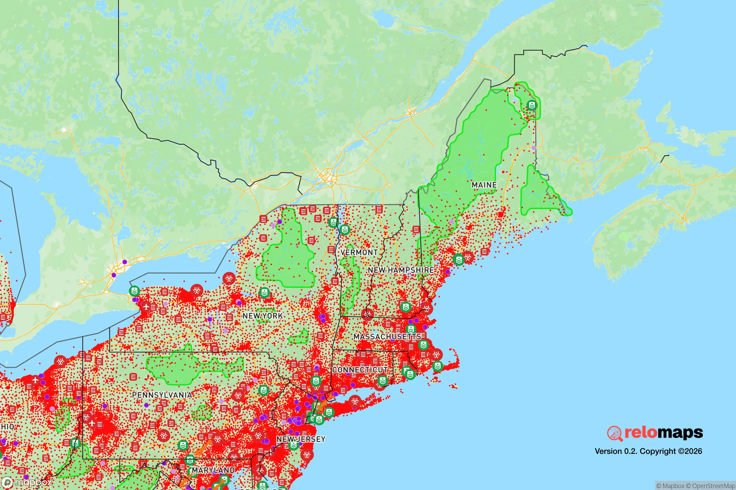
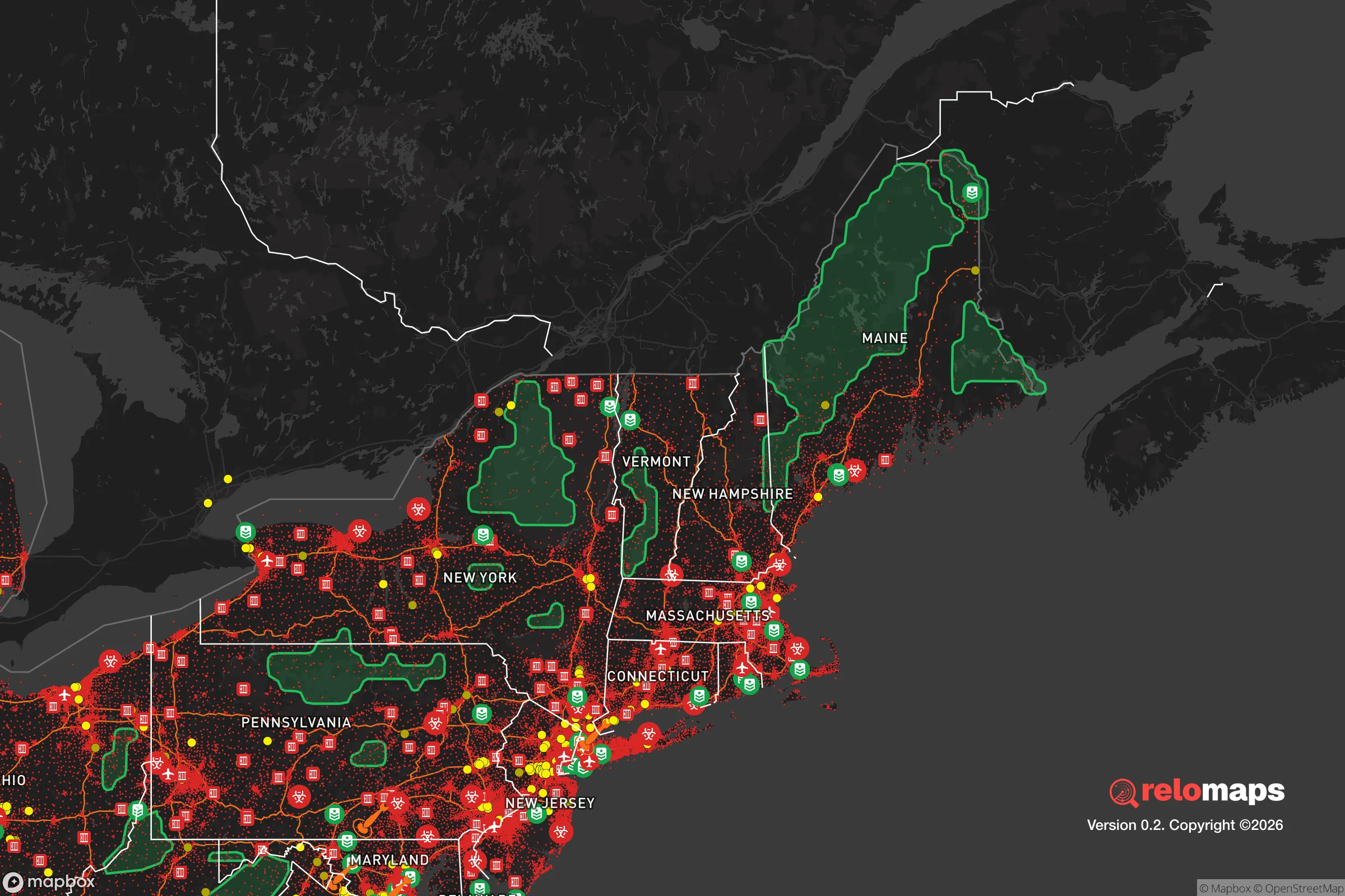


Important Note: For informational purposes only. This does not mean nothing bad ever happens in the green zones. Please use common sense. This is based on public data and modeled with AI. We tried to take a conservative approach but mistakes happen. We update this regularly as new information becomes available.
Solar Generator Recommendations
Backup power matters more here than in safer locations. We've picked three solar generators across budgets and capacity tiers — start with the budget unit if you only need a few essentials, or step up if you want to run a fridge and HVAC for days at a time.

Jackery Portable Power Station Explorer 300
Budget OptionPower on the Go: Weighing only 11 lbs, it's convenient to set up and store with book-sized foldable solar panels

BLUETTI Portable Power Station AC180
Designed for both indoor and outdoor scenarios, AC180 is highly capable as it has a robost capacity and continuous output power.

EF ECOFLOW DELTA Pro Ultra Power Station
Upgraded PickEcoFlow DELTA Pro Ultra is a whole-home energy system designed to grow with your family. Integrated with the Smart Home Panel 2, it scales to meet your evolving energy needs — keeping your home powered, intelligent, and secure through every stage of life.
We earn a commission, at no additional cost to you.
Strategic Assessment Analysis
Sherborn, Massachusetts, occupies a unique strategic position that balances deep rural resilience with proximity to Boston’s economic engine, making it a compelling option for relocation-minded readers who prioritize disaster readiness and self-sufficiency. This small town of roughly 4,200 residents sits in Middlesex County, about 20 miles west of Boston, yet its zoning and land-use policies have preserved a landscape of working farms, conservation land, and large-lot subdivisions that create natural buffers. For a family or individual thinking seriously about long-term preparedness, Sherborn offers a rare combination of low population density, defensible terrain, and access to regional resources — but it also carries specific risks tied to its location near major infrastructure and population centers that demand honest assessment.
Geographic position and natural advantages for long-term resilience
Sherborn’s geography is defined by its position along the Charles River watershed, with rolling hills, extensive wetlands, and dense hardwood forests covering roughly 60% of the town’s 16 square miles. The town sits on a bedrock of Dedham granite and Cambridge argillite, which provides stable foundations for wells and septic systems — a critical advantage for off-grid water and waste management. Elevation ranges from about 100 to 300 feet above sea level, with no floodplain exposure for most residential parcels; the Charles River’s flood zone is largely confined to conservation land along the eastern edge. The town’s zoning requires minimum lot sizes of two acres in most districts, with many parcels exceeding five acres, creating natural spacing that reduces wildfire spread risk and provides privacy for defensive planning. Sherborn is also part of the Massachusetts Audubon Society’s 1,200-acre Rocky Hill Wildlife Sanctuary and the 600-acre Sherborn Town Forest, which together form a contiguous green corridor that supports local food foraging, hunting, and timber resources. For a relocator, this means the land itself can sustain basic needs — firewood, game, wild edibles, and clean groundwater — without relying on municipal systems. The town’s road network is limited to a few main arteries (Routes 16 and 27), which can be easily monitored or blocked if needed, and there are no major highways running through town, reducing the risk of evacuation gridlock or unwanted traffic during a crisis.
Risks, exposures, and proximity to fallout-relevant landmarks
Sherborn’s greatest strategic vulnerability is its proximity to high-value targets in the Boston metropolitan area, which is roughly 20 miles east as the crow flies. The town lies within the 50-mile radius of the Pilgrim Nuclear Power Station (Plymouth, MA), though that facility has been decommissioned since 2019 and fuel is being removed; the more immediate concern is the Seabrook Nuclear Power Plant in New Hampshire, about 45 miles north, which remains operational. In a major radiological event, Sherborn’s prevailing westerly winds would carry fallout away from the town in most scenarios, but a shift in wind direction could deposit contamination across the area. More pressing for a strategic assessment is the town’s location relative to military and industrial infrastructure: Hanscom Air Force Base (Bedford, MA) is 15 miles northeast, the Massachusetts Military Reservation (Cape Cod) is 60 miles southeast, and the Port of Boston — a major container and fuel terminal — is 25 miles east. Any of these could be primary or secondary targets in a conflict scenario, and Sherborn sits within the blast and fallout zones for a ground burst at Hanscom. The town also lies along the I-95 corridor, which is a primary evacuation route for Boston; during a crisis, Sherborn’s roads could become clogged with evacuees from the east, potentially cutting off access to the town’s western exits. Natural risks are comparatively low: the area has no significant earthquake history, tornadoes are rare (F2 or higher once every 30-40 years), and the primary weather threat is nor’easters that can dump 2-3 feet of snow and knock out power for days. The Charles River’s floodplain is limited, but heavy rain events can cause localized flooding in low-lying areas near the river and its tributaries — something to check on any specific property.
Practical resilience for a relocator: food, water, energy, and defensibility
For a relocator serious about self-sufficiency, Sherborn offers strong fundamentals but requires active investment. Water is the town’s standout advantage: nearly all homes rely on private wells, with typical depths of 150-300 feet tapping into the bedrock aquifer, which has excellent yield and quality. The average well produces 10-20 gallons per minute, more than enough for a family and small-scale agriculture. The town has no municipal water system, so there is no single point of failure; each household controls its own supply. However, well pumps require electricity, so a backup generator or solar-powered pump is essential for extended grid outages. Food production is viable but not automatic: the growing season runs from late April to early October (USDA Zone 6a), with about 160 frost-free days. The soil is primarily sandy loam over glacial till, which drains well but requires amendment for heavy vegetable production. Several working farms in town — including the 200-year-old Dowse Farm and the Sherborn Community Farm — offer CSA shares and local meat, but a relocator should plan to establish their own garden and possibly a small orchard (apples, pears, and hardy plums do well). Deer and turkey are abundant for hunting, and the town allows bow hunting on private land with a permit. Energy resilience is moderate: Eversource provides grid electricity, and outages are common during winter storms (typically 1-3 times per year, lasting 4-24 hours). Solar adoption is growing but not yet widespread; about 5% of homes have rooftop panels. Wood heat is a practical option, with many homes having existing fireplaces or wood stoves, and firewood is plentiful from local forests. Propane is the primary backup fuel for heating and cooking in many homes, delivered by local companies like Downeast Energy. Defensibility is high for a suburban town: the road network is sparse, with only two main entry points from the east (Route 16 from Natick and Route 27 from Dover) and two from the west (Route 16 from Holliston and Route 27 from Sherborn’s western border with Medfield). The town’s police department is small (about 10 full-time officers), but the Middlesex County Sheriff’s Office can provide backup. For a prepared individual or family, the ability to monitor these choke points and the town’s low population density make it relatively easy to secure a perimeter. The town also has a strong volunteer fire department and a Community Emergency Response Team (CERT) that trains residents in basic disaster response.
The overall strategic picture for Sherborn is one of high potential tempered by geographic reality. For a relocator who can invest in off-grid infrastructure — solar, battery storage, a backup well pump, and a substantial garden — the town offers a defensible, resource-rich base that can sustain a family through most regional disruptions. The proximity to Boston is a double-edged sword: it provides access to world-class medical facilities, supply chains, and employment, but it also places Sherborn within the fallout and evacuation zones of a major metropolitan target. The town’s rural character is genuine, not cosmetic — the zoning, conservation land, and private wells create a level of independence that is rare within commuting distance of a major city. However, a relocator should not assume that Sherborn is a remote bunker; it is a well-connected suburb with all the vulnerabilities that entails. The smartest approach is to treat Sherborn as a base camp — a place to live and work day-to-day, with the capacity to become a fully self-sufficient homestead if needed, but with a clear plan for evacuation to more remote areas (northern New England or the Berkshires) if a catastrophic event makes the Boston corridor uninhabitable. For the right person — someone with capital, skills, and a realistic understanding of risk — Sherborn is one of the better strategic bets in eastern Massachusetts.

* Values derived from national, state, county, city and local statistics and may differ in a specific area. Last updated: 2026-11-09T06:04:24.000Z
Narrative content on this page is AI-generated and may contain mistakes. Verify any details that matter before acting on them.
ReloMaps may earn a commission from affiliate links at no extra cost to you.

