
Strategic Assessment of Shenandoah Farms, VA
Workable tactical position. Some exposure to population density or targets, but generally defensible in a crisis.
What does the Strategic Assessment tell us?
Our Strategic Assessment grades tactical survivability of an area. Major population centers, military targets, fallout zones, natural disasters, and border exposure all drive risk — lower exposure means a more defensible position in a crisis.
This is heavily inspired by Joel Skousen's Strategic Relocation book. Highly recommended you checkout the book ($)What does this tell us?
Our Strategic Assessment grades tactical survivability of an area. Major population centers, military targets, fallout zones, natural disasters, and border exposure all drive risk — lower exposure means a more defensible position in a crisis.
This is heavily inspired by Joel Skousen's Strategic Relocation book. Highly recommended you checkout the book ($)Strategic Pillars

Key Distances
Regional Safe Places
Below is our recommended "safe zones" in Virginia and the surrounding area based on our strategic heuristics. For most people, it's unrealistic to live in a “safe zone” full-time due to work, family or other personal reasons. They tend to be more rural. However, many of these areas are perfect for second homes and retreat properties that double as a vacation home or even a short-term rental.




Important Note: For informational purposes only. This does not mean nothing bad ever happens in the green zones. Please use common sense. This is based on public data and modeled with AI. We tried to take a conservative approach but mistakes happen. We update this regularly as new information becomes available.
Solar Generator Recommendations
Backup power matters more here than in safer locations. We've picked three solar generators across budgets and capacity tiers — start with the budget unit if you only need a few essentials, or step up if you want to run a fridge and HVAC for days at a time.

Jackery Portable Power Station Explorer 300
Budget OptionPower on the Go: Weighing only 11 lbs, it's convenient to set up and store with book-sized foldable solar panels

BLUETTI Portable Power Station AC180
Designed for both indoor and outdoor scenarios, AC180 is highly capable as it has a robost capacity and continuous output power.

EF ECOFLOW DELTA Pro Ultra Power Station
Upgraded PickEcoFlow DELTA Pro Ultra is a whole-home energy system designed to grow with your family. Integrated with the Smart Home Panel 2, it scales to meet your evolving energy needs — keeping your home powered, intelligent, and secure through every stage of life.
We earn a commission, at no additional cost to you.
Strategic Assessment Analysis
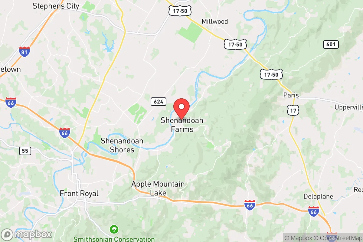
Shenandoah Farms is one of the more interesting strategic options in the Mid-Atlantic for a relocator prioritizing resilience, primarily because it sits in a geographic pocket that combines mountain terrain, rural spacing, and proximity to the Shenandoah River without the density of the I-81 corridor or the D.C. exurbs. The community is unincorporated, spread across roughly 20 square miles in Warren County, and its development pattern — large lots, winding gravel roads, and heavy tree cover — naturally lends itself to low visibility and decentralized living. For someone thinking in terms of disaster readiness, the location offers a meaningful buffer from the urbanized East Coast while still keeping essential supply routes within a reasonable drive.
Geographic position and natural advantages for long-term stability
The defining feature of Shenandoah Farms is its position in the northern Shenandoah Valley, tucked between the Massanutten Mountain range to the west and the Blue Ridge foothills to the east. This placement provides a natural shield from the flat, exposed terrain that characterizes much of the Virginia Piedmont. The elevation varies considerably across the community, with many parcels sitting on ridgelines that offer both defensible sightlines and natural drainage — a practical advantage in flood scenarios, since the lowest-lying areas near the Shenandoah River are the only ones with meaningful flood exposure. The river itself is a double-edged asset: it provides a reliable surface water source and supports local agriculture, but it also marks the floodplain, so a relocator should choose a lot above the 100-year flood line, which is well-documented in Warren County GIS data.
The climate is moderate by Eastern standards, with hot summers and cold but not extreme winters. This reduces the strain on heating and cooling systems compared to New England or the Deep South, and the growing season — roughly 170 days — is long enough to support a serious vegetable garden, orchard, and even small grains. The surrounding soils are a mix of clay and loam, which require amendment but are workable. Water availability is a genuine strength: the area sits over the North Fork Shenandoah aquifer system, and most homes in Shenandoah Farms rely on private wells that typically produce adequate yield at depths of 150 to 400 feet. That said, well depth and yield vary significantly by lot, so a pre-purchase well test is non-negotiable.
Risk exposure, man-made hazards, and proximity to fallout-relevant landmarks
No resilience assessment is honest without addressing the region's vulnerabilities, and Shenandoah Farms has a few that a serious relocator must weigh. The most significant is its position relative to the Washington, D.C. metropolitan area. The community is roughly 70 miles west of the District, which places it outside the most severe blast and thermal effects of a hypothetical nuclear detonation in the capital, but well within the range of significant radioactive fallout depending on wind patterns. Prevailing winds in the region generally move from west to east, which is favorable — fallout from a D.C. event would likely drift toward the Chesapeake Bay rather than up the Shenandoah Valley. However, a ground burst at a target like the Pentagon or the White House could loft debris high enough to deposit measurable fallout across northern Virginia, and Shenandoah Farms is not far enough to ignore that scenario entirely.
Other man-made risks are more immediate and practical. The community sits within a reasonable radius of the North Anna Nuclear Generating Station, roughly 60 miles to the southeast, and while the plant's safety record is solid, a major incident there would put the area in a downwind risk zone under certain conditions. Additionally, the region's proximity to I-66 and I-81 means that a major transportation disruption — whether from a cyberattack on the power grid, a fuel shortage, or a natural disaster — would quickly affect supply chains. Shenandoah Farms is not self-contained; it depends on external food, fuel, and medical supplies, and a prolonged grid outage would expose that dependency within days. The area also experiences occasional severe thunderstorms, derechos, and winter ice storms that can knock out power for extended periods, particularly on the rural feeder lines that serve the community.
Practical resilience for a relocator: food, water, energy, and defensibility
For a relocator serious about self-sufficiency, Shenandoah Farms offers a workable baseline, but it requires deliberate investment. On food, the community benefits from Warren County's active agricultural sector — there are working farms, orchards, and livestock operations within a 15-minute drive, and the Front Royal Farmers Market operates seasonally. A household with a half-acre or more can realistically produce a substantial portion of its own vegetables, and the local extension office provides soil testing and canning resources. For long-term food storage, the dry climate of the valley (relative to coastal Virginia) reduces spoilage risk, and root cellars are viable in the hillside terrain.
Water and energy are where the area shines and where it demands attention. Private wells mean a household is not dependent on municipal infrastructure, but they also mean a power outage disables the pump unless a backup system is in place. A solar array with battery storage, paired with a small propane or diesel generator for the well pump, is the standard resilience setup here, and the region's solar insolation — roughly 4.5 peak sun hours per day — is adequate for a modest off-grid system. Firewood is abundant and affordable, and most homes in the area have woodstove or fireplace infrastructure, which is a practical heat source during winter grid failures. Defensibility is a mixed picture: the terrain offers natural chokepoints and visibility from ridgelines, but the community's open, unincorporated nature means there is no coordinated neighborhood security. A relocator should prioritize a property with a single, controllable access point and good sightlines rather than relying on the broader community for protection.
Medical resilience is a weaker link. The nearest hospital is Warren Memorial Hospital in Front Royal, about 10 miles east, and it is a small community facility — adequate for routine care but not for major trauma. For serious emergencies, the trip to Winchester Medical Center or the University of Virginia Medical Center in Charlottesville is 45 minutes to an hour. A relocator with chronic health conditions or a family with young children should factor in this distance and build a robust home medical kit and training plan accordingly.
The overall strategic picture for Shenandoah Farms is one of qualified strength. It offers a genuine rural buffer from the D.C. metroplex, reliable water, workable land, and a climate that supports year-round habitation without extreme stress. Its weaknesses — distance from advanced medical care, dependence on external supply chains, and a non-zero fallout risk from a capital-area event — are manageable with planning and investment. For a single individual or family willing to install backup power, test and deepen their well, and build a real food storage program, this is one of the better positioned communities in the Mid-Atlantic for riding out both natural and man-made disruptions. It is not a remote mountain redoubt, but it is also not a suburban cul-de-sac; it sits in a practical middle ground that rewards preparation.

* Values derived from national, state, county, city and local statistics and may differ in a specific area. Last updated: 2026-09-22T01:53:00.000Z
Narrative content on this page is AI-generated and may contain mistakes. Verify any details that matter before acting on them.
ReloMaps may earn a commission from affiliate links at no extra cost to you.

