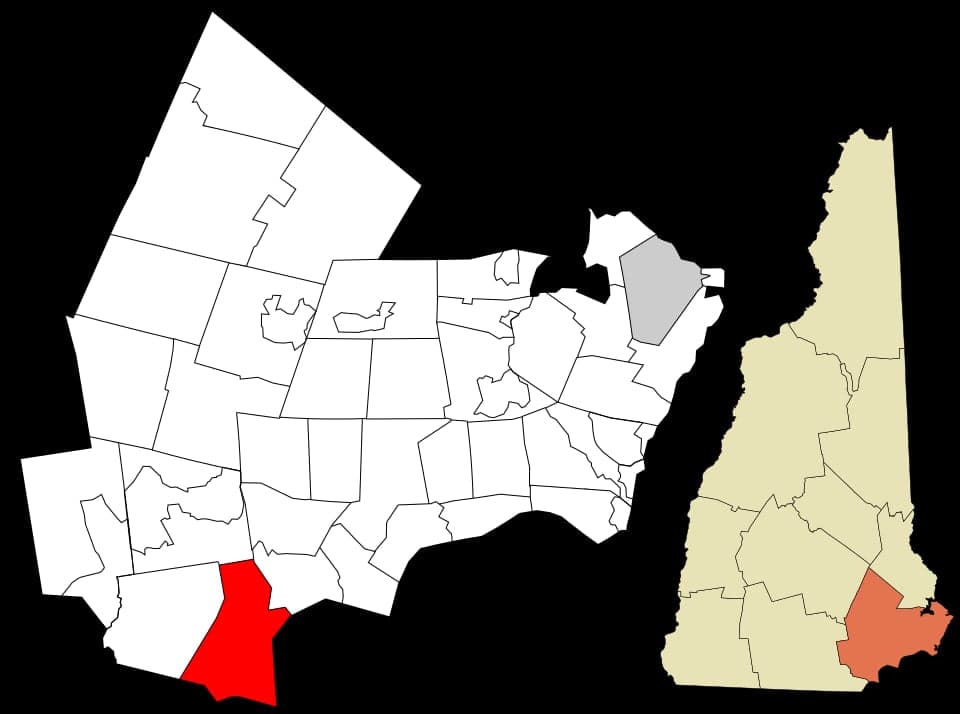
Photo: Wikipedia
Strategic Assessment of Salem, NH
Multiple tactical vulnerabilities. Population density, target proximity, or disaster risk are likely compounding. A retreat property and exit planning is required.
What does the Strategic Assessment tell us?
Our Strategic Assessment grades tactical survivability of an area. Major population centers, military targets, fallout zones, natural disasters, and border exposure all drive risk — lower exposure means a more defensible position in a crisis.
This is heavily inspired by Joel Skousen's Strategic Relocation book. Highly recommended you checkout the book ($)What does this tell us?
Our Strategic Assessment grades tactical survivability of an area. Major population centers, military targets, fallout zones, natural disasters, and border exposure all drive risk — lower exposure means a more defensible position in a crisis.
This is heavily inspired by Joel Skousen's Strategic Relocation book. Highly recommended you checkout the book ($)Strategic Pillars

Key Distances
Regional Safe Places
Below is our recommended "safe zones" in New Hampshire and the surrounding area based on our strategic heuristics. For most people, it's unrealistic to live in a “safe zone” full-time due to work, family or other personal reasons. They tend to be more rural. However, many of these areas are perfect for second homes and retreat properties that double as a vacation home or even a short-term rental.




Important Note: For informational purposes only. This does not mean nothing bad ever happens in the green zones. Please use common sense. This is based on public data and modeled with AI. We tried to take a conservative approach but mistakes happen. We update this regularly as new information becomes available.
Solar Generator Recommendations
Backup power matters more here than in safer locations. We've picked three solar generators across budgets and capacity tiers — start with the budget unit if you only need a few essentials, or step up if you want to run a fridge and HVAC for days at a time.

Jackery Portable Power Station Explorer 300
Budget OptionPower on the Go: Weighing only 11 lbs, it's convenient to set up and store with book-sized foldable solar panels

BLUETTI Portable Power Station AC180
Designed for both indoor and outdoor scenarios, AC180 is highly capable as it has a robost capacity and continuous output power.

EF ECOFLOW DELTA Pro Ultra Power Station
Upgraded PickEcoFlow DELTA Pro Ultra is a whole-home energy system designed to grow with your family. Integrated with the Smart Home Panel 2, it scales to meet your evolving energy needs — keeping your home powered, intelligent, and secure through every stage of life.
We earn a commission, at no additional cost to you.
Strategic Assessment Analysis
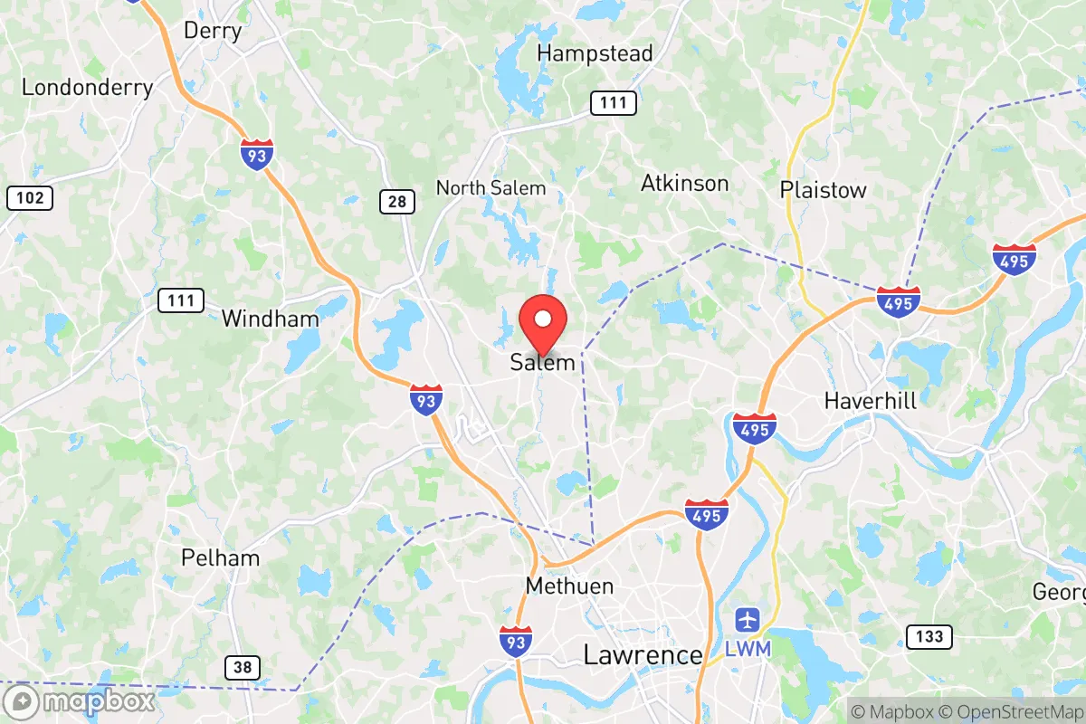
Salem, New Hampshire, sits in a strategic sweet spot that most relocation guides completely miss: close enough to Boston’s economic engine to matter, but far enough from the urban core to offer genuine defensive depth. For a relocator thinking in terms of resilience rather than mere commute times, Salem’s position along the I-93 corridor—roughly 30 miles north of Boston and 12 miles from the Massachusetts border—provides a rare combination of access and buffer. The town’s real strategic value, however, lies in how its geography, infrastructure, and regional context interact under stress, which is precisely what this assessment examines.
Geographic position and natural defensive advantages
Salem’s topography is unremarkable but quietly favorable. The town sits on the edge of the New Hampshire highlands, with elevations ranging from roughly 100 to 300 feet, which means it avoids the flood-prone lowlands of the Merrimack River valley to the south and west. The soil is predominantly glacial till and bedrock, which drains well and supports septic systems—a non-trivial consideration if municipal services are disrupted. The town’s 27 square miles include substantial undeveloped parcels, particularly in the northern and eastern sections, where forested tracts and wetlands create natural buffers and potential foraging or timber resources.
The climate is a double-edged sword. Winters are genuinely cold, with average January lows near 15°F, which is a defensive asset in terms of food storage and reduced biological threats, but a liability for energy dependence. The region receives about 50 inches of snowfall annually, meaning any resilience plan must account for prolonged power outages during nor’easters. Summer heat is rarely extreme—average July highs stay near 85°F—so passive cooling is viable in most homes. The absence of hurricane storm surge, earthquake risk, and wildfire danger (the town’s forest is predominantly hardwood, not the flammable conifer stands of the West) makes Salem a low-hazard location compared to coastal or seismic zones.
Risk exposure and proximity to fallout-relevant landmarks
The honest assessment of Salem’s risk profile must acknowledge its proximity to high-value targets. The town is 30 miles from Boston’s urban core, which places it within the plausible fallout plume zone for a ground-burst nuclear detonation at the city center, depending on wind direction. More specifically, Salem sits within 15 miles of the Portsmouth Naval Shipyard on the Maine-New Hampshire border, a strategic submarine maintenance facility that would be a primary target in any conflict. The Seabrook Nuclear Power Station is just 12 miles to the southeast, across the state line in New Hampshire’s Rockingham County—a facility whose failure, whether from accident or attack, would render a significant downwind zone uninhabitable for an extended period.
Beyond weapons-related risks, Salem’s transportation infrastructure creates secondary vulnerabilities. The I-93 corridor is a single choke point for evacuation and supply movement; a disruption at the Salem interchange, where I-93 meets NH Route 28, would effectively sever the town from southern supply lines. The town is also within the Boston metropolitan area’s emergency planning zone, meaning that any regional crisis—a pandemic, a cyberattack on the grid, or a mass evacuation—would draw resources away from Salem toward the urban core. The Lawrence, Massachusetts, industrial corridor, just 10 miles south, contains chemical facilities and rail lines that present a non-nuclear industrial hazard. In practical terms, Salem is not a remote redoubt; it is a suburban node with meaningful exposure to regional cascading failures.
Practical resilience for a relocator: food, water, energy, and defensibility
For a relocator serious about self-sufficiency, Salem’s practical resilience is a mixed bag that rewards preparation. Water is the strongest asset: the town sits atop the Spruce Pond and Canobie Lake aquifers, and most single-family homes on larger lots have access to private wells. A well with a hand pump or a 12-volt backup system provides an essentially unlimited water supply independent of municipal infrastructure. The Merrimack River, 8 miles west, is a reliable secondary source, though it requires filtration and treatment. Municipal water users in the denser village areas are more vulnerable, as the town’s treatment plant depends on grid power.
Energy is the critical weakness. Salem’s housing stock is predominantly older New England construction—wood-frame, poorly insulated, and reliant on heating oil or natural gas. The electrical grid is exposed, with overhead lines running through heavily treed corridors that routinely fail during ice storms. A relocator should plan for a minimum of two weeks of autonomous power: a dual-fuel generator, a wood stove with a cord of seasoned hardwood, and a solar array with battery storage are not luxuries here but baseline equipment. The town’s zoning allows for residential solar and small-scale wind, and there are no HOA restrictions in most neighborhoods, which is a genuine advantage for defensible energy independence.
Food security is moderate. Salem has no significant agricultural production within its borders, but the surrounding region—particularly the dairy and vegetable farms of Rockingham County and neighboring Haverhill, Massachusetts—provides a local food shed within a 20-mile radius. The town’s two major supermarkets, Market Basket and Shaw’s, are typical suburban operations with roughly three days of shelf stock; a relocator should not rely on them in a crisis. Foraging potential is real but limited: the town’s forests contain oak, hickory, and beech, which produce mast crops, and Canobie Lake supports freshwater fishing. Defensibility is the weakest category. Salem is a suburban town with multiple road entrances, no natural chokepoints, and a population density of roughly 1,400 people per square mile. It is not a location for a stand-alone retreat; it is a location where community resilience—neighborhood networks, mutual aid, and local knowledge—matters more than individual fortification.
The strategic picture for Salem is one of qualified viability. It offers genuine geographic advantages—elevation, water access, moderate climate, and a buffer from the immediate urban blast zone—that make it a reasonable choice for a relocator who wants proximity to Boston’s economy without living inside its defensive perimeter. The risks are real but manageable: proximity to Portsmouth Naval Shipyard and Seabrook elevates the fallout and industrial hazard profile, and the energy infrastructure is fragile. A prepared relocator who invests in well water, backup power, and a wood heat source can achieve a high degree of practical resilience. Salem is not a wilderness retreat, but it is a defensible suburban position—a place where a serious individual or family can build a resilient life while remaining connected to the region’s resources. The key is to treat the town as a base, not a bunker, and to build the local networks and redundancies that make any location survivable under stress.

* Values derived from national, state, county, city and local statistics and may differ in a specific area. Last updated: 2026-10-10T16:28:50.000Z
Narrative content on this page is AI-generated and may contain mistakes. Verify any details that matter before acting on them.
ReloMaps may earn a commission from affiliate links at no extra cost to you.

