Photo: Wikipedia
Strategic Assessment of Ridgway, PA
Meaningful friction. Expect exposure to either population pressure, blast zones, or natural disaster risk. Consider buying a retreat property.
What does the Strategic Assessment tell us?
Our Strategic Assessment grades tactical survivability of an area. Major population centers, military targets, fallout zones, natural disasters, and border exposure all drive risk — lower exposure means a more defensible position in a crisis.
This is heavily inspired by Joel Skousen's Strategic Relocation book. Highly recommended you checkout the book ($)What does this tell us?
Our Strategic Assessment grades tactical survivability of an area. Major population centers, military targets, fallout zones, natural disasters, and border exposure all drive risk — lower exposure means a more defensible position in a crisis.
This is heavily inspired by Joel Skousen's Strategic Relocation book. Highly recommended you checkout the book ($)Strategic Pillars

Key Distances
Regional Safe Places
Below is our recommended "safe zones" in Pennsylvania and the surrounding area based on our strategic heuristics. For most people, it's unrealistic to live in a “safe zone” full-time due to work, family or other personal reasons. They tend to be more rural. However, many of these areas are perfect for second homes and retreat properties that double as a vacation home or even a short-term rental.
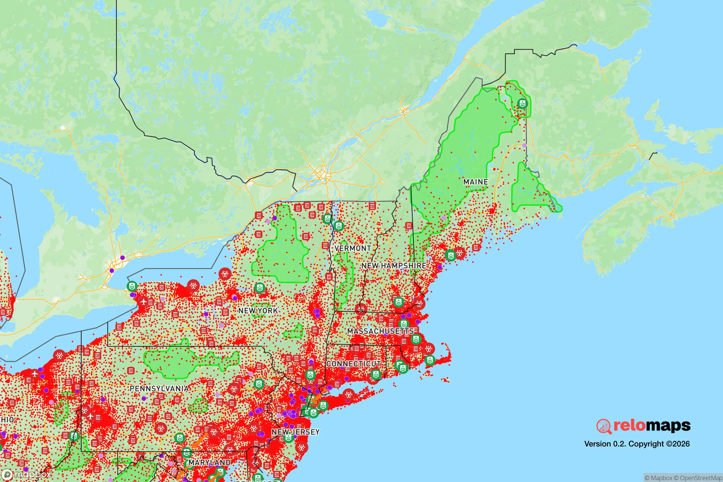
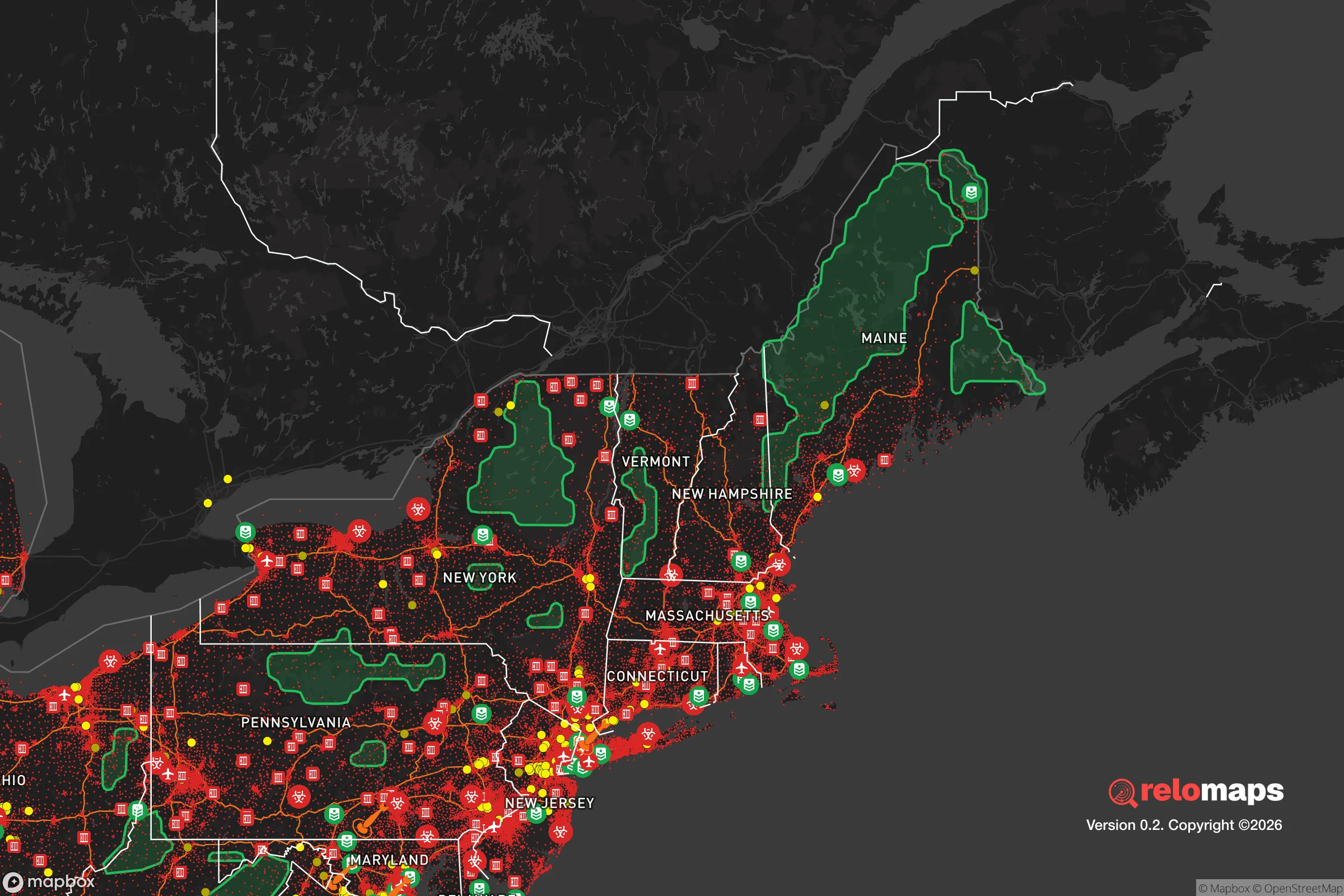


Important Note: For informational purposes only. This does not mean nothing bad ever happens in the green zones. Please use common sense. This is based on public data and modeled with AI. We tried to take a conservative approach but mistakes happen. We update this regularly as new information becomes available.
Solar Generator Recommendations
Backup power matters more here than in safer locations. We've picked three solar generators across budgets and capacity tiers — start with the budget unit if you only need a few essentials, or step up if you want to run a fridge and HVAC for days at a time.
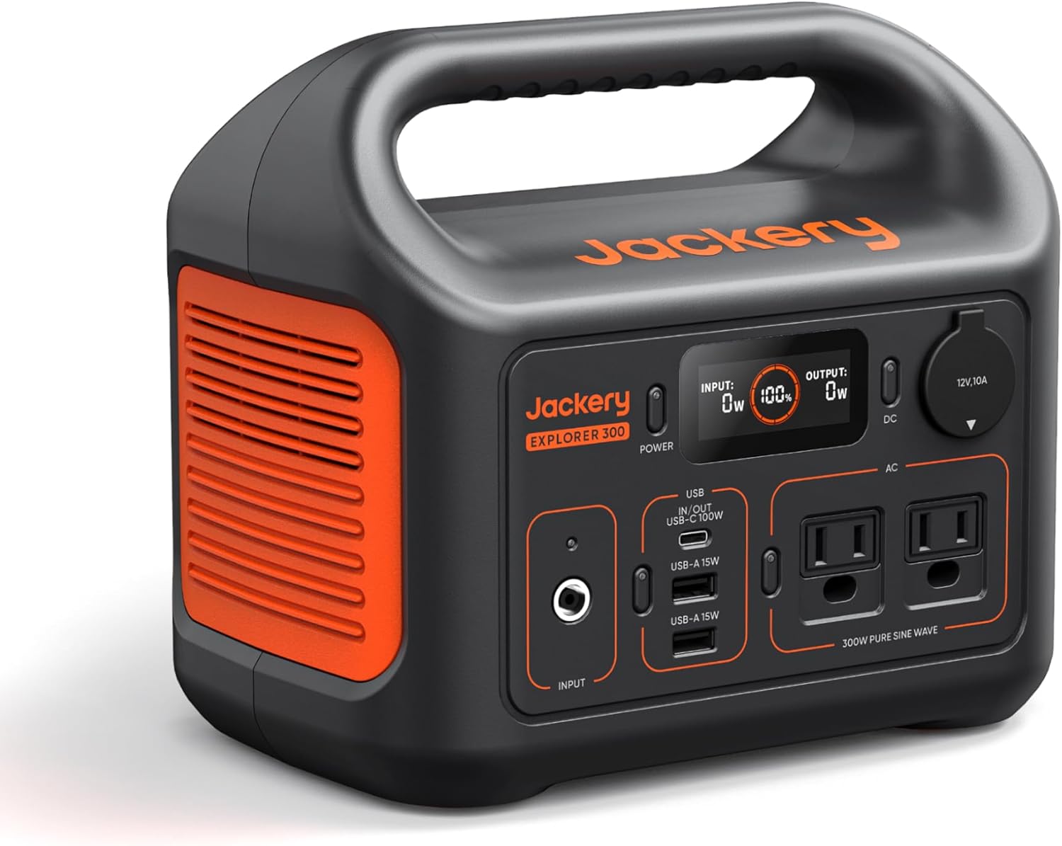
Jackery Portable Power Station Explorer 300
Budget OptionPower on the Go: Weighing only 11 lbs, it's convenient to set up and store with book-sized foldable solar panels

BLUETTI Portable Power Station AC180
Designed for both indoor and outdoor scenarios, AC180 is highly capable as it has a robost capacity and continuous output power.

EF ECOFLOW DELTA Pro Ultra Power Station
Upgraded PickEcoFlow DELTA Pro Ultra is a whole-home energy system designed to grow with your family. Integrated with the Smart Home Panel 2, it scales to meet your evolving energy needs — keeping your home powered, intelligent, and secure through every stage of life.
We earn a commission, at no additional cost to you.
Strategic Assessment Analysis
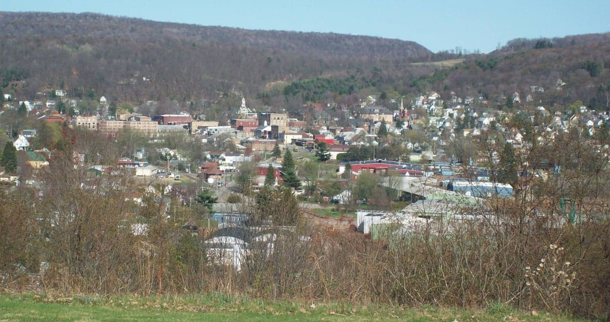
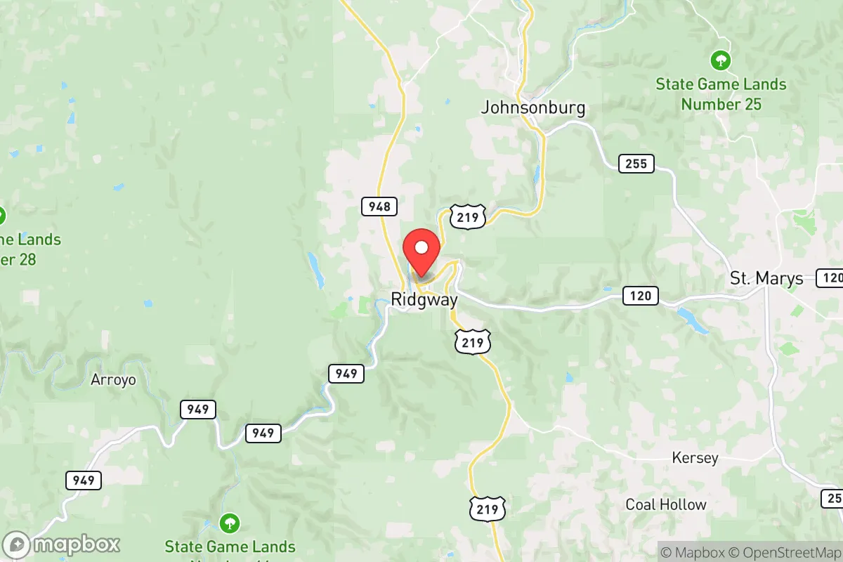
Ridgway sits in Elk County in north-central Pennsylvania, roughly 100 miles northeast of Pittsburgh and 130 miles south of Buffalo, and its resilience case rests on a simple fact: it is small, isolated, and surrounded by one of the largest contiguous forest blocks in the eastern United States. The borough itself holds under 4,000 residents, the county seat is a short drive south in Elk County's seat of Ridgway, and the nearest interstate-quality highway is I-80, which clips the county's southern edge near DuBois. For a reader thinking seriously about disaster readiness, Ridgway offers genuine geographic insulation from the urban corridors where most man-made risk concentrates — but that insulation comes with real trade-offs in services, infrastructure redundancy, and economic depth that a relocator should weigh honestly.
Geographic position and natural advantages of the Ridgway area
Ridgway is the seat of Elk County and sits at the confluence of the Clarion River and Elk Creek, in the Allegheny Plateau's deeply cut hill country. The surrounding Allegheny National Forest — about 513,000 acres — begins just west and north of the borough, and the broader "Pennsylvania Wilds" region wraps the area in roughly 2 million acres of forest. That matters for resilience in several concrete ways. Timber, wild game, and surface water are abundant relative to population; the Clarion River is a designated National Wild and Scenic River segment and flows clean enough to support trout and paddling. The terrain is defensible in the literal sense: narrow valleys, wooded ridges, and a limited number of road approaches mean any movement into or out of the area is channelized. Ridgway is also far from the coastal hurricane belt and outside the primary tornado alley, though the plateau sees severe thunderstorms and winter ice. The nearest large population centers — Pittsburgh, Buffalo, Erie, State College — are all 90 minutes to two-plus hours away, which is the kind of buffer that keeps a small town out of the immediate blast radius of urban unrest, industrial accidents, or a mass evacuation surge.
Risks, exposures, and proximity to fallout-relevant landmarks
The honest risk picture is less about what's nearby than about what's far away and what's underneath. Ridgway has no nuclear plant, no major chemical works, and no large military installation in the immediate vicinity, which is a meaningful positive. The nearest nuclear facilities of note are the Beaver Valley plant west of Pittsburgh and the Limerick and Susquehanna plants in the eastern part of the state — all well over 100 miles off, and the prevailing westerly flow puts most of the state's industrial corridor downwind of Ridgway rather than the reverse. The bigger exposures are mundane and local: winter ice storms and heavy lake-effect-adjacent snow can close Route 219 and Route 948 for hours, the region's steep terrain makes flash flooding in the Clarion valley a real seasonal hazard, and the area's economy has long depended on a handful of employers — historically the powdered-metal and carbon industries, now dominated by the Dominion/Elk County cluster of manufacturing and the nearby Allegheny Wood Products and gas-field service sector. A single plant closure ripples through a county of 30,000 people. Marcellus Shale gas development brought pipeline and compressor-station infrastructure into the surrounding townships, which introduces a low-probability but non-zero industrial risk. And the isolation cuts both ways: in a genuine regional emergency, Ridgway is not where state resources arrive first.
Practical resilience for a relocator: food, water, energy, and defensibility
On the practical side, Ridgway scores well on water and food potential and only moderately on energy and services. The Clarion River and Elk Creek provide surface water, and the borough operates a municipal water system fed by local sources — a relocator with a well and a hand pump on a rural parcel outside town gains real independence. Growing conditions are workable but not generous: the plateau's short growing season (roughly 120 to 140 frost-free days) favors potatoes, brassicas, and cold-hardy crops over long-season vegetables, and the region's Amish and Mennonite farm communities around nearby towns like St. Marys and Emporium demonstrate that serious subsistence agriculture is feasible with the right methods. Energy is the weak point. The grid serving rural Elk County is fed by long transmission lines through forest, so winter outages after ice storms are a recurring reality, and propane and heating oil — not natural gas — heat most rural homes. A relocator serious about resilience should plan on a woodlot, a backup generator with stored fuel, and a propane supply large enough to ride out a multi-week outage. Defensibility is a genuine strength: low population density, a cohesive small-town social fabric, and a volunteer fire and EMS culture that still functions. The trade-off is medical depth — the nearest full-service hospital is in St. Marys or DuBois, and serious trauma care means a drive to Pittsburgh or Buffalo.
The strategic read on Ridgway is that it is a solid second-tier resilience location rather than a top-tier one. It wins on isolation, forest and water access, low man-made risk, and a defensible small-town social structure; it loses on winter infrastructure fragility, a thin local economy, limited medical depth, and the practical difficulty of full self-sufficiency in a short growing season. For a single person or family prioritizing distance from urban fallout corridors and a genuine small-community buffer, Ridgway is a credible choice — provided they arrive with realistic expectations about heating fuel, generator capacity, and the two-hour drive to serious medical care. It is not a fortress; it is a quiet, well-watered, well-wooded corner of the Alleghenies that rewards preparation and punishes wishful thinking.

* Values derived from national, state, county, city and local statistics and may differ in a specific area. Last updated: 2026-11-03T14:21:51.000Z
Narrative content on this page is AI-generated and may contain mistakes. Verify any details that matter before acting on them.
ReloMaps may earn a commission from affiliate links at no extra cost to you.

