
Photo: Wikipedia
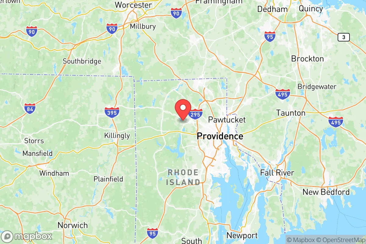
Strategic Assessment of Providence County
Multiple tactical vulnerabilities. Population density, target proximity, or disaster risk are likely compounding. A retreat property and exit planning is required.
What does the Strategic Assessment tell us?
Our Strategic Assessment grades tactical survivability of an area. Major population centers, military targets, fallout zones, natural disasters, and border exposure all drive risk — lower exposure means a more defensible position in a crisis.
This is heavily inspired by Joel Skousen's Strategic Relocation book. Highly recommended you checkout the book ($)What does this tell us?
Our Strategic Assessment grades tactical survivability of an area. Major population centers, military targets, fallout zones, natural disasters, and border exposure all drive risk — lower exposure means a more defensible position in a crisis.
This is heavily inspired by Joel Skousen's Strategic Relocation book. Highly recommended you checkout the book ($)Strategic Pillars

Key Distances
Strategic Assessment Analysis
Providence County, Rhode Island, presents a complex strategic picture for the conservative prepper or survivalist. Its primary resilience advantage is its position as a secondary coastal hub—close enough to the economic and political power of Boston and New York to benefit from supply chains, yet far enough to avoid the immediate blast radius of a major strike or the worst of civil unrest in those megacities. However, this proximity cuts both ways: the county’s dense urban core, heavy reliance on imported food and energy, and concentration of critical infrastructure make it a high-risk zone for anyone prioritizing long-term self-sufficiency and fallout avoidance.
Geographic position and natural advantages for long-term survival
Providence County sits at the head of Narragansett Bay, with the city of Providence as its anchor. The county’s geography offers a mix of coastal access and inland forest, with the Blackstone River Valley providing a natural corridor to the north. For a relocator, the key natural advantage is the abundance of fresh water—the Blackstone, Pawtuxet, and Woonasquatucket rivers, plus numerous reservoirs like the Scituate Reservoir (which supplies most of the county’s drinking water). The terrain is hilly and wooded in the western and northern towns—places like Foster, Glocester, and Burrillville—offering defensible positions with limited road access. These rural pockets are a stark contrast to the dense urban sprawl of Providence, Pawtucket, and Central Falls. The county’s coastline along Narragansett Bay provides maritime access, but that’s a double-edged sword: it’s a potential evacuation route but also a vector for naval threats or storm surge. The climate is temperate, with four distinct seasons, meaning a prepper must plan for harsh winters and nor’easters, which can disrupt power and transport for days.
Risks, exposures, and proximity to fallout-relevant landmarks
This is where Providence County becomes a hard sell for the serious survivalist. The county is home to Providence’s port, a major hub for petroleum and chemical shipments, including the Tiverton LNG terminal just across the bay. A strike or accident at these facilities would create a toxic plume affecting much of the eastern half of the county. The Quonset Point Naval Air Station in neighboring North Kingstown (Washington County) is a strategic military asset, making the region a potential target. Within Providence County itself, TF Green Airport in Warwick sits on the county line and is a major civilian and cargo hub—another high-value target. The county also hosts several large industrial parks, including the Port of Providence and the Pawtucket industrial corridor, which handle chemicals, fuels, and heavy manufacturing. For the prepper, the biggest risk is the density of the population: Providence County has over 650,000 people packed into 413 square miles, with a population density of over 1,500 per square mile. In a grid-down or civil unrest scenario, this means competition for resources, choke points on major highways (I-95, I-295, Route 146), and a high likelihood of looting and violence in the urban core. The Scituate Reservoir is a critical water source, but its dam and treatment facilities are vulnerable to sabotage or failure. The county’s proximity to Boston’s Logan Airport and the New York City metro area (about 150 miles south) means fallout from a strike on either city could drift over Providence County depending on wind patterns.
Practical resilience for a relocator: food, water, energy, and defensibility
For a relocator looking to set up a sustainable homestead, Providence County offers a mixed bag. Food production is limited: the county has some farmland in the western towns (Foster, Glocester, Scituate), but most of the land is forested or developed. The growing season is short (roughly May to October), and the soil is rocky and acidic in many areas, requiring significant amendment for serious gardening. Local agriculture is mostly hay, dairy, and some vegetables—not enough to support the county’s population in a crisis. Water is the one bright spot: the Scituate Reservoir and numerous smaller ponds and streams provide ample surface water, but it requires treatment (boiling, filtration, or chemical purification) due to agricultural runoff and industrial pollution in the lower reaches. Energy is a vulnerability: the county relies on the New England grid, which is heavily dependent on natural gas (piped from the Marcellus Shale via the Algonquin Pipeline) and imported LNG. A pipeline disruption or cyberattack on the grid would leave most of the county without power for weeks. Solar is viable, but winter cloud cover and snow reduce output. Defensibility is highly location-dependent. The rural towns in the northwest (Foster, Glocester, Burrillville) offer the best options: low population density, limited road access (mostly two-lane state roads), and wooded terrain for concealment. However, these areas are also far from major supply routes, meaning a prepper must stockpile everything in advance. The urban core is indefensible for a small group—too many people, too many entry points, and too little cover. The Blackstone River Valley National Heritage Corridor provides some green space but is a public recreation area, not a defensible retreat.
The overall strategic picture for Providence County is one of calculated risk. It is not a top-tier relocation destination for the conservative prepper seeking total self-sufficiency and isolation. The county’s dense population, critical infrastructure targets, and reliance on fragile supply chains make it a high-risk zone in a major crisis. However, for someone who must remain in the Northeast for work or family reasons, the western rural towns offer a viable compromise: access to fresh water, some defensible terrain, and proximity to the resources of Providence and Boston without being in the blast zone. The key is to avoid the urban core entirely, secure a property with a well and solar backup, and build a network with like-minded locals in the rural pockets. If you can afford the land and are willing to invest in serious off-grid infrastructure, Providence County can work—but it’s a hard-mode start compared to the interior West or Appalachia. For the serious survivalist, this is a location to approach with eyes wide open, not a bug-out paradise.
* Values derived from national, state, county, city and local statistics and may differ in a specific area. Last updated: 2026-05-12T04:33:20.000Z
Narrative content on this page is AI-generated and may contain mistakes. Verify any details that matter before acting on them.
ReloMaps may earn a commission from affiliate links at no extra cost to you.