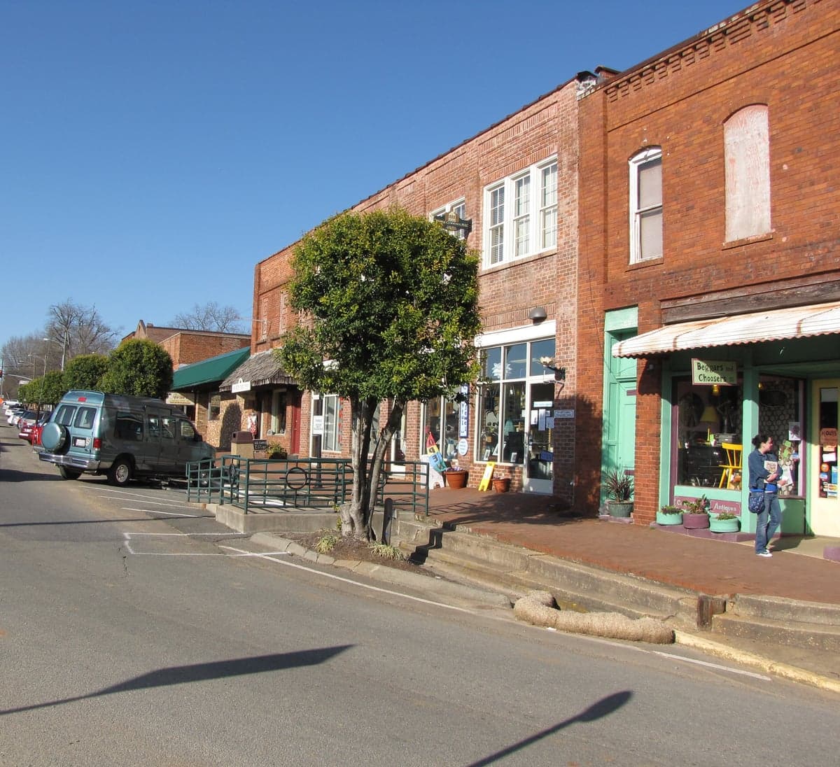
Photo: Wikipedia
Strategic Assessment of Pittsboro, NC
Meaningful friction. Expect exposure to either population pressure, blast zones, or natural disaster risk. Consider buying a retreat property.
What does the Strategic Assessment tell us?
Our Strategic Assessment grades tactical survivability of an area. Major population centers, military targets, fallout zones, natural disasters, and border exposure all drive risk — lower exposure means a more defensible position in a crisis.
This is heavily inspired by Joel Skousen's Strategic Relocation book. Highly recommended you checkout the book ($)What does this tell us?
Our Strategic Assessment grades tactical survivability of an area. Major population centers, military targets, fallout zones, natural disasters, and border exposure all drive risk — lower exposure means a more defensible position in a crisis.
This is heavily inspired by Joel Skousen's Strategic Relocation book. Highly recommended you checkout the book ($)Strategic Pillars

Key Distances
Regional Safe Places
Below is our recommended "safe zones" in North Carolina and the surrounding area based on our strategic heuristics. For most people, it's unrealistic to live in a “safe zone” full-time due to work, family or other personal reasons. They tend to be more rural. However, many of these areas are perfect for second homes and retreat properties that double as a vacation home or even a short-term rental.

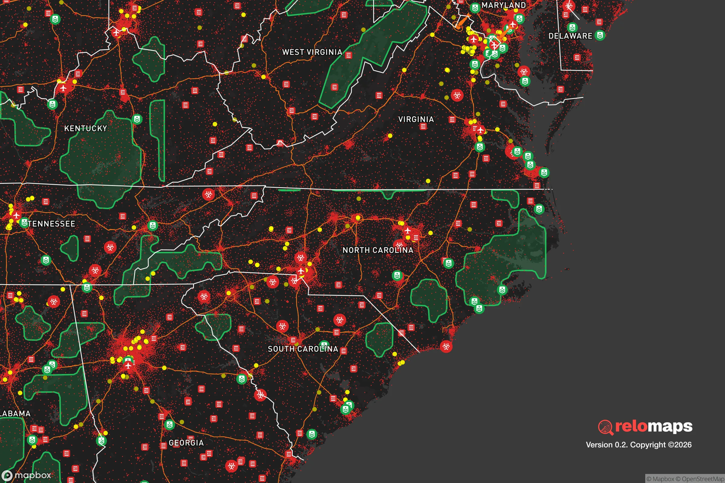


Important Note: For informational purposes only. This does not mean nothing bad ever happens in the green zones. Please use common sense. This is based on public data and modeled with AI. We tried to take a conservative approach but mistakes happen. We update this regularly as new information becomes available.
Solar Generator Recommendations
Backup power matters more here than in safer locations. We've picked three solar generators across budgets and capacity tiers — start with the budget unit if you only need a few essentials, or step up if you want to run a fridge and HVAC for days at a time.

Jackery Portable Power Station Explorer 300
Budget OptionPower on the Go: Weighing only 11 lbs, it's convenient to set up and store with book-sized foldable solar panels

BLUETTI Portable Power Station AC180
Designed for both indoor and outdoor scenarios, AC180 is highly capable as it has a robost capacity and continuous output power.

EF ECOFLOW DELTA Pro Ultra Power Station
Upgraded PickEcoFlow DELTA Pro Ultra is a whole-home energy system designed to grow with your family. Integrated with the Smart Home Panel 2, it scales to meet your evolving energy needs — keeping your home powered, intelligent, and secure through every stage of life.
We earn a commission, at no additional cost to you.
Strategic Assessment Analysis
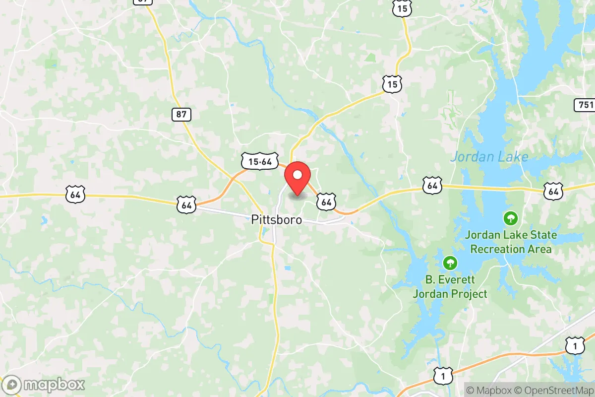
Pittsboro, North Carolina, occupies a strategic position in the Piedmont region that offers a compelling mix of accessibility and buffer from major metropolitan vulnerabilities, making it a noteworthy option for those prioritizing disaster readiness and long-term self-sufficiency. Located roughly 35 miles southwest of Raleigh and 15 miles from Chapel Hill, the town sits at the crossroads of US-64 and US-15-501, providing practical access to urban resources without the density and target risk of a major city. For a relocator weighing resilience, Pittsboro’s geography, natural resources, and community character present a balanced profile—neither a hardened bunker nor a sprawling suburb, but a place where thoughtful preparation can yield genuine advantages.
Geographic position and natural advantages for disaster readiness
Pittsboro’s location in the central Piedmont places it in a zone that is generally less exposed to the most severe natural disasters common to the coastal plain or mountain regions. The area sits at an elevation of roughly 400–500 feet above sea level, well above the flood-prone zones of the coastal plain, and is not in a designated hurricane storm-surge area. While tropical systems can still bring heavy rain and wind, the inland position significantly reduces the risk of catastrophic storm surge or direct hurricane-force winds. The region’s geology is dominated by stable crystalline bedrock and clay soils, which means the risk of landslides or liquefaction is very low. The Haw River and its tributaries run through the area, but the town itself is situated on higher ground, and most residential development is on well-drained slopes rather than floodplains. For a relocator concerned with natural hazards, Pittsboro offers a relatively low baseline risk profile compared to coastal or mountain alternatives.
The surrounding landscape is a mix of hardwood forests, farmland, and rolling hills, which provides natural resources for those pursuing self-sufficiency. The area’s temperate climate supports a long growing season—roughly 200 frost-free days—allowing for substantial home food production. Annual rainfall averages around 47 inches, distributed fairly evenly throughout the year, which reduces the likelihood of prolonged drought and supports rain catchment systems. The presence of the Haw River and Jordan Lake (a large reservoir about 10 miles northeast) offers additional water security, though access and rights vary by property. For a relocator, the combination of arable land, reliable precipitation, and moderate climate makes Pittsboro a viable location for establishing a homestead or small farm.
Risks, exposures, and proximity to fallout-relevant landmarks
The most significant strategic risk for Pittsboro is its proximity to the Research Triangle region—Raleigh, Durham, and Chapel Hill—which concentrates population, infrastructure, and potential targets. In a major geopolitical disruption or conflict scenario, the area’s closeness to major universities (UNC Chapel Hill, Duke, NC State), research facilities (EPA, NIEHS, multiple biotech campuses), and transportation hubs (Raleigh-Durham International Airport, I-40 corridor) could make it a secondary zone of concern. While Pittsboro itself is not a primary target, its location within 30–40 miles of these assets means it could experience indirect effects: refugee flow, supply chain disruption, or military checkpoints on major highways. The town’s position along US-64 and US-15-501, both major evacuation routes from the Triangle, could become congested or controlled during a crisis.
Natural hazard risks are moderate but worth noting. The area lies in a region with occasional tornado activity—North Carolina averages about 30 tornadoes per year, and Chatham County has seen several EF-1 and EF-2 events in the past decade. Severe thunderstorms with damaging winds and hail are common in spring and summer. Wildfire risk is low due to the humid climate, but the forested areas around Pittsboro can support surface fires during dry spells. The most likely natural disruption is extended power outages from ice storms or high winds, which occur every few years. For a relocator, these risks are manageable with standard preparedness measures—generator, storm shelter, and emergency supplies—but they do require attention.
On the man-made risk side, the closest nuclear facility is the Shearon Harris Nuclear Power Plant, located about 25 miles east of Pittsboro near New Hill. While the plant has a strong safety record, its presence introduces a low-probability, high-consequence risk. The plant’s emergency planning zone extends 10 miles, which Pittsboro falls outside of, but prevailing winds could carry fallout toward the area in a worst-case scenario. The proximity to I-40 and major rail lines also means hazardous material transport routes pass within 20 miles. For the strategic-minded relocator, these risks are not dealbreakers but should factor into property selection and emergency planning.
Practical resilience for a relocator: food, water, energy, and defensibility
Pittsboro’s practical resilience profile is strong for a town of its size (population roughly 5,000 within town limits, with Chatham County at about 75,000). The area has a robust local food system, anchored by the Chatham County Farmers Market, multiple CSAs, and a growing number of small farms specializing in vegetables, pastured meats, and eggs. The town itself is home to the Chatham Marketplace cooperative grocery, which provides a local supply chain less dependent on national distribution. For a relocator aiming for food self-sufficiency, the soil quality varies—some areas have heavy clay that requires amendment—but the growing conditions are favorable for most temperate crops, and the extension service offers strong support for home gardeners and small farmers.
Water access is generally good. Most properties in the area rely on private wells, which tap into the Piedmont aquifer system. Well depths typically range from 100 to 300 feet, and yields are moderate but reliable for household use and small-scale irrigation. For those on municipal water, the town’s supply comes from the Haw River and is treated at a local plant. Rainwater harvesting is legal and encouraged, with average roof collection potential of 0.6 gallons per square foot per inch of rain. For a relocator, securing a property with a tested well and good drainage is a priority.
Energy resilience is an area where Pittsboro has room for improvement. The grid is served by Duke Energy, and outages are not uncommon during storms. Solar potential is good—the area receives about 4.5 peak sun hours per day—and there are no restrictive HOA covenants in most rural areas that would prevent solar panel installation. However, net metering policies are standard, and battery storage is becoming more common. For off-grid capability, a combination of solar, a backup generator, and wood heat (the area has abundant firewood) would provide reasonable energy security. Natural gas is available in some parts of town but not in rural areas, where propane is the norm.
Defensibility is a mixed picture. Pittsboro’s rural character means many properties are set back from main roads, with tree cover and distance providing natural screening. The town’s layout—a compact historic core surrounded by dispersed subdivisions and farms—makes it difficult to control access points, which is a disadvantage for organized defense but an advantage for avoiding unwanted attention. The local law enforcement presence is modest (Chatham County Sheriff’s Office), and the community is generally self-policing. For a relocator, the key is to choose a property with good visibility of approaches, defensible perimeter (creeks, fences, or dense woods), and a neighbor network that shares preparedness values.
Overall, Pittsboro presents a balanced strategic picture for the disaster-conscious relocator. Its geographic advantages—inland location, moderate climate, abundant water, and arable land—are genuine assets. The primary vulnerabilities stem from its proximity to the Research Triangle’s population and infrastructure, which introduces risks of congestion, secondary effects, and potential target adjacency. For a single individual or family willing to invest in property selection, well water, solar power, and food production, Pittsboro offers a realistic path to meaningful self-sufficiency without the isolation of more remote locations. It is not a survivalist redoubt, but a place where practical preparedness can be integrated into a functional, community-oriented life. The key is to go in with eyes open: buy on high ground, secure your own water and power, and build relationships with neighbors who share your mindset.

* Values derived from national, state, county, city and local statistics and may differ in a specific area. Last updated: 2026-11-13T01:55:02.000Z
Narrative content on this page is AI-generated and may contain mistakes. Verify any details that matter before acting on them.
ReloMaps may earn a commission from affiliate links at no extra cost to you.

