
Photo: Wikipedia
Strategic Assessment of Lebanon County
Meaningful friction. Expect exposure to either population pressure, blast zones, or natural disaster risk. Consider buying a retreat property.
What does the Strategic Assessment tell us?
Our Strategic Assessment grades tactical survivability of an area. Major population centers, military targets, fallout zones, natural disasters, and border exposure all drive risk — lower exposure means a more defensible position in a crisis.
This is heavily inspired by Joel Skousen's Strategic Relocation book. Highly recommended you checkout the book ($)What does this tell us?
Our Strategic Assessment grades tactical survivability of an area. Major population centers, military targets, fallout zones, natural disasters, and border exposure all drive risk — lower exposure means a more defensible position in a crisis.
This is heavily inspired by Joel Skousen's Strategic Relocation book. Highly recommended you checkout the book ($)Strategic Pillars

Key Distances
Strategic Assessment Analysis
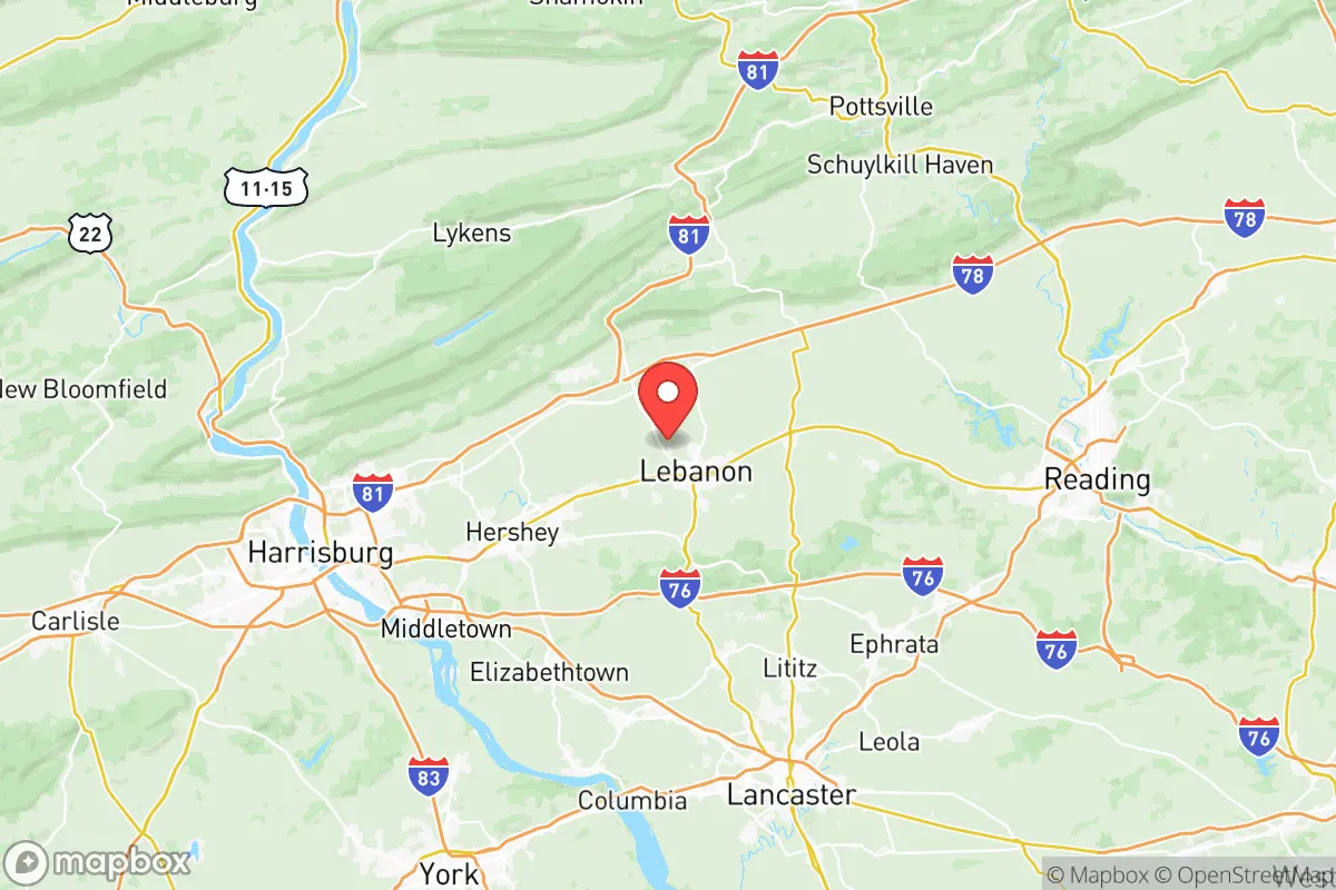
Lebanon County, Pennsylvania, offers a compelling mix of strategic depth and practical resilience for those prioritizing disaster readiness and self-sufficiency. Its position in the fertile Lebanon Valley, roughly 25 miles east of Harrisburg and 90 miles west of Philadelphia, provides a buffer from major metropolitan chaos while retaining access to critical infrastructure. The county’s 2024 population of roughly 145,000 is spread across a mix of small cities like the county seat of Lebanon, the historic borough of Palmyra, and the rural expanse of townships like North Londonderry and Bethel, offering a balance of community and seclusion.
Geographic position and natural advantages for long-term stability
Lebanon County’s geography is its primary strategic asset. The county sits entirely within the Great Appalachian Valley, a broad, fertile corridor flanked by the Blue Mountain ridge to the north and the South Mountain range to the south. This valley provides excellent agricultural soil—the county is a top producer of corn, soybeans, and dairy in Pennsylvania—and a natural funnel for weather patterns that often spare the area from the worst of coastal storms. The Swatara Creek and the Quittapahilla Creek drain the region, providing reliable surface water sources, though not as abundant as in the state’s northern tier. The surrounding ridges offer natural defensibility: the Blue Mountain ridge, with its state game lands and forested slopes, creates a physical barrier to the north, while the South Mountain ridge to the south offers similar cover. This topography means that a relocator in the northern townships near Fredericksburg or Jonestown enjoys a natural buffer from the more populated southern corridor along I-81. The county’s elevation, averaging 400-600 feet, keeps it above the flood-prone zones of the Susquehanna River, which lies just to the west. For a family seeking a location that is not a primary target for any major threat—whether hurricane, earthquake, or civil unrest—Lebanon County’s position in the “Pennsylvania Dutch” region is a quiet but significant advantage.
Risks, exposures, and proximity to fallout-relevant landmarks
No location is without risk, and Lebanon County’s proximity to several high-value targets is a key consideration. The most immediate concern is the Three Mile Island (TMI) nuclear plant, located just 15 miles southwest in Londonderry Township, Dauphin County. While the plant has been permanently shut down since 2019, the site still houses spent nuclear fuel in dry cask storage, and the decommissioning process is ongoing. A major incident at TMI—though statistically unlikely—could render large portions of the county uninhabitable for a period, depending on wind patterns. The county is also within 50 miles of the Harrisburg International Airport and the Susquehanna River bridges, both potential choke points or targets in a conflict scenario. Further south, the Philadelphia refinery corridor (including the former PES refinery and current energy infrastructure) is about 90 miles away, placing Lebanon County within the fallout plume range of a major industrial accident or attack on that complex. The county itself hosts no major military bases, but the Fort Indiantown Gap military reservation lies just to the west in Lebanon County itself, a major National Guard training center and a potential target for sabotage or aerial attack. The presence of the Lebanon VA Medical Center and the county’s role as a regional medical hub also make it a secondary target. For natural risks, the county is in a low seismic zone, but the Ramapo Fault system to the east could produce a moderate earthquake (5.0-6.0 magnitude) that would affect older masonry buildings in Lebanon city. Tornado risk is low but not zero; the county averages one or two weak tornadoes per decade. The primary man-made risk is a prolonged power grid failure, given the county’s reliance on the PJM Interconnection grid, which is aging and vulnerable to cyberattacks.
Practical resilience for a relocator: food, water, energy, and defensibility
For a relocator serious about self-sufficiency, Lebanon County offers strong practical foundations. Food security is excellent: the county has over 1,200 farms, many of which are small, family-run operations selling directly to consumers through farmers’ markets in Lebanon, Palmyra, and Myerstown. The Pennsylvania Dutch tradition of home canning and food preservation is still alive here, and the Lebanon Farmers Market is a year-round source of local produce, meats, and dairy. The county’s agricultural extension office offers workshops on gardening, livestock, and food storage. Water security is moderate: most of the county relies on groundwater from the Lebanon Valley aquifer, which is generally reliable but has seen some nitrate contamination from agricultural runoff. A well with a hand pump or a rainwater catchment system is a wise investment, especially in rural areas like Bethel Township or East Hanover Township. The Swatara Creek and Quittapahilla Creek are perennial streams, but they can run low during summer droughts. Energy resilience is a mixed bag: the county has no major power plants of its own, but the Susquehanna Steam Electric Station (a nuclear plant) is 40 miles north, and the PPL transmission lines run through the area. Solar potential is good—the county averages 200 sunny days per year—and many rural properties are zoned for small-scale solar arrays. Wood heating is common in the northern townships, with ample firewood available from state game lands. Defensibility is the county’s strongest suit: the valley’s natural choke points, such as the Blue Mountain ridge and the Swatara Gap, can be monitored and controlled. The county’s low population density (about 200 people per square mile in rural areas) means fewer eyes and less competition for resources. The Lebanon County Department of Emergency Services runs a well-regarded emergency management program, and the county’s volunteer fire companies are active, though they can be stretched thin in a major event.
The overall strategic picture for Lebanon County is one of quiet competence. It is not a fortress, but it is a functional, fertile, and relatively low-profile location that offers a genuine path to self-reliance. The proximity to the TMI site and the Fort Indiantown Gap are real concerns, but they are manageable with proper planning—a good HEPA filter, a radiation detector, and a pre-planned evacuation route to the north or west. For a family or individual who values local food production, community cohesion, and a slower pace of life, Lebanon County provides a solid foundation. The key is to choose a location north of the I-81 corridor, ideally in the northern townships like Bethel or Pine Grove, to maximize the natural buffer of the Blue Mountain ridge. The county’s Amish and Mennonite communities are a living example of low-tech resilience, and their presence is a cultural asset for anyone serious about learning traditional skills. In a world of increasing uncertainty, Lebanon County offers a balanced, defensible, and sustainable option for the prepared relocator.

* Values derived from national, state, county, city and local statistics and may differ in a specific area. Last updated: 2026-07-23T11:52:47.000Z
Narrative content on this page is AI-generated and may contain mistakes. Verify any details that matter before acting on them.
ReloMaps may earn a commission from affiliate links at no extra cost to you.

