
Photo: Wikipedia
Strategic Assessment of Lancaster County
Meaningful friction. Expect exposure to either population pressure, blast zones, or natural disaster risk. Consider buying a retreat property.
What does the Strategic Assessment tell us?
Our Strategic Assessment grades tactical survivability of an area. Major population centers, military targets, fallout zones, natural disasters, and border exposure all drive risk — lower exposure means a more defensible position in a crisis.
This is heavily inspired by Joel Skousen's Strategic Relocation book. Highly recommended you checkout the book ($)What does this tell us?
Our Strategic Assessment grades tactical survivability of an area. Major population centers, military targets, fallout zones, natural disasters, and border exposure all drive risk — lower exposure means a more defensible position in a crisis.
This is heavily inspired by Joel Skousen's Strategic Relocation book. Highly recommended you checkout the book ($)Strategic Pillars

Key Distances
Strategic Assessment Analysis
Lancaster County, Pennsylvania, occupies a strategic sweet spot in the Mid-Atlantic that appeals to relocators prioritizing long-term stability and self-sufficiency. Its combination of productive agricultural land, a strong regional economy centered on the city of Lancaster, and a population that historically values preparedness and community makes it one of the more resilient locations east of the Appalachians. For families and individuals thinking seriously about disaster readiness, the county offers a rare balance: deep-rooted local food systems, a capable energy grid, and a position that is close enough to major East Coast corridors to access resources but far enough away to avoid the worst of a regional disruption.
Geographic position and natural advantages for long-term stability
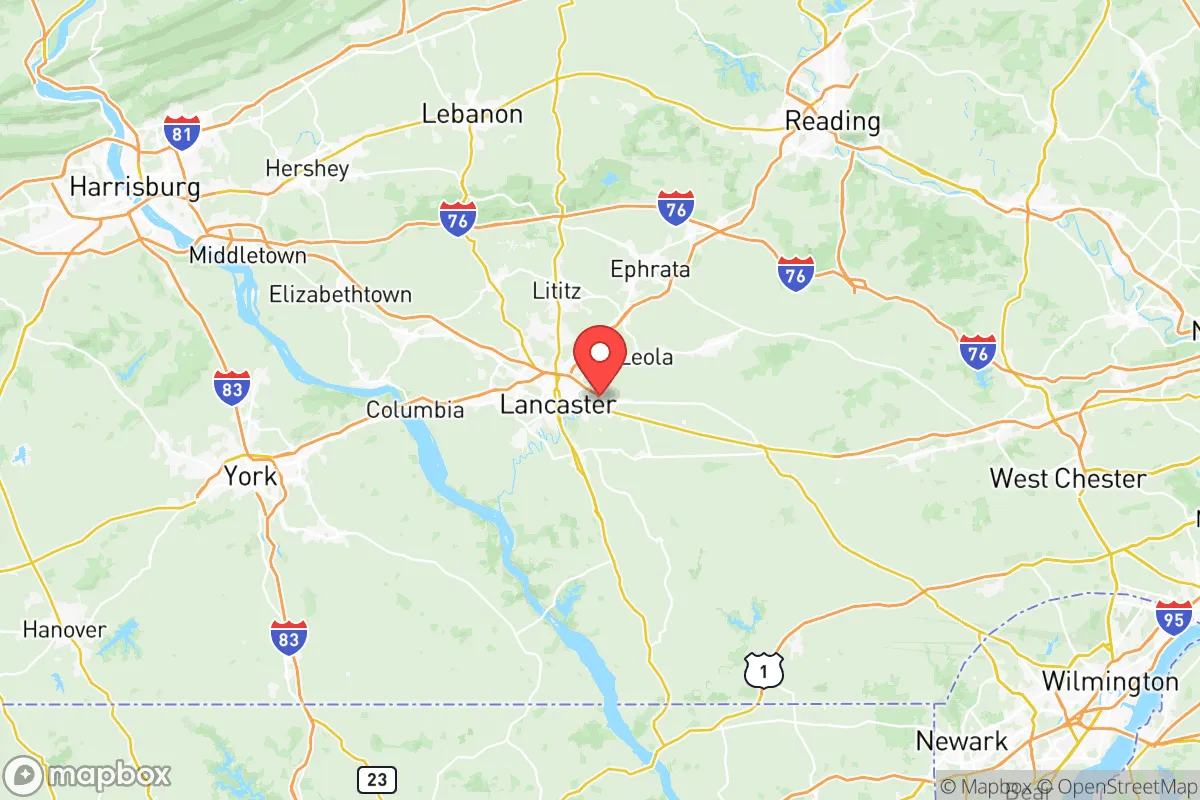
Lancaster County’s geography is its first and most important advantage. The county sits within the fertile Lancaster Plain, part of the Great Valley, which provides some of the richest topsoil in the northeastern United States. This terrain is not prone to flooding in most areas—unlike downstream communities along the Susquehanna River—and the rolling hills offer natural drainage and defensible microclimates. The county is nearly 950 square miles, with a mix of dense farmland, small towns like Lititz and Ephrata, and suburban development around the city of Lancaster. Critically, the area is sheltered from coastal storm surges by roughly 80 miles of inland buffer, and the Appalachian ridges to the northwest provide a partial windbreak and reduce the impact of severe weather outbreaks. The climate is moderate—humid continental with four distinct seasons—which supports year-round agriculture and reduces the risk of extreme heat or cold compared to more northern or southern locations. For a relocator, this means fewer weather-related emergencies and a landscape capable of sustaining life without heavy reliance on outside supply chains.
Risks, exposures, and proximity to potential man-made hazards
No location is without vulnerabilities, and Lancaster County has several that a strategic planner must weigh. The most significant risk is its proximity to the Susquehanna River and the potential for flooding in low-lying areas, particularly around the towns of Marietta, Columbia, and along the river’s edge. The remnants of Hurricane Agnes in 1972 and Tropical Storm Lee in 2011 caused severe inundation there. On the man-made side, the county is less than 30 miles from the Three Mile Island nuclear plant in Dauphin County—now mostly decommissioned but still a spent-fuel storage site—and within 60 miles of the Peach Bottom Atomic Power Station in York County. A major incident at either facility could affect Lancaster County’s air and water, depending on wind patterns. More broadly, the county sits roughly 65 miles west of Philadelphia and 90 miles north of Baltimore, placing it within the fallout plume path of any major industrial or infrastructure attack on those cities. The Pennsylvania Turnpike (I-76) and Route 30 cut through the county, which aids supply movement but also makes it a potential evacuation or military transit corridor in times of crisis. Finally, there are no active military bases or major refineries within Lancaster County itself, which is a clear advantage—but the nearby naval support activities at Aberdeen Proving Ground in Maryland (~60 miles south) and the distribution hubs around Harrisburg mean that the area is not completely off the radar.
Practical resilience for a relocator: food, water, energy, and defensibility
This is where Lancaster County stands out among relocation destinations. The county is consistently ranked among the top in the nation for agricultural output, with over 5,000 farms producing dairy, poultry, grains, vegetables, and fruit. The presence of a large Amish and Mennonite population—primarily concentrated in the area around Intercourse, Bird-in-Hand, and New Holland—means that traditional farming techniques, animal-powered transport, and community-based food preservation are not just historical artifacts but living practices. For a relocator, this translates directly into food security: local farmers' markets, raw milk availability, and dozens of small-scale processors mean that even a full breakdown of national grocery distribution would leave Lancaster County with functional, decentralized food networks. Water resources are similarly robust. The county sits atop multiple aquifers, and the Susquehanna River provides a massive freshwater source, though treatment infrastructure would be vulnerable without power. Private wells are common in rural townships such as East Earl and Leacock, and many properties have easy access to springs or creeks. Energy resilience is moderate: while most homes rely on the regional PJM grid, the area has a growing number of solar installations, and the dense woodlands provide ample fuel for wood stoves—a common heating source in older farmhouses and Amish homes. As for defensibility, the county’s layout is naturally favorable. The farmland is open, providing long sightlines, while the many creeks, stone walls, and narrow country lanes would make any large-scale movement slow. Community cohesion is high, especially in smaller towns, and local law enforcement agencies (including the Lancaster County Sheriff’s Department) have historically coordinated well with emergency services. A relocator who buys land here will find immediate neighbors who know how to rebuild a fence, milk a goat, or share a well pump—skills far rarer in suburban or exurban settings.
The overall strategic picture for Lancaster County is one of genuine strength tempered by proximity to certain risks. For the reader who is serious about disaster readiness and self-sufficiency, this area offers what few locations on the East Coast can: a working rural economy that is not merely nostalgic but functional, a climate that supports year-round food production, and a population that has not lost the knowledge of how to live without modern conveniences. The key trade-offs are clear: you trade the complete isolation of the interior West for access to rich soil, abundant water, and a supportive community. If the goal is to build a resilient life for a family in a place that could weather a moderate-to-severe disruption without descending into chaos, Lancaster County deserves a very close look—and a real estate search that prioritizes a well-site, a southern-facing slope, and good neighbors.

* Values derived from national, state, county, city and local statistics and may differ in a specific area. Last updated: 2026-07-01T23:49:38.000Z
Narrative content on this page is AI-generated and may contain mistakes. Verify any details that matter before acting on them.
ReloMaps may earn a commission from affiliate links at no extra cost to you.

