
Photo: Wikipedia
Strategic Assessment of Cumberland County
Meaningful friction. Expect exposure to either population pressure, blast zones, or natural disaster risk. Consider buying a retreat property.
What does the Strategic Assessment tell us?
Our Strategic Assessment grades tactical survivability of an area. Major population centers, military targets, fallout zones, natural disasters, and border exposure all drive risk — lower exposure means a more defensible position in a crisis.
This is heavily inspired by Joel Skousen's Strategic Relocation book. Highly recommended you checkout the book ($)What does this tell us?
Our Strategic Assessment grades tactical survivability of an area. Major population centers, military targets, fallout zones, natural disasters, and border exposure all drive risk — lower exposure means a more defensible position in a crisis.
This is heavily inspired by Joel Skousen's Strategic Relocation book. Highly recommended you checkout the book ($)Strategic Pillars

Key Distances
Strategic Assessment Analysis
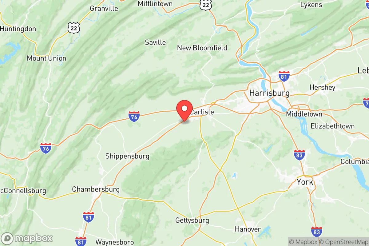
Cumberland County, Pennsylvania, offers a compelling mix of strategic depth and everyday livability for those prioritizing resilience and preparedness. Its location in the south-central part of the state, anchored by the county seat of Carlisle and the borough of Mechanicsburg, places it within a 90-minute drive of major East Coast population centers like Philadelphia and Baltimore, yet far enough removed to avoid the immediate chaos of a metropolitan collapse. The county’s historical role as a transportation and logistics hub—home to the Carlisle Barracks, the U.S. Army War College, and a dense network of rail and interstate highways—provides a built-in infrastructure advantage that a relocator can leverage for supply access and mobility.
Geographic position and natural advantages for long-term stability
Cumberland County sits in the Great Appalachian Valley, a broad, fertile corridor that runs through the heart of the region. This geography offers two distinct advantages: defensible terrain to the west (the Blue Mountain ridge) and rich agricultural soil in the valley floor. The county is drained by the Yellow Breeches Creek and the Conodoguinet Creek, both tributaries of the Susquehanna River, providing reliable surface water sources that are less prone to contamination than urban watersheds. The area’s rolling hills and forested ridges create natural chokepoints for any potential movement, while the valley itself is wide enough to support dispersed settlement patterns. Unlike the flood-prone lowlands of the Susquehanna’s main stem, Cumberland County’s elevation—averaging around 400 to 600 feet above sea level in the populated areas—keeps most of its towns, including Shippensburg and Newville, above the worst of regional flooding. The climate is temperate, with four distinct seasons and an average annual rainfall of about 40 inches, which supports rain-fed agriculture without the drought risks seen in the western U.S.
Risks, exposures, and proximity to fallout-relevant landmarks
No strategic assessment is complete without a clear-eyed look at vulnerabilities. Cumberland County’s primary risk exposure comes from its proximity to Three Mile Island, the decommissioned nuclear plant located roughly 25 miles east in Dauphin County. While the plant has been shut down since 2019, spent fuel remains stored on-site in dry casks—a potential target for sabotage or a long-term contamination hazard if the site were compromised. More immediately, the county lies within the fallout shadow of the Philadelphia metropolitan area (about 100 miles east) and the Baltimore-Washington corridor (about 80 miles south). A major nuclear exchange or industrial accident in those regions could deposit fallout across Cumberland County depending on prevailing westerly winds, though the Blue Mountain ridge offers some shielding effect for the valley floor. The county is also home to the Carlisle Barracks, a U.S. Army installation that, while primarily a training and education center, could become a secondary target in a conflict scenario. On the natural hazard front, the area experiences occasional tornadoes (EF-1 or EF-2 strength, typically) and winter ice storms that can knock out power for days, but it is not in a hurricane zone, seismic zone, or wildfire-prone landscape. The biggest day-to-day risk for a relocator is the I-81 corridor, which runs north-south through the county and carries heavy truck traffic, including hazardous materials—a derailment or tanker accident could temporarily disrupt travel or contaminate a local waterway.
Practical resilience for a relocator: food, water, energy, and defensibility
For someone serious about self-sufficiency, Cumberland County scores well on the basics. Food security is a standout: the county is part of Pennsylvania’s agricultural heartland, with over 1,200 farms producing corn, soybeans, hay, and livestock. The Carlisle Farmers Market (one of the oldest continuously operating markets in the country) and numerous roadside stands in the rural townships of West Pennsboro and Southampton provide direct access to local produce, meat, and dairy. A relocator with a few acres can easily supplement with a home garden and small livestock. Water availability is excellent: the county’s groundwater aquifers are generally shallow and productive, and many rural properties have private wells. Surface water from the Yellow Breeches and Conodoguinet is fishable and swimmable, though treatment would be needed for drinking. Energy resilience is more mixed. The grid is served by PPL Electric Utilities and FirstEnergy, both of which have faced criticism for outage response times during storms. However, the county’s rolling terrain and tree cover make solar panel placement viable on south-facing slopes, and wood heating is a practical backup—firewood is abundant from the state game lands and private woodlots in the northern part of the county. Propane is widely available for cooking and heating, with several bulk suppliers in the area. Defensibility is where the county’s layout shines: the small towns (Carlisle, Mechanicsburg, Shippensburg) are compact and walkable, with a grid of back roads that allow for multiple escape routes. The rural townships offer large lot sizes (often 2-5 acres minimum) and natural screening from tree lines and rolling hills. A well-chosen property on a dead-end road with a creek boundary provides a high degree of privacy and security without feeling like a bunker. The local culture is also a factor: Cumberland County has a strong tradition of hunting, fishing, and firearms ownership, and the Carlisle Gun Show is a regional fixture—this means a relocator will find a community that takes preparedness seriously, not as a fringe activity but as a normal part of life.
The overall strategic picture for Cumberland County is one of balanced resilience. It is not a remote wilderness—you will have neighbors, traffic on I-81, and the occasional drone of a military helicopter from the War College. But it is also not a soft target. The combination of fertile soil, reliable water, defensible terrain, and a community that values self-reliance makes it a strong choice for a relocator who wants to be prepared without living off-grid. The key trade-off is proximity to risk: you are close enough to major population centers to benefit from their resources (hospitals, supply chains, job markets) but close enough to be affected by their collapse. For a family or individual willing to invest in a well-stocked pantry, a backup power system, and a network of like-minded neighbors, Cumberland County offers a realistic path to long-term stability in an uncertain future.

* Values derived from national, state, county, city and local statistics and may differ in a specific area. Last updated: 2026-06-28T20:45:54.000Z
Narrative content on this page is AI-generated and may contain mistakes. Verify any details that matter before acting on them.
ReloMaps may earn a commission from affiliate links at no extra cost to you.

