Photo: Wikipedia
Strategic Assessment of Paso Robles, CA
Multiple tactical vulnerabilities. Population density, target proximity, or disaster risk are likely compounding. A retreat property and exit planning is required.
What does the Strategic Assessment tell us?
Our Strategic Assessment grades tactical survivability of an area. Major population centers, military targets, fallout zones, natural disasters, and border exposure all drive risk — lower exposure means a more defensible position in a crisis.
This is heavily inspired by Joel Skousen's Strategic Relocation book. Highly recommended you checkout the book ($)What does this tell us?
Our Strategic Assessment grades tactical survivability of an area. Major population centers, military targets, fallout zones, natural disasters, and border exposure all drive risk — lower exposure means a more defensible position in a crisis.
This is heavily inspired by Joel Skousen's Strategic Relocation book. Highly recommended you checkout the book ($)Strategic Pillars

Key Distances
Regional Safe Places
Below is our recommended "safe zones" in California and the surrounding area based on our strategic heuristics. For most people, it's unrealistic to live in a “safe zone” full-time due to work, family or other personal reasons. They tend to be more rural. However, many of these areas are perfect for second homes and retreat properties that double as a vacation home or even a short-term rental.




Important Note: For informational purposes only. This does not mean nothing bad ever happens in the green zones. Please use common sense. This is based on public data and modeled with AI. We tried to take a conservative approach but mistakes happen. We update this regularly as new information becomes available.
Solar Generator Recommendations
Backup power matters more here than in safer locations. We've picked three solar generators across budgets and capacity tiers — start with the budget unit if you only need a few essentials, or step up if you want to run a fridge and HVAC for days at a time.

Jackery Portable Power Station Explorer 300
Budget OptionPower on the Go: Weighing only 11 lbs, it's convenient to set up and store with book-sized foldable solar panels

BLUETTI Portable Power Station AC180
Designed for both indoor and outdoor scenarios, AC180 is highly capable as it has a robost capacity and continuous output power.

EF ECOFLOW DELTA Pro Ultra Power Station
Upgraded PickEcoFlow DELTA Pro Ultra is a whole-home energy system designed to grow with your family. Integrated with the Smart Home Panel 2, it scales to meet your evolving energy needs — keeping your home powered, intelligent, and secure through every stage of life.
We earn a commission, at no additional cost to you.
Strategic Assessment Analysis
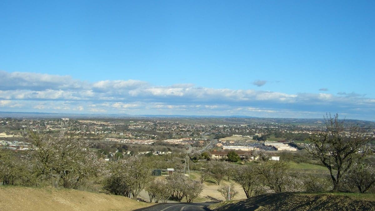
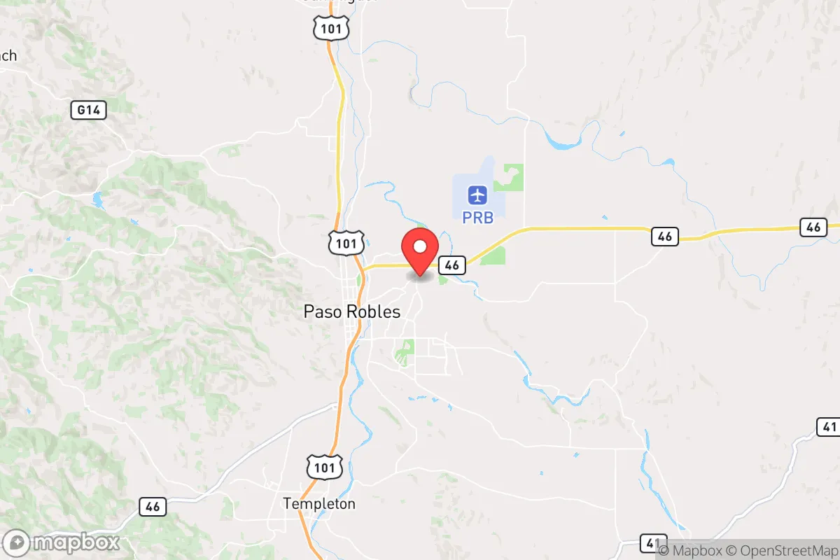
Paso Robles offers a compelling mix of strategic depth and practical resilience for those prioritizing disaster readiness and self-sufficiency, largely due to its inland location on California's Central Coast. Positioned roughly halfway between Los Angeles and San Francisco, it sits far enough from major metropolitan centers to avoid the immediate chaos of a urban crisis, yet remains connected enough for supply access. The area’s agricultural base, moderate climate, and lower population density create a foundation for long-term stability that many coastal or inland-empire locations simply cannot match.
Geographic position and natural advantages for long-term stability
Paso Robles sits at roughly 800 feet elevation in the Salinas River Valley, shielded from the direct coastal fog by the Santa Lucia Range to the west. This positioning provides a Mediterranean climate with over 300 days of sunshine annually and average highs in the 70s and 80s, which is ideal for year-round food production and solar energy generation. The area is far enough inland—about 30 miles from the Pacific—to avoid the worst of a tsunami threat, yet close enough to benefit from marine-influenced weather patterns that reduce wildfire risk compared to the Sierra foothills. The surrounding terrain is a mix of rolling hills, oak woodlands, and vineyard-covered valleys, offering natural defensibility through limited road access: US-101 is the primary north-south artery, and only a handful of two-lane state routes (46, 41, 58) connect the area to the coast and the Central Valley. This chokepoint geography means that in a crisis, controlling ingress and egress is feasible, but it also means evacuation routes are limited—a trade-off that favors those who plan to stay put rather than flee.
Risks, exposures, and proximity to fallout-relevant landmarks
No location is without vulnerabilities, and Paso Robles has several that a strategic relocator must weigh. The most immediate natural risk is earthquake activity along the San Andreas Fault, which runs roughly 30 miles east of town. While Paso Robles itself is not directly on the fault line, the 2003 San Simeon earthquake (magnitude 6.5) caused significant damage to downtown buildings, demonstrating that even moderate seismic events can disrupt infrastructure. Wildfire is a seasonal concern, particularly in the dry summer and fall months, with the 2020 Dolan Fire and 2021 River Fire burning in nearby areas. However, the urban-wildland interface here is less extreme than in places like Santa Rosa or Paradise, and the region’s agricultural land acts as a natural firebreak. From a man-made risk perspective, Paso Robles is not near any major military installations, nuclear power plants, or high-value strategic targets like Silicon Valley or the Ports of Los Angeles and Long Beach. The nearest significant fallout-relevant landmark is Vandenberg Space Force Base, about 90 miles south, which launches satellites and test missiles—a potential target in a conflict, but far enough away that fallout would be diluted by distance and prevailing winds that typically blow west to east. The Diablo Canyon Nuclear Power Plant near San Luis Obispo (about 40 miles south) is in decommissioning, reducing that risk. For a reader concerned about being near large cities and fallout dangers, Paso Robles scores well: it is far enough from the Bay Area and Los Angeles (both about 200 miles) to avoid the immediate blast and fallout zones of a nuclear event, while still being within a day’s drive for supply runs.
Practical resilience for a relocator: food, water, energy, and defensibility
Paso Robles’ agricultural economy is its strongest resilience asset. The area is one of California’s top wine-producing regions, with over 40,000 acres of vineyards, but it also supports cattle ranching, almond orchards, and vegetable farming. For a relocator focused on food security, this means local food production is abundant and diverse, with farmers’ markets operating year-round and a strong network of small-scale growers. Water is a more complex issue. Paso Robles sits atop the Paso Robles Groundwater Basin, which has been heavily overdrafted for decades, leading to state-mandated pumping restrictions under the Sustainable Groundwater Management Act (SGMA). While residential wells are still viable, new well permits are increasingly difficult to obtain, and existing wells may require deepening. The Salinas River runs through town but is often dry in summer, so rainwater catchment and storage are prudent investments. Energy resilience is favorable: the area receives excellent solar insolation, and many rural properties already use solar panels with battery backup. Natural gas is available in town, but propane is common in outlying areas. The local utility, PG&E, has a poor track record for grid reliability during fire season, so a backup generator or solar-plus-storage system is almost mandatory for anyone serious about self-sufficiency. Defensibility is aided by the area’s low crime rate—Paso Robles has a violent crime rate about 30% below the national average—and a community culture that leans toward self-reliance and neighborly cooperation. The terrain offers good visibility and limited approach routes, making it easier to secure a rural property than in densely forested or flat, open areas.
Overall, Paso Robles presents a balanced strategic picture for the disaster-conscious relocator. It avoids the worst of California’s seismic and wildfire hotspots while offering a robust agricultural base, moderate climate, and distance from major target zones. The trade-offs are real: water scarcity requires careful planning, and the limited road network means evacuation is not a viable strategy for a fast-moving crisis. But for those willing to invest in on-site water storage, renewable energy, and a defensible property, Paso Robles provides a foundation for long-term resilience that is hard to beat on the Central Coast. It is not a bunker location, but it is a smart, livable base for building a self-sufficient lifestyle in an uncertain future.

* Values derived from national, state, county, city and local statistics and may differ in a specific area. Last updated: 2026-09-02T21:56:32.000Z
Narrative content on this page is AI-generated and may contain mistakes. Verify any details that matter before acting on them.
ReloMaps may earn a commission from affiliate links at no extra cost to you.

