Photo: Wikipedia
Strategic Assessment of Owings Mills, MD
Meaningful friction. Expect exposure to either population pressure, blast zones, or natural disaster risk. Consider buying a retreat property.
What does the Strategic Assessment tell us?
Our Strategic Assessment grades tactical survivability of an area. Major population centers, military targets, fallout zones, natural disasters, and border exposure all drive risk — lower exposure means a more defensible position in a crisis.
This is heavily inspired by Joel Skousen's Strategic Relocation book. Highly recommended you checkout the book ($)What does this tell us?
Our Strategic Assessment grades tactical survivability of an area. Major population centers, military targets, fallout zones, natural disasters, and border exposure all drive risk — lower exposure means a more defensible position in a crisis.
This is heavily inspired by Joel Skousen's Strategic Relocation book. Highly recommended you checkout the book ($)Strategic Pillars

Key Distances
Regional Safe Places
Below is our recommended "safe zones" in Maryland and the surrounding area based on our strategic heuristics. For most people, it's unrealistic to live in a “safe zone” full-time due to work, family or other personal reasons. They tend to be more rural. However, many of these areas are perfect for second homes and retreat properties that double as a vacation home or even a short-term rental.
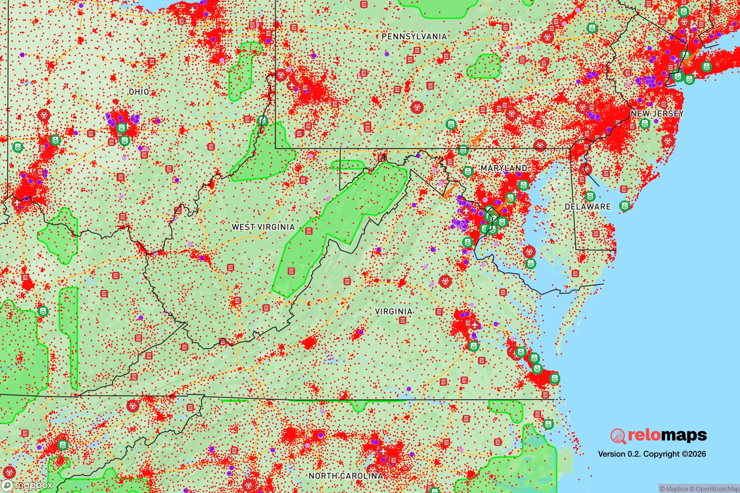
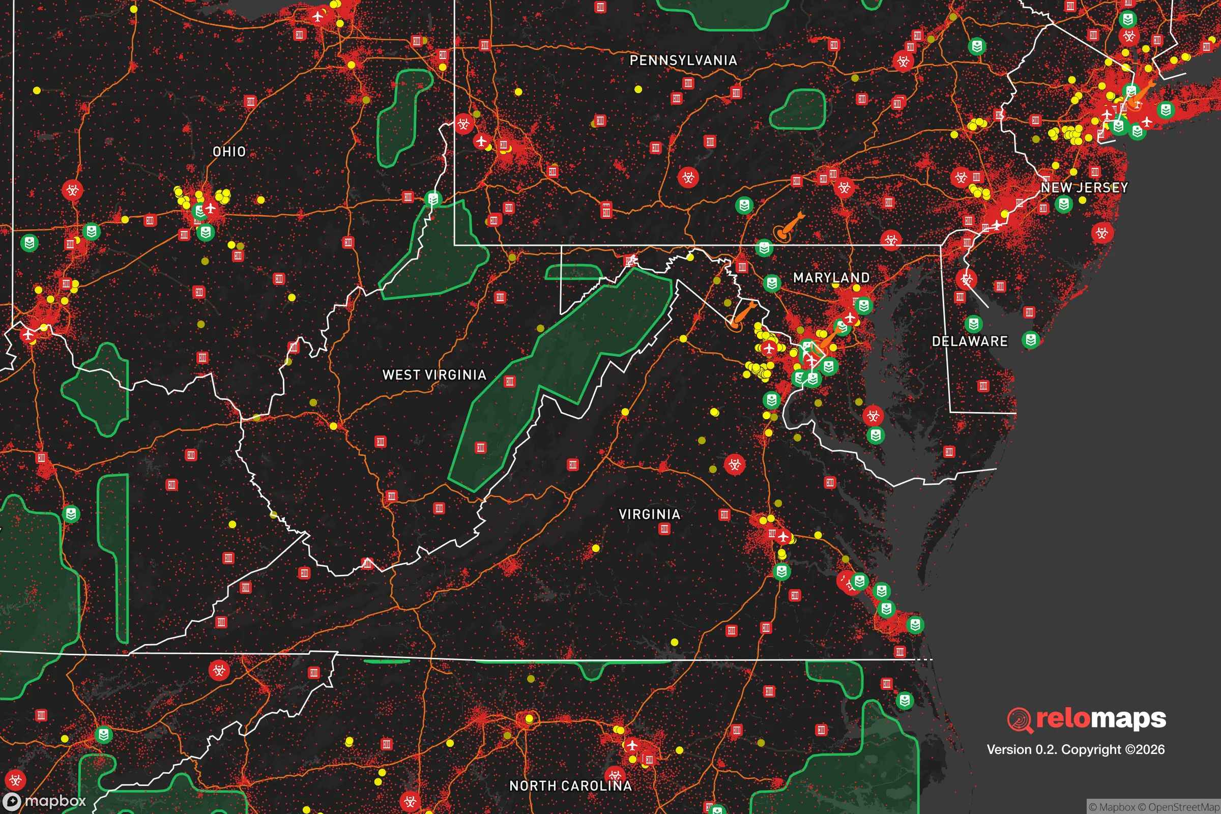


Important Note: For informational purposes only. This does not mean nothing bad ever happens in the green zones. Please use common sense. This is based on public data and modeled with AI. We tried to take a conservative approach but mistakes happen. We update this regularly as new information becomes available.
Solar Generator Recommendations
Backup power matters more here than in safer locations. We've picked three solar generators across budgets and capacity tiers — start with the budget unit if you only need a few essentials, or step up if you want to run a fridge and HVAC for days at a time.
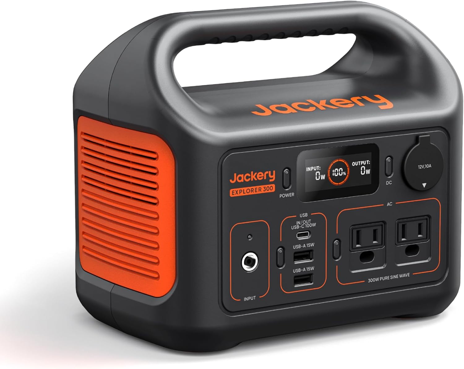
Jackery Portable Power Station Explorer 300
Budget OptionPower on the Go: Weighing only 11 lbs, it's convenient to set up and store with book-sized foldable solar panels

BLUETTI Portable Power Station AC180
Designed for both indoor and outdoor scenarios, AC180 is highly capable as it has a robost capacity and continuous output power.

EF ECOFLOW DELTA Pro Ultra Power Station
Upgraded PickEcoFlow DELTA Pro Ultra is a whole-home energy system designed to grow with your family. Integrated with the Smart Home Panel 2, it scales to meet your evolving energy needs — keeping your home powered, intelligent, and secure through every stage of life.
We earn a commission, at no additional cost to you.
Strategic Assessment Analysis
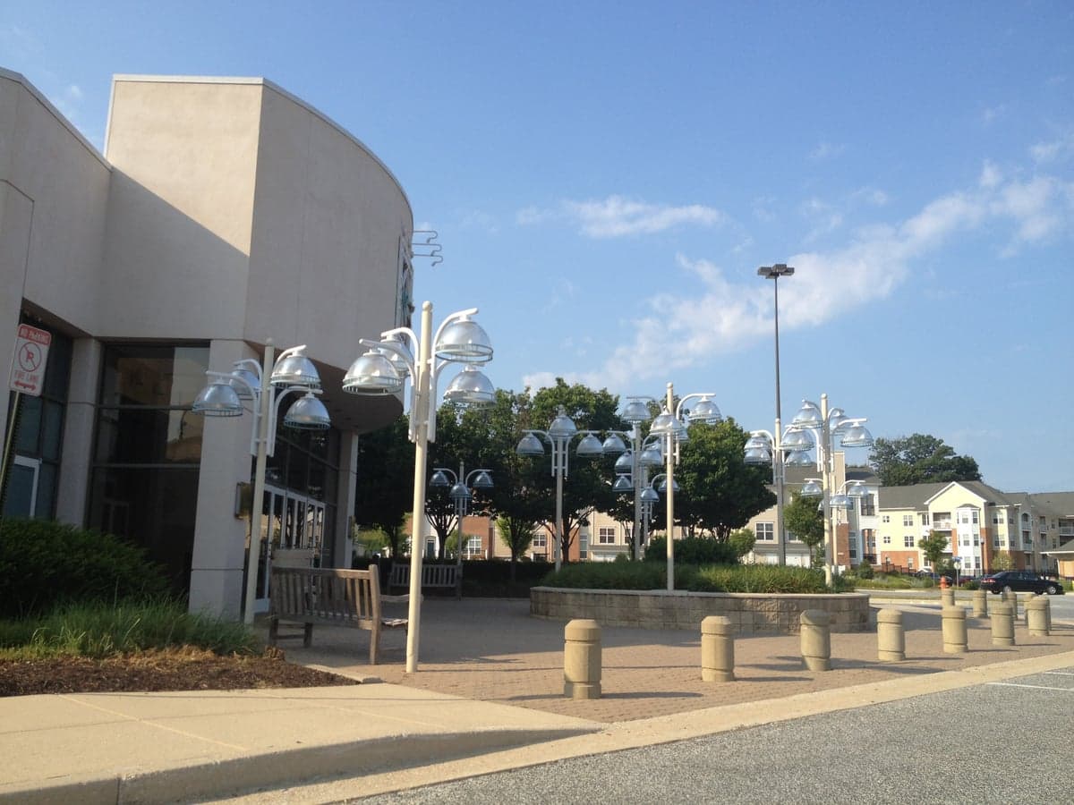
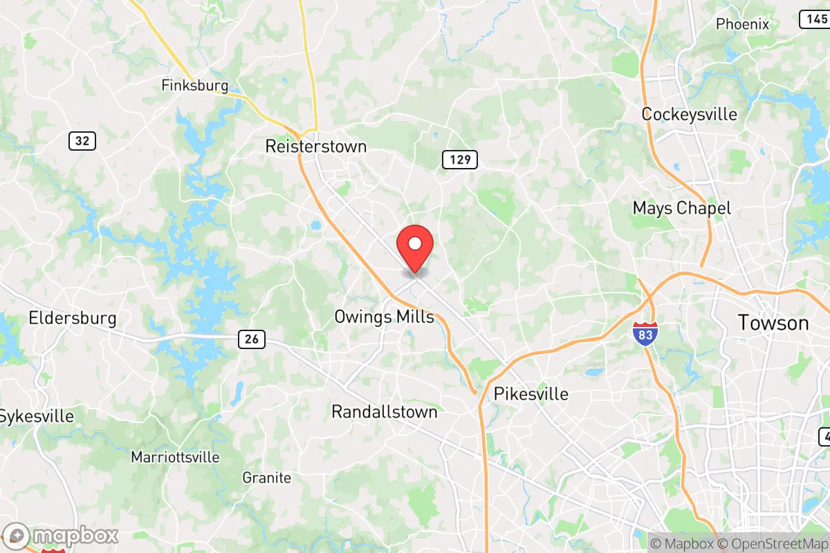
Owings Mills, Maryland, sits in a position that is both strategically advantageous and strategically exposed, depending on what you are planning for. Located in Baltimore County roughly 15 miles northwest of downtown Baltimore, this unincorporated community of about 35,000 residents offers a mix of suburban infrastructure and proximity to rural escape routes that makes it a serious candidate for relocation analysis. For the preparedness-minded individual or family, Owings Mills presents a workable balance: close enough to major employment and medical hubs to be practical, yet far enough from the urban core to offer a meaningful buffer against the worst of a metropolitan-scale disruption.
Geographic position and natural advantages for long-term stability
The most significant natural asset Owings Mills possesses is its position along the Piedmont Plateau, a transition zone between the coastal plain and the Appalachian foothills. This means the area sits at a slightly higher elevation than the Baltimore metro core, generally 300 to 500 feet above sea level, which provides a measurable advantage in terms of drainage and flood resilience. The Gwynns Falls and Liberty Reservoir watersheds dominate the local hydrology, and while the reservoir itself is a critical water source for the region, the surrounding land is characterized by rolling hills, mixed hardwood forest, and a patchwork of agricultural preserves that break up the density of suburban development.
That green space matters more than most relocation guides acknowledge. The Soldiers Delight Natural Environment Area, a 1,900-acre serpentine barren just west of Owings Mills, and the extensive watershed lands around Liberty Reservoir create a natural buffer zone that would complicate any large-scale ground movement and provide meaningful cover and resources in a prolonged emergency. The area's tree canopy is dense, and the topography offers natural defensible positions — high ground with clear sightlines over the valley floor. For a family thinking about self-sufficiency, the soil quality in the surrounding county is workable for small-scale agriculture, though the clay-heavy Piedmont soil requires amendment and effort to produce reliable yields.
Climate-wise, Owings Mills experiences all four seasons with occasional winter storms and summer thunderstorms, but it sits outside the highest-risk hurricane storm-surge zones and is not in a designated tornado alley. The primary natural threat is the occasional nor'easter or ice storm that can knock out power for several days, which is a manageable scenario with basic preparation. The area is also far enough inland that sea-level rise projections, which are a genuine concern for coastal Maryland communities like Annapolis or Ocean City, are essentially irrelevant here.
Risk exposure and proximity to fallout-relevant landmarks
Here is where the strategic picture gets more complicated. Owings Mills is undeniably within the extended blast and fallout footprint of several high-value targets. The community sits roughly 15 miles from downtown Baltimore, home to the Port of Baltimore, major rail infrastructure, and the headquarters of several federal agencies including the Social Security Administration and the Centers for Medicare and Medicaid Services. The I-95 corridor, which runs through the Baltimore-Washington metropolitan area, is one of the most critical transportation arteries on the East Coast, and the BWI Airport complex lies approximately 20 miles to the south. In a conflict scenario involving strategic weapons, the Baltimore-Washington corridor is among the highest-priority target sets in the United States, and Owings Mills would be downwind of any ground burst in the city depending on prevailing westerly winds.
Additionally, the area's own infrastructure creates secondary risks. The Baltimore Gas and Electric grid serving Owings Mills is aging and has demonstrated fragility during extreme weather events, and the community's reliance on the regional power network means a cascading failure would affect everything from water pumping to fuel distribution. The nearby Hunt Valley and Cockeysville industrial corridors, which host defense contractors and electronics manufacturers, add another layer of target relevance that a serious analyst cannot ignore. On the man-made risk side, the area's proximity to I-795 and the Baltimore Beltway means that any major evacuation event would likely produce severe gridlock on the primary routes, making pre-positioned supplies and a willingness to use secondary roads essential.
Practical resilience for a relocator: food, water, energy, and defensibility
For the relocator serious about preparedness, Owings Mills offers a mixed but workable practical picture. Water is the strongest suit: the community draws from the Liberty Reservoir system, and while municipal supply is vulnerable to power loss, the presence of numerous streams, the Gwynns Falls, and the reservoir itself means surface water is accessible for filtration and purification. A household with a Berkey or similar gravity filter and a supply of purification tablets can secure a reliable water source within walking distance in most parts of Owings Mills. The groundwater table in the Piedmont is generally accessible at depths of 50 to 150 feet, and while private wells are uncommon in the suburban core, the surrounding rural parcels in Carroll County to the west offer viable well-drilling options for those willing to commute.
Food security is more challenging but manageable. The immediate area has limited agricultural production, and the grocery infrastructure — including the Wegmans, Giant, and Aldi locations in the Owings Mills corridor — is dependent on just-in-time supply chains that would falter within days of a major disruption. However, the surrounding region offers genuine opportunities: the Baltimore County Agricultural Reserve and the farms of northern Baltimore County and southern Carroll County are within a 20- to 30-minute drive, and establishing relationships with local farmers and the farmers markets in nearby Reisterstown and Westminster would provide a meaningful food network. For those with land, the growing season runs roughly April through October, and the region supports a wide range of cold-hardy and warm-season crops, though the clay soil and deer population require fencing and raised-bed strategies.
Energy resilience is the weakest link. The area has no meaningful community solar infrastructure, and the suburban housing stock is predominantly grid-dependent. A natural gas generator or a solar array with battery storage is a significant investment but would be the single highest-impact upgrade for an Owings Mills household. The good news is that the area's moderate climate means heating and cooling loads are manageable, and a wood-burning fireplace or stove, combined with the abundant local timber, provides a viable heating backup. Defensibility is a relative strength: the suburban layout with cul-de-sacs, the natural chokepoints created by the valley topography, and the buffer of watershed land to the west all work in favor of a prepared household. The community's demographic profile — largely professional, with a strong presence of healthcare workers from the nearby LifeBridge Health and Northwest Hospital systems — means a neighborhood-level response would likely be more organized and capable than in many urban or exurban areas.
The overall strategic picture for Owings Mills is one of calculated trade-offs. It is not a retreat location; it is a forward operating base. The proximity to Baltimore and the I-95 corridor creates genuine risk in a worst-case scenario, and the grid dependence and supply-chain fragility are real vulnerabilities. But for a family that wants to maintain professional employment and access to world-class medical care while building genuine resilience — a home with backup power, water filtration, food stores, and a network of rural contacts to the west — Owings Mills offers a defensible middle ground. The key is to treat it as what it is: a suburban position with good natural buffers and serious man-made exposure, requiring deliberate preparation rather than passive assumption of safety. If you are willing to invest in the infrastructure and relationships that create true self-sufficiency, this area can work. If you are looking for a location that is inherently safe by virtue of obscurity, this is not it.

* Values derived from national, state, county, city and local statistics and may differ in a specific area. Last updated: 2026-11-03T19:57:22.000Z
Narrative content on this page is AI-generated and may contain mistakes. Verify any details that matter before acting on them.
ReloMaps may earn a commission from affiliate links at no extra cost to you.

