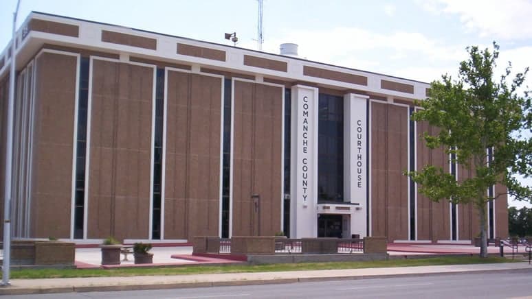
Photo: Wikipedia
Strategic Assessment of Comanche County
Workable tactical position. Some exposure to population density or targets, but generally defensible in a crisis.
What does the Strategic Assessment tell us?
Our Strategic Assessment grades tactical survivability of an area. Major population centers, military targets, fallout zones, natural disasters, and border exposure all drive risk — lower exposure means a more defensible position in a crisis.
This is heavily inspired by Joel Skousen's Strategic Relocation book. Highly recommended you checkout the book ($)What does this tell us?
Our Strategic Assessment grades tactical survivability of an area. Major population centers, military targets, fallout zones, natural disasters, and border exposure all drive risk — lower exposure means a more defensible position in a crisis.
This is heavily inspired by Joel Skousen's Strategic Relocation book. Highly recommended you checkout the book ($)Strategic Pillars

Key Distances
Strategic Assessment Analysis
Comanche County, Oklahoma, offers a strategic balance of rural self-sufficiency and proximity to regional infrastructure, making it a resilient choice for relocators prioritizing disaster readiness and long-term stability. Anchored by the city of Lawton and adjacent to Fort Sill, the area combines a low population density with access to essential services, while its position in the southwestern part of the state places it well outside the highest-risk zones for natural disasters and major industrial accidents. For those assessing relocation through a lens of preparedness, Comanche County presents a defensible, resource-rich environment with manageable exposure to both natural and man-made threats.
Geographic position and natural advantages for self-sufficiency
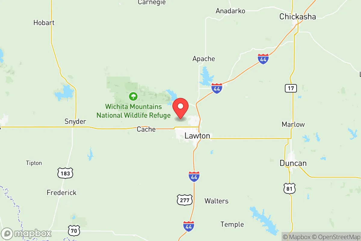
Comanche County sits at the intersection of the Wichita Mountains and the Red River plains, a geography that provides both natural barriers and fertile land. The Wichita Mountains Wildlife Refuge, located just north of Lawton, offers a rugged, low-elevation terrain that is difficult to navigate for large-scale threats while providing ample hunting, foraging, and water sources. The county's elevation averages around 1,100 feet, which reduces flood risk compared to eastern Oklahoma, though flash flooding can occur in low-lying areas near Cache Creek and the Red River. The region's climate is semi-arid, with hot summers and mild winters, supporting a longer growing season for food production—typically 210–220 frost-free days per year. This makes Comanche County viable for year-round gardening and small-scale agriculture, a key factor for self-sufficiency. The county's position roughly 90 miles southwest of Oklahoma City and 150 miles northwest of Dallas-Fort Worth places it outside the immediate blast and fallout zones of major metropolitan targets, while still allowing access to larger markets for supplies and medical care if needed.
Risks, exposures, and proximity to fallout-relevant landmarks
While Comanche County avoids the highest-risk corridors, it is not without exposure. The most significant man-made risk is Fort Sill, a major U.S. Army base covering over 94,000 acres just north of Lawton. Fort Sill is a training and artillery center, meaning it could be a secondary target in a conflict scenario. However, its military nature also means the area benefits from a strong emergency response infrastructure and a population accustomed to preparedness. The county is also within 120 miles of the Cushing oil storage hub in Payne County, one of the largest crude oil storage facilities in the world, and roughly 150 miles from the Ardmore refinery corridor. These are potential industrial targets, but the distance and prevailing wind patterns (typically from the south-southwest) reduce direct fallout risk. Natural risks include tornadoes, which are common in Oklahoma, but Comanche County lies in a zone with a slightly lower frequency than the central part of the state—the city of Lawton averages about 3 tornado warnings per year, compared to 6–8 in Moore or Oklahoma City. Wildfire risk is moderate, particularly in the Wichita Mountains during dry summers, but the county's fire departments are well-equipped and coordinated. Earthquake risk is low, as the county is outside the induced seismicity zones of central Oklahoma.
Practical resilience for a relocator: food, water, energy, and defensibility
For a relocator focused on practical resilience, Comanche County offers strong fundamentals. Water access is reliable, with the county sitting atop the Rush Springs Aquifer, a high-yield groundwater source that supplies Lawton and surrounding rural areas. The Lawton Water Treatment Plant processes water from Lake Lawtonka and the Wichita River, providing redundancy. For off-grid setups, shallow wells (typically 50–150 feet) are common and productive. Food production is viable: the county has over 1,200 farms, with a strong tradition of cattle ranching, wheat farming, and pecan orchards. The Comanche County Farmers Market in Lawton operates year-round, and local feed stores stock seeds, tools, and livestock supplies. Energy resilience is solid—the county is served by Public Service Company of Oklahoma, with natural gas and coal plants nearby, and the region has growing solar potential, averaging 5.2 peak sun hours per day. For off-grid power, the area's open terrain and moderate wind speeds (12–15 mph average) support small wind turbines. Defensibility is a mixed picture: the Wichita Mountains provide natural chokepoints and high ground for rural properties, but the flat plains around Lawton offer less concealment. The county's population density is about 110 people per square mile, with large tracts of undeveloped land, making it easier to secure a homestead. The presence of Fort Sill also means a high concentration of firearms owners and trained individuals, which can be a community asset in a crisis, though it also means the area is more likely to be a staging ground for federal response efforts.
Overall, Comanche County presents a compelling strategic picture for the disaster-conscious relocator. Its geographic isolation from major metropolitan targets, combined with abundant water, fertile soil, and a climate suited to year-round food production, creates a strong foundation for self-sufficiency. The primary risks—proximity to Fort Sill and moderate tornado activity—are manageable with proper planning, such as building a reinforced safe room and maintaining a 90-day supply of essentials. The county's infrastructure is robust enough to support a modern lifestyle while still offering the space and resources for off-grid living. For a single individual or family willing to invest in preparedness, Comanche County offers a defensible, resource-rich environment that balances access to civilization with genuine resilience.

* Values derived from national, state, county, city and local statistics and may differ in a specific area. Last updated: 2026-07-20T00:31:34.000Z
Narrative content on this page is AI-generated and may contain mistakes. Verify any details that matter before acting on them.
ReloMaps may earn a commission from affiliate links at no extra cost to you.

