Photo: Wikipedia
Strategic Assessment of Ocean Shores, WA
Meaningful friction. Expect exposure to either population pressure, blast zones, or natural disaster risk. Consider buying a retreat property.
What does the Strategic Assessment tell us?
Our Strategic Assessment grades tactical survivability of an area. Major population centers, military targets, fallout zones, natural disasters, and border exposure all drive risk — lower exposure means a more defensible position in a crisis.
This is heavily inspired by Joel Skousen's Strategic Relocation book. Highly recommended you checkout the book ($)What does this tell us?
Our Strategic Assessment grades tactical survivability of an area. Major population centers, military targets, fallout zones, natural disasters, and border exposure all drive risk — lower exposure means a more defensible position in a crisis.
This is heavily inspired by Joel Skousen's Strategic Relocation book. Highly recommended you checkout the book ($)Strategic Pillars

Key Distances
Regional Safe Places
Below is our recommended "safe zones" in Washington and the surrounding area based on our strategic heuristics. For most people, it's unrealistic to live in a “safe zone” full-time due to work, family or other personal reasons. They tend to be more rural. However, many of these areas are perfect for second homes and retreat properties that double as a vacation home or even a short-term rental.
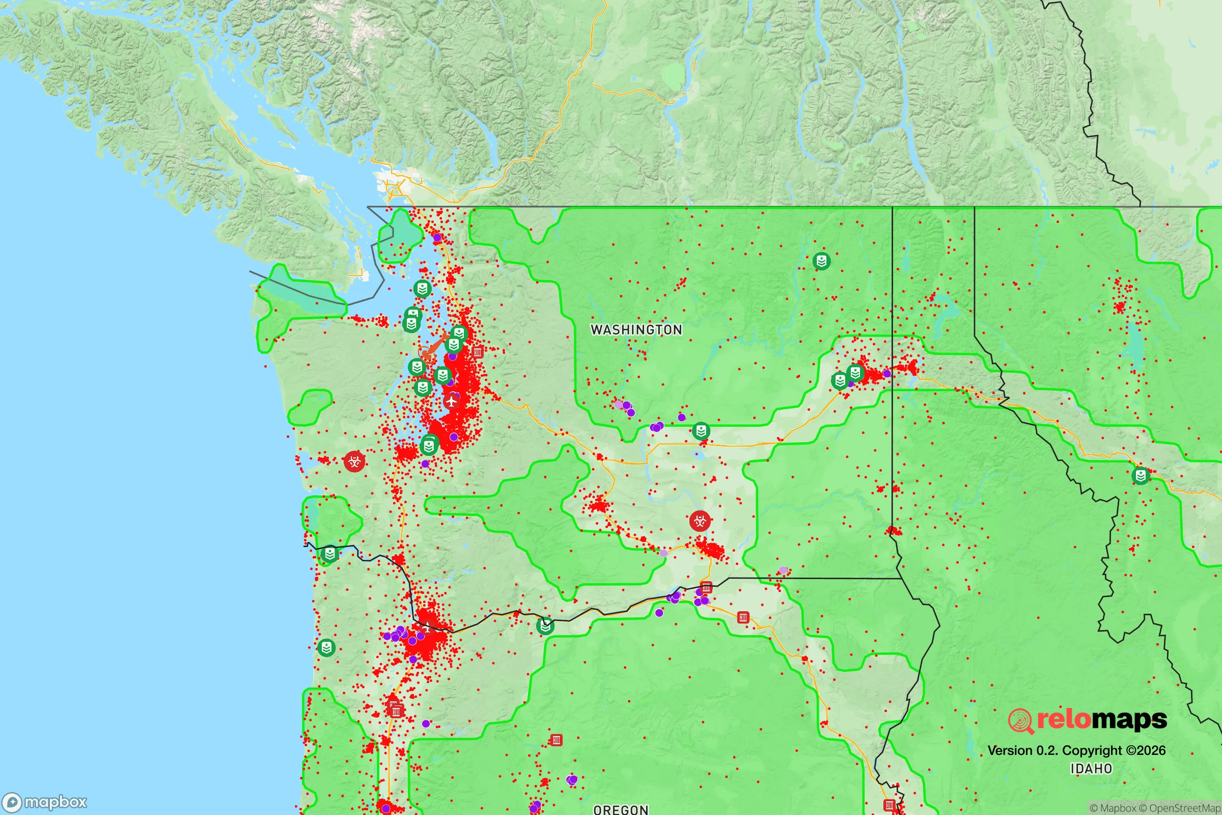
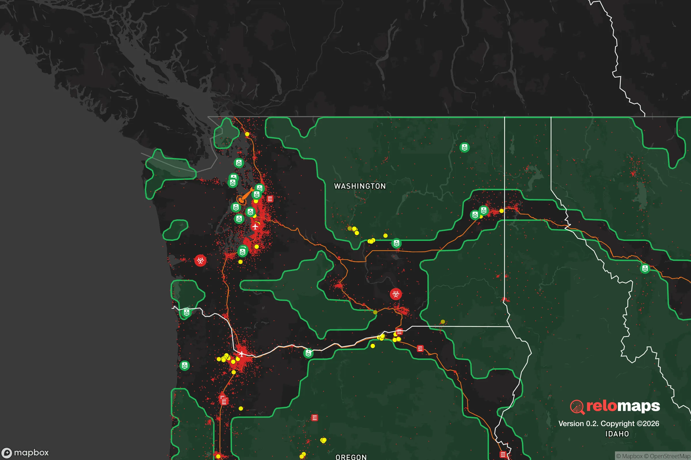


Important Note: For informational purposes only. This does not mean nothing bad ever happens in the green zones. Please use common sense. This is based on public data and modeled with AI. We tried to take a conservative approach but mistakes happen. We update this regularly as new information becomes available.
Solar Generator Recommendations
Backup power matters more here than in safer locations. We've picked three solar generators across budgets and capacity tiers — start with the budget unit if you only need a few essentials, or step up if you want to run a fridge and HVAC for days at a time.

Jackery Portable Power Station Explorer 300
Budget OptionPower on the Go: Weighing only 11 lbs, it's convenient to set up and store with book-sized foldable solar panels

BLUETTI Portable Power Station AC180
Designed for both indoor and outdoor scenarios, AC180 is highly capable as it has a robost capacity and continuous output power.

EF ECOFLOW DELTA Pro Ultra Power Station
Upgraded PickEcoFlow DELTA Pro Ultra is a whole-home energy system designed to grow with your family. Integrated with the Smart Home Panel 2, it scales to meet your evolving energy needs — keeping your home powered, intelligent, and secure through every stage of life.
We earn a commission, at no additional cost to you.
Strategic Assessment Analysis
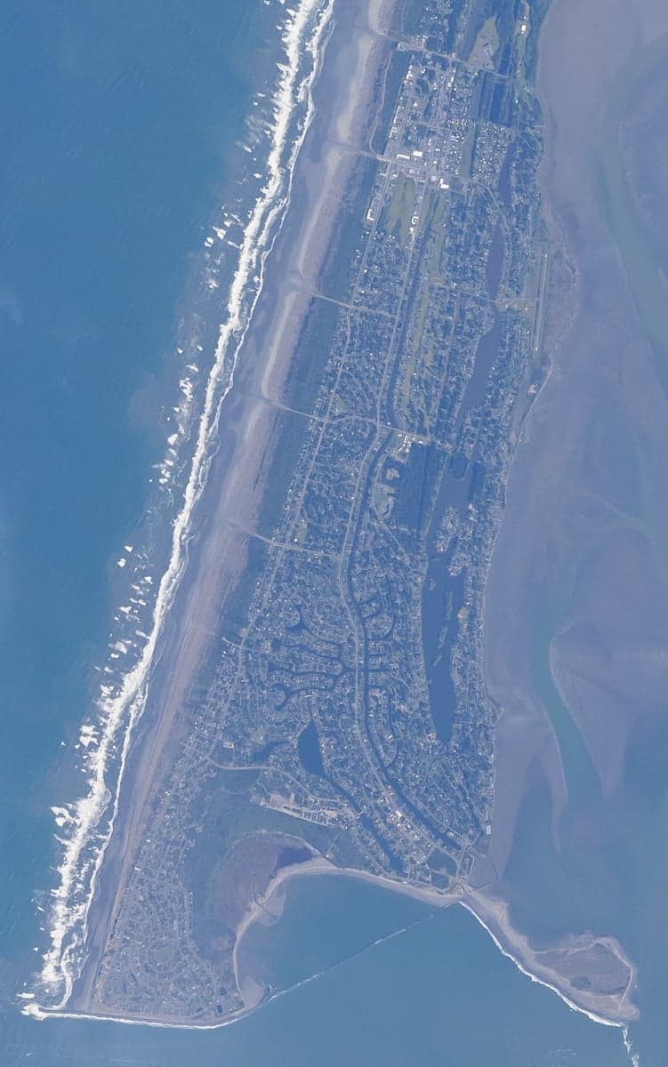
Ocean Shores, Washington, offers a unique strategic profile for the relocation-minded reader focused on resilience: it is a coastal peninsula that is simultaneously isolated from major population centers and vulnerable to the very natural forces that define its geography. Located on a 6-mile-long sand spit on the Pacific coast, roughly 90 miles west of Olympia and 120 miles southwest of Seattle, the city of roughly 6,500 residents sits at the end of a single road—State Route 115—which creates a natural chokepoint and a built-in defensibility advantage. For someone weighing disaster readiness and self-sufficiency, Ocean Shores presents a mixed picture: its remoteness from large cities and strategic targets is a clear positive, but its exposure to tsunami, storm surge, and seismic risks demands serious contingency planning.
Geographic position and natural advantages for self-sufficiency
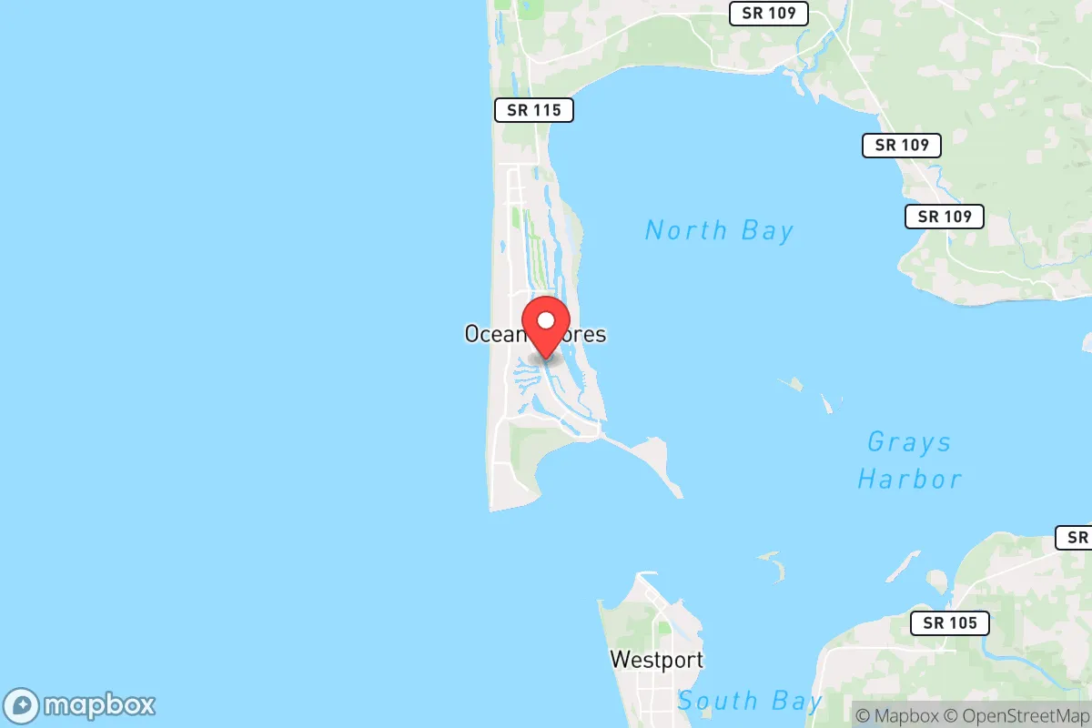
Ocean Shores sits on the southern end of the Olympic Peninsula, bordered by the Pacific Ocean to the west, Grays Harbor to the east, and the North Bay to the south. This peninsular geography provides a natural buffer: the nearest city of any size is Aberdeen-Hoquiam, about 20 miles east, with a combined population under 20,000. The larger metropolitan areas of Seattle, Tacoma, and Portland are all 2–3 hours away by car, which means the area is far removed from the immediate fallout zones of major urban centers, military installations (Joint Base Lewis-McChord is 100 miles east), or industrial targets like the Puget Sound naval shipyards. For a relocator concerned with man-made disasters—whether economic collapse, civil unrest, or a nuclear event—this distance is a significant advantage. The surrounding landscape is dominated by the Olympic National Forest and the Quinault Indian Reservation, providing vast, sparsely populated buffer zones. The climate is maritime temperate, with mild winters (averaging 40–50°F) and cool summers (60–70°F), and annual rainfall around 70 inches—ample for off-grid water collection. The area's natural resources include abundant timber, shellfish (razor clams, Dungeness crab), and salmon runs in nearby rivers, which support subsistence-level foraging and fishing. The local aquifer is generally reliable, though well depths vary, and the city's water system draws from groundwater wells. For a self-sufficient household, the combination of rainfall, coastal marine life, and forest resources is a genuine asset, though the sandy soil makes large-scale gardening challenging without raised beds or imported topsoil.
Risks, exposures, and proximity to fallout-relevant landmarks
The primary natural risk for Ocean Shores is its location on the Cascadia Subduction Zone, which generates magnitude 8–9 earthquakes every 300–500 years—the last was in 1700. A major Cascadia event would produce a tsunami reaching the coast within 15–30 minutes, with wave heights potentially exceeding 30 feet in the low-lying areas of the peninsula. The entire city sits at an elevation of 10–20 feet above sea level, meaning most of the developed area is in the tsunami inundation zone. This is the single greatest vulnerability for any relocator considering long-term resilience. The city has tsunami evacuation routes marked, but the only egress is SR 115 eastward, which would be quickly overwhelmed. For a serious prepper, this means either building on higher ground (the eastern edge of the peninsula near the bay reaches 30–40 feet) or having a plan to move inland within minutes of a quake. Secondary natural risks include winter storm surges, coastal erosion (the beach recedes about 1–2 feet per year in some areas), and occasional flooding from the Chehalis River system during heavy rains. On the man-made side, the area's distance from major targets is a strength, but there are two nearby considerations: the Grays Harbor nuclear power plant (the now-decommissioned Satsop plant, 40 miles east) and the Port of Grays Harbor, which handles shipping traffic and could be a secondary target in a conflict scenario. The decommissioned plant is not an active risk, but the port's industrial infrastructure—including a large log export terminal and a proposed methanol plant—could draw attention. Overall, the risk profile is dominated by natural forces rather than man-made threats, which is a net positive for a relocator who can plan around seismic hazards.
Practical resilience for a relocator: food, water, energy, and defensibility
For food security, Ocean Shores offers strong coastal foraging: razor clamming is a major local activity (seasonal, with limits), and crabbing in Grays Harbor is productive. The nearby Quinault and Chehalis rivers provide salmon fishing, and the forest offers deer and elk hunting. However, the sandy soil and salt spray make conventional gardening difficult; most locals rely on raised beds, greenhouses, or imported soil. The nearest large grocery store is a Safeway in Aberdeen, 20 miles away, so a relocator should plan for at least a 3–6 month food stockpile for true self-sufficiency. Water is less of a concern: the high rainfall (70+ inches annually) makes rainwater catchment highly viable, and the local aquifer is generally clean, though well water should be tested for saltwater intrusion near the coast. A household with a 1,000-gallon cistern can easily meet annual needs. Energy resilience is mixed: the grid is served by Grays Harbor PUD, which has a decent reliability record but is vulnerable to winter storms that knock out power for 1–3 days several times a year. Solar potential is moderate—the area gets about 150 sunny days per year, with heavy cloud cover from November to February—so a solar-plus-battery system would need oversizing (at least 5–7 kW for a typical home) and a backup generator for winter. Propane is widely available and is the common heating fuel. Defensibility is the area's strongest resilience feature: the single road in and out (SR 115) creates a natural chokepoint that can be monitored or controlled, and the surrounding water and forest provide multiple escape routes by boat or foot. The local population is small and generally self-reliant, with a strong hunting and fishing culture. The Grays Harbor County Sheriff's Office has a substation in Ocean Shores, but response times to the outer edges of the peninsula can be 20–30 minutes. For a relocator, the practical takeaway is that Ocean Shores is a viable long-term retreat location if you can mitigate the tsunami risk—either by building on the eastern, higher-elevation side of the peninsula or by having a pre-planned evacuation route to higher ground inland (e.g., the town of Hoquiam at 100+ feet elevation, 20 miles east).
The overall strategic picture for Ocean Shores is one of trade-offs: it offers genuine isolation from urban centers and man-made threats, abundant natural resources for subsistence, and a defensible geography, but it demands serious preparation for the region's seismic and tsunami risks. For a relocator who can accept the natural hazard profile—and who is willing to invest in raised-bed gardening, a robust water catchment system, and a tsunami evacuation plan—the area provides a rare combination of remoteness and resource availability. It is not a location for someone seeking a low-maintenance retreat; it requires active management of coastal erosion, storm readiness, and long-term food storage. But for the strategic-minded individual or family who values distance from fallout-relevant landmarks and a community that already lives with a self-sufficient mindset, Ocean Shores is a defensible, resource-rich option on the Pacific coast that deserves serious consideration.

* Values derived from national, state, county, city and local statistics and may differ in a specific area. Last updated: 2026-08-27T20:00:48.000Z
Narrative content on this page is AI-generated and may contain mistakes. Verify any details that matter before acting on them.
ReloMaps may earn a commission from affiliate links at no extra cost to you.

