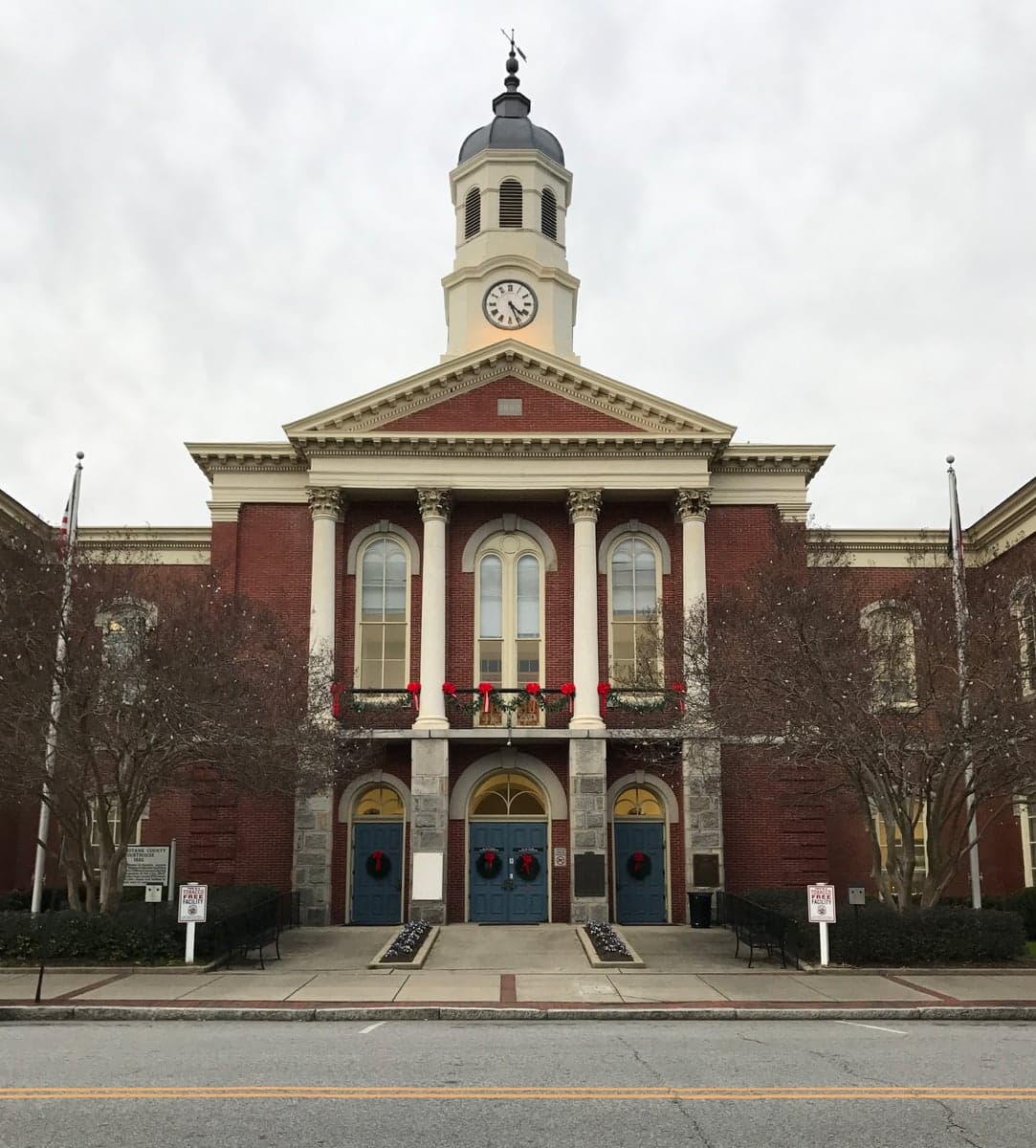
Photo: Wikipedia
Strategic Assessment of Pasquotank County
Meaningful friction. Expect exposure to either population pressure, blast zones, or natural disaster risk. Consider buying a retreat property.
What does the Strategic Assessment tell us?
Our Strategic Assessment grades tactical survivability of an area. Major population centers, military targets, fallout zones, natural disasters, and border exposure all drive risk — lower exposure means a more defensible position in a crisis.
This is heavily inspired by Joel Skousen's Strategic Relocation book. Highly recommended you checkout the book ($)What does this tell us?
Our Strategic Assessment grades tactical survivability of an area. Major population centers, military targets, fallout zones, natural disasters, and border exposure all drive risk — lower exposure means a more defensible position in a crisis.
This is heavily inspired by Joel Skousen's Strategic Relocation book. Highly recommended you checkout the book ($)Strategic Pillars

Key Distances
Strategic Assessment Analysis
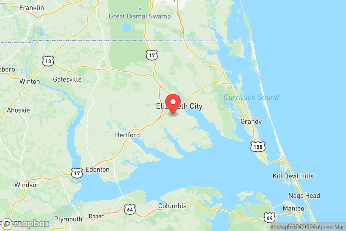
Pasquotank County, anchored by Elizabeth City, offers a resilience profile that is quietly strong: it sits on the protected waters of the Albemarle Sound, roughly 45 miles south of the Hampton Roads metropolitan complex and about 50 miles north of the Outer Banks. The county’s position as a regional hub for northeastern North Carolina means it has the infrastructure of a small city—hospital, college, regional airport—without the concentration of targets that plague larger metros. For a relocator weighing disaster readiness and self-sufficiency, Pasquotank presents a workable balance of access and isolation, though it is not without specific vulnerabilities tied to its coastal geography and nearby military installations.
Geographic position and natural advantages for long-term stability
Pasquotank County’s defining feature is its waterfront location on the Albemarle Sound, the large, shallow estuary that separates the inner coastal plain from the Atlantic. Elizabeth City, the county seat and only municipality of note, sits on the Pasquotank River, which feeds directly into the sound. This positioning provides a natural buffer: the Outer Banks absorb the brunt of Atlantic storms, and the sound’s shallow waters reduce the storm surge that devastates coastal communities further south. The county is also bisected by the Dismal Swamp Canal, a historic waterway that connects to the Intracoastal Waterway, offering a navigable route for evacuation or supply movement that does not depend on road networks.
The land itself is flat, low-lying coastal plain, with elevations rarely exceeding 20 feet above sea level. That flatness is a double-edged sword—it makes the area easy to farm and build on, but it also means drainage is slow and flooding is a recurring concern. The county’s agricultural base, centered on soybeans, corn, and timber from the surrounding pocosin wetlands, provides a local food supply that many urban areas lack. The Great Dismal Swamp National Wildlife Refuge, which spills over from Virginia into the county’s northwest corner, functions as a natural water filter and flood absorber, though it also limits developable land and creates a wildland-urban interface that carries its own fire risk.
Risk exposure and proximity to fallout-relevant landmarks
The most significant man-made risk for Pasquotank County comes from its proximity to military infrastructure. Naval Air Station Oceana, the Navy’s master jet base, lies roughly 50 miles northeast in Virginia Beach, and the Norfolk Naval Shipyard—home to the Atlantic Fleet’s carriers and submarines—is about 55 miles north. In a conflict scenario, these are primary targets, and Pasquotank sits squarely in the fallout corridor for prevailing westerly winds. The county is also home to the U.S. Coast Guard’s Aviation Logistics Center at Elizabeth City’s regional airport, a major maintenance and supply hub for the service’s aircraft. While this base is a significant employer—roughly 3,000 civilian and military personnel—it is also a potential secondary target that a relocator should factor into their planning.
Industrial exposure is comparatively light. The nearest major refinery complex is in the Hampton Roads area, with the Yorktown Refinery about 70 miles north, and there are no nuclear power plants within 100 miles. The county’s own industrial base is modest: a few food processing plants, a plastics manufacturer, and the ubiquitous big-box distribution centers along U.S. Highway 17. The real natural risk is hurricane surge and inland flooding. Hurricane Isabel in 2003 pushed water into Elizabeth City’s downtown, and the 2016 flooding from Hurricane Matthew, while less severe here than further south, demonstrated how slow drainage can turn a moderate rain event into a localized disaster. Sea-level rise is a slow-motion concern; the county’s low elevation means that a one-foot rise in the sound would permanently inundate substantial portions of the waterfront.
Practical resilience for a relocator: food, water, energy, and defensibility
For a family or individual serious about self-sufficiency, Pasquotank County’s practical resilience is above average for the eastern seaboard. The agricultural base means fresh produce, meat, and dairy are available within a short drive—the Elizabeth City Farmers Market operates seasonally, and there are working farms within 10 minutes of downtown. The surrounding waters of the Albemarle Sound and the Pasquotank River offer year-round fishing, crabbing, and waterfowl hunting, though the sound’s brackish water means that freshwater sources require more planning. Municipal water in Elizabeth City comes from the Pasquotank River and is treated at the county’s water plant, but a well-drilling contractor in the county will confirm that the shallow aquifer is generally potable with basic filtration—a meaningful advantage over counties reliant on surface water alone.
Energy resilience is a mixed picture. The county is served by Dominion Energy, and the regional grid is vulnerable to hurricane-related outages; after Isabel, some areas were without power for two weeks. However, the flat terrain and relatively low tree density along the main corridors mean that restoration is generally faster than in the mountainous west. Solar is viable—the county averages about 210 sunny days per year—and there are no restrictive covenants in the unincorporated areas that would prevent a homeowner from installing panels or a backup generator. Propane is widely available through local suppliers like Suburban Propane in Elizabeth City, and firewood is abundant from the surrounding timberlands.
Defensibility is where Pasquotank’s geography works in a relocator’s favor. The county is bounded on the north by the Dismal Swamp and on the east by the sound, creating natural chokepoints on the two main roads in and out: U.S. Highway 17 north to Virginia and U.S. Highway 158 east to the Outer Banks. The interior is a patchwork of small farms and large timber tracts, with long sightlines and few dense population centers. Elizabeth City itself has a population of roughly 18,000, and the county total is about 40,000—small enough that a family can establish a defensible rural property without being isolated from medical care or supply runs. The Sentara Albemarle Medical Center in Elizabeth City is a full-service hospital with a helipad, and the Coast Guard base has its own emergency response capabilities that could be leveraged in a regional crisis.
The overall strategic picture for Pasquotank County is one of moderate resilience with specific, manageable trade-offs. It is not a bug-out location in the mountains, nor is it a fortified inland redoubt; it is a working coastal county that offers a genuine agricultural base, a protected waterway, and a small-city infrastructure hub in Elizabeth City. The primary risks—hurricane flooding and proximity to Hampton Roads military targets—are real but quantifiable, and a relocator who chooses property above the 15-foot contour line and away from the immediate river floodplain can mitigate most of the natural exposure. The military risk is the harder variable to plan around, but it is a trade-off that comes with the county’s economic stability and the steady employment base provided by the Coast Guard. For a family that wants to be close enough to civilization to function but far enough to breathe, Pasquotank County is a defensible choice—provided they go in with eyes open about the water, the wind, and the occasional military overflight.

* Values derived from national, state, county, city and local statistics and may differ in a specific area. Last updated: 2026-10-28T00:27:26.000Z
Narrative content on this page is AI-generated and may contain mistakes. Verify any details that matter before acting on them.
ReloMaps may earn a commission from affiliate links at no extra cost to you.

