
Photo: Wikipedia
Strategic Assessment of Pamlico County
Meaningful friction. Expect exposure to either population pressure, blast zones, or natural disaster risk. Consider buying a retreat property.
What does the Strategic Assessment tell us?
Our Strategic Assessment grades tactical survivability of an area. Major population centers, military targets, fallout zones, natural disasters, and border exposure all drive risk — lower exposure means a more defensible position in a crisis.
This is heavily inspired by Joel Skousen's Strategic Relocation book. Highly recommended you checkout the book ($)What does this tell us?
Our Strategic Assessment grades tactical survivability of an area. Major population centers, military targets, fallout zones, natural disasters, and border exposure all drive risk — lower exposure means a more defensible position in a crisis.
This is heavily inspired by Joel Skousen's Strategic Relocation book. Highly recommended you checkout the book ($)Strategic Pillars

Key Distances
Strategic Assessment Analysis
Pamlico County, North Carolina, offers a strategic relocation option for those prioritizing resilience and self-sufficiency, largely due to its position along the Neuse River and Pamlico Sound—a geography that buffers it from the densest population corridors while still providing access to regional infrastructure. The county seat, Bayboro, and the unincorporated community of Oriental serve as practical anchors, with Oriental’s working waterfront and Bayboro’s county services forming a low-key but functional hub. For a reader weighing disaster readiness, Pamlico County’s combination of rural character, water access, and relative isolation from major metropolitan targets makes it a defensible choice, though not without its own exposure to natural and man-made risks.
Geographic position and natural advantages for long-term security
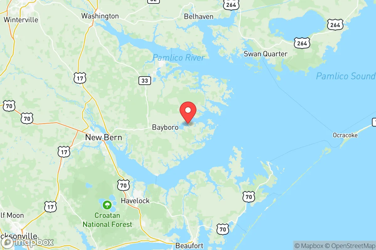
Pamlico County sits on the eastern edge of North Carolina’s Coastal Plain, bordered by the Pamlico Sound to the east and the Neuse River to the south. This location places it roughly 100 miles east of Raleigh and 120 miles northeast of Wilmington, distances that provide meaningful separation from the state’s primary population centers and their associated vulnerabilities—such as the Research Triangle’s concentration of high-tech infrastructure or Wilmington’s port and chemical facilities. The county’s low population density, roughly 13,000 residents across 340 square miles, means fewer targets for disruption and more available land for self-sufficient living. The Neuse River and Pamlico Sound offer abundant fishing and crabbing opportunities, a practical food source that requires no industrial supply chain. The area’s flat terrain and extensive wetlands also create natural barriers to overland movement, which can be an advantage for those seeking defensibility. The county’s position within the larger Pamlico Sound region means it is not directly on the Atlantic coast, reducing exposure to direct hurricane storm surge while still benefiting from maritime resources.
Risks, exposures, and proximity to fallout-relevant landmarks
While Pamlico County avoids the immediate fallout zones of major cities, it is not without strategic risks. The county lies within 50 miles of Marine Corps Base Camp Lejeune in Jacksonville, a major military installation that could be a target in a conflict scenario. Camp Lejeune’s training ranges and ammunition depots represent a potential secondary hazard, though prevailing winds from the southwest would carry fallout away from Pamlico County in most weather patterns. To the north, the Cherry Point Marine Corps Air Station in Havelock is roughly 40 miles away, another potential target. The county’s own infrastructure is minimal: no major refineries, ports, or industrial complexes exist within its borders, which is a net positive for resilience. However, the county’s reliance on the two-lane NC-55 and NC-304 highways for evacuation and supply routes creates a chokepoint vulnerability—any disruption to these roads could isolate the area. The proximity to the Pamlico Sound also means vulnerability to storm surge from major hurricanes, though the sound’s shallow waters moderate surge heights compared to open-ocean exposure. Flooding from heavy rainfall is a more frequent concern, particularly in low-lying areas near Bayboro and Oriental.
Practical resilience for a relocator: food, water, energy, and defensibility
For a relocator focused on self-sufficiency, Pamlico County offers several practical advantages. The county’s agricultural base—primarily soybeans, corn, and wheat—means local food production is a reality, not just a theoretical option. Farmers markets in Bayboro and Oriental provide direct access to fresh produce, and the Neuse River and Pamlico Sound offer year-round seafood. Water availability is strong: the county sits atop the Castle Hayne aquifer, a reliable groundwater source, and many rural properties have private wells. Surface water from the Neuse River is also accessible, though treatment would be necessary. Energy resilience is more mixed. Duke Energy provides grid electricity, but outages from storms are common; solar panel adoption is growing but not yet widespread. The county’s flat terrain and open fields make solar a viable option, and wood-burning stoves are common for heating. Defensibility is a key strength: the county’s network of rural roads, many unpaved, creates natural obstacles for outsiders, and the sparse population means fewer potential threats. The county’s sheriff’s office, based in Bayboro, maintains a visible presence but is small—roughly 20 sworn officers—so community-based security networks are more practical than relying on law enforcement alone. The county’s lack of a major hospital (the nearest is CarolinaEast Medical Center in New Bern, 25 miles away) is a vulnerability for medical emergencies, but the low crime rate and quiet lifestyle offset this for many relocators.
The overall strategic picture for Pamlico County is one of moderate resilience with clear trade-offs. Its geographic isolation from major cities and industrial targets is a genuine advantage, and the abundance of natural resources—water, seafood, farmland—supports long-term self-sufficiency. The proximity to Camp Lejeune and Cherry Point introduces a man-made risk that cannot be ignored, but the county’s position downwind of prevailing winds mitigates the worst-case fallout scenarios. The primary vulnerabilities are natural: hurricane flooding and storm-related infrastructure disruptions. For a relocator willing to invest in solar power, well water, and food storage, Pamlico County offers a defensible, low-profile base that balances access to the coast with meaningful separation from the risks of urban and industrial centers. It is not a fortress, but it is a practical choice for those who value quiet, resourcefulness, and a measured approach to disaster readiness.

* Values derived from national, state, county, city and local statistics and may differ in a specific area. Last updated: 2026-11-05T10:19:56.000Z
Narrative content on this page is AI-generated and may contain mistakes. Verify any details that matter before acting on them.
ReloMaps may earn a commission from affiliate links at no extra cost to you.

