
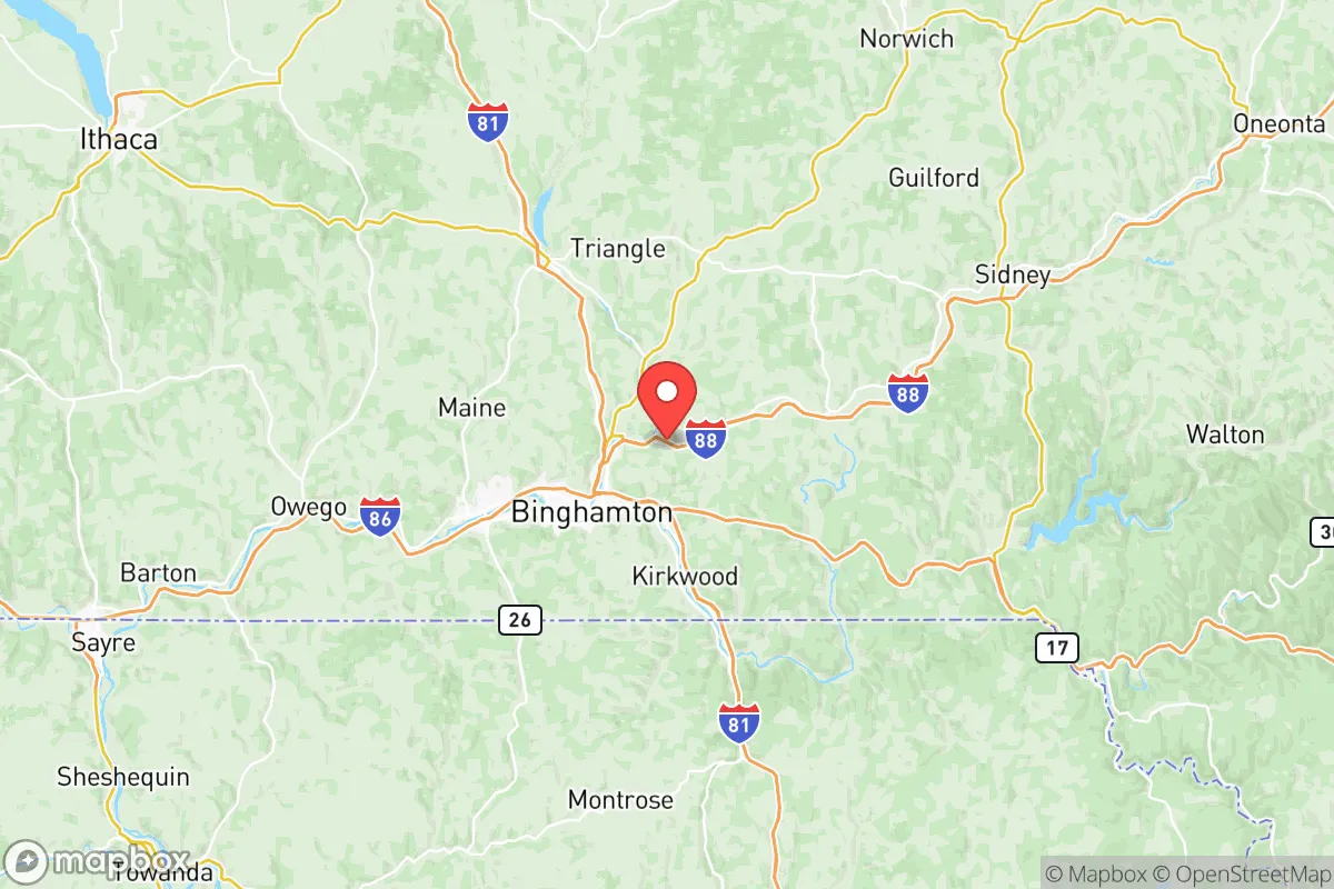
Photo: Wikipedia
Strategic Assessment of Broome County
Meaningful friction. Expect exposure to either population pressure, blast zones, or natural disaster risk. Consider buying a retreat property.
What does the Strategic Assessment tell us?
Our Strategic Assessment grades tactical survivability of an area. Major population centers, military targets, fallout zones, natural disasters, and border exposure all drive risk — lower exposure means a more defensible position in a crisis.
This is heavily inspired by Joel Skousen's Strategic Relocation book. Highly recommended you checkout the book ($)What does this tell us?
Our Strategic Assessment grades tactical survivability of an area. Major population centers, military targets, fallout zones, natural disasters, and border exposure all drive risk — lower exposure means a more defensible position in a crisis.
This is heavily inspired by Joel Skousen's Strategic Relocation book. Highly recommended you checkout the book ($)Strategic Pillars

Key Distances
Strategic Assessment Analysis
Broome County, anchored by the City of Binghamton, offers a strategic blend of geographic insulation and practical resilience that appeals to relocation-minded individuals and families prioritizing preparedness and self-sufficiency. Situated in New York’s Southern Tier, the county sits roughly 75 miles south of Syracuse and 150 miles northwest of New York City—close enough for occasional access to urban resources, yet far enough to avoid the immediate fallout zones and congestion of major metropolitan areas. Its position along the Susquehanna River Valley, surrounded by the rolling hills of the Appalachian Plateau, provides natural defensibility and a temperate climate that supports year-round living without the extremes of more northern or coastal regions.
Geographic position and natural advantages for self-sufficiency
Broome County’s topography is its first line of strategic advantage. The county is defined by the Susquehanna and Chenango River valleys, with elevations rising to over 1,800 feet in the surrounding hills. This terrain creates natural chokepoints and observation points, making the area inherently more defensible than flat, open regions. The county’s 715 square miles include significant forested areas—over 60% of the land is wooded—offering ample cover, firewood, and wildlife for those with hunting or foraging skills. The Susquehanna River, which flows through Binghamton, Endicott, and Johnson City, provides a reliable freshwater source, though its floodplain requires careful site selection. The county’s location in the Southern Tier places it outside the direct path of major hurricane tracks and away from the seismic risks of the New Madrid zone, though minor tremors are possible. Winters bring moderate snowfall (averaging 70-80 inches annually), which supports water tables but also demands robust heating and snow removal plans.
Risks, exposures, and proximity to fallout-relevant landmarks
While Broome County avoids the highest-risk zones, it is not without exposure. The most significant man-made risk comes from the NYSEG (New York State Electric & Gas) natural gas compressor station in the Town of Kirkwood, a critical node in the regional energy grid. A failure or attack here could disrupt natural gas supply to thousands of homes. Additionally, the Binghamton-Johnson City Wastewater Treatment Plant on the Susquehanna is a potential contamination point during flooding or infrastructure collapse. The county is also within 100 miles of the Nine Mile Point Nuclear Generating Station in Oswego County—a distance that, while not in the immediate blast zone, places it within a plausible fallout plume corridor depending on wind patterns. Closer to home, the Broome County Airport in Johnson City and the Binghamton Rail Yard are moderate targets for disruption, though neither is a high-value military objective. On the natural hazard side, the Susquehanna River has a history of severe flooding—most notably in 2006 and 2011—with the downtown Binghamton flood wall providing protection only up to a 100-year event. The county’s hilly terrain also creates localized landslide risks in areas like the Town of Union and the Village of Endicott. Overall, Broome County’s risk profile is moderate: it avoids the extreme fallout dangers of a major city or military base, but residents should plan for infrastructure disruptions tied to energy and water systems.
Practical resilience for a relocator: food, water, energy, and defensibility
For a relocator focused on self-sufficiency, Broome County offers several practical advantages. Water access is strong: the Susquehanna and Chenango Rivers, along with numerous smaller creeks and groundwater wells, provide multiple sources. However, surface water requires filtration or boiling due to agricultural runoff and upstream industrial history (e.g., IBM’s legacy contamination in Endicott). The county’s agricultural capacity is solid but not abundant: there are roughly 400 farms, mostly dairy and livestock, with significant corn and hay production. The Binghamton Farmers Market and local CSAs (e.g., at the Broome County Regional Farmers Market) offer seasonal produce, but year-round food independence would require greenhouse investment or stockpiling. Energy resilience is mixed: the grid is served by NYSEG, with natural gas and electricity widely available, but rural areas (e.g., the Towns of Sanford or Colesville) are prone to outages during ice storms. Solar potential is moderate—the region averages 160 sunny days per year, below the national average—but micro-hydro on smaller streams is viable for off-grid setups. Wood heating is common and practical, given the forest cover. Defensibility is high in the hillier towns like Windsor, Barker, and Nanticoke, where narrow roads and dense woods create natural barriers. The county’s population density (roughly 200 people per square mile) means most areas are sparsely populated enough to avoid the chaos of urban collapse, yet dense enough to offer community support. The presence of Lourdes Hospital in Binghamton and UHS Wilson Medical Center in Johnson City provides medical backup within 30 minutes for most residents, though these facilities would be stressed in a major event.
The overall strategic picture for Broome County is one of balanced resilience. It is not a hardened bunker location, nor is it a high-risk urban center. For a family or individual seeking a place that combines moderate natural hazards, manageable man-made risks, and practical self-sufficiency options, the county offers a solid foundation. The key trade-offs are clear: you gain geographic insulation and defensible terrain, but you must plan for seasonal flooding, winter energy demands, and the need to treat surface water. The proximity to smaller cities like Binghamton and Johnson City provides a buffer of resources—hardware stores, medical facilities, and local food networks—without the fallout risks of a major metro. For the strategic-minded relocator, Broome County is a viable middle-ground option that rewards preparation without demanding extreme measures.

* Values derived from national, state, county, city and local statistics and may differ in a specific area. Last updated: 2026-06-16T00:36:40.000Z
Narrative content on this page is AI-generated and may contain mistakes. Verify any details that matter before acting on them.
ReloMaps may earn a commission from affiliate links at no extra cost to you.

