
Photo: Wikipedia
Strategic Assessment of Cheshire County
Meaningful friction. Expect exposure to either population pressure, blast zones, or natural disaster risk. Consider buying a retreat property.
What does the Strategic Assessment tell us?
Our Strategic Assessment grades tactical survivability of an area. Major population centers, military targets, fallout zones, natural disasters, and border exposure all drive risk — lower exposure means a more defensible position in a crisis.
This is heavily inspired by Joel Skousen's Strategic Relocation book. Highly recommended you checkout the book ($)What does this tell us?
Our Strategic Assessment grades tactical survivability of an area. Major population centers, military targets, fallout zones, natural disasters, and border exposure all drive risk — lower exposure means a more defensible position in a crisis.
This is heavily inspired by Joel Skousen's Strategic Relocation book. Highly recommended you checkout the book ($)Strategic Pillars

Key Distances
Strategic Assessment Analysis
Cheshire County, New Hampshire, offers a compelling strategic profile for the relocation-minded reader prioritizing resilience and self-sufficiency. Its location in the southwestern corner of the state, bordering both Vermont and Massachusetts, provides a unique blend of rural seclusion and practical access to regional resources, all while remaining well outside the primary fallout zones of major metropolitan areas. The county’s economic and demographic stability, anchored by the city of Keene and the college town of Swanzey, presents a low-key, defensible base for those serious about long-term preparedness.
Geographic position and natural advantages for long-term security
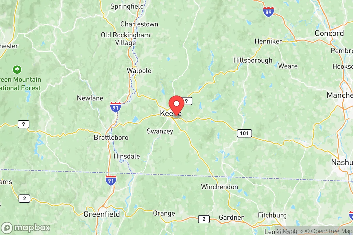
Cheshire County’s geography is its primary strategic asset. The county is defined by the Connecticut River Valley, which forms its western border with Vermont, and the rising foothills of the Monadnock Region to the east. This terrain—a mix of fertile valley floors, forested hills, and numerous small lakes and ponds—offers natural defensibility and resource abundance. The presence of Mount Monadnock itself, a prominent landmark near Jaffrey, provides a high-ground vantage point and a reliable source of spring-fed streams. The county’s position places it roughly 80 miles from the Boston metropolitan area and over 150 miles from New York City, distances that significantly reduce exposure to the immediate blast, fire, and fallout effects of a major urban or industrial event. Unlike areas closer to the I-95 corridor, Cheshire County is not a primary target for strategic strikes, nor is it a major transit corridor for military or industrial convoys. The region’s natural water supply is robust, with the Connecticut River and its tributaries (the Ashuelot, the Cold, and the Otter Brook) providing reliable surface water, while the underlying bedrock aquifers support deep wells for those who drill them. The climate, while featuring harsh winters, also ensures adequate annual precipitation (roughly 40-45 inches) for rain catchment and gardening, a key advantage over drier western states.
Risks, exposures, and proximity to fallout-relevant landmarks
While Cheshire County is far from the highest-risk zones, it is not immune to man-made and natural threats. The most significant man-made risk is the Vermont Yankee Nuclear Power Plant in Vernon, Vermont, located directly across the Connecticut River from the town of Hinsdale. Though the plant ceased power generation in 2014, it remains in decommissioning, with spent nuclear fuel stored on-site in dry casks. A major accident or deliberate attack on this facility could pose a localized fallout hazard, particularly for communities within a 10- to 20-mile radius downwind. The county is also within the broader fallout plume zone of a major event at the Seabrook Station nuclear plant in New Hampshire (about 70 miles east) or the Pilgrim plant in Massachusetts (about 90 miles southeast), though the risk diminishes significantly with distance. On the natural hazard side, the region is seismically quiet but not inactive; the 2012 M 4.0 earthquake near Hollis Center, Maine was felt across the county, and the area sits atop the Merrimack Valley seismic zone, capable of producing a moderate (M 5.0-6.0) event. Flooding is the most common natural risk, particularly along the Ashuelot River in Keene and the Connecticut River in Hinsdale and Winchester. Ice storms and heavy snow events are annual occurrences, capable of downing power lines for days or weeks, which tests the resilience of any off-grid or backup power setup. There are no major military bases, refineries, or chemical plants within the county, which is a net positive for a relocator seeking to avoid collateral damage from a targeted strike or industrial accident.
Practical resilience for a relocator: food, water, energy, and defensibility
For the individual or family serious about self-sufficiency, Cheshire County offers a strong practical foundation. Food security is achievable: the Connecticut River Valley contains some of the most productive agricultural soil in New England, with numerous small farms, orchards, and community-supported agriculture (CSA) operations in towns like Walpole and Surry. The growing season is short (roughly 120-140 frost-free days) but productive for cold-hardy crops, and the county has a robust network of farmers' markets and local food co-ops, including the Keene Food Co-op. Water security is excellent: most rural properties can be drilled for a well, and surface water is abundant. The key is proper filtration and storage, as surface water may carry agricultural runoff or be contaminated in a fallout event. Energy resilience is a mixed picture. The county is served by Eversource and the New Hampshire Electric Cooperative, both of which have improved grid hardening but remain vulnerable to ice storms. Solar potential is moderate (roughly 4.0-4.5 peak sun hours per day), making a grid-tied solar system with battery backup a viable option, especially with state incentives. Wood heat is a practical and culturally accepted primary or backup heat source, with abundant firewood available from the county’s extensive forests. Defensibility is a strong point: the terrain—narrow valleys, wooded hills, and limited major roads—creates natural chokepoints. The county’s population density is low (roughly 100 people per square mile in the rural towns, compared to over 1,200 in Keene), meaning that a relocator can find a property with good visibility, limited neighbors, and multiple egress routes. The local culture is one of quiet independence, with a strong tradition of hunting, fishing, and small-scale farming, which aligns well with a preparedness mindset.
The overall strategic picture for Cheshire County is one of balanced, low-profile resilience. It is not a hardened bunker or a remote wilderness, but a livable, functional region where a prepared individual or family can establish a sustainable base. The primary trade-off is between proximity to resources (Keene provides hospitals, hardware stores, and supply chains) and the inherent risks of being near a decommissioned nuclear plant and within a few hours’ drive of major population centers. For the relocator who values practical self-sufficiency over absolute isolation, Cheshire County offers a defensible, water-rich, and agriculturally viable environment that is far enough from the highest-risk targets to provide genuine strategic depth, while still being connected enough to maintain a normal life. The key is to choose a property with good southern solar exposure, a reliable well, and a location on high ground away from the major river floodplains—and to accept that the winters will test your resolve as much as your preparedness.

* Values derived from national, state, county, city and local statistics and may differ in a specific area. Last updated: 2026-07-12T04:42:18.000Z
Narrative content on this page is AI-generated and may contain mistakes. Verify any details that matter before acting on them.
ReloMaps may earn a commission from affiliate links at no extra cost to you.

