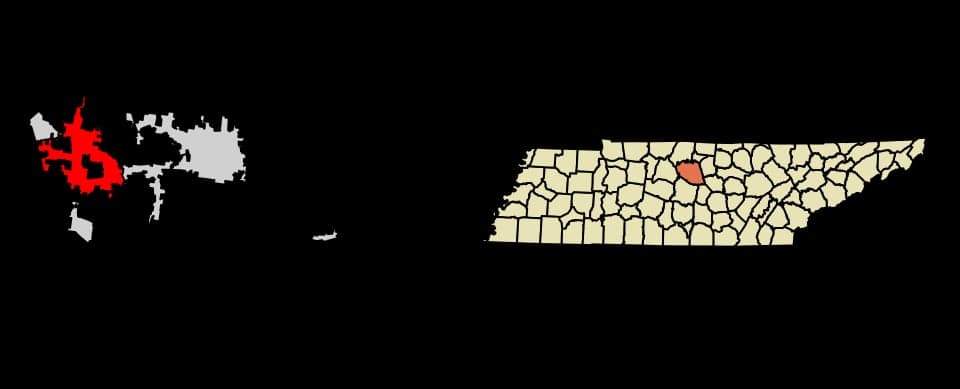
Photo: Wikipedia
Strategic Assessment of Mt. Juliet, TN
Meaningful friction. Expect exposure to either population pressure, blast zones, or natural disaster risk. Consider buying a retreat property.
What does the Strategic Assessment tell us?
Our Strategic Assessment grades tactical survivability of an area. Major population centers, military targets, fallout zones, natural disasters, and border exposure all drive risk — lower exposure means a more defensible position in a crisis.
This is heavily inspired by Joel Skousen's Strategic Relocation book. Highly recommended you checkout the book ($)What does this tell us?
Our Strategic Assessment grades tactical survivability of an area. Major population centers, military targets, fallout zones, natural disasters, and border exposure all drive risk — lower exposure means a more defensible position in a crisis.
This is heavily inspired by Joel Skousen's Strategic Relocation book. Highly recommended you checkout the book ($)Strategic Pillars

Key Distances
Regional Safe Places
Below is our recommended "safe zones" in Tennessee and the surrounding area based on our strategic heuristics. For most people, it's unrealistic to live in a “safe zone” full-time due to work, family or other personal reasons. They tend to be more rural. However, many of these areas are perfect for second homes and retreat properties that double as a vacation home or even a short-term rental.
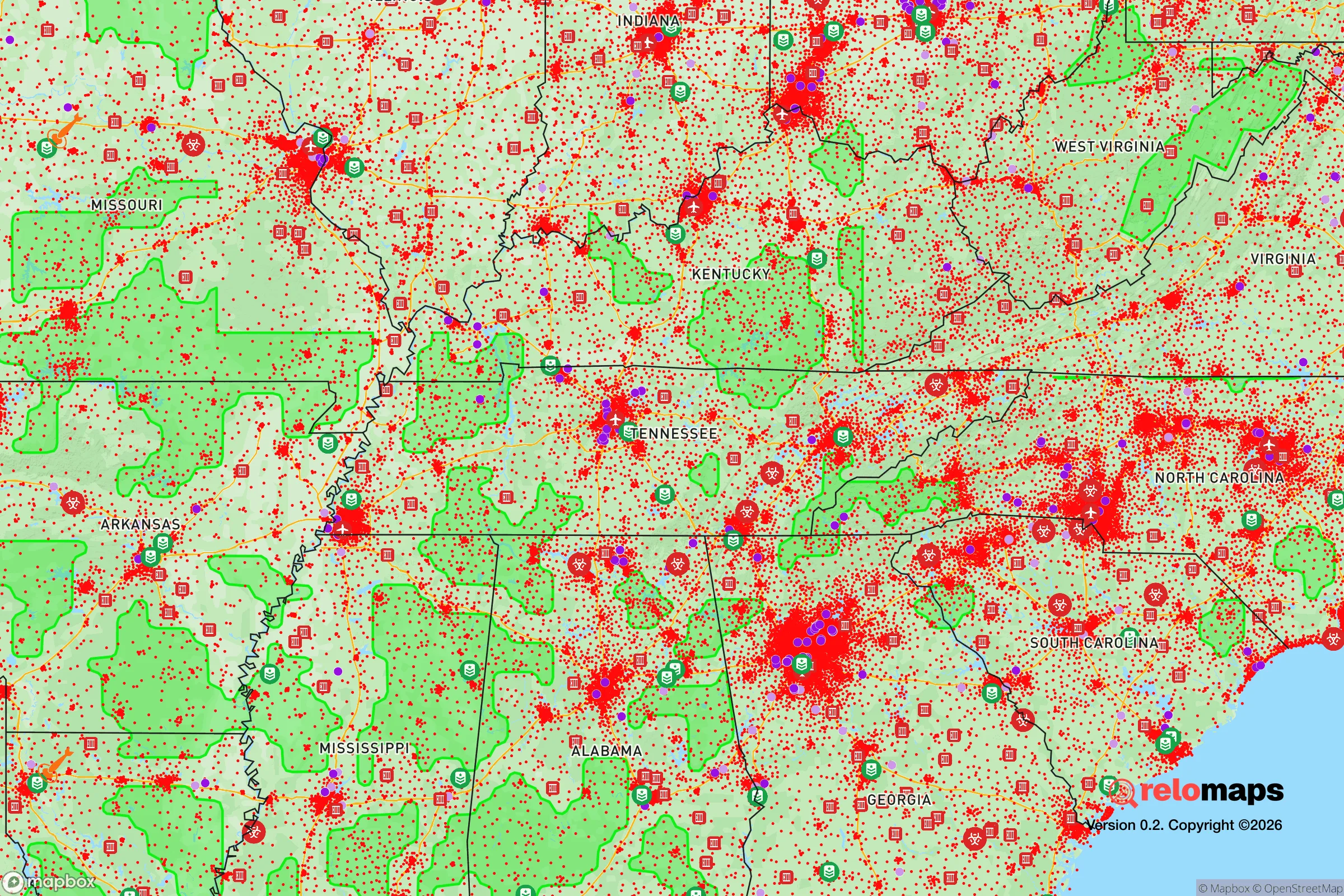
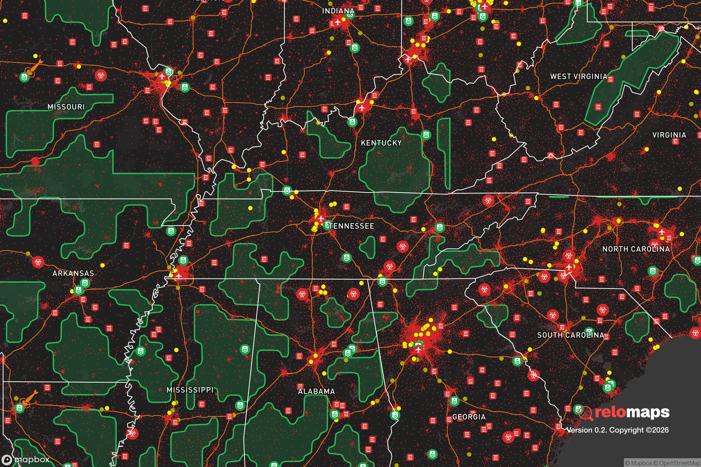


Important Note: For informational purposes only. This does not mean nothing bad ever happens in the green zones. Please use common sense. This is based on public data and modeled with AI. We tried to take a conservative approach but mistakes happen. We update this regularly as new information becomes available.
Solar Generator Recommendations
Backup power matters more here than in safer locations. We've picked three solar generators across budgets and capacity tiers — start with the budget unit if you only need a few essentials, or step up if you want to run a fridge and HVAC for days at a time.

Jackery Portable Power Station Explorer 300
Budget OptionPower on the Go: Weighing only 11 lbs, it's convenient to set up and store with book-sized foldable solar panels

BLUETTI Portable Power Station AC180
Designed for both indoor and outdoor scenarios, AC180 is highly capable as it has a robost capacity and continuous output power.

EF ECOFLOW DELTA Pro Ultra Power Station
Upgraded PickEcoFlow DELTA Pro Ultra is a whole-home energy system designed to grow with your family. Integrated with the Smart Home Panel 2, it scales to meet your evolving energy needs — keeping your home powered, intelligent, and secure through every stage of life.
We earn a commission, at no additional cost to you.
Strategic Assessment Analysis
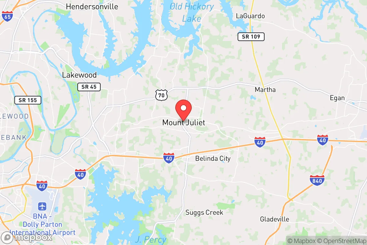
Mt. Juliet, Tennessee, sits in a genuinely strong position for a relocator thinking about resilience, offering a mix of geographic stability, moderate distance from major urban fallout zones, and a growing local infrastructure that supports self-sufficiency. Located in Wilson County, roughly 17 miles east of downtown Nashville, the city benefits from being close enough to metropolitan resources but far enough to avoid the worst of a regional crisis. The area's topography, climate patterns, and development trajectory make it a defensible choice for families and individuals who want a suburban lifestyle without completely severing ties to urban supply chains.
Geographic position and natural advantages for long-term stability
Mt. Juliet's location on the eastern edge of the Nashville Basin gives it a meaningful edge over many other Sun Belt relocation targets. The terrain is gently rolling rather than mountainous, which means fewer landslide risks and more buildable land for those looking to add outbuildings, gardens, or water catchment systems. The Cumberland River flows roughly 10 miles to the west, providing a regional water source, but Mt. Juliet itself sits above the floodplain in most areas, reducing the flood exposure that plagues riverfront communities like nearby Hendersonville or Clarksville.
The climate is another quiet advantage. Middle Tennessee experiences all four seasons but avoids the extremes of the Deep South and the Upper Midwest. Winter lows rarely stay below freezing for extended stretches, which keeps infrastructure stress low, while summer heat is manageable compared to Texas or Florida. Tornado risk exists—Wilson County sits on the western edge of Dixie Alley—but the local terrain and the city's inland position mean that hurricane storm surge, saltwater intrusion, and coastal evacuation chaos are non-factors. For a resilience-minded relocator, the region's agricultural capacity is also notable: Tennessee has over 10 million acres of farmland, and Wilson County itself retains significant rural acreage just outside the suburban core, meaning local food production is a realistic option rather than a theoretical one.
Risks, exposures, and proximity to fallout-relevant landmarks
The primary strategic weakness for Mt. Juliet is its proximity to Nashville, a major metropolitan hub with significant infrastructure that could become a liability in a crisis. The city sits within the blast-and-fallout radius of several high-value targets: Nashville International Airport (BNA) is roughly 15 miles west, the Tennessee Valley Authority's Cumberland Fossil Plant is about 30 miles northwest, and the city's role as a regional logistics hub means rail yards, interstate bridges, and fuel depots are all within a 20-mile radius. In a nuclear exchange scenario, prevailing westerly winds would carry fallout from a Nashville strike directly toward Mt. Juliet, making the city a downwind exposure zone rather than a safe haven.
Beyond nuclear concerns, the area faces more mundane but more probable risks. The New Madrid Seismic Zone, roughly 200 miles west, has a history of major earthquakes—the 1811-1812 sequence was among the largest in U.S. history—and a repeat event would likely damage infrastructure across the region, including the I-40 corridor that connects Mt. Juliet to Nashville. Tornadoes are a recurring seasonal threat, with Wilson County averaging several warnings each spring. The 2020 Easter tornado outbreak demonstrated this vulnerability, with an EF-3 tornado passing within a few miles of Mt. Juliet's northern boundary. Additionally, the city's rapid growth—population has roughly doubled since 2010—has strained local infrastructure, and new developments are increasingly built on former farmland with less mature drainage systems, raising localized flash-flood risks during intense summer storms.
Practical resilience for a relocator: food, water, energy, and defensibility
For the individual or family actually moving to Mt. Juliet, the practical resilience picture is mixed but generally favorable. The city's water supply comes from the Cumberland River via the Wilson County Water Authority, which means a single-source dependency that could be compromised by upstream industrial accidents or prolonged power outages. However, the area's relatively high water table and clay soils make private wells viable on larger lots, and the region's average annual rainfall of about 48 inches means rainwater catchment is a practical supplement for non-potable uses. A relocator serious about water security should budget for a well-drilling project or a substantial cistern system, as municipal supply is the weak link.
Food security is a stronger suit. Wilson County has active farmers markets in Lebanon and Mt. Juliet, and the surrounding rural areas support livestock, orchards, and row crops. The growing season runs roughly 210 days, from early April to late October, which allows for meaningful home food production. The city's zoning allows backyard chickens and small livestock on standard residential lots, and several local farms offer CSA shares. For long-term storage, the proximity to Nashville's wholesale food distributors is a double-edged sword—it provides supply diversity but also means the local grocery network is dependent on the same interstate corridors that would be disrupted in a regional emergency.
Energy resilience is improving but not yet robust. The Tennessee Valley Authority provides electricity, and the grid is generally reliable, but the region has experienced multi-day outages during severe storms. Natural gas is the dominant home heating source, which is a vulnerability if pipeline infrastructure is compromised. Solar adoption is growing, and Wilson County's net metering policies make rooftop solar a reasonable investment, though the upfront cost remains significant. For defensibility, Mt. Juliet's suburban layout is a mixed bag: the newer developments are typically cul-de-sac designs with limited entry points, which is good for neighborhood security, but the city's position along I-40 means it's a natural corridor for evacuation traffic and potential unrest from Nashville in a collapse scenario. The Wilson County Sheriff's Office maintains a strong presence, and the local gun culture is robust, with several shooting ranges and firearms retailers in the area, which aligns with a self-sufficiency mindset.
Overall, Mt. Juliet offers a solid but not exceptional resilience profile for a relocator. The geographic advantages—moderate climate, low flood risk, agricultural surroundings, and distance from coastal threats—are genuine and should not be discounted. The primary vulnerabilities are the proximity to Nashville's target-rich environment, the single-source municipal water dependency, and the area's growing population density, which erodes the self-sufficiency potential that existed a decade ago. For a family willing to invest in well water, solar capacity, and food storage, Mt. Juliet can be a defensible long-term base. For someone expecting a prepper's paradise, the suburban reality will disappoint. The city is best understood as a balanced middle ground: close enough to urban resources to be practical, far enough to avoid the worst of a regional crisis, and grounded in a community that still values self-reliance. It is not a bunker, but it is a reasonable place to build one.

* Values derived from national, state, county, city and local statistics and may differ in a specific area. Last updated: 2026-10-09T04:27:40.000Z
Narrative content on this page is AI-generated and may contain mistakes. Verify any details that matter before acting on them.
ReloMaps may earn a commission from affiliate links at no extra cost to you.

