Photo: Wikipedia
Strategic Assessment of Morro Bay, CA
Multiple tactical vulnerabilities. Population density, target proximity, or disaster risk are likely compounding. A retreat property and exit planning is required.
What does the Strategic Assessment tell us?
Our Strategic Assessment grades tactical survivability of an area. Major population centers, military targets, fallout zones, natural disasters, and border exposure all drive risk — lower exposure means a more defensible position in a crisis.
This is heavily inspired by Joel Skousen's Strategic Relocation book. Highly recommended you checkout the book ($)What does this tell us?
Our Strategic Assessment grades tactical survivability of an area. Major population centers, military targets, fallout zones, natural disasters, and border exposure all drive risk — lower exposure means a more defensible position in a crisis.
This is heavily inspired by Joel Skousen's Strategic Relocation book. Highly recommended you checkout the book ($)Strategic Pillars

Key Distances
Regional Safe Places
Below is our recommended "safe zones" in California and the surrounding area based on our strategic heuristics. For most people, it's unrealistic to live in a “safe zone” full-time due to work, family or other personal reasons. They tend to be more rural. However, many of these areas are perfect for second homes and retreat properties that double as a vacation home or even a short-term rental.




Important Note: For informational purposes only. This does not mean nothing bad ever happens in the green zones. Please use common sense. This is based on public data and modeled with AI. We tried to take a conservative approach but mistakes happen. We update this regularly as new information becomes available.
Solar Generator Recommendations
Backup power matters more here than in safer locations. We've picked three solar generators across budgets and capacity tiers — start with the budget unit if you only need a few essentials, or step up if you want to run a fridge and HVAC for days at a time.

Jackery Portable Power Station Explorer 300
Budget OptionPower on the Go: Weighing only 11 lbs, it's convenient to set up and store with book-sized foldable solar panels

BLUETTI Portable Power Station AC180
Designed for both indoor and outdoor scenarios, AC180 is highly capable as it has a robost capacity and continuous output power.

EF ECOFLOW DELTA Pro Ultra Power Station
Upgraded PickEcoFlow DELTA Pro Ultra is a whole-home energy system designed to grow with your family. Integrated with the Smart Home Panel 2, it scales to meet your evolving energy needs — keeping your home powered, intelligent, and secure through every stage of life.
We earn a commission, at no additional cost to you.
Strategic Assessment Analysis
Morro Bay, California, presents a complex strategic picture for the relocation-minded reader focused on resilience and self-sufficiency. Its location on the Central Coast offers a rare combination of natural defensive barriers and access to critical resources, but it sits within a state with high population density, significant seismic risk, and proximity to major metropolitan and military targets. For a conservative-leaning individual or family weighing long-term security, Morro Bay is not a bunker—it is a calculated trade-off between genuine geographic advantages and unavoidable exposure to California's systemic vulnerabilities.
Geographic position and natural defensive advantages
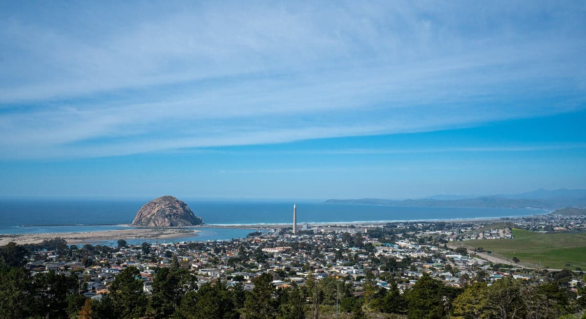
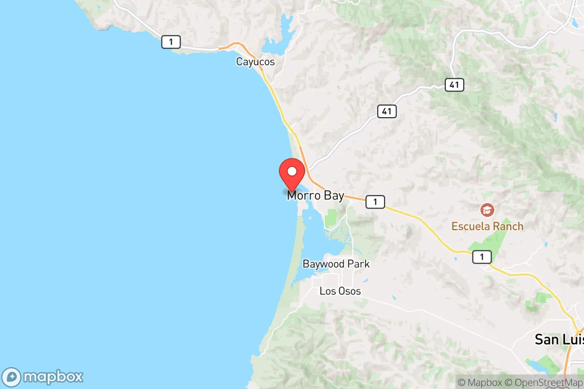
Morro Bay's primary strategic asset is its position on a relatively narrow coastal strip, flanked by the Pacific Ocean to the west and the Santa Lucia Range to the east. This creates a natural chokepoint: the only major road access is via Highway 1 north to Monterey or south to San Luis Obispo, and Highway 41 east over the coastal range. In a grid-down or evacuation scenario, these routes are vulnerable to landslides, earthquake damage, or simple congestion, but they also mean the area is not a natural thoroughfare for large-scale population movement. The surrounding Los Padres National Forest and the Carrizo Plain National Monument to the east provide a buffer of sparsely populated public land, reducing the likelihood of urban sprawl encroachment. The marine layer and coastal fog moderate temperatures year-round, which reduces the risk of extreme heat events and lowers water demand compared to inland California communities. The bay itself, protected by the Morro Rock formation, offers a natural harbor that could support small-scale maritime resupply or fishing operations—a significant advantage for food security that inland towns lack.
Risks, exposures, and proximity to fallout-relevant landmarks
The most serious risk for Morro Bay is seismic activity. The area lies near the San Andreas Fault system, with the Hosgri Fault running just offshore. A major earthquake (7.0+) could sever Highway 1 and Highway 41 simultaneously, isolating the town for days or weeks. Liquefaction risk is high in the low-lying areas around the bay and the estuary, which includes much of the commercial district and the harbor. Tsunami risk is real but limited: the bay's shape and the offshore reef provide some attenuation, but a distant-source tsunami (e.g., from Alaska or Japan) could still produce dangerous currents and flooding in the harbor area. The Diablo Canyon Power Plant, located roughly 12 miles northwest of Morro Bay, is a critical consideration. While the plant is scheduled for decommissioning by 2030, it remains operational and stores spent nuclear fuel on-site. In a worst-case seismic event or a targeted attack, the plant's proximity introduces a low-probability but high-consequence fallout risk. Prevailing winds blow from the northwest, which would carry any airborne contamination toward the southeast—directly over San Luis Obispo and inland areas, not over Morro Bay itself, but the psychological and logistical impact of a nearby nuclear incident cannot be ignored. Additionally, Vandenberg Space Force Base, approximately 60 miles south, is a high-value military target. While the distance provides some safety, a kinetic or cyber attack on the base could disrupt regional communications and power grids. The broader Central Coast is also a corridor for drug trafficking and illegal immigration, which can strain local law enforcement and emergency services during a crisis.
Practical resilience for a relocator: food, water, energy, and defensibility
Morro Bay's practical resilience is a mixed bag. Water is the most critical concern. The area relies on the State Water Project and local groundwater, both of which are under increasing stress from drought and over-allocation. The city has a desalination plant feasibility study underway, but as of 2026, no operational facility exists. A relocator should plan for rainwater catchment and storage, as annual rainfall averages only 20 inches, concentrated in winter months. Food is a relative strength. The commercial fishing fleet in Morro Bay is one of the last active harbors on the California coast, landing albacore, rockfish, and Dungeness crab. Local farmers' markets and CSAs are robust, and the surrounding Paso Robles wine country and agricultural valleys produce a wide variety of crops. However, the region is not a grain basket—most staple crops (wheat, corn, rice) are imported from the Central Valley or outside the state. For a family aiming for self-sufficiency, the growing season is long (March through November) but limited by fog and cool temperatures; warm-season crops like tomatoes and peppers require careful site selection or greenhouse assistance. Energy is a bright spot. The area has significant wind and solar potential, and the Diablo Canyon plant provides a stable baseload for the regional grid. A relocator with a solar-plus-battery system can achieve near-total energy independence, though permitting in coastal zones can be restrictive. Defensibility is moderate. The town's layout—a narrow strip between the bay and the hills—means that a determined group could control access points, but the population (roughly 10,000) is too large for a single community to effectively secure. The local sheriff's office and police department are professional but under-resourced for a prolonged crisis. The broader community leans politically moderate to conservative relative to coastal California, with a strong libertarian streak among fishermen and retirees, which can foster a culture of mutual aid rather than dependency on government. Gun ownership is common but not universal; the county has a "shall issue" concealed carry policy, and there are no local magazine capacity or assault weapon bans beyond state law.
The overall strategic picture for Morro Bay is one of constrained viability. It offers genuine advantages—a temperate climate, a working harbor, defensible terrain, and a community with a practical, independent mindset—that are rare on the California coast. But it is not a retreat from risk. The seismic threat is real and recurring, the water supply is precarious, and the proximity to Diablo Canyon and Vandenberg introduces low-probability but high-consequence man-made hazards. For a relocator who is willing to invest in off-grid water and energy systems, build local relationships, and accept that a major earthquake could isolate the town for weeks, Morro Bay is a defensible coastal option. For someone seeking absolute security from natural disasters or societal collapse, the Central Coast is not that place—no coastal California town is. The honest assessment is that Morro Bay is a calculated compromise: better than most of the state for resilience, but still within the blast radius of California's systemic vulnerabilities.

* Values derived from national, state, county, city and local statistics and may differ in a specific area. Last updated: 2026-09-20T22:01:51.000Z
Narrative content on this page is AI-generated and may contain mistakes. Verify any details that matter before acting on them.
ReloMaps may earn a commission from affiliate links at no extra cost to you.

