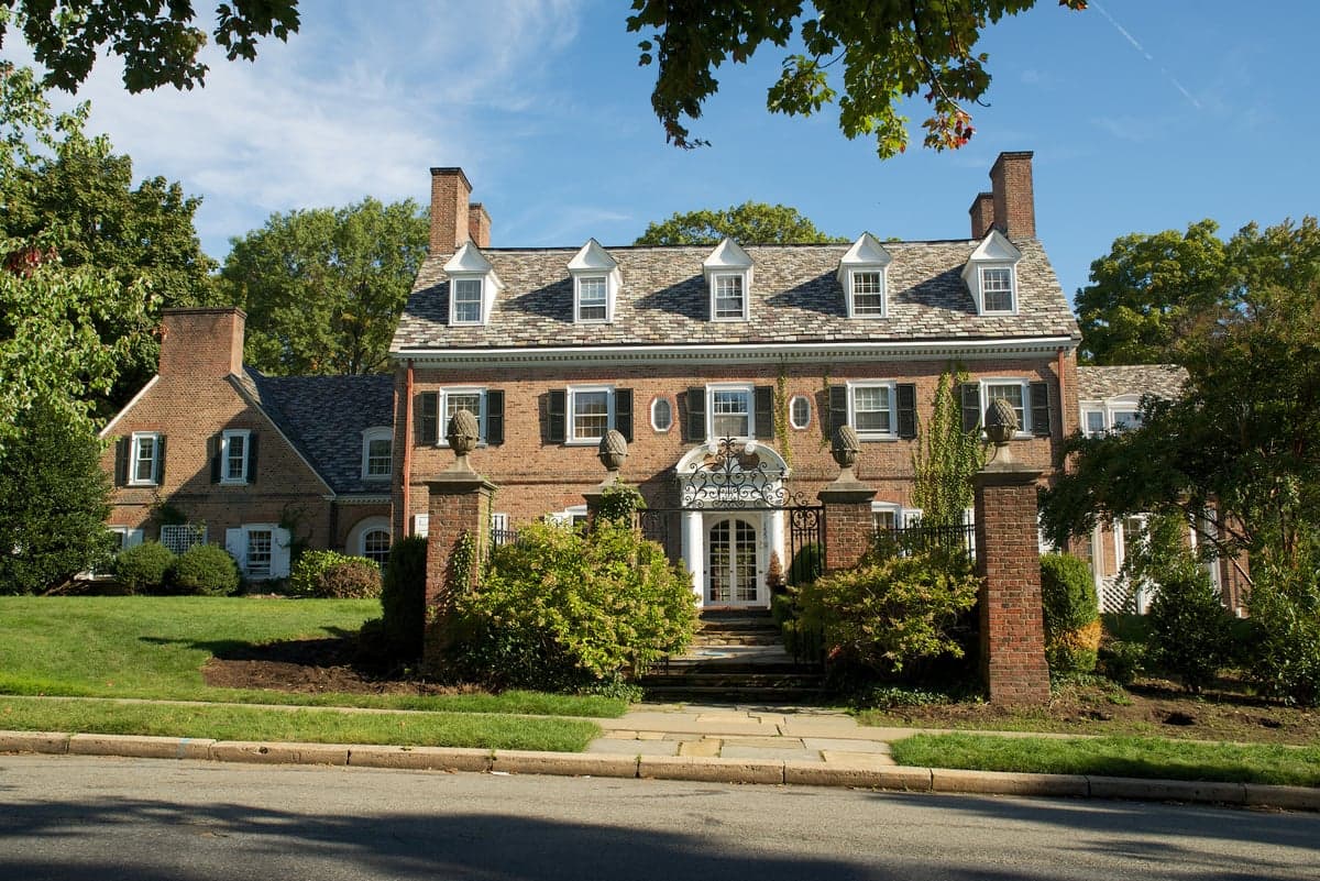
Photo: Wikipedia
Strategic Assessment of Montclair, NJ
Meaningful friction. Expect exposure to either population pressure, blast zones, or natural disaster risk. Consider buying a retreat property.
What does the Strategic Assessment tell us?
Our Strategic Assessment grades tactical survivability of an area. Major population centers, military targets, fallout zones, natural disasters, and border exposure all drive risk — lower exposure means a more defensible position in a crisis.
This is heavily inspired by Joel Skousen's Strategic Relocation book. Highly recommended you checkout the book ($)What does this tell us?
Our Strategic Assessment grades tactical survivability of an area. Major population centers, military targets, fallout zones, natural disasters, and border exposure all drive risk — lower exposure means a more defensible position in a crisis.
This is heavily inspired by Joel Skousen's Strategic Relocation book. Highly recommended you checkout the book ($)Strategic Pillars

Key Distances
Regional Safe Places
Below is our recommended "safe zones" in New Jersey and the surrounding area based on our strategic heuristics. For most people, it's unrealistic to live in a “safe zone” full-time due to work, family or other personal reasons. They tend to be more rural. However, many of these areas are perfect for second homes and retreat properties that double as a vacation home or even a short-term rental.
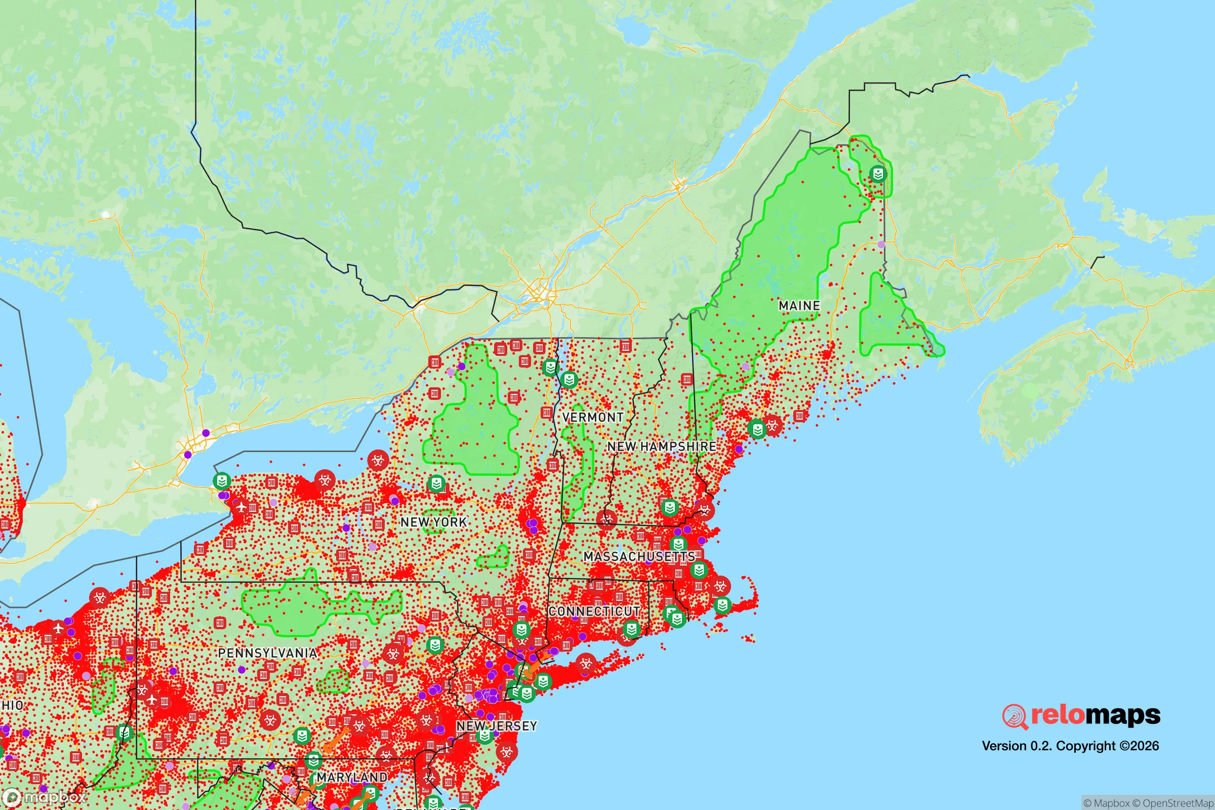
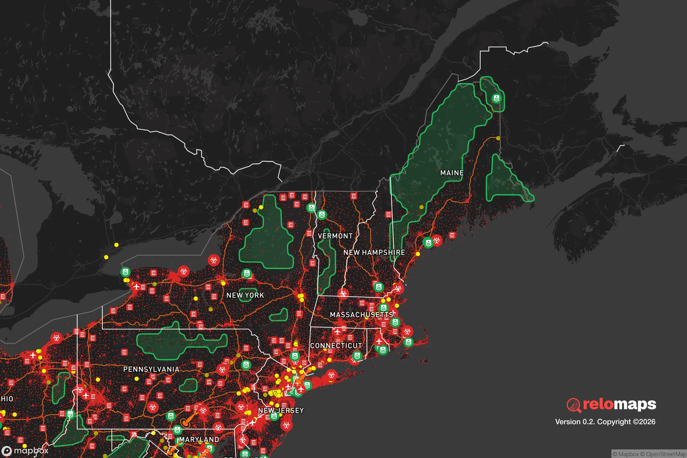


Important Note: For informational purposes only. This does not mean nothing bad ever happens in the green zones. Please use common sense. This is based on public data and modeled with AI. We tried to take a conservative approach but mistakes happen. We update this regularly as new information becomes available.
Solar Generator Recommendations
Backup power matters more here than in safer locations. We've picked three solar generators across budgets and capacity tiers — start with the budget unit if you only need a few essentials, or step up if you want to run a fridge and HVAC for days at a time.

Jackery Portable Power Station Explorer 300
Budget OptionPower on the Go: Weighing only 11 lbs, it's convenient to set up and store with book-sized foldable solar panels

BLUETTI Portable Power Station AC180
Designed for both indoor and outdoor scenarios, AC180 is highly capable as it has a robost capacity and continuous output power.

EF ECOFLOW DELTA Pro Ultra Power Station
Upgraded PickEcoFlow DELTA Pro Ultra is a whole-home energy system designed to grow with your family. Integrated with the Smart Home Panel 2, it scales to meet your evolving energy needs — keeping your home powered, intelligent, and secure through every stage of life.
We earn a commission, at no additional cost to you.
Strategic Assessment Analysis
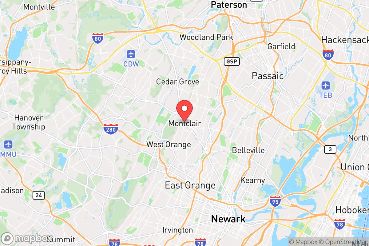
Montclair, New Jersey, presents a complex strategic picture for the relocation-minded individual or family prioritizing resilience and self-sufficiency. While its immediate proximity to New York City (roughly 12 miles west of Manhattan) is a clear liability in a major crisis scenario, the town's specific geographic and infrastructural characteristics offer a few counterbalancing advantages that a serious preparedness-minded relocator should weigh carefully. The key is understanding that Montclair is not a remote retreat but a densely populated suburban node with both unique defensive attributes and significant exposure to cascading regional risks.
Geographic position and natural advantages for a preparedness-minded relocator
Montclair sits atop the Watchung Mountains, a series of volcanic ridges that provide the town with its most notable natural asset: elevation. The highest point in town, near the intersection of Upper Mountain Avenue and Bellevue Avenue, reaches roughly 600 feet above sea level, offering a commanding view of the New York City skyline and the surrounding Newark Basin. This elevation provides a modest but real advantage in terms of flood risk avoidance—most of Montclair's residential neighborhoods are well above the 100-year floodplain, unlike low-lying communities along the Passaic River just a few miles to the east. The ridge also creates a natural drainage divide, meaning stormwater runoff flows away from the town's core rather than pooling in it. The underlying basalt bedrock is stable and not prone to liquefaction, a concern in the sandy coastal plains of New Jersey. Additionally, the town's position on the western slope of the ridge means it is somewhat shielded from the worst of coastal storm surges and hurricane-force winds that can devastate areas closer to the Atlantic, though it remains vulnerable to inland wind damage from severe thunderstorms and nor'easters.
Risks, exposures, and proximity to fallout-relevant landmarks
The most significant vulnerability for a Montclair relocator is its location within the Newark-New York metropolitan area, a dense concentration of population, infrastructure, and potential targets. The town lies approximately 8 miles from Newark Liberty International Airport, a major transportation hub that could be a secondary target or a source of cascading disruption in a conflict scenario. More critically, Montclair is within the fallout plume zone of several potential high-value targets in northern New Jersey and New York City, including the Port of Newark/Elizabeth marine terminals, the Linden oil refinery complex, and the numerous chemical plants along the Arthur Kill. The prevailing westerly winds in the region mean that fallout from a strike on Manhattan or the Hudson River waterfront would likely be carried eastward, away from Montclair, but a strike on Newark or the industrial complexes to the south and east could place the town directly in a danger zone. The town's own infrastructure—including a major rail line (the Montclair-Boonton Line) and a natural gas pipeline running along the ridge—represents a secondary risk. Civil unrest and supply chain disruption are also realistic concerns: Montclair's population of roughly 40,000 is dense by suburban standards, and its reliance on just a few major road arteries (Glenridge Avenue, Bloomfield Avenue, and Valley Road) means that evacuation or resupply could be severely constrained if those routes are blocked. The town's proximity to the heavily populated Essex County corridor means that any regional crisis would likely trigger a rapid influx of people from Newark and the Oranges seeking higher ground, potentially overwhelming local resources.
Practical resilience: food, water, energy, and defensibility for a relocator
For a relocator serious about self-sufficiency, Montclair's practical resilience is a mixed bag. Water security is a moderate positive: the town draws its municipal water from the Wanaque Reservoir system and the Passaic Valley Water Commission, both of which are surface-water sources vulnerable to contamination or disruption. However, many homes on the ridge have private wells tapping into the basalt aquifer, which provides a backup water source independent of the municipal grid. A well-equipped relocator could secure a hand pump or solar-powered pump to access this groundwater. Food security is a significant challenge. Montclair has no significant agricultural land within its borders—the town is almost entirely built out with residential and commercial development. The nearest farmland is in the western part of Essex County or in Morris County, a 20- to 30-minute drive. The town does have a robust farmers' market (seasonal) and several community gardens, but these are not sufficient to sustain the population in a prolonged disruption. A relocator would need to rely on stored food supplies or have a plan to access rural areas to the west. Energy resilience is a bright spot: Montclair's elevation and tree cover mean that solar panel installation is viable on many south-facing roofs, and the town's grid is served by multiple substations, reducing the risk of a single point of failure. However, the dense tree canopy also means that power outages from fallen limbs are common during storms, making a backup generator or battery system almost mandatory. Defensibility is the weakest link. Montclair is a walkable, transit-oriented town with numerous entry points and a dense street grid. It is not easily defensible in any traditional sense. The town's police department is well-funded and professional, but in a widespread crisis, it would be stretched thin. The best a relocator can do is choose a home on a dead-end street or a cul-de-sac on the ridge, where natural chokepoints (narrow roads, steep grades) provide a modest layer of passive security. The town's strong sense of community and active neighborhood associations can be a force multiplier for mutual aid, but this is a double-edged sword—it also means that outsiders will be noticed quickly, which could be a problem or a benefit depending on the scenario.
The overall strategic picture for a Montclair relocator is one of calculated trade-offs. The town offers genuine advantages in elevation, water access, and community cohesion that are rare in a suburban setting so close to a major city. For a single individual or family willing to invest in solar, well water, and food storage, Montclair can be a defensible outpost that provides a high quality of life in normal times and a reasonable fallback position in a moderate crisis. However, for those prioritizing true rural self-sufficiency or seeking to avoid all proximity to high-value targets and dense populations, Montclair is not the right choice. It is a place for the strategic relocator who wants to stay connected to urban opportunities while maintaining a credible baseline of preparedness, accepting that in a worst-case scenario, the town's location within the New York metropolitan area would become a severe liability. The wise relocator will treat Montclair as a base camp, not a bunker, and will have a secondary plan for relocation further west if the regional situation deteriorates beyond a certain threshold.

* Values derived from national, state, county, city and local statistics and may differ in a specific area. Last updated: 2026-11-15T18:45:38.000Z
Narrative content on this page is AI-generated and may contain mistakes. Verify any details that matter before acting on them.
ReloMaps may earn a commission from affiliate links at no extra cost to you.

