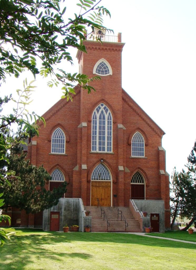
Photo: Wikipedia
Strategic Assessment of Lake County
Strong survivability profile. Good buffer from population centers, with manageable environmental and tactical risks.
What does the Strategic Assessment tell us?
Our Strategic Assessment grades tactical survivability of an area. Major population centers, military targets, fallout zones, natural disasters, and border exposure all drive risk — lower exposure means a more defensible position in a crisis.
This is heavily inspired by Joel Skousen's Strategic Relocation book. Highly recommended you checkout the book ($)What does this tell us?
Our Strategic Assessment grades tactical survivability of an area. Major population centers, military targets, fallout zones, natural disasters, and border exposure all drive risk — lower exposure means a more defensible position in a crisis.
This is heavily inspired by Joel Skousen's Strategic Relocation book. Highly recommended you checkout the book ($)Strategic Pillars

Key Distances
Strategic Assessment Analysis
Lake County, Montana, offers a compelling strategic profile for relocation-minded individuals and families who prioritize resilience, self-sufficiency, and a buffer from the vulnerabilities of major metropolitan centers. Situated in the northwestern part of the state, the county combines a low population density—roughly 30,000 residents spread over 1,654 square miles—with access to the natural resources and geographic isolation that make it a viable long-term holding ground. Its position along the southern end of the Flathead Valley, anchored by the city of Polson and the communities of Ronan and St. Ignatius, provides a balance of remote security and practical connectivity to essential services, without the congestion and target risks of larger urban areas.
Geographic position and natural advantages for long-term security
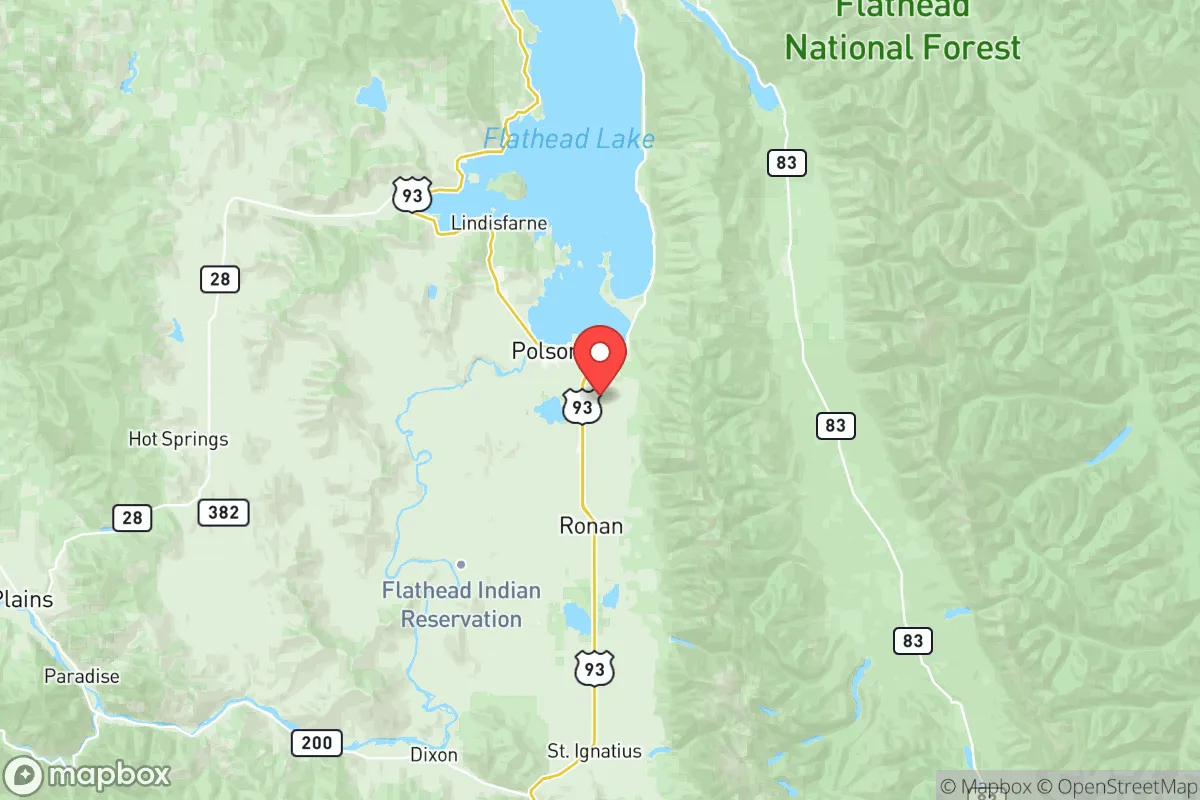
Lake County’s primary strategic asset is its location within the Flathead Valley, flanked by the Mission Mountains to the east and the Salish Mountains to the west. This topography creates natural chokepoints and defensible terrain, particularly along the U.S. Highway 93 corridor that runs north-south through the county. The presence of Flathead Lake, the largest natural freshwater lake in the western U.S. west of the Mississippi, provides an immense, reliable water source—over 200 square miles of surface area—that is less susceptible to drought than many other Western water bodies. The county’s elevation, averaging around 3,000 feet, moderates climate extremes while still offering a four-season environment that supports agriculture and timber. For a relocator, the ability to draw from the lake, coupled with the surrounding national forest lands (Flathead National Forest to the north and Lolo National Forest to the south), means access to game, firewood, and natural barriers against large-scale population movement. The nearest major city, Missoula, lies roughly 60 miles south, offering a supply and medical hub without the daily exposure to its urban risks. Spokane, Washington, is about 200 miles west, and the Canadian border is just 70 miles north, providing an additional geopolitical buffer and potential cross-border resource access.
Risks, exposures, and proximity to fallout-relevant landmarks
While Lake County’s isolation is a strength, it is not without exposure to man-made and natural risks that a strategic relocator must weigh. The county sits within the Flathead Valley seismic zone, with the potential for moderate earthquakes along the Mission Fault, though major events are infrequent and typically below magnitude 6.0. Wildfire risk is the most immediate natural threat, particularly in dry summers, with the 2017 Rice Ridge Fire and the 2021 Trail Creek Fire burning tens of thousands of acres in adjacent areas; the county’s interface with national forest land means that defensible space and fire-resistant construction are non-negotiable for any property. On the man-made side, Lake County’s distance from major industrial targets is a net positive. The nearest significant fallout-relevant landmarks are the oil refineries and rail yards in Billings (over 300 miles east) and the Hanford Site nuclear reservation in Washington (roughly 250 miles west). Neither poses a direct plume risk under most scenarios, though prevailing westerly winds could carry particulate from a Hanford incident across the Idaho panhandle and into western Montana, with Lake County on the fringe of that zone. More locally, the Malmstrom Air Force Base near Great Falls (about 150 miles east) is a primary nuclear missile field, but its silos are spread across central Montana, and Lake County is not in a primary target corridor. The county’s lack of major military bases, refineries, or ports within 100 miles is a distinct advantage for those prioritizing fallout avoidance. The primary risk is not a direct strike but rather secondary effects: potential influx of refugees from Missoula or Kalispell (60 and 40 miles away, respectively) during a regional crisis, which could strain local resources.
Practical resilience for a relocator: food, water, energy, and defensibility
For a family or individual serious about self-sufficiency, Lake County offers a strong baseline across four critical domains. Water is the county’s standout asset: Flathead Lake and the Flathead River system provide surface water that is generally clean and abundant, though well-drilling in the valley is common and yields good results at depths of 100-300 feet. The county’s agricultural heritage supports a robust local food network, with the Mission Valley producing hay, grains, and livestock, and the Flathead Reservation (which covers much of the county) hosting tribal farms and ranches. Farmers’ markets in Polson and Ronan operate from May through October, and the growing season (roughly 100-120 frost-free days) allows for home gardening of cold-hardy crops like potatoes, carrots, and kale. Energy infrastructure is mixed: the county is served by Flathead Electric Cooperative, which draws from hydroelectric dams on the Flathead River (including the Kerr Dam near Polson), providing a relatively stable grid. However, rural properties often rely on propane or wood heat, and solar potential is moderate (about 4.5 peak sun hours per day), making off-grid setups feasible but requiring battery storage for winter months. Defensibility is aided by the county’s geography: the Mission Mountains create a natural eastern barrier, while the lake and river systems limit approach routes from the west. The population is sparse enough that a well-chosen property—say, on a bench above the valley near St. Ignatius or along the eastern shore of the lake—offers clear sightlines and limited access points. The local culture, shaped by a mix of ranching families and the Confederated Salish and Kootenai Tribes, leans toward self-reliance and mutual aid, though outsiders should expect to build trust over time. The county’s law enforcement presence is thin (the Lake County Sheriff’s Office covers the entire area with about 20 deputies), so personal security and community networks are paramount.
The overall strategic picture for Lake County is one of balanced viability for a relocator who values isolation without complete disconnection. It avoids the high-risk zones of the Intermountain West—no major military targets, no refinery corridors, no nuclear plants within 200 miles—while offering the water and agricultural capacity to sustain a household through extended disruptions. The trade-offs are real: wildfire risk demands active mitigation, the winter climate requires serious preparation (average January lows in Polson are around 20°F, with snowpack that can isolate rural roads), and the county’s distance from specialized medical care (the nearest Level II trauma center is in Missoula) means that serious emergencies require a 60-mile drive. For a family or individual willing to invest in fire-resistant construction, a reliable water system, and a strong local network, Lake County provides a defensible, resource-rich base that ranks favorably against most other Western relocation destinations. It is not a bug-out location for the unprepared, but a long-term holding ground for those who treat resilience as a lifestyle, not a contingency.

* Values derived from national, state, county, city and local statistics and may differ in a specific area. Last updated: 2026-07-25T20:18:41.000Z
Narrative content on this page is AI-generated and may contain mistakes. Verify any details that matter before acting on them.
ReloMaps may earn a commission from affiliate links at no extra cost to you.

