Photo: Wikipedia
Strategic Assessment of Lafayette County
Workable tactical position. Some exposure to population density or targets, but generally defensible in a crisis.
What does the Strategic Assessment tell us?
Our Strategic Assessment grades tactical survivability of an area. Major population centers, military targets, fallout zones, natural disasters, and border exposure all drive risk — lower exposure means a more defensible position in a crisis.
This is heavily inspired by Joel Skousen's Strategic Relocation book. Highly recommended you checkout the book ($)What does this tell us?
Our Strategic Assessment grades tactical survivability of an area. Major population centers, military targets, fallout zones, natural disasters, and border exposure all drive risk — lower exposure means a more defensible position in a crisis.
This is heavily inspired by Joel Skousen's Strategic Relocation book. Highly recommended you checkout the book ($)Strategic Pillars

Key Distances
Strategic Assessment Analysis
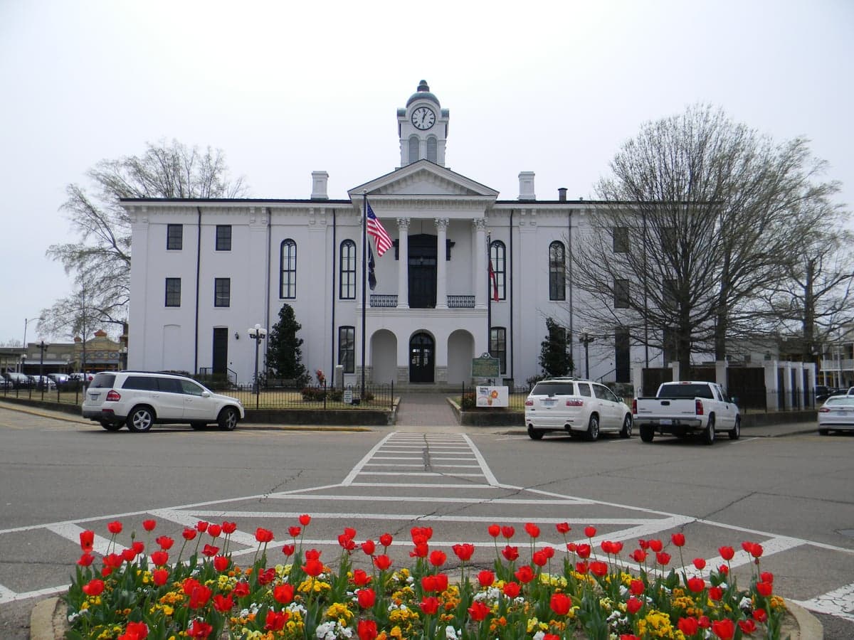
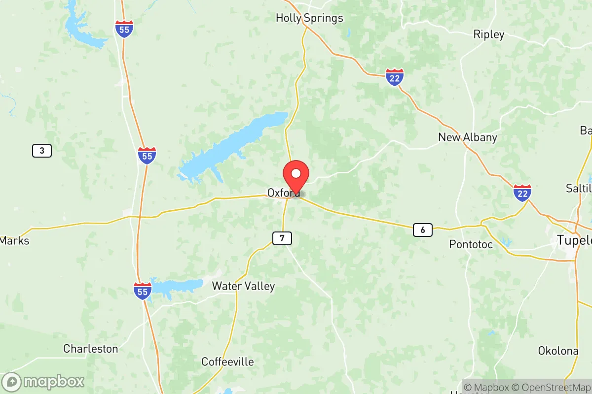
Lafayette County, Mississippi, offers a compelling mix of geographic insulation and moderate accessibility that appeals to relocation-minded individuals prioritizing resilience and self-sufficiency. Anchored by the college town of Oxford, the county sits in the rolling hills of north Mississippi, well removed from the hurricane-prone Gulf Coast and the dense urban corridors that could become focal points during a major disruption. Its position roughly 80 miles southeast of Memphis and 100 miles south of the Tennessee border places it far enough from major metropolitan areas to avoid the worst fallout scenarios yet close enough to access regional supply chains and medical care under normal conditions. For a reader weighing long-term security over convenience, Lafayette County represents a balanced bet—moderate risk, solid natural buffers, and a cultural inclination toward preparedness rooted in its rural Southern identity.
Geographic position and natural advantages for self-sufficiency
Lafayette County sits on the edge of the Mississippi Black Prairie region, transitioning into the North Central Hills, a terrain of forested ridges and fertile valleys that naturally supports both agriculture and timber. The elevation ranges from roughly 300 to 600 feet, which limits flood risk compared to the Delta counties to the west. The county's major water body, Sardis Lake, is a 98,000-acre reservoir managed by the U.S. Army Corps of Engineers, providing a reliable surface water supply and recreational resources. The lake lies partly in the southern part of the county near the town of Taylor, a small community that serves as a access point. In addition, the Yocona River and its tributaries drain the county, offering additional riparian resources for those looking to secure off-grid water.
The natural vegetation—mixed hardwood and pine forests—covers roughly 60% of the county's land area, offering building materials, fuel, and cover. The climate is humid subtropical with a long growing season of around 220 days, enough for a reliable home garden and even small-scale orchards. Cold snaps are rare and short, which reduces the risk of crop loss. Soils in the county are primarily silt loams and clay loams, moderately fertile, and support pasture for livestock. The county seat, Oxford, benefits from a surrounding rural buffer; even its suburban fringe gives way quickly to fields and woods, meaning a relocator can find acreage within a 15-minute drive of town. This mix of accessible water, timber, and arable land gives Lafayette County a genuine foundation for self-sufficiency that many flatter, more developed counties lack.
Risk exposures and proximity to potential fallout-relevant landmarks
While Lafayette County is not a high-consequence target, it does face risks that a conscientious relocator should evaluate. The most immediate natural hazard is severe thunderstorms and tornadoes. North Mississippi sits in the southern edge of the traditional "Dixie Alley," and the county averages about 50 tornado warnings per year. Direct hits are uncommon, but the topography offers fewer natural barriers than mountainous regions, so sturdy construction and a storm shelter are prudent investments. Flooding is localized; the Yocona River and small creeks can overflow after heavy rain, but typical building sites away from drainage ways are safe.
Man-made risks are more subtle. Oxford is home to the University of Mississippi (Ole Miss), a large public university with a student population of over 24,000. In a broader crisis, the campus could become a focal point for population movement, straining local resources and potentially drawing unwanted attention. More critically, Lafayette County lies roughly 140 miles southeast of the Memphis metropolitan area, which includes the Tennessee Valley Authority's Allen Fossil Plant and the Valero Memphis Refinery in nearby South Memphis. While not in the immediate blast or fallout zone from a strike on those targets, prevailing winds from the northwest could carry airborne contamination into the county within hours. Additionally, the nearby town of Batesville (Panola County) hosts food processing and logistics facilities, but these are unlikely to be strategic targets. For a relocator focused on fallout avoidance, the county's distance from major military bases—Fort Campbell, KY is about 200 miles north, and Columbus Air Force Base in Mississippi is 90 miles southeast—means it is not a primary target corridor. The single greatest exposure is its position downwind of Memphis, which is moderate compared to areas closer to major ports or refineries.
Practical resilience: food, water, energy, and defensibility
For a relocator building a resilient homestead, Lafayette County offers strong fundamentals. Food production is viable: the growing season runs from mid-April to mid-October, and local soil supports corn, soybeans, vegetables, and pasture for cattle and goats. Oxford has a well-established farmers' market and a culture of home gardening, making it easy to source seeds and livestock from neighbors. The county's proximity to Tupelo (60 miles northeast) and Grenada (30 miles south) provides multiple USDA packing houses and feed stores that are not dependent on any single supply chain.
Water is the county's strongest resilience asset. Sardis Lake holds roughly 1.3 million acre-feet of water at full pool, providing a massive reserve unaffected by local drought. Groundwater is accessible through shallow wells in most areas, with the Wilcox aquifer underlying the region. The city of Oxford draws its municipal water from Sardis Lake via a treatment plant, but rural residents rely on wells or surface sources. The abundance of flowing creeks means gravity-fed systems and cisterns are practical, and the county's watershed ordinances are minimal, allowing private water infrastructure without excessive permitting hurdles.
Energy is a mixed picture. The county is served by Northcentral Electric Power Association and Oxford's municipal utility, both of which have reasonable reliability but are tied to the regional grid. For off-grid capability, the forest canopy and rolling terrain make solar less optimal than in the Southwest, but southern-facing slopes exist. Wood heating is the dominant backup—firewood is abundant, and many rural properties already have wood stoves. Propane is widely used for cooking and water heating, with bulk suppliers in Oxford and Abbeville. Battery storage is becoming more common, but the county lacks a strong off-grid community that might share resources—this is developing slowly.
Defensibility derives from the terrain itself. The densely wooded hills and narrow rural roads create natural chokepoints and make large-scale ingress difficult. The University of Mississippi's police force and Lafayette County Sheriff's Office maintain a moderate law enforcement presence, but in a prolonged breakdown, the rural edges of the county—areas like Paris or Springville—offer low population density and good line-of-sight for defense. The proximity to the Oxford city limits is a double-edged sword: it provides resources but also population density. A relocator should prioritize property on the periphery, ideally with access to multiple exit routes toward the Natchez Trace Parkway or State Highway 7, which run north-south through the county and offer quick access to less populated areas.
Overall, Lafayette County strikes a pragmatic balance for the resilience-minded relocator who values community and access to resources without sacrificing rural insulation. Its water abundance, forest cover, and moderate climate support a baseline level of self-sufficiency that many relocation destinations cannot match. The primary downsides—tornado risk and downwind proximity to Memphis—are real but manageable with proper construction and awareness. For a single individual or family willing to invest in a storm shelter, a well, and a wood stove, the county offers a solid strategic position in the southeastern U.S. corridor, far enough from disaster zones to remain livable, close enough to civilization to avoid isolation.

* Values derived from national, state, county, city and local statistics and may differ in a specific area. Last updated: 2026-07-10T09:51:24.000Z
Narrative content on this page is AI-generated and may contain mistakes. Verify any details that matter before acting on them.
ReloMaps may earn a commission from affiliate links at no extra cost to you.

