
Photo: Wikipedia
Strategic Assessment of Jones County
Workable tactical position. Some exposure to population density or targets, but generally defensible in a crisis.
What does the Strategic Assessment tell us?
Our Strategic Assessment grades tactical survivability of an area. Major population centers, military targets, fallout zones, natural disasters, and border exposure all drive risk — lower exposure means a more defensible position in a crisis.
This is heavily inspired by Joel Skousen's Strategic Relocation book. Highly recommended you checkout the book ($)What does this tell us?
Our Strategic Assessment grades tactical survivability of an area. Major population centers, military targets, fallout zones, natural disasters, and border exposure all drive risk — lower exposure means a more defensible position in a crisis.
This is heavily inspired by Joel Skousen's Strategic Relocation book. Highly recommended you checkout the book ($)Strategic Pillars

Key Distances
Strategic Assessment Analysis
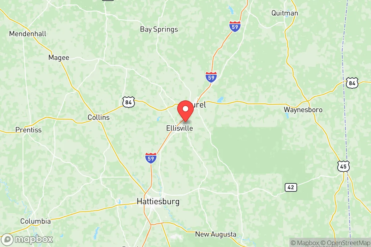
Jones County, Mississippi, offers a compelling strategic profile for relocators prioritizing resilience and self-sufficiency, balancing deep-rooted community stability with a location that is neither isolated nor dangerously exposed. Centered on the city of Laurel, the county provides a practical blend of rural buffer and access to regional infrastructure, making it a serious consideration for families and individuals who value preparedness without sacrificing everyday livability. Its position in the Pine Belt region, roughly 90 miles from the Gulf Coast and 80 miles from the Mississippi state capital of Jackson, places it in a sweet spot—close enough to major resources, far enough from the highest-density risk zones.
Geographic position and natural advantages for long-term stability
Jones County sits atop the Chickasawhay River watershed, with Laurel and the smaller town of Ellisville forming its primary population centers. The area's topography is gently rolling piney woods, part of the broader Coastal Plain, which provides natural drainage and reduces flood risk compared to low-lying Delta counties. The region's abundant annual rainfall—averaging 55-60 inches—supports robust local agriculture and recharges groundwater reliably, a key advantage for long-term water security. The county's position away from the immediate Gulf Coast (about 90 miles inland) offers a meaningful buffer against the most severe storm surge and hurricane-force winds, while still being within a day's drive of ports like Gulfport and Mobile for supply chain access. The De Soto National Forest lies just south, providing a large, undeveloped natural buffer and potential resource zone. For a relocator, this means a landscape that can sustain itself: timber, game, and water are all locally available without relying on fragile long-distance supply lines.
Risk exposure: natural hazards and proximity to man-made targets
No area is without risk, and Jones County's primary natural threat is severe weather, including tornadoes and inland flooding from tropical systems. The county sits within "Dixie Alley," where tornado frequency is high, and the 2020 Easter tornado outbreak demonstrated this vulnerability, with an EF-4 tornado cutting through parts of the county. However, the dispersed, wooded settlement pattern means that a single storm event rarely cripples the entire county. The man-made risk profile is more nuanced. Jones County is not near any major military base (the closest is Camp Shelby, about 30 miles south near Hattiesburg, a training facility rather than a strategic target). It is also not within the immediate fallout zone of any major metropolitan area—Jackson is 80 miles northwest, Mobile 100 miles south, and New Orleans 150 miles southwest. The most significant nearby industrial landmark is the Chevron Pascagoula Refinery on the Gulf Coast, roughly 100 miles south, which is a potential target but far enough that fallout dispersion would be significantly diluted before reaching Jones County. The county's own industrial base is modest, centered on lumber, poultry processing (Wayne-Sanderson Farms in Laurel), and small manufacturing—none of which are high-value strategic targets. This relative anonymity is a strategic asset.
Practical resilience for a relocator: food, water, energy, and defensibility
For someone serious about self-sufficiency, Jones County delivers on the fundamentals. Water is the strongest pillar: the county sits atop the Citronelle Aquifer, a prolific, shallow groundwater source that supplies most private wells with clean water at depths of 100-300 feet. This means a relocator with a well and a hand pump or solar-powered pump can secure water independent of municipal systems. Food production is viable: the growing season runs from March to October, and the sandy loam soils are well-suited for gardens, orchards, and small livestock. Local farmers' markets in Laurel and Ellisville are active, and the county's agricultural extension service offers strong support for new growers. Energy resilience is improving: while the grid is served by Mississippi Power (a Southern Company subsidiary), tree-covered power lines mean outages are common after storms. However, the county's rural character means solar is practical—most properties have open southern exposure, and local installers are available. Wood heating is also a realistic option given the abundant timber. Defensibility is a mixed picture: the county's dispersed population and dense pine forests provide natural cover and make it hard to isolate or control. However, the major highways—Interstate 59 running north-south and U.S. Highway 84 running east-west—create two primary corridors that could become chokepoints in a crisis. Laurel itself is a small city of about 18,000, meaning it has enough population to support a hospital (South Central Regional Medical Center) and basic services, but not so large that it would attract widespread looting or civil unrest. The county's strong hunting culture means a high percentage of households own firearms, which is a practical consideration for security-minded relocators.
The overall strategic picture for Jones County is one of balanced, unglamorous resilience. It lacks the dramatic natural defenses of mountainous regions or the extreme isolation of the Great Plains, but it compensates with reliable water, a long growing season, and a low-target profile. The county's location—far enough from Gulf Coast hurricane zones and major metropolitan fallout risks, yet close enough to regional medical and supply hubs—makes it a practical choice for a family or individual who wants to be prepared without living off-grid in a remote cabin. The biggest trade-off is the tornado risk, which is real and requires a storm shelter or reinforced safe room. For the relocator who accepts that, Jones County offers a foundation for long-term stability: a place where you can dig a well, grow food, heat with wood, and live quietly, without being a target. It is not a bug-out location for the prepper elite, but a workable, everyday home for someone who thinks ahead.

* Values derived from national, state, county, city and local statistics and may differ in a specific area. Last updated: 2026-06-16T05:10:42.000Z
Narrative content on this page is AI-generated and may contain mistakes. Verify any details that matter before acting on them.
ReloMaps may earn a commission from affiliate links at no extra cost to you.

