
Photo: Wikipedia
Strategic Assessment of Hinds County
Workable tactical position. Some exposure to population density or targets, but generally defensible in a crisis.
What does the Strategic Assessment tell us?
Our Strategic Assessment grades tactical survivability of an area. Major population centers, military targets, fallout zones, natural disasters, and border exposure all drive risk — lower exposure means a more defensible position in a crisis.
This is heavily inspired by Joel Skousen's Strategic Relocation book. Highly recommended you checkout the book ($)What does this tell us?
Our Strategic Assessment grades tactical survivability of an area. Major population centers, military targets, fallout zones, natural disasters, and border exposure all drive risk — lower exposure means a more defensible position in a crisis.
This is heavily inspired by Joel Skousen's Strategic Relocation book. Highly recommended you checkout the book ($)Strategic Pillars

Key Distances
Strategic Assessment Analysis
Hinds County, Mississippi, anchored by the state capital Jackson, presents a mixed strategic picture for relocation-minded readers prioritizing resilience and self-sufficiency. Its central location in the state offers moderate geographic advantages, but proximity to significant man-made and natural risk factors requires careful consideration. For those weighing disaster readiness, Hinds County offers a blend of accessible resources and notable vulnerabilities that demand a clear-eyed assessment.
Geographic position and natural advantages for self-sufficiency
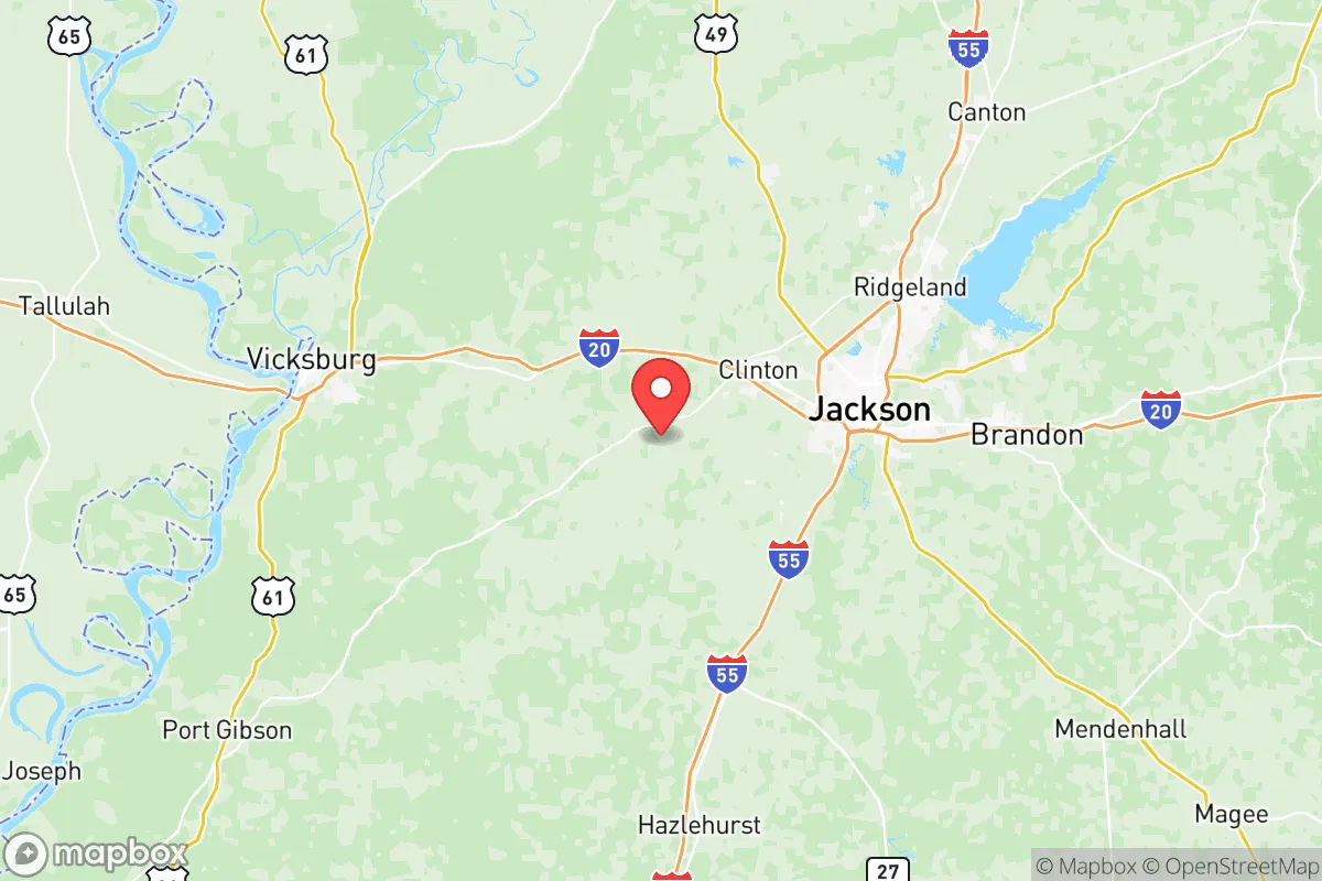
Hinds County sits in west-central Mississippi, roughly 40 miles east of the Mississippi River and 150 miles north of the Gulf Coast. This inland position provides a meaningful buffer against hurricane storm surge, though the region is not immune to tropical storm winds and heavy rainfall. The county's terrain is predominantly rolling hills and hardwood forests, with the Pearl River forming its eastern boundary and the Big Black River cutting through the western portion. These waterways offer potential for private water sources, though both are subject to flooding during heavy rain events. The area's clay-loam soils support small-scale agriculture, and the moderate climate allows for a growing season of roughly 220 days per year—long enough for most staple crops. For a relocator, the ability to tap into groundwater via a private well is feasible in many rural parts of the county, particularly outside the Jackson urban core. The county's position along Interstate 20 and Interstate 55 provides logistical connectivity, but also means that major evacuation or supply routes could become congested during regional emergencies.
Risks, exposures, and proximity to fallout-relevant landmarks
The most significant strategic concern for Hinds County is its concentration of man-made risk factors. Jackson is home to the University of Mississippi Medical Center (UMMC), a major Level I trauma center and research facility that handles biological and chemical agents—a potential target in a national security scenario. The city also hosts the Jackson-Evers International Airport, a commercial and military airfield that could become a focal point during evacuation or conflict. More critically, Hinds County lies within 50 miles of the Grand Gulf Nuclear Station in nearby Claiborne County, a single-unit pressurized water reactor that generates over 1,400 megawatts. While the plant has a strong safety record, its proximity means that any radiological incident would directly affect Hinds County. Additionally, the county sits roughly 100 miles from the Chevron Pascagoula Refinery on the Gulf Coast, one of the largest refineries in the United States, and within 200 miles of the Louisiana Offshore Oil Port (LOOP), a critical energy infrastructure node. For a reader concerned about fallout from industrial accidents or targeted attacks, these are concrete exposures. On the natural disaster front, the county experiences frequent severe thunderstorms, tornadoes (the region sits in the Dixie Alley corridor), and occasional ice storms that can disrupt power for days. The Jackson metropolitan area's aging infrastructure—particularly its water system, which suffered a widely publicized crisis in 2022—adds a layer of systemic fragility.
Practical resilience for a relocator: food, water, energy, and defensibility
For a relocator seeking practical self-sufficiency, Hinds County offers a mixed bag. Water availability is a strong point outside the urban core: the Sparta Aquifer underlies much of the county, and private wells are common in rural areas like Bolton and Raymond. However, the Jackson water system's well-documented failures—including pressure loss and boil-water notices affecting over 150,000 residents—underscore the risks of relying on municipal infrastructure. Food production potential is moderate: the county has several active farms and farmers' markets, particularly in the Clinton and Byram areas, but prime agricultural land is increasingly fragmented by suburban development. Hunting and fishing are viable in the Pearl River Wildlife Management Area and the Ross Barnett Reservoir (just north of the county line), providing a protein source for those with skills. Energy resilience is a vulnerability: the county's grid is served by Entergy Mississippi, and power outages from storms are common. Solar potential is decent, with roughly 215 sunny days per year, but net metering policies in Mississippi are less favorable than in some neighboring states. Backup generation is advisable. Defensibility is limited in the Jackson metro area, which has a population of roughly 150,000 within Hinds County alone. The urban core presents challenges for security and resource control during a breakdown. However, the county's western and southern rural areas—around Utica and Terry—offer more defensible terrain with lower population density, better access to water, and more land for self-sufficient living. The presence of the Mississippi Army National Guard's Camp Shelby (about 100 miles south) and the Naval Air Station Meridian (about 80 miles east) means military assets are within reach, though these could also become targets.
The overall strategic picture for Hinds County is one of moderate resilience with notable caveats. The county's inland location and access to groundwater are genuine advantages for a relocator willing to invest in private infrastructure. However, the concentration of critical infrastructure in Jackson—medical, transportation, and industrial—creates a target-rich environment that a disaster-preparedness-minded reader should weigh carefully. The 2022 water crisis serves as a real-world stress test that revealed systemic fragility in the region's core systems. For a family or individual committed to self-sufficiency, the rural fringes of Hinds County offer a viable base of operations, provided they secure independent water, power, and food sources. The county's central position in Mississippi also means it is within a day's drive of multiple state and federal resources, but that same centrality makes it a potential chokepoint during regional evacuations. Ultimately, Hinds County is a location that rewards preparation and punishes complacency—a solid choice for those who treat resilience as an active practice rather than a passive assumption.

* Values derived from national, state, county, city and local statistics and may differ in a specific area. Last updated: 2026-06-24T12:07:23.000Z
Narrative content on this page is AI-generated and may contain mistakes. Verify any details that matter before acting on them.
ReloMaps may earn a commission from affiliate links at no extra cost to you.

