Photo: Wikipedia
Strategic Assessment of Mission, TX
Meaningful friction. Expect exposure to either population pressure, blast zones, or natural disaster risk. Consider buying a retreat property.
What does the Strategic Assessment tell us?
Our Strategic Assessment grades tactical survivability of an area. Major population centers, military targets, fallout zones, natural disasters, and border exposure all drive risk — lower exposure means a more defensible position in a crisis.
This is heavily inspired by Joel Skousen's Strategic Relocation book. Highly recommended you checkout the book ($)What does this tell us?
Our Strategic Assessment grades tactical survivability of an area. Major population centers, military targets, fallout zones, natural disasters, and border exposure all drive risk — lower exposure means a more defensible position in a crisis.
This is heavily inspired by Joel Skousen's Strategic Relocation book. Highly recommended you checkout the book ($)Strategic Pillars

Key Distances
Regional Safe Places
Below is our recommended "safe zones" in Texas and the surrounding area based on our strategic heuristics. For most people, it's unrealistic to live in a “safe zone” full-time due to work, family or other personal reasons. They tend to be more rural. However, many of these areas are perfect for second homes and retreat properties that double as a vacation home or even a short-term rental.

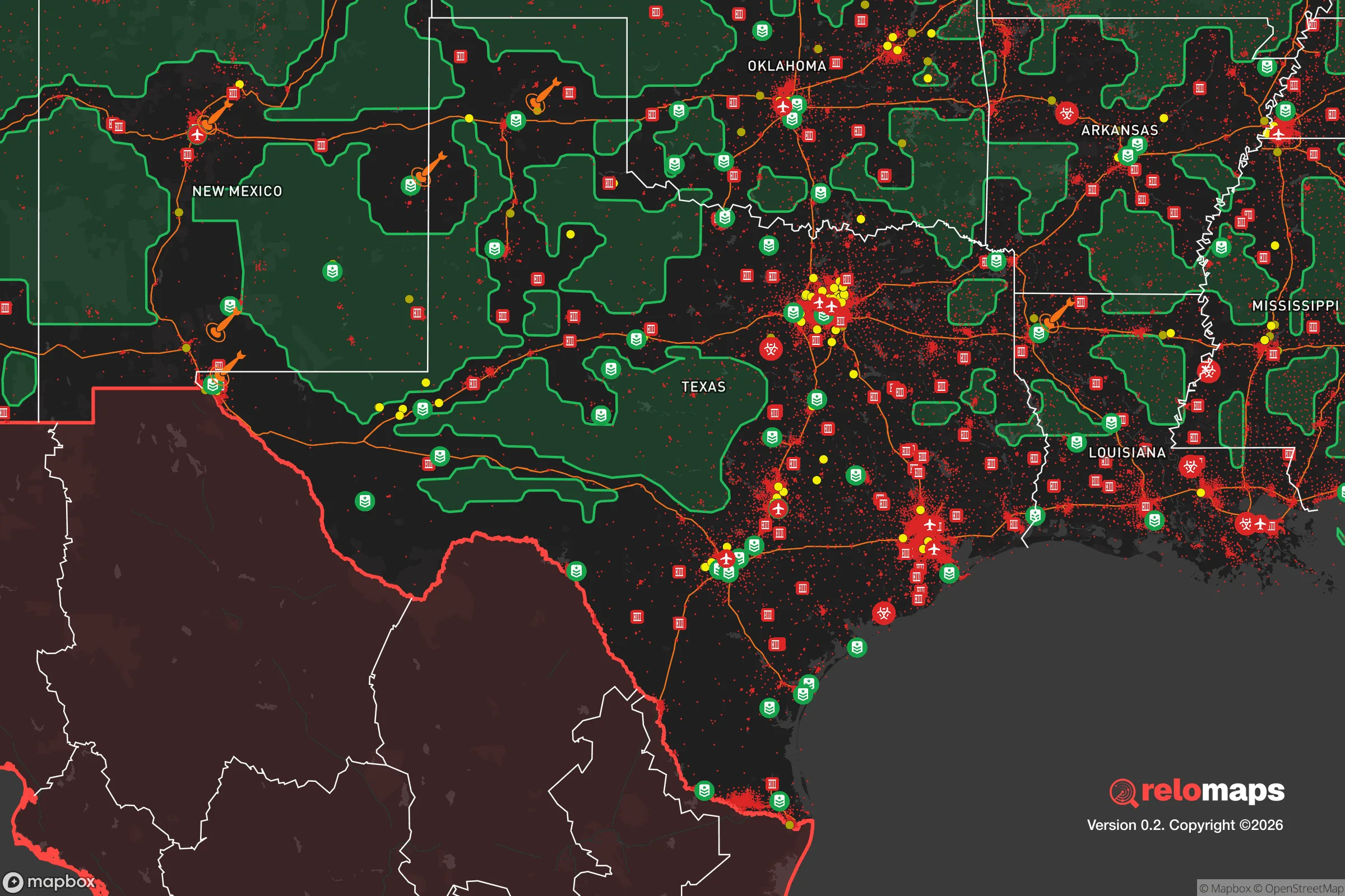


Important Note: For informational purposes only. This does not mean nothing bad ever happens in the green zones. Please use common sense. This is based on public data and modeled with AI. We tried to take a conservative approach but mistakes happen. We update this regularly as new information becomes available.
Solar Generator Recommendations
Backup power matters more here than in safer locations. We've picked three solar generators across budgets and capacity tiers — start with the budget unit if you only need a few essentials, or step up if you want to run a fridge and HVAC for days at a time.

Jackery Portable Power Station Explorer 300
Budget OptionPower on the Go: Weighing only 11 lbs, it's convenient to set up and store with book-sized foldable solar panels

BLUETTI Portable Power Station AC180
Designed for both indoor and outdoor scenarios, AC180 is highly capable as it has a robost capacity and continuous output power.

EF ECOFLOW DELTA Pro Ultra Power Station
Upgraded PickEcoFlow DELTA Pro Ultra is a whole-home energy system designed to grow with your family. Integrated with the Smart Home Panel 2, it scales to meet your evolving energy needs — keeping your home powered, intelligent, and secure through every stage of life.
We earn a commission, at no additional cost to you.
Strategic Assessment Analysis
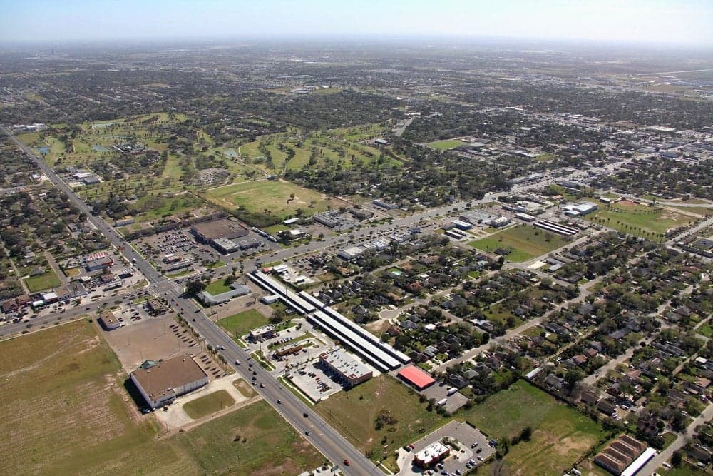
Mission, Texas, offers a strategic relocation option for those prioritizing disaster readiness and self-sufficiency, largely due to its position deep in the Rio Grande Valley (RGV), far from major metropolitan targets and natural disaster hotspots. The area’s resilience is rooted in its semi-arid climate, proximity to the U.S.-Mexico border for trade continuity, and a relatively low population density compared to Houston, San Antonio, or Dallas. For a single individual or family looking to balance affordability with practical preparedness, Mission presents a unique mix of advantages and trade-offs that deserve a grounded, factual assessment.
Geographic position and natural advantages for long-term stability
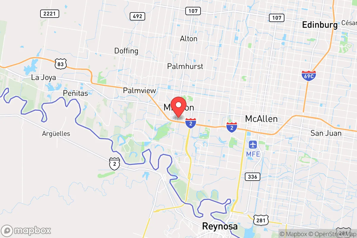
Mission sits in Hidalgo County, roughly 10 miles from the Rio Grande and 60 miles inland from the Gulf of Mexico. This inland buffer reduces exposure to hurricane storm surge, a significant risk for coastal communities like South Padre Island or Corpus Christi. The region’s flat, semi-arid terrain—averaging less than 22 inches of rain annually—means flooding is localized and manageable compared to flood-prone areas of East Texas. The subtropical climate supports a year-round growing season, which is a major asset for anyone serious about food self-sufficiency. The area’s elevation, around 100 feet above sea level, provides no topographic defensibility but also eliminates risks from landslides or seismic activity. For a relocator, the key geographic advantage is isolation: Mission is over 200 miles from the nearest major city (San Antonio) and over 350 miles from Houston, placing it well outside the immediate fallout zones of high-value targets like military bases, refineries, or major ports. The nearby Anzalduas International Bridge and the Pharr-Reynosa International Bridge ensure cross-border supply chains remain viable, even if domestic logistics are disrupted.
Risks, exposures, and proximity to fallout-relevant landmarks
While Mission avoids the worst of hurricane impacts, it is not immune to weather-related disruptions. The region experiences occasional severe thunderstorms, hail, and tornadoes—though these are less frequent and intense than in Tornado Alley. The primary natural risk is extreme heat: summer temperatures regularly exceed 100°F, which stresses power grids and water supplies. On the man-made risk side, the area’s proximity to the border introduces concerns about cartel-related violence, though Hidalgo County’s violent crime rate (roughly 300 per 100,000 residents) is comparable to the national average and lower than many urban centers. The more significant strategic risk is the McAllen-Mission metropolitan area’s reliance on the South Texas Project Nuclear Power Plant, located about 150 miles north in Bay City. While not an immediate fallout danger, a major incident there could affect regional power stability. Additionally, the nearby SpaceX facility at Boca Chica (about 70 miles east) and the Port of Brownsville (60 miles east) are potential targets for disruption, though neither is a high-value military target. For a relocator, the most practical concern is the area’s dependence on the Rio Grande for irrigation and municipal water—a resource increasingly strained by drought and U.S.-Mexico water treaty disputes. In a prolonged crisis, water availability could become the region’s Achilles’ heel.
Practical resilience for a relocator: food, water, energy, and defensibility
Mission’s practical resilience is a mixed bag. On the positive side, the RGV is one of the most productive agricultural regions in the U.S., with over 1.5 million acres of farmland producing citrus, sugarcane, cotton, and vegetables. For a family looking to establish a small homestead, the growing season lasts 300+ days, and local farmers’ markets and co-ops are abundant. Water, however, is the critical constraint. The region relies on the Rio Grande and the Amistad-Falcon reservoir system, which has seen levels drop to historic lows in recent years. A relocator should plan for rainwater harvesting and deep-well access—though groundwater in the area is often brackish and requires treatment. Energy resilience is moderate: the grid is part of the Texas Interconnection, which is prone to winter storms (as seen in 2021) and summer demand spikes. Solar is a strong option, with the area averaging over 260 sunny days per year, and many homes already have solar panels. Natural gas is widely available, and propane is a common backup. Defensibility is low due to the flat, open terrain, but the area’s low population density (about 200 people per square mile in the county) and spread-out suburban layout reduce the risk of civil unrest compared to dense urban centers. The local law enforcement presence is adequate, but for serious preparedness, a rural property outside city limits—such as in nearby Starr County or western Hidalgo County—offers better seclusion and space for self-sufficient infrastructure.
Overall, Mission, Texas, presents a viable but not ideal strategic relocation option for those focused on disaster readiness. Its strengths—agricultural abundance, low population density, distance from major targets, and a stable climate for off-grid living—are balanced by significant vulnerabilities in water security and grid reliability. For a single individual or family willing to invest in rainwater collection, solar power, and a well, the area offers a low-cost, low-profile base with access to cross-border resources and a supportive community of like-minded preppers and homesteaders. However, those seeking absolute isolation or defensible terrain should look further north or west. Mission is best suited as a practical, affordable hub for long-term resilience—not a fortress, but a solid foundation for a prepared lifestyle in a region that remains under the radar of most relocation guides.

* Values derived from national, state, county, city and local statistics and may differ in a specific area. Last updated: 2026-11-11T17:26:40.000Z
Narrative content on this page is AI-generated and may contain mistakes. Verify any details that matter before acting on them.
ReloMaps may earn a commission from affiliate links at no extra cost to you.

