Photo: Wikipedia
Strategic Assessment of Middlefield, CT
Multiple tactical vulnerabilities. Population density, target proximity, or disaster risk are likely compounding. A retreat property and exit planning is required.
What does the Strategic Assessment tell us?
Our Strategic Assessment grades tactical survivability of an area. Major population centers, military targets, fallout zones, natural disasters, and border exposure all drive risk — lower exposure means a more defensible position in a crisis.
This is heavily inspired by Joel Skousen's Strategic Relocation book. Highly recommended you checkout the book ($)What does this tell us?
Our Strategic Assessment grades tactical survivability of an area. Major population centers, military targets, fallout zones, natural disasters, and border exposure all drive risk — lower exposure means a more defensible position in a crisis.
This is heavily inspired by Joel Skousen's Strategic Relocation book. Highly recommended you checkout the book ($)Strategic Pillars

Key Distances
Regional Safe Places
Below is our recommended "safe zones" in Connecticut and the surrounding area based on our strategic heuristics. For most people, it's unrealistic to live in a “safe zone” full-time due to work, family or other personal reasons. They tend to be more rural. However, many of these areas are perfect for second homes and retreat properties that double as a vacation home or even a short-term rental.




Important Note: For informational purposes only. This does not mean nothing bad ever happens in the green zones. Please use common sense. This is based on public data and modeled with AI. We tried to take a conservative approach but mistakes happen. We update this regularly as new information becomes available.
Solar Generator Recommendations
Backup power matters more here than in safer locations. We've picked three solar generators across budgets and capacity tiers — start with the budget unit if you only need a few essentials, or step up if you want to run a fridge and HVAC for days at a time.

Jackery Portable Power Station Explorer 300
Budget OptionPower on the Go: Weighing only 11 lbs, it's convenient to set up and store with book-sized foldable solar panels

BLUETTI Portable Power Station AC180
Designed for both indoor and outdoor scenarios, AC180 is highly capable as it has a robost capacity and continuous output power.

EF ECOFLOW DELTA Pro Ultra Power Station
Upgraded PickEcoFlow DELTA Pro Ultra is a whole-home energy system designed to grow with your family. Integrated with the Smart Home Panel 2, it scales to meet your evolving energy needs — keeping your home powered, intelligent, and secure through every stage of life.
We earn a commission, at no additional cost to you.
Strategic Assessment Analysis
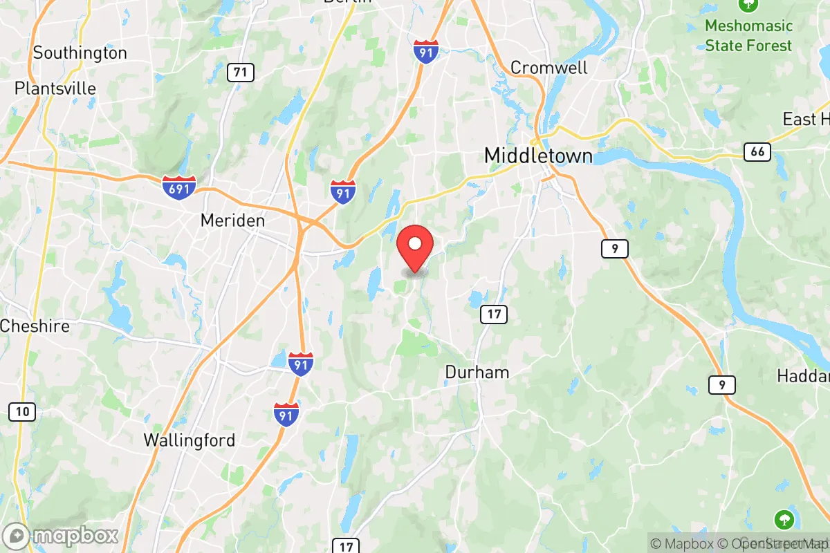
Middlefield, Connecticut, offers a compelling strategic profile for the relocation-minded reader who prioritizes resilience and self-sufficiency, balancing the quiet stability of a small New England town with a surprisingly advantageous geographic position. Located in Middlesex County, roughly 20 miles southeast of Hartford and 30 miles northeast of New Haven, Middlefield sits in a zone that avoids the immediate density and target profile of major metropolitan areas while still providing reasonable access to their economic and logistical resources. The town’s population hovers around 4,400, with a land area of roughly 21 square miles, giving it a low population density that is a foundational asset for anyone thinking seriously about disaster readiness and long-term sustainability.
Geographic position and natural advantages for long-term stability
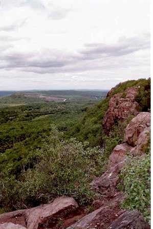
Middlefield’s location within the Connecticut River Valley provides a mix of defensive and resource-based advantages that are hard to overstate for a preparedness-minded relocator. The town is situated on the western edge of the valley, with the Metacomet Ridge running through its eastern portion, offering natural elevation changes that can aid in drainage, observation, and microclimate moderation. The surrounding landscape is a patchwork of working farms, state forests, and conservation land—Cockaponset State Forest lies just to the south, and the Meshomasic State Forest is a short drive east—providing a substantial buffer of undeveloped land that reduces the risk of suburban sprawl and offers potential foraging, timber, and wildlife resources. The Coginchaug River runs through the town center, and the area is dotted with small ponds and wetlands, giving Middlefield a reliable surface water supply that is less vulnerable to the kind of infrastructure failures that plague denser urban areas. The town’s position also places it outside the immediate blast and fallout zones of any major military or industrial targets—there are no major nuclear power plants, military bases, or large-scale chemical facilities within a 10-mile radius—which is a significant plus for anyone concerned about man-made disasters. The nearest nuclear plant, Millstone, is over 40 miles away on the coast, and the closest major airport, Bradley International, is roughly 30 miles north, both far enough to reduce the risk of a direct event while still being within a reasonable distance for emergency supply runs.
Risk exposure: natural hazards and proximity to fallout-relevant landmarks
No location is without risk, and Middlefield’s profile includes several exposures that a serious relocator should weigh. The primary natural hazard is flooding: the Coginchaug River and its tributaries have a history of moderate flooding during heavy rain events or rapid snowmelt, particularly in low-lying areas near the town center and along Route 147. The 2021 remnants of Hurricane Ida caused localized flooding in the region, though Middlefield fared better than downstream communities like Middletown. Winter storms are a recurring challenge—ice storms and heavy snow can knock out power for days, as seen in the 2011 Halloween nor’easter and the 2020 Tropical Storm Isaias, which left parts of the state without power for over a week. The town’s tree canopy, while beautiful, is a liability during these events, with falling limbs and downed lines being the primary cause of outages. From a man-made risk perspective, Middlefield’s proximity to Hartford (a state capital and insurance hub) and New Haven (home to Yale University and several industrial facilities) places it within the potential fallout zone of a targeted strike or major industrial accident. While the town itself is not a primary target, prevailing winds from the west-northwest could carry fallout from a Hartford event, and the Connecticut River Valley acts as a natural funnel for airborne contaminants. The presence of the Connecticut Yankee nuclear power plant site in Haddam, about 15 miles south, is a historical concern—the plant is decommissioned, but spent fuel remains stored on-site in dry casks, a low-probability but high-consequence risk. For the preparedness-minded, these factors underscore the importance of having a robust shelter-in-place plan, a well-stocked first-aid kit, and a reliable means of monitoring air quality and weather alerts.
Practical resilience for a relocator: food, water, energy, and defensibility
Middlefield’s practical resilience is where the town truly shines for someone looking to build a self-sufficient lifestyle. The town’s agricultural heritage is still alive: there are several working farms within the town limits, including Lyman Orchards, a 1,100-acre operation that produces apples, peaches, berries, and pumpkins, and offers a farm store and pick-your-own operations that can supplement a home garden. The local farmers’ market in nearby Middletown runs from June to October, and the Connecticut Farm Map shows dozens of small producers within a 15-mile radius, covering everything from eggs and meat to honey and maple syrup. For water security, the town’s groundwater is generally good quality, and many homes in the more rural parts of Middlefield rely on private wells, which are far more resilient than municipal systems during a grid-down scenario. The Coginchaug River is a viable backup source, though it requires proper filtration and boiling—Giardia and other pathogens are present in surface water throughout the region. Energy resilience is a mixed picture: the town is served by Eversource, which has a mixed reputation for outage restoration speed, but the prevalence of wood-burning stoves and fireplaces in older homes is a significant advantage for winter heating. Solar adoption is growing, and the state’s net metering policies make it financially viable, though homeowners should budget for battery storage to maintain power during outages. Defensibility is a strong point: Middlefield’s layout, with a compact village center surrounded by winding rural roads and wooded hills, creates natural chokepoints and limited access routes, making it easier to monitor and control movement during a crisis. The town’s low crime rate—violent crime is virtually nonexistent, and property crime is below state averages—means that most residents are not accustomed to the kind of security concerns that come with urban living, but the community is tight-knit, with active volunteer fire departments and a local emergency management team that conducts regular drills. For a relocator, the key is to build relationships with neighbors early—self-sufficiency in Middlefield is best achieved as part of a mutual-aid network, not as a lone operator.
The overall strategic picture for Middlefield is one of a solid, middle-of-the-road option for the disaster-ready relocator who wants to avoid the extremes of both urban vulnerability and remote isolation. It offers a defensible, resource-rich environment with good water access, a functioning agricultural base, and a low population density that reduces both target risk and disease transmission vectors. The trade-offs are real: the flood and winter storm risks require proactive mitigation, the proximity to Hartford and New Haven introduces a non-zero fallout exposure, and the town’s infrastructure is not hardened for a long-duration grid-down event. But for a family or individual willing to invest in a well, a wood stove, a solar array, and a solid pantry, Middlefield provides a foundation that is both practical and pleasant—a place where preparedness doesn’t mean living in a bunker, but rather living in a community that still remembers how to grow food, split wood, and look out for its neighbors. It is not a survivalist’s paradise, but it is a rational, defensible choice for anyone who values resilience without sacrificing the comforts of New England small-town life.

* Values derived from national, state, county, city and local statistics and may differ in a specific area. Last updated: 2026-09-02T17:21:24.000Z
Narrative content on this page is AI-generated and may contain mistakes. Verify any details that matter before acting on them.
ReloMaps may earn a commission from affiliate links at no extra cost to you.

